Safety Score: 3,0 of 5.0 based on data from 9 authorites. Meaning we advice caution when travelling to United Kingdom.
Travel warnings are updated daily. Source: Travel Warning United Kingdom. Last Update: 2024-07-26 08:00:33
Discover Norbury
The district Norbury of London in Greater London (England) is a district in United Kingdom and is a district of the nations capital.
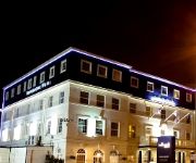
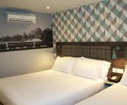
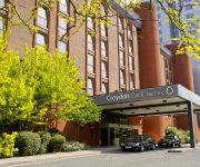
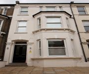
Looking for a place to stay? we compiled a list of available hotels close to the map centre further down the page.
When in this area, you might want to pay a visit to some of the following locations: Croydon, Camberwell, City of Westminster, Morden and City of London. To further explore this place, just scroll down and browse the available info.
Local weather forecast
Todays Local Weather Conditions & Forecast: 22°C / 71 °F
| Morning Temperature | 14°C / 58 °F |
| Evening Temperature | 20°C / 68 °F |
| Night Temperature | 17°C / 62 °F |
| Chance of rainfall | 0% |
| Air Humidity | 40% |
| Air Pressure | 1015 hPa |
| Wind Speed | Moderate breeze with 9 km/h (6 mph) from South-East |
| Cloud Conditions | Broken clouds, covering 53% of sky |
| General Conditions | Broken clouds |
Sunday, 28th of July 2024
24°C (75 °F)
18°C (64 °F)
Few clouds, gentle breeze.
Monday, 29th of July 2024
26°C (80 °F)
20°C (69 °F)
Sky is clear, gentle breeze, clear sky.
Tuesday, 30th of July 2024
28°C (82 °F)
21°C (71 °F)
Broken clouds, gentle breeze.
Hotels and Places to Stay
Hilton London Croydon
Hallmark Croydon
Best Western Plus London Croydon Aparthotel
Croydon Park
onefinestay - Clapham private homes
Westciti Caroco Aparthotel
Clapham Guest House
Flexistay South Park Aparthotel
The Windmill
The Furzedown
Videos from this area
These are videos related to the place based on their proximity to this place.
Matami Sangat Rab-e-Wafa | Matamdari at Norbury, Croydon (26/10/2013)
Matami Sangat Rab-e-Wafa | Matamdari at Norbury, Croydon | 26th October 2013.
Winter in Streatham Common playground - 1208
No snow, but a cold winter's Monday afternoon; Harriet takes to the swings, tries a few steps, falls over, has a crack at some crazy sliding, then chases a pigeon.
manchester united vs manchester City Sergio Agüero goal manchester united 2015
Sergio Agüero football england 2015 best of football 2015 soccer best of england football 2015 premier league champions league UEFA league.
Harriet's Easter trip to the playground - 0409
A wet Easter 2009 doesn't deter Harriet from getting outdoors. In this latest video, you can see how her new-found love of walking means that getting to the park can take up more time than...
Adrian co Chartered Certified Accountants Norbury | Best Chartered Certified Accountant in Norbury
http://www.adrianco.com 020 8240 7483 1417/1419 London Road, Norbury, London, SW16 4AH Adrian co chartered certified accountants Norbury | Best Chartered certified accountants in Norbury ...
Home Floors West Norwood London
Home Floors is a family run flooring company located in West Norwood, Lambeth in South London. To Get a video like this one for your business, contact William on 07905417623.
Bus drivers on Streatham High road.
Streatham High road (A23), one arsehole bus driver!, waiting for TFL to e-mail about this incident..
Wimbledon Driving School Helped Katharine Bee From Streatham Pass Her Driving Test
Congratulations to Katharine Bee from Streatham for passing her driving test, thanks in no small part to the excellent lessons she received from the Wimbledon Driving School. http://bit.ly/1uPVMNm...
Driving lessons in Streatham Helped Charlotte Fox Pass Her Driving Test
Congratulations to Charlotte Fox for passing her driving test, thanks in no small part to the excellent driving lessons in Streatham she received from the Wimbledon Driving School. http://bit.ly/1...
Videos provided by Youtube are under the copyright of their owners.
Attractions and noteworthy things
Distances are based on the centre of the city/town and sightseeing location. This list contains brief abstracts about monuments, holiday activities, national parcs, museums, organisations and more from the area as well as interesting facts about the region itself. Where available, you'll find the corresponding homepage. Otherwise the related wikipedia article.
London Borough of Lambeth
The London Borough of Lambeth is a London borough in south London, England and forms part of Inner London. The local authority is Lambeth London Borough Council.
South Circular Road
The A205 or South Circular Road is the 20.7 mile long route which crosses South London, running from Woolwich in the east to the junction of the A406 (North Circular Road), the M4 and the A4 at Gunnersbury in the west. Together with the North Circular Road, the South Circular forms a ring road through the inner part of Outer London. This ring road does not make a complete circuit of the city, as the crossing of the River Thames in the east is made on the Woolwich Ferry.
West Norwood Cemetery
West Norwood Cemetery is a 40-acre cemetery in West Norwood in London, England. It was also known as the South Metropolitan Cemetery. One of the first private landscaped cemeteries in London, it is one of the Magnificent Seven cemeteries of London, and is a site of major historical, architectural and ecological interest. Its grounds are a mixture of historic monumental cemetery and modern lawn cemetery, but it also has catacombs, cremation plots and a columbarium for cinery ashes.
Streatham (UK Parliament constituency)
Streatham is a constituency represented in the House of Commons of the UK Parliament since 2010 by Chuka Umunna, a member of the Labour Party.
Tooting Bec Lido
Tooting Bec Lido is an open-air fresh water swimming pool in South London. It is the largest swimming pool by surface area in the United Kingdom, being 100 yards (91.44 m) long and 33 yards (30.18 m) wide. The Lido is on Tooting Bec Common between Tooting and Streatham. An original condition of construction was that it should be concealed from views across the common by a surrounding earth ramp.
Streatham Park
Streatham Park is an area of suburban southwest London. It comprises the eastern part of Furzedown ward in the London Borough of Wandsworth, formerly in the historic parish of Streatham. It is bounded by Tooting Bec Common to the north, Thrale Road and West Road to the west, and the London to Brighton railway to the east. The area takes its name from a Georgian country mansion built by the brewer Ralph Thrale.
Streatham High Road
Streatham High Road, some two miles (3.6 km) in length, is part of the main A23 road from London to Brighton, and is in the London Borough of Lambeth. It begins in the north at Streatham Hill railway station, being an end-on junction with Streatham Hill and continues south to Norbury where the A23 becomes London Road.
Norwood Park (London)
Norwood Park is a 33 acre park in South London It commands a great view across Dulwich to The City and Central London 7 miles (11 km) away. On a clear day it may even be possible to see the Alexandra Palace in North London.
Knight's Hill
Knights Hill is a main road on the A215 in West Norwood, London and a mound to the north adjoining Tulse Hill. The road itself starts in the north at West Norwood in the Norwood Triangle. It ends in the south at a junction with the A214 at Crown Lane and Crown Dale. Knights Hill becomes Beulah Hill at this point. In the north, Knights Hill is home to a large parade of shops. See A215 road for more information.
Croydon Cemetery
Croydon Cemetery' is a cemetery located next to Mitcham Common near Croydon, which is part of the London Borough of Croydon, London. It is managed by Croydon Cemeteries and Crematoriums. The cemetery is much larger than other ones in London and Croydon Crematorium is located inside the cemetery. There is also a church located inside the cemetery.
Streatham & Clapham High School
Streatham & Clapham High School is a successful independent day school for girls aged 3 to 18, situated in south London. The school was founded in 1887 by the Girls' Public Day School Company, which aimed to establish schools for girls of all classes by providing a high standard of academic, moral and religious education. The Head Master is Dr Millan Sachania, a music scholar and late Bachelor Scholar of Christ's College, Cambridge, where he attained Double First Class Honours.
St Luke's Church, West Norwood
St Luke's Church in West Norwood is an Anglican Church in the London Borough of Lambeth. It currently has an Evangelical emphasis.
Bensham Manor (ward)
Bensham Manor is a ward in the London Borough of Croydon, covering part of the Thornton Heath area of London in the United Kingdom. The ward extends from Thornton Heath railway station westwards and is largely residential with a retail or industrial core. The ward currently forms part of Malcolm Wicks MP's Croydon North constituency. The ward returns three councillors every four years to Croydon Council.
Fenstanton Primary School
Fenstanton Primary School is a community school in Tulse Hill, London. The school serves children from 3 to 11 years old and is situated in the London Borough of Lambeth.
Bishop Thomas Grant School
Bishop Thomas Grant School (BTG) is a Catholic high school situated in Streatham, London. The school was named after the first Bishop of Southwark, Thomas Grant (1816-1870) who was named in the First Vatican Council. The school was opened on the 9th September 1959. The current headmaster of the school is Mr. Louis Desa. BTG is specialist school in Mathematics and ICT. In September 2009 Bishop Thomas Grant re-opened their sixth form which had closed in 1986.
Dunraven School
Dunraven School is an inner city coeducational secondary school with academy status located in Streatham in the London Borough of Lambeth. The school takes its name after the Earl Of Dunraven and still has ties with the Earl until this day. The buildings are based over two sites that were previously used as a teacher training college (this site is now known as upper school) and a primary school (this site is now known as lower school). There are building works going on around the school.
St Leonard's (ward)
St Leonard's ward is an administrative division of the London Borough of Lambeth, United Kingdom. It is located in the South West of the borough and shares a border with Wandsworth. The ward comprises the western part of the Streatham town centre and is mostly to the west of the A23 Streatham High Road with the exception of the Stanthorpe Triangle area immediately east of St Leonard's church in the historic village centre. St Leonard's ward is located in the Streatham Parliamentary constituency.
Streatham Hill (ward)
Streatham Hill ward is an administrative division of the London Borough of Lambeth, United Kingdom. It includes the neighbourhoods in the northern part of Streatham either side of the road of the same name.
Streatham South (ward)
Streatham South ward is an administrative division of the London Borough of Lambeth, United Kingdom. It is the most southerly ward of the borough and has borders with Croydon, Merton, and Wandsworth. The ward includes the neighbourhoods of: Streatham Vale; Lower Streatham (west of Streatham High Road and south of Greyhound Lane); Streatham Lodge Estate conservation area (east of Streatham High Road and south of the Streatham Common open space).
Streatham Wells (ward)
Streatham Wells ward is an administrative division of the London Borough of Lambeth, United Kingdom. It contains part of Streatham town centre to the east of the A23 Streatham High Road. Streatham Wells ward is located in the Streatham Parliamentary constituency.
Knight's Hill (ward)
Knight's Hill ward is an administrative division of the London Borough of Lambeth, United Kingdom. The boundaries of Knights Hill are the A214 in the south and the A215 to the east. The population of Knights Hill is 13,687 according to the 2001 census, this is an increase of around 2000. This is 5.1% of the Lambeth borough population. The population is predominantly over 65. The area of the ward is 146.8 hectares.
Gipsy Hill (ward)
Gipsy Hill ward is an administrative division of the London Borough of Lambeth, England. The ward contains much of West Norwood as well as Norwood park and West Norwood Cemetery. it also contains Gipsy Hill railway station. Gipsy Hill ward is located in the Dulwich and West Norwood Parliamentary constituency.
JW Hobbs Ground
JW Hobbs Ground was a cricket ground in Norbury, Surrey. The ground was constructed in 1885 within the grounds of Norbury Hall by local philanthropist J.W. Hobbs. The first recorded match on the ground was in 1887, when CI Thornton's XI played the Gentlemen of Canada. It hosted its only first-class match in the following year, when CI Thornton's XI played the touring Australians.
Streatham Library
Streatham Library is located at 63 Streatham High Road, Streatham, in the London Borough of Lambeth, England. The Library opened in 1890, and is one of several historical libraries in the vicinity which were built by Henry Tate. It is a public library.
Streatham Ice Arena
Streatham Ice Arena, opened in 1931, was an ice rink in London, England, and the home ice of the Streatham Redskins. It permanently closed on December 18, 2011, and has since been demolished for a mixed use-complex opening end of 2013 that features a Tesco store and a new ice rink and swimming pool.


