Safety Score: 3,0 of 5.0 based on data from 9 authorites. Meaning we advice caution when travelling to United Kingdom.
Travel warnings are updated daily. Source: Travel Warning United Kingdom. Last Update: 2024-07-26 08:00:33
Discover Selsdon
The district Selsdon of in Greater London (England) is a subburb in United Kingdom a little south of London, the country's capital city.
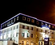
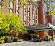
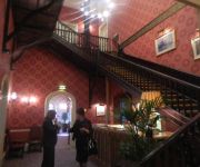
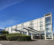
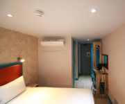
If you need a hotel, we compiled a list of available hotels close to the map centre further down the page.
While being here, you might want to pay a visit to some of the following locations: Croydon, Bromley, Catford, Camberwell and Sutton. To further explore this place, just scroll down and browse the available info.
Local weather forecast
Todays Local Weather Conditions & Forecast: 21°C / 71 °F
| Morning Temperature | 14°C / 58 °F |
| Evening Temperature | 20°C / 68 °F |
| Night Temperature | 16°C / 61 °F |
| Chance of rainfall | 0% |
| Air Humidity | 42% |
| Air Pressure | 1015 hPa |
| Wind Speed | Gentle Breeze with 9 km/h (5 mph) from South-East |
| Cloud Conditions | Broken clouds, covering 58% of sky |
| General Conditions | Broken clouds |
Sunday, 28th of July 2024
24°C (75 °F)
17°C (62 °F)
Few clouds, gentle breeze.
Monday, 29th of July 2024
26°C (79 °F)
19°C (67 °F)
Sky is clear, gentle breeze, clear sky.
Tuesday, 30th of July 2024
28°C (82 °F)
20°C (68 °F)
Broken clouds, gentle breeze.
Hotels and Places to Stay
De Vere Selsdon Estate
Hallmark Croydon
Croydon Park
Best Western Plus London Croydon Aparthotel
Westciti Caroco Aparthotel
Coulsdon Manor Hotel and Golf Club
Hilton London Croydon
Croham Park Bed & Breakfast
Queens Euro Hotel
TRAVELODGE LONDON CRYSTAL PALACE
Videos from this area
These are videos related to the place based on their proximity to this place.
Driving School in Croydon Helped Ansuka Pass Her Driving Test
Congratulations to Ansuka for passing her driving test, thanks in no small part to the excellent lessons she received from her driving school in Croydon: the Wimbledon Driving School. http://bit.l...
Mountain bike riding in the snow, Croydon UK
http://www.mbr.co.uk/ Andy Waterman headed out into the UK's record snowfall this January 2010 aboard a Tomac Snyper.
Southern Class 455 arrives at South Croydon
A Southern EMU class 455, built BREL in 1982 in York, arrives at the somewhat dilapidated station of South Croydon station. It is quite shocking the extremely low height of the platforms.
Friendly atmosphere & instructors at the Kung Fu Schools
You'll immediately feel at home within the very inviting and welcoming Kung Fu Schools... The classes are at a pace that suits anyone new to Wing Chun Kung Fu and the instructors team are...
Calling at Lloyd Park in the snow
A short film inside a tram as it approaches and then calls as Lloyd Park tramstop on a snowy day in February 2009.
LumFlum - Looking Back
a Mini-Tage by LumFlum Here. http://www.youtube.com/user/TheLumFlum comment, like, fav.
Southern Class 455 (455 814) Purley - East Croydon.
On board a Southern Class 455/8 from Purley to East Croydon on a Semi-Fast Tattenham Corner - London Bridge service, just listen to the screamage as we pass Purley Oaks!
No.70000 'Britannia' at Purley Oaks (14-7-11)
BR Class 7MT 4-6-2 No.70000 'Britannia' on 'The Cathedrals Express', approaching Purley Oaks station. Routing: Lewes-Haywards Heath-Kensington Olympia Broxbourne-Ely and return.
Hannah's Story Thread Lifting Surgery Facelift, amazing difference
Listen to Hannah takes us through her journey at kent and surrey aesthetics and what a huge difference it has made to her. http://www.kentandsurreyaesthetics.co.uk Hannah takes us through...
Continuous Welded Rail v Jointed Rail
Continuous Welded Rail v Jointed Rail A quick video showing the difference in noise and vibration between modern Welded Rail and older jointed rail. Filmed on the Caterham line in Whyteleafe...
Videos provided by Youtube are under the copyright of their owners.
Attractions and noteworthy things
Distances are based on the centre of the city/town and sightseeing location. This list contains brief abstracts about monuments, holiday activities, national parcs, museums, organisations and more from the area as well as interesting facts about the region itself. Where available, you'll find the corresponding homepage. Otherwise the related wikipedia article.
London Borough of Croydon
The London Borough of Croydon is a London borough in South London, England and is part of Outer London. It covers an area of 87 km and is the largest London borough by population. It is the southernmost borough of London. At its centre is the historic town of Croydon from which the borough takes its name. Croydon is mentioned in the Domesday Book, and from a small market town has expanded into one of the most populous areas on the fringe of London.
Addington Palace
Addington Palace is an 18th century mansion in Addington near Croydon, South London, England.
Coombe, Croydon
Coombe is a place in the London Borough of Croydon, not far from central Croydon. Coombe is located between the green spaces of Shirley (Addington) Hills, Lloyd Park, Ballards and Coombe Wood. It is unusual in this part of South London as it has barely been urbanised and has retained its collection of large houses fairly intact. Its rural character is maintained by the woodland aspect of the road and an old cattle trough at the junction of Coombe Lane and Oaks Road.
Purley station rail crash
The Purley station rail crash is a train collision that occurred just to the north of Purley railway station in the London Borough of Croydon on Saturday 4 March 1989, leaving five dead and 88 injured. The collision was caused by the driver of one of the trains passing a signal at danger and he pleaded guilty to manslaughter and was sentenced to 12 months in prison plus 6 months suspended, although this was reduced to four months upon appeal, and in 2007 overturned.
Croydon Central (UK Parliament constituency)
Croydon Central is a borough constituency represented in the House of Commons of the Parliament of the United Kingdom. It elects one Member of Parliament (MP) by the first past the post system of election. The current MP is Conservative Gavin Barwell, who won by 2,969 votes in May 2010.
Croydon South (UK Parliament constituency)
Croydon South is a parliamentary constituency represented in the House of Commons of the UK Parliament since 1992 by Richard Ottaway, a Conservative.
Warlingham F.C
Warlingham Football Club is an English football club based in Warlingham, Surrey. The club are members of Division One of the Combined Counties League, and currently groundshare at Whyteleafe's Church Road ground, due to their Verdayne Sports Ground not being of the required standard for the Combined Counties League. The club is affiliated to the Surrey County Football Association
South Croydon rail crash
The South Croydon rail crash on the British railway system occurred on 24 October 1947. The crash took place south of South Croydon railway station. Two electric commuter trains collided in fog and 32 people were killed, one of whom was the driver of the second train. It was the worst accident on Britain's Southern Railway during its existence, from 1923 to 1947. The accident was a rear collision caused by a signalman's error.
Sanderstead Court
Sanderstead Court is a country house in Surrey, England.
Addington Hills
Addington Hills is a park in Upper Shirley, London, England. It is managed by the London Borough of Croydon. It was part of the old parish of Addington before the suburb of Shirley was developed in the 1930s. The site consists largely of woodland on a gravel bed, with London's largest area of heathland at its heart. It is a Site of Metropolitan Importance. It is a peaceful area with many pathways close to central Croydon.
Coombe Lane tram stop
Coombe Lane tram stop is a light rail stop in the London Borough of Croydon in the southern suburbs of London. It is located next to Addington Hills serving Royal Russell School and the Ballards residential estate close to Upper Shirley, Addington and Coombe. The tram stop is served by Tramlink route 3, which connects Wimbledon with New Addington via central Croydon. 40x40px Wikimedia Commons has media related to: Coombe Lane tram stop
Addington Park
Addington Park is a park situated in Addington in the London Borough of Croydon. The park covers an area of 24.5 acres .
Addiscombe Recreation Ground
Addiscombe Recreation Ground, commonly known as Bingham Park, is a park situated in Addiscombe, London. The park is managed by London Borough of Croydon. Addiscombe tram stop is located just next to the recreation ground, and is served by Tramlink routes 1 and 2. The area covers 8 acres .
Coombe Wood
Coombe Wood is a small woodland and garden area in the old village of Coombe, Upper Shirley, in the London Borough of Croydon near the junction of Coombe Lane and Conduit Lane. The Coombe Wood Gardens are divided into a series of rooms which together give an all year round display of shrubs and plants set against a backdrop of mature woodland.
Lloyd Park tram stop
Lloyd Park tram stop is in the London Borough of Croydon in the southern suburbs of London on the edge of Lloyd Park, beside Coombe Road and opposite Croham Park Avenue and Castlemaine Avenue. The stop is served by Tramlink route 3, which connects Wimbledon with New Addington via central Croydon. It is 200 metres east of the site of Coombe Road railway station. The northbound route from Lloyd Park Tramlink follows the former Woodside and South Croydon Railway line through the Park Hill Tunnels.
Sandilands tram stop
Sandilands tram stop is a light rail stop in the London Borough of Croydon in the southern suburbs of London. It serves the residential area along Addiscombe Road to the east of the centre of the town of Croydon. The tram stop is served by all three Tramlink routes: 1 (Central Croydon to Elmers End) 2 (Central Croydon to Beckenham) 3.
Selsdon Wood
Selsdon Wood is a woodland area located in the London Borough of Croydon. The park is owned by the National Trust but managed by the London Borough of Croydon. It is a Local Nature Reserve. The wood has a Friends group - the Friends of Selsdon Wood (FSW) - who have their own website. Sir Julian Huxley (a zoological scientist) was one of the main backers of the Selsdon Wood Nature Reserve.
Gravel Hill tram stop
Gravel Hill tram stop is a light rail stop serving Addington, in the London Borough of Croydon in the southern suburbs of London. It is the main destination for tourists visiting the historic site of Addington Palace. It is also used for students who attend the John Ruskin College. It is also the nearest stop for Forestdale. The tram stop is served by Tramlink route 3, which connects Wimbledon with New Addington via central Croydon.
Selsdon railway station
Selsdon railway station was on the Croydon, Oxted and East Grinstead Railway and the now-closed Woodside and South Croydon Railway. Opened in 1885 as "Selsdon Road", it was two miles from Selsdon village. The name was changed with effect from 30 September 1935 in an attempt to attract more passengers to the line - users of the railway preferring to use nearby South Croydon, which had a higher frequency of service.
Croham (ward)
Croham is a ward in the London Borough of Croydon, covering part of the Croham Hurst and South Croydon area of London in the United Kingdom. The ward currently forms part of Richard Ottaway MP's Croydon South constituency, which is one of the most safe for the Conservatives in London. The ward returns three councillors every four years to Croydon Council. At the Croydon Council election 2006, Maria Gatland, Michael Neal and Jason Perry were elected to the council.
Spencer Road Halt railway station
Spencer Road Halt was a railway halt on the Woodside and South Croydon Railway, which opened in 1906. It closed on 15 March 1915.
St. John's Church of England Primary School, Croydon
St. John's Church of England Primary School is a primary school in Spring Park Road, Shirley, Croydon, South London. It takes a single form of entry (about 30 pupils) each year, from 'Reception' (ages 4–5) to 'Class 6' (ages 10–11). It is linked to the neighbouring St John's Church in Shirley. Its school crest includes the Shirley Poppy, developed by one of that church's vicars.
Cambridge Tutors College
Cambridge Tutors College (CTC) is an Independent Sixth Form College situated in South Croydon. Founded in 1958 as a tutorial centre to help boys in preparation for their common entrance exam, it has expanded into a successful international sixth form college. Students are from over thirty countries including China, Malaysia, Latvia, Estonia, and Russia.
Elmhurst School for Boys
The Elmhurst School for Boys is an independent day preparatory and pre-preparatory boys' school in South Croydon, England. The school was founded in 1879. The present Principal, Henry Wickham, who bought the school in 2009, is the husband of well-known author Sophie Kinsella. He runs the school with the Executive Headmaster Charles South.
Riddlesdown Common
Riddlesdown Common or Riddlesdown is a 43 hectare area of green space located towards the northern end of the North Downs in the London Borough of Croydon. It is maintained by the City of London Corporation. Most of it is a biological Site of Special Scientific Interest. The name Riddlesdown also applies to the local district of residential housing.


