Safety Score: 3,0 of 5.0 based on data from 9 authorites. Meaning we advice caution when travelling to United Kingdom.
Travel warnings are updated daily. Source: Travel Warning United Kingdom. Last Update: 2024-07-26 08:00:33
Explore Dagenham
Dagenham in Greater London (England) with it's 108,368 inhabitants is a city in United Kingdom about 13 mi (or 21 km) east of London, the country's capital.
Local time in Dagenham is now 03:07 AM (Saturday). The local timezone is named Europe / London with an UTC offset of one hour. We know of 9 airports in the vicinity of Dagenham, of which 5 are larger airports. The closest airport in United Kingdom is London City Airport in a distance of 6 mi (or 9 km), South-West. Besides the airports, there are other travel options available (check left side).
There are several Unesco world heritage sites nearby. The closest heritage site in United Kingdom is Palace of Westminster and Westminster Abbey including Saint Margaret’s Church in a distance of 4 mi (or 6 km), South-West. Also, if you like golfing, there are multiple options in driving distance. We found 3 points of interest in the vicinity of this place. If you need a place to sleep, we compiled a list of available hotels close to the map centre further down the page.
Depending on your travel schedule, you might want to pay a visit to some of the following locations: Romford, Bexleyheath, Ilford, Woolwich and East Ham. To further explore this place, just scroll down and browse the available info.
Local weather forecast
Todays Local Weather Conditions & Forecast: 22°C / 72 °F
| Morning Temperature | 15°C / 59 °F |
| Evening Temperature | 21°C / 70 °F |
| Night Temperature | 17°C / 63 °F |
| Chance of rainfall | 0% |
| Air Humidity | 38% |
| Air Pressure | 1014 hPa |
| Wind Speed | Gentle Breeze with 9 km/h (5 mph) from South-East |
| Cloud Conditions | Broken clouds, covering 60% of sky |
| General Conditions | Broken clouds |
Sunday, 28th of July 2024
25°C (76 °F)
18°C (65 °F)
Few clouds, gentle breeze.
Monday, 29th of July 2024
26°C (79 °F)
19°C (67 °F)
Sky is clear, gentle breeze, clear sky.
Tuesday, 30th of July 2024
27°C (80 °F)
21°C (70 °F)
Broken clouds, gentle breeze.
Hotels and Places to Stay
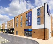
TRAVELODGE LONDON ROMFORD
Harefield Manor
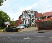
Gidea Park Hotel
TRAVELODGE LONDON BELVEDERE
O'Grady's
Holiday Inn Express LONDON - NEWBURY PARK
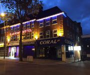
Barking Hotel
Romview
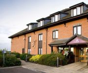
Premier Inn London Romford Central
London Rainham
Videos from this area
These are videos related to the place based on their proximity to this place.
Full time whistle. Dagenham 1-2 Plymouth Argyle
The scenes in the away end as the full time whistle is blown at Dagenham v Plymouth Argyle 22/02/2014.
Underwater Fishing at Chase Lakes Dagenham (Bardag) 2015. Missed common carp
Testing the new camera and discovered that my pop up is too high and that the camera causes the line to twist on the cast. I will be using PVA in future to help stop this.
HS1 at Dagenham Docks
Three scenes from HS1 at Dagenham Docks on the north bank of the Thames. This includes two Southeastern Trains Javelin services (one in each direction) and a Eurostar from the Continent towards.
92009 @ Dagenham HS1.MTS
92009 & 66152 ' 4O57 'entering HS1 from Ripple lane Yard @ Dagenham. this train was the first Freight to traverse the link line and was running to Dollands Moor.
ZANTOS 2 SFC DAGENHAM 3 - 27th March 2011
First goal for SFC Dagenham in this Webb Cup quarter-final @ Old Dagenham Park,.
Fulham FC v Dagenham & Redbridge FC (2)
phillper0906 - 2007 http://sports.webshots.com/album/559932011RkMkEW http://sports.webshots.com/album/558798548ejutnY Dagenham & Redbridge Vs. Fulham friendly played on July 17 2007,...
ZANTOS 2 SFC DAGENHAM 3 - 27/03/2011
Second goal for SFC Dagenham in this Webb Cup quarter-final @ Old Dagenham Park.
Videos provided by Youtube are under the copyright of their owners.
Attractions and noteworthy things
Distances are based on the centre of the city/town and sightseeing location. This list contains brief abstracts about monuments, holiday activities, national parcs, museums, organisations and more from the area as well as interesting facts about the region itself. Where available, you'll find the corresponding homepage. Otherwise the related wikipedia article.
Barking and Dagenham College
Barking and Dagenham College, formerly Barking College, is a secondary education college with approximately 3000 full-time students located in the London Borough of Barking and Dagenham in Dagenham east London, England. Barking College Further and Higher Education College is located in Dagenham Road, Rush Green, London, UK. The college offers many courses at many levels, such as A-Levels, HNC/HND, BTEC and many more.
Dagenham (UK Parliament constituency)
Dagenham was a borough constituency represented in the House of Commons of the Parliament of the United Kingdom. It elected one Member of Parliament (MP) by the first past the post system of election. It was replaced at the 2010 general election by the new Dagenham and Rainham constituency.
Municipal Borough of Dagenham
Dagenham was a local government district in south west Essex, England from 1926 to 1965 covering the parish of Dagenham. Initially created as an urban district, it was incorporated as a municipal borough in 1938. It was established to deal with the increase in population and the change from rural to urban area caused by the building of the Becontree estate by the London County Council and the subsequent movement of people from Inner London.
Dagenham East rail crash
The Dagenham East rail crash was a railway accident on the London, Tilbury and Southend Railway line of British Railways which occurred at Dagenham, United Kingdom. The accident took place at around 19:34 on 30 January 1958 and was a rear-end collision of two late-running trains. Conditions at Dagenham East station were foggy at the time. The accident occurred after one train had passed a signal indicating danger due to a driver error. Ten passengers were killed in the accident and 89 injured.
Victoria Road (Dagenham)
Victoria Road, currently known as the London Borough of Barking & Dagenham Stadium, for sponsorship purposes, is the home ground of Dagenham & Redbridge F.C. of London, England. It has a capacity of 6,078. The site on Victoria Road has been a football ground since 1917, when it was used by the Sterling Works side, whose factory was situated alongside it. It was not fully enclosed until the summer of 1955, when Briggs Sports moved out to Rush Green Road, and Dagenham F.C. moved from the Arena.
Rush Green Hospital
Rush Green Hospital was a hospital located at Rush Green in the London Borough of Barking and Dagenham in London from 1900 to 1995. The hospital was opened as the Romford Isolation Hospital in 1900 by Romford Rural District Council in co-operation with Romford Urban District Council (the hospital was located in the rural district). It was renamed Rush Green in 1939; by this time the rural district had been abolished and the local area now formed part of Dagenham.
Crowlands Heath Golf Club
Crowlands Heath Golf Club is a golf course located in Chadwell Heath in London, United Kingdom.
St. Peter and St. Paul, Dagenham
St. Peter and St. Paul is a parish church in the London Borough of Barking and Dagenham, England, formerly part of Essex. It is of medieval origin, largely rebuilt at the beginning of the nineteenth century.
Becontree Heath bus station
Becontree Heath Bus Station is a bus station in East London, UK. It has lost most of its routes as all buses serving the area no longer stop in the bus station, rather several new stops built along the road nearby. The only bus to use the bus station is 150, which terminates in the bus station. It is the alighting point only and you will have to pick it up on the main road nearby.


