Safety Score: 3,0 of 5.0 based on data from 9 authorites. Meaning we advice caution when travelling to United Kingdom.
Travel warnings are updated daily. Source: Travel Warning United Kingdom. Last Update: 2024-04-24 08:14:40
Discover Hornchurch
The district Hornchurch of Dagenham in Greater London (England) with it's 25,470 citizens Hornchurch is a district in United Kingdom about 15 mi east of London, the country's capital city.
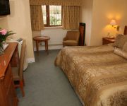
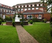
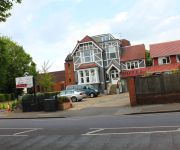
Looking for a place to stay? we compiled a list of available hotels close to the map centre further down the page.
When in this area, you might want to pay a visit to some of the following locations: Romford, Bexleyheath, Grays, Ilford and Woolwich. To further explore this place, just scroll down and browse the available info.
Local weather forecast
Todays Local Weather Conditions & Forecast: 11°C / 52 °F
| Morning Temperature | 4°C / 40 °F |
| Evening Temperature | 9°C / 49 °F |
| Night Temperature | 7°C / 44 °F |
| Chance of rainfall | 2% |
| Air Humidity | 43% |
| Air Pressure | 1005 hPa |
| Wind Speed | Gentle Breeze with 8 km/h (5 mph) from East |
| Cloud Conditions | Overcast clouds, covering 100% of sky |
| General Conditions | Light rain |
Friday, 26th of April 2024
8°C (46 °F)
6°C (42 °F)
Overcast clouds, gentle breeze.
Saturday, 27th of April 2024
12°C (54 °F)
11°C (52 °F)
Light rain, moderate breeze, overcast clouds.
Sunday, 28th of April 2024
14°C (57 °F)
11°C (52 °F)
Light rain, moderate breeze, overcast clouds.
Hotels and Places to Stay
Derougemont Manor Hotel & Suites
Marygreen Manor
JCT.28 Holiday Inn BRENTWOOD M25
TRAVELODGE LONDON BELVEDERE
Thurrock Hotel
Harefield Manor
Gidea Park Hotel
TRAVELODGE LONDON ROMFORD
Brentwood Guest House
Romview
Videos from this area
These are videos related to the place based on their proximity to this place.
M0UKD/P Hornchurch Country Park 30.6.2013
Operating portable in the evening with an FT-897D 100W, half wave Inverted 'V' doublet, powered from a 22AH Lead Acid battery.
Dagenham Scrap Yard Fire Nov 1st 2013
Dagenham Scrap Yard Fire Nov 1st 2013 as viewed from top of Horchurch Country Park. Huge plumes of smoke still visible hours after fire started.
My dad feeding a Greylag Goose. Filmed with Toshiba Camelio H20 at HD 720
In Hornchurch Country Park.
Cyst, Blood Spot / Campel de Morgan, Common Wart, Skin Tags, Mole, Xanthomas, Milia
Example treatments provided by the Diane Matthews Clinic in Romford Essex including Cyst, Blood Spot / Campel de Morgan, Common Wart, Skin Tags, Mole, Xanthomas, Milia.
Emerson Park Halt Contrasts
Trains at Emerson Park. Class 315 in the 1990's and Class 317 in 2012 and 2010. I show the 2012 scenes before the 2010 scenes because they represent a better 'contrast', since the 2010 views...
London 2011 (2/4): Here Comes The Train
Only that one train in the previous video passed through the station before our train arrived, so I decided to film our train arriving. Please comment and like!
Buses Trains Windmill Near Upminster Bridge Stn
Buses, trains and a windmill as seen from the street close to Upminster Bridge railway station on the eastern outskirts of Greater London. Filmed in the mid 1990's. Bus operators include...
M0TAZ Kite portable operating from Hornchurch country park
working as M0TAZ/p operating kite portable from Hornchurch country park around 20km east of London. Radio Icom 7000 around 60w into a long wire supported by the kite. I had around 80m of wire...
Hornchurch Country Park / Hacton Parkway Flooded
Two days of heavy rain overnight on 25th & 26th May 2008 caused the River Ingrebourne to go over the banks and over the pathway and surrounding areas. A video of Dave and I riding through it....
Videos provided by Youtube are under the copyright of their owners.
Attractions and noteworthy things
Distances are based on the centre of the city/town and sightseeing location. This list contains brief abstracts about monuments, holiday activities, national parcs, museums, organisations and more from the area as well as interesting facts about the region itself. Where available, you'll find the corresponding homepage. Otherwise the related wikipedia article.
London Borough of Havering
The London Borough of Havering (pronounced "HAY-vering" is a London borough in North East London, England and forms part of Outer London. The principal town in Havering is Romford and the other main communities are Hornchurch, Upminster and Rainham. The borough is mainly characterised by suburban development with large areas of protected open space.
River Ingrebourne
The River Ingrebourne is a tributary of the River Thames 27 miles (43.3km) in length. It is considered a strategic waterway in London, forming part of the Blue Ribbon Network. It flows through the London Borough of Havering roughly from north to south, joining the Thames at Rainham.
Hornchurch Stadium
Hornchurch Stadium is located on Bridge Avenue in Upminster in the London Borough of Havering, east London, England. It was opened in 1956 by Hornchurch Urban District Council and is home to A.F.C. Hornchurch One stand, the 'Riverside', took its name from the River Ingrebourne, a few feet away. The stadium contains a recently renovated athletics track, which is home to the Havering Mayesbrook Athletics Club. It is near Upminster Bridge tube station.
Hornchurch Country Park
Hornchurch Country Park is a park on the former site of Hornchurch Airfield, south of Hornchurch in the London Borough of Havering, east London. The River Ingrebourne passes through the park and if forms part of Thames Chase Community Forest. The most popular part of the park is to the west of the Ingreborne, where the ground is flat and paved; this area is most commonly frequented by dog walkers.
Hare Hall
Hare Hall is a house and grounds located in Gidea Park in the London Borough of Havering, east London. It was built in 1769-70 as a country house for John A. Wallinger and since 1921 has housed the Royal Liberty School. The Palladian mansion was built to designs by James Paine, who included it in his published Plans. The main north front is of five bays, with a rusticated basement storey, above which the two upper storeys are unified by a giant portico and pilasters at the angles.
Langtons
Langtons House and Langtons Gardens are a grade II listed 18th century house and landscaped gardens located in Hornchurch, in the London Borough of Havering, Greater London. The house and gardens became local authority property in 1929 and are currently used as the borough register office and a public park. Langtons House was used as the council offices of Hornchurch Urban District Council from 1929 to 1965.
Hornchurch (UK Parliament constituency)
Hornchurch was a borough constituency represented in the House of Commons of the Parliament of the United Kingdom. It elected one Member of Parliament (MP) by the first past the post system of election. At the 2010 general election parts formed the new seats of Hornchurch and Upminster; and Dagenham and Rainham.
RAF Hornchurch
Royal Air Force Station Hornchurch or RAF Hornchurch was an airfield in the parish of Hornchurch, Essex (now the London Borough of Havering in Greater London), located to the southeast of Romford. The airfield was known as Sutton's Farm during the First World War, it occupied 90 acres of the farm of the same name and it had Albyns Farm alongside its southern perimeter. It was an airfield located and used for the protection of London and was situated 14 miles east north-east of Charing Cross.
Hornchurch Urban District
Hornchurch was a local government district in south west Essex, England from 1926 to 1965. The urban district council was based at Langtons House. The district formed a suburb of London and was expanded in 1934. It now forms the greater part of the London Borough of Havering in Greater London.
Hornchurch and Upminster (UK Parliament constituency)
Hornchurch and Upminster is a constituency represented in the House of Commons of the UK Parliament since 2010 by Angela Watkinson, a Conservative.
Romford Rural District
Romford Rural District was a local government district in south west Essex, England from 1894 to 1934. It surrounded, but did not include, Romford which formed a separate urban district. During the life of the district the area changed in use from rural farm land to sprawling London suburb and in 1926 much of it was removed to form new urban districts.
Roomes Stores
Roomes Stores is a group of two furniture and interior retail businesses in Upminster, England under a shared brand, with separate ownership. Roomes Furniture and Interiors is an independent family-run furniture store which has occupied several sites in east London and is currently operating on Station Road, Upminster. It is one of largest furniture supply outlets in east London.
Havering Sixth Form College
Havering Sixth Form College (alternatively styled Havering VI Form College), abbreviated as HSFC, is a sixth form college in Wingletye Lane, Hornchurch in the London Borough of Havering, East London, England. Built on the site of Dury Falls Secondary School, it opened in September 1991, and educates full-time students from the ages of 16 to 19. The college offers a wide range of subjects, in A-level, BTEC and diploma formats, amongst others. The current principal is Paul Wakeling.
Harold Wood Hospital
Harold Wood Hospital was a hospital in northeast London, United Kingdom. It was located in Gubbins Lane, Harold Wood, in the London Borough of Havering. The Havering Campus of London South Bank University, an NHS polyclinic and a long term conditions unit continue to operate at the hospital site, and a residential development by Countryside Properties is planned.
Campion School, Hornchurch
The Campion School is a Catholic boys' academy school and mixed sixth form located in Hornchurch, in the London Borough of Havering, United Kingdom. The school has been awarded Specialist Science College status.
Hacton
Hacton is a small dispersed settlement surrounded by the Metropolitan Green Belt, located between the suburbs of Upminster and Rainham in the London Borough of Havering in London, England. It was historically a hamlet in the ancient parish of Upminster and is within the Upminster post town. The name means 'farmstead on a hook-shaped piece of land', referring to an area adjacent to the River Ingrebourne.
Frances Bardsley Academy for Girls
Frances Bardsley Academy for Girls Frances Bardsley Academy for Girls is a non-denominational girls school and sixth form centre in the London Borough of Havering, England. The school educates girls between the ages of 11 and 18 (school years 7 to 13).
Abbs Cross Academy and Arts College
Abbs Cross Academy and Arts College (once known as Abbs Cross Technical High School) is situated on Abbs Cross Lane, Hornchurch, in the London Borough of Havering. Abbs Cross is now an Arts College. Like most secondary schools in its area, it lacks a sixth form centre although the school has a strong link with Havering Sixth Form College in which a majority of its students go on to attend. The Academy's Headteacher is Mr S.
Lodge Farm Park
Lodge Farm Park is a public park in the town of Romford in the London Borough of Havering. The park is one of a series of parks which stretch northwards from the railway line at Romford. The southern entrance to Lodge Farm Park is in Carlton Road in Romford (which runs parallel to the railway line), and the northern entrance is on Main Road in Romford.
Langton Park
Langton Park was a first-class cricket ground in Hornchurch, Essex. Surrounding Langton's House, built in the 18th century, the park was the home of Hornchurch Cricket Club and was a major venue from 1785 to 1793. At that time, the Hornchurch club was representative of Essex as a county. The earliest recorded first-class match at Langton Park was in May 1785 when Essex played Middlesex and the last was Essex v MCC in May 1793.
St Andrew's Church, Hornchurch
The church of St Andrew's, Hornchurch is a Church of England religious building in Hornchurch, England.
Heath Park, London
Heath Park is a district of the London Borough of Havering in London, England.
Church of St Laurence, Upminster
The church of St Laurence, Upminster is the Church of England parish church in Upminster, England. It is a Grade I listed building. It is the historic minster or church from which Upminster derives its name, meaning 'upper church', probably signifying 'church on higher ground'. The place-name is first attested as 'Upmynster' in 1062, and appears as 'Upmunstra' in the Domesday Book of 1086. The churchyard contains war graves of six service personnel of World War II.
Gidea Park Sports Ground
Gidea Park Sports Ground is a cricket ground in Romford, England. The first recorded match on the ground was in 1948, when the Essex Second XI played the Sussex Second XI in the Minor Counties Championship. Essex played their first first-class match there in 1950, when they played Hampshire. From 1950 to 1968, the ground played host to 34 first-class matches, the last of which saw Essex play Surrey.
Hornchurch Cutting
Hornchurch Cutting is an 0.8-hectare geological Site of Special Scientific Interest in Hornchurch in the London Borough of Havering. It marks the southern extremity of the Anglian ice sheet 450,000 years ago, and is the most southerly point reached by any ice sheet in Britain during the Pleistocence ice ages of the last 2.58 million years. It is the type site for Hornchurch Till, boulder clay laid down by the ice sheet in the Ingrebourne Valley. The site was discovered by geologist T. V.


