Safety Score: 3,0 of 5.0 based on data from 9 authorites. Meaning we advice caution when travelling to United Kingdom.
Travel warnings are updated daily. Source: Travel Warning United Kingdom. Last Update: 2024-07-26 08:00:33
Delve into Slade Green
Slade Green in Greater London (England) is a town located in United Kingdom about 14 mi (or 22 km) east of London, the country's capital town.
Time in Slade Green is now 03:16 AM (Saturday). The local timezone is named Europe / London with an UTC offset of one hour. We know of 8 airports closer to Slade Green, of which 5 are larger airports. The closest airport in United Kingdom is London City Airport in a distance of 6 mi (or 10 km), North-West. Besides the airports, there are other travel options available (check left side).
There are several Unesco world heritage sites nearby. The closest heritage site in United Kingdom is Palace of Westminster and Westminster Abbey including Saint Margaret’s Church in a distance of 4 mi (or 6 km), North-West. Also, if you like the game of golf, there are some options within driving distance. We saw 3 points of interest near this location. In need of a room? We compiled a list of available hotels close to the map centre further down the page.
Since you are here already, you might want to pay a visit to some of the following locations: Bexleyheath, Dagenham, Romford, Woolwich and Grays. To further explore this place, just scroll down and browse the available info.
Local weather forecast
Todays Local Weather Conditions & Forecast: 22°C / 72 °F
| Morning Temperature | 15°C / 59 °F |
| Evening Temperature | 21°C / 70 °F |
| Night Temperature | 17°C / 63 °F |
| Chance of rainfall | 0% |
| Air Humidity | 38% |
| Air Pressure | 1014 hPa |
| Wind Speed | Gentle Breeze with 8 km/h (5 mph) from South-East |
| Cloud Conditions | Broken clouds, covering 67% of sky |
| General Conditions | Broken clouds |
Sunday, 28th of July 2024
25°C (76 °F)
18°C (64 °F)
Few clouds, gentle breeze.
Monday, 29th of July 2024
26°C (79 °F)
19°C (67 °F)
Sky is clear, gentle breeze, clear sky.
Tuesday, 30th of July 2024
27°C (81 °F)
21°C (69 °F)
Broken clouds, gentle breeze.
Hotels and Places to Stay
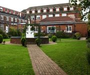
Bexleyheath Marriott Hotel
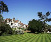
Rowhill Grange and Utopia Spa
DoubleTree by Hilton Dartford Bridge
Thurrock Hotel
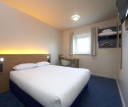
TRAVELODGE LONDON BELVEDERE
TRAVELODGE LONDON SIDCUP
Holiday Inn Express LONDON - DARTFORD
Holiday Inn LONDON - BEXLEY
Thurrock East
TRAVELODGE THURROCK M25
Videos from this area
These are videos related to the place based on their proximity to this place.
Seo Experts Dartford Kent Call 01322 329493
http://www.localmarketingresults.co.uk, We are your Dartford SEO Experts in Kent. Call Us Today at 01322 329493 If your business is not ranking on the first page of Google for your town/city...
How to Build an Extension in Dartford Kent
S M Berry Building Contractors Twenty Four Week Home Extension Project in Dartford Kent.
Skip Hire, Waste Management in Dartford - Medway Skip Hire
Know about proficient skip hire in Dartford (http://www.dartfordskiphire.co.uk) offering waste management, waste disposal and recycling service all over the Dartford area to make environment...
How to Build a Two Storey Home Extension in Dartford Kent in Less Than Fourteen Weeks
Kent and Londons Best Most Trustworthy and Reliable Builder, S M Berry Building Contractors Ltd, show how to build a two storey side and single storey rear extension in Dartford, Kent in under...
Waste Disposal & Management in Dartford
Know about waste management (http://www.dartfordskiphire.co.uk/waste-disposal.html) service in Dartford. Get tips about waste disposal or recycling in Dartford area with experienced and quality...
Bennie? lifts at the Priory shopping center dartford
Possibal Bennie lift (refurbished by tower lifts) in the Priory shopping center in dartford http://benobve.110mb.com.
Oliver! Behind the Scenes - Dartford Grammar Schools Production 1988
Rehearsal footage and behind the scenes at the Dartford Grammar Schools production of Oliver! November 1988. The production was directed by Pamela Lambert and the video footage recorded and...
Bridgeport Mazda RX7 in Dartford Tunnel
GoPro HD Hero in Mazda RX7 which has a Bridgeported 13B Twin Turbo engine going through Dartford Tunnel.
Erith Town U21 v Faversham Town U21 - Feb 2015
Erith Town U21 v Faversham Town U21, Kent Intermediate Cup - Semi Final, Saturday, 28 February 2015, Match Abandoned after 40 mins, Score after 40 mins: Erith Town U21 0 Faversham Town U21 ...
Videos provided by Youtube are under the copyright of their owners.
Attractions and noteworthy things
Distances are based on the centre of the city/town and sightseeing location. This list contains brief abstracts about monuments, holiday activities, national parcs, museums, organisations and more from the area as well as interesting facts about the region itself. Where available, you'll find the corresponding homepage. Otherwise the related wikipedia article.
Crayford Urban District
Crayford was a local government district in north west Kent from 1920 to 1965 around the town of Crayford. As well as Crayford, it included Barnehurst, Barnes Cray and Slade Green. It was created an urban district in 1920 from part of Dartford Rural District. In 1965 it was abolished by the London Government Act 1963 and its former area transferred to Greater London from Kent. Its former area was combined with that of other districts to form the present-day London Borough of Bexley.
Municipal Borough of Erith
Erith was a local government district in north west Kent from 1894 to 1965 around the town of Erith. It also included the generally suburban areas of Northumberland Heath, Belvedere, and parts of Barnehurst, Bexleyheath, Crayford and the SE2 London Postal District of Abbey Wood. It was created an urban district by the Local Government Act 1894.
Erith Town F.C
Erith Town Football Club is a football club based in Erith in the London Borough of Bexley, England. In their previous guise as Erith Town, they had reached the Second Round of the FA Vase five times in their history. They are currently members of the Kent League Premier Division.
Slade Green F.C
Slade Green F.C. was a football club based in Slade Green in the London Borough of Bexley, England. They were established in 1946 and played in the Kent League from 1970 until 2009 when the club folded.
Erith and Crayford (UK Parliament constituency)
Erith and Crayford was a parliamentary constituency in the London Borough of Bexley, south-east London, which returned one Member of Parliament to the House of Commons of the Parliament of the United Kingdom. It was created for the 1955 general election, and abolished for the 1997 general election, when it was replaced by the new constituencies of Erith & Thamesmead and Bexleyheath & Crayford.
North End (Bexley ward)
North End is an electoral ward in the London Borough of Bexley which consists of Slade Green, the eastern part of Erith and a tiny part of Barnehurst, along with parts of Northend. Community interests are represented by Slade Green Community Forum, which is a registered charity. There are approximately 4800 residences within the ward. Ward Councillors are Alan Deadman, John Eastaugh and Brenda Langstead (all Labour).
Crayford Manor House Astronomical Society
Crayford Manor House Astronomical Society
Slade Green Depot
Slade Green Depot is a major railway depot in Slade Green, South East London.


