Safety Score: 3,0 of 5.0 based on data from 9 authorites. Meaning we advice caution when travelling to United Kingdom.
Travel warnings are updated daily. Source: Travel Warning United Kingdom. Last Update: 2024-07-26 08:00:33
Explore Grange Hill
Grange Hill in Essex (England) with it's 12,449 inhabitants is a city in United Kingdom a little north-east of London, the country's capital.
Local time in Grange Hill is now 03:08 AM (Saturday). The local timezone is named Europe / London with an UTC offset of one hour. We know of 9 airports in the vicinity of Grange Hill, of which 5 are larger airports. The closest airport in United Kingdom is London City Airport in a distance of 7 mi (or 12 km), South. Besides the airports, there are other travel options available (check left side).
There are several Unesco world heritage sites nearby. The closest heritage site in United Kingdom is Tower of London in a distance of 7 mi (or 12 km), South. Also, if you like golfing, there are multiple options in driving distance. We found 4 points of interest in the vicinity of this place. If you need a place to sleep, we compiled a list of available hotels close to the map centre further down the page.
Depending on your travel schedule, you might want to pay a visit to some of the following locations: Ilford, East Ham, Dagenham, Romford and Walthamstow. To further explore this place, just scroll down and browse the available info.
Local weather forecast
Todays Local Weather Conditions & Forecast: 22°C / 71 °F
| Morning Temperature | 14°C / 58 °F |
| Evening Temperature | 20°C / 68 °F |
| Night Temperature | 16°C / 60 °F |
| Chance of rainfall | 0% |
| Air Humidity | 40% |
| Air Pressure | 1014 hPa |
| Wind Speed | Moderate breeze with 9 km/h (6 mph) from South-East |
| Cloud Conditions | Broken clouds, covering 53% of sky |
| General Conditions | Light rain |
Sunday, 28th of July 2024
24°C (74 °F)
18°C (64 °F)
Few clouds, gentle breeze.
Monday, 29th of July 2024
26°C (78 °F)
19°C (66 °F)
Sky is clear, gentle breeze, clear sky.
Tuesday, 30th of July 2024
27°C (80 °F)
21°C (70 °F)
Broken clouds, gentle breeze.
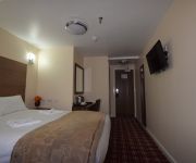
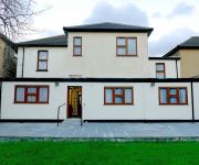
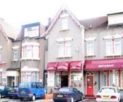
Hotels and Places to Stay
Lucky 8 Hotel
Best Western Greater London
Best Western Ilford
Rosalee Hotel
Holiday Inn Express LONDON - NEWBURY PARK
TRAVELODGE LONDON ILFORD GANTS HILL
The Beehive
O'Grady's
The Blue Boar
Cranbrook
Videos from this area
These are videos related to the place based on their proximity to this place.
Travelling from Chigwell to Grange Hill Station
A ride on the south-bound Central Line into Grange Hill station, Essex.
Underground Trains at Chigwell Station.
Central Line Underground Trains at Chigwell Station. Filmed in 1990 and 2010. We see red and silver 3 car trains of 1960 stock, 8 car trains of 1962 stock and 8 car trains of 1992 stock....
New Homes | Oakwood House | Forest Lane | Chigwell | Essex | Banner Homes
forest-lane.co.uk From the solid floors through to the high quality fixtures and fittings, Banner Homes' Oakwood House in Forest Lane, Chigwell boasts the very best. Thoughtful features such...
DebraChigwell.co.uk - Debra Chigwell - Luxury Clothes Boutique Essex - SPINKYmedia.com
http://www.DebraChigwell.co.uk - Luxury Clothes Boutique Chigwell Essex.
Central line tube train arriving and then leaving Chigwell
http://www.londonphotoproject.co.uk/blog/ Central line tube train arriving and then leaving Chigwell underground station.
Travelling from Hainault to Fairlop stations
Travelling from Hainault to Fairlop stations on the Central line on the London Underground.
Sessile House | Forest Lane | Chigwell | Essex
Introducing Sessile House an exceptionally stylish 6 bedroom detached home located in Chigwell, Essex. Offering timeless elegance and almost 6000sqft of sumptuous space. Perfectly placed in...
Plot 10 | The Penthouse | The Regency Apartments | Chigwell | Essex
An exclusive development of ten stylish two and three bedroom apartments in Chigwell, Essex. Combining comfort with convenience, with magnificent views over the prestigious Chigwell Golf Club.
Forest Lane | Chigwell | Essex | CALA Homes
Just two elegant and spacious detached six bedroom family homes, Deepings House (plot 1) and Shirbern House (plot 2), located in sought-after Forest Lane, Chigwell.
Videos provided by Youtube are under the copyright of their owners.
Attractions and noteworthy things
Distances are based on the centre of the city/town and sightseeing location. This list contains brief abstracts about monuments, holiday activities, national parcs, museums, organisations and more from the area as well as interesting facts about the region itself. Where available, you'll find the corresponding homepage. Otherwise the related wikipedia article.
Chigwell Urban District
Chigwell was a local government district in south west Essex, England. It contained the settlements of Chigwell, Loughton and Buckhurst Hill; and formed part of the Metropolitan Police District.
Ilford North (UK Parliament constituency)
Ilford North is a constituency represented in the House of Commons of the UK Parliament since 2005 by Lee Scott, a Conservative.
Waltham Holy Cross Urban District
Waltham Holy Cross was an urban district in the county of Essex, England. It was created in 1894 and covered the area of the large and ancient parish of Waltham Holy Cross, which included the town of Waltham Abbey as well as the hamlets of Holyfield, High Beach, Sewardstone and Upshire. The district was bounded on the west by the River Lea and contained a large part of Epping Forest. The urban district council was the successor to Waltham Holy Cross Local Board of Health, formed in 1850.
Claybury Hospital
Claybury Hospital was a psychiatric hospital at Woodford Bridge in Essex. It was opened in 1893 making it the fifth London County Council Asylum.
RAF Fairlop
Royal Air Force Station Fairlop or more simply RAF Fairlop was an Royal Air Force station situated near Ilford in Essex. Fairlop is now a district in the London Borough of Redbridge, England.
Fullwell Cross
Fullwell Cross is a district of Ilford in the London Borough of Redbridge, now forming the northwest part of neighbouring Barkingside. It is named for the roundabout at the northern end of the A123 Barkingside High Street.
St John's RC School
St John's RC School is a Roman Catholic secondary school in Essex, England. According to Ofsted the school has 99 students on roll. The school is not to be confused with either of the two other secondary schools in Essex also called St Johns: St John's School (an independent school), Billericay St John's Church of England School, Epping
Mansoor-ul-Haq Malik
Brigadier (r) Mansoor-ul-Haq Malik was a retired 1-Star officer of the Pakistan Army Corps of Signals. He had also served as Director General of the Pakistan Telephone & Telegraph Department (T&T) which is now PTCL and as Managing Director of the Overseas Pakistanis Foundation.


