Safety Score: 3,0 of 5.0 based on data from 9 authorites. Meaning we advice caution when travelling to United Kingdom.
Travel warnings are updated daily. Source: Travel Warning United Kingdom. Last Update: 2024-04-23 08:18:23
Explore Aldersbrook
Aldersbrook in Greater London (England) is a city in United Kingdom a little north-east of London, the country's capital.
Local time in Aldersbrook is now 02:29 PM (Tuesday). The local timezone is named Europe / London with an UTC offset of one hour. We know of 7 airports in the vicinity of Aldersbrook, of which 5 are larger airports. The closest airport in United Kingdom is London City Airport in a distance of 4 mi (or 6 km), South. Besides the airports, there are other travel options available (check left side).
There are several Unesco world heritage sites nearby. The closest heritage site in United Kingdom is Tower of London in a distance of 4 mi (or 7 km), South-East. Also, if you like golfing, there are multiple options in driving distance. We found 3 points of interest in the vicinity of this place. If you need a place to sleep, we compiled a list of available hotels close to the map centre further down the page.
Depending on your travel schedule, you might want to pay a visit to some of the following locations: East Ham, Ilford, Walthamstow, Poplar and Woolwich. To further explore this place, just scroll down and browse the available info.
Local weather forecast
Todays Local Weather Conditions & Forecast: 8°C / 46 °F
| Morning Temperature | 5°C / 41 °F |
| Evening Temperature | 8°C / 47 °F |
| Night Temperature | 5°C / 41 °F |
| Chance of rainfall | 0% |
| Air Humidity | 76% |
| Air Pressure | 1023 hPa |
| Wind Speed | Moderate breeze with 11 km/h (7 mph) from South |
| Cloud Conditions | Overcast clouds, covering 100% of sky |
| General Conditions | Light rain |
Wednesday, 24th of April 2024
7°C (44 °F)
3°C (37 °F)
Light rain, moderate breeze, overcast clouds.
Thursday, 25th of April 2024
10°C (50 °F)
7°C (45 °F)
Overcast clouds, gentle breeze.
Friday, 26th of April 2024
12°C (53 °F)
7°C (45 °F)
Light rain, gentle breeze, overcast clouds.
Hotels and Places to Stay
201 Upton Lane
Britannia Inn
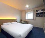
TRAVELODGE LONDON SNARESBROOK
Best Western Ilford
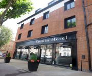
Ruskin Hotel
Rosalee Hotel
TRAVELODGE LONDON ILFORD GANTS HILL
The Beehive
Banks Hotel
Paradise Accomodation
Videos from this area
These are videos related to the place based on their proximity to this place.
Wanstead Practical Test Routes - Green Man Roundabout
www.uturndriving.com One of the places you may go through if you take your practical driving test at Wanstead. The route is from the A12 to Hermon Hill. The Green Man Roundabout is large &...
Looking up Redbridge Lane East to the Mini-Roundabout and Pedestrian Crossing (RedRag)
http://www.redrag.info In this clip you can see how traffic emerging from Roding Lane South onto Redbridge Lane East at the mini-roundabout adds to the slowness of the traffic coming down Redbridge.
Snaresbrook Underground Station - 31/10/2013 - Underground
An underground train arriving at Snaresbrook Underground Station, arriving late at night after I had eaten a nice meal at the Toby Carvery there.
Wanstead Practical Test Routes - Beehive and Redbridge Roundabouts
www.uturndriving.com This route might be taken in the latter half of the test. This is a tricky route, as the Beehive roundabout has an exit that's easily overlooked, followed by a right turn...
Redbridge Roundabaout - Redbridge Lane East Junction Simulation (RedRag)
http://www.redrag.info Animation illustrating the problems for drivers on Redbridge Lane East trying to get on to Redbridge Roundabout. 'Like' us on FaceBook - http://www.facebook.com/RedRag1200.
A trip around Redbridge Roundabout from Redbridge Lane East (RedRag)
http://www.redrag.info A typical journey coming from Redbridge Lane East onto Redbridge Roundabout. Notice how the traffic is slowed by cars entering the mini-roundabout from Roding Lane South...
Railway Journey London Bridge to Euston - Fleetwood Awayday - Part 1
This is the first of five parts detailing my Awayday to Fleetwood via London Bridge, Euston, Preston, Kirkham & Wesham, and South Blackpool. This section covers arrival and departure at London...
Three Trains at East Ham
Three London Underground trains seen at East Ham on Wednesday 10th July 2013. 0:00 7091+7086 depart for Upminster. 0:14 21302+21301 depart for Barking. 0:32 7122+7117 arrive for Richmond.
Videos provided by Youtube are under the copyright of their owners.
Attractions and noteworthy things
Distances are based on the centre of the city/town and sightseeing location. This list contains brief abstracts about monuments, holiday activities, national parcs, museums, organisations and more from the area as well as interesting facts about the region itself. Where available, you'll find the corresponding homepage. Otherwise the related wikipedia article.
Wanstead Flats
Wanstead Flats is the southern-most portion of Epping Forest in eastern London. It falls within the boundary of the London Borough of Redbridge.
A118 road
The A118 is a road in east London, England which links Bow with Gallows Corner, east of Romford. The section from Stratford to Gallows Corner formed the original route of the A12 until the designation was transferred to the Eastern Avenue soon after the latter opened in 1925. This route has even older pedigree, dating back to Roman times, forming the London to Colchester road.
Wanstead Park
Wanstead Park is a grade II listed municipal park covering an area of about 140 acres (57 hectares), located in Wanstead, in the London Borough of Redbridge, historically within the county of Essex. It is bordered to the north by the A12 road, to the east by the River Roding and A406 North Circular Road, to the south by the Aldersbrook Estate and the City of London Cemetery and Crematorium and to the west by Wanstead Golf Course.
Forest Gate rail crash
The Forest Gate rail crash was an accident that occurred on the Great Eastern Main Line when two trains collided. Fourteen people were injured though there were no deaths.
Forest Gate Community School
Forest Gate Community School is a secondary school located in Forest Gate, part of the London Borough of Newham, in the east of London, United Kingdom. The school has been awarded specialist Business and Enterprise College status. The school is located directly opposite Forest Gate railway station, allowing good transport access for all its students.
City of London Cemetery and Crematorium
The City of London Cemetery and Crematorium is a cemetery and crematorium in the north east of London. It is the largest such municipal facility in the UK and probably in Europe . It is owned and operated by the City of London Corporation. It is designated Grade I on the English Heritage National Register of Historic Parks and Gardens. Anyone may be interred at the City of London Cemetery irrespective of city connections or religious beliefs.
A114 road (England)
The A114 road is a road in England connecting Plaistow, Newham and Whipps Cross University Hospital.
A116 road (England)
The A116 road is a road in England connecting Manor Park, London and Wanstead.
Our Lady of Lourdes, Wanstead
Our Lady Of Lourdes church is the Catholic parish church of Wanstead, and is part of the Diocese of Brentwood.


