Safety Score: 3,0 of 5.0 based on data from 9 authorites. Meaning we advice caution when travelling to United Kingdom.
Travel warnings are updated daily. Source: Travel Warning United Kingdom. Last Update: 2024-07-26 08:00:33
Delve into Beddington Hill
The district Beddington Hill of in Greater London (England) is a district located in United Kingdom a little south of London, the country's capital town.
In need of a room? We compiled a list of available hotels close to the map centre further down the page.
Since you are here already, you might want to pay a visit to some of the following locations: Croydon, Sutton, Morden, Camberwell and Wandsworth. To further explore this place, just scroll down and browse the available info.
Local weather forecast
Todays Local Weather Conditions & Forecast: 22°C / 71 °F
| Morning Temperature | 14°C / 58 °F |
| Evening Temperature | 20°C / 68 °F |
| Night Temperature | 17°C / 62 °F |
| Chance of rainfall | 0% |
| Air Humidity | 40% |
| Air Pressure | 1015 hPa |
| Wind Speed | Moderate breeze with 9 km/h (6 mph) from South-East |
| Cloud Conditions | Broken clouds, covering 53% of sky |
| General Conditions | Broken clouds |
Sunday, 28th of July 2024
24°C (75 °F)
18°C (64 °F)
Few clouds, gentle breeze.
Monday, 29th of July 2024
26°C (80 °F)
20°C (69 °F)
Sky is clear, gentle breeze, clear sky.
Tuesday, 30th of July 2024
28°C (82 °F)
21°C (71 °F)
Broken clouds, gentle breeze.
Hotels and Places to Stay
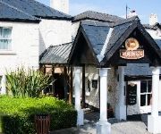
The Dukes Head Hotel
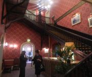
Hilton London Croydon
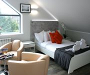
Croham Park Bed & Breakfast
Coulsdon Manor Hotel and Golf Club
Westciti Caroco Aparthotel
Best Western Plus London Croydon Aparthotel
Hallmark Croydon
Croydon Park
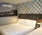
TRAVELODGE LONDON SOUTH CROYDON
Kato London Haus
Videos from this area
These are videos related to the place based on their proximity to this place.
Self Assessment tax returns | HMRC Tax advisor, accountant in Croydon, Wandsworth, Merton, Lambeth.
0208 664 8096 http://www.ibissandco.com/ At iBISS & Co we appreciate the complexities of providing self assessment tax advice in respect of HMRC. We are based in Croydon and serve almost...
Croydon Airport Video Footage
Just messing around practicing orientation control with my DJI Phantom 2 Vision + drone.
Old Plymouthians 3 - 3 Cheam Village Warriors Penalty Shoot
The first penalty in Old Plymouthians' epic cup semi-final penalty shootout win against Cheam Village Warriors. 3-0 down at half-time, it looked like another semi-final exit for OPFC, but they...
Elite Lessons- Choosing Between A Manual & Automatic Car
ELITE Driving Instructor Training Ltd. Helena Suite 3 Airport House Purley Way Croydon Surrey CR0 0XZ 020 8781 1818 More info at http://www.elitelessons.co.uk Elite Lessons is a driving...
ABC LIGHT REMOVALS professional removalist
http://www.abc-light-removals.com/ 07930302580 info@abc-light-removals.com ..WHY CHOOSE A B C ..? A B C Light Removals gets the job done right! We move you efficiently from A to B and...
Ray Mears Eating
This Ray Mears compilation has been 10 yrs in the thinking, and 4 weekends in the making. I hope that you appreciate it as much as I do. If you want to learn more about bushcraft and wilderness...
Minecraft | The Shrine Server | SMP | Factions | Plugins | Shops | Trading | & More
JOIN NOW: 77.103.222.251:25575.
Lanterns for Laurence (HD)
On 10th February 2009, Laurence Clifford celebrated his 60th Birthday. The following Saturday evening saw family and friends assemble for a party. These traditional Chinese Wish Lanterns...
Videos provided by Youtube are under the copyright of their owners.
Attractions and noteworthy things
Distances are based on the centre of the city/town and sightseeing location. This list contains brief abstracts about monuments, holiday activities, national parcs, museums, organisations and more from the area as well as interesting facts about the region itself. Where available, you'll find the corresponding homepage. Otherwise the related wikipedia article.
Tramlink
Tramlink (originally and sometimes still called Croydon Tramlink) is a tramway system in south London in the United Kingdom which began operation in May 2000. The service is operated by London Tramlink, an arm of Transport for London (TfL).
Croydon Airport
Croydon Airport was an airport in South London straddling the boundary between what are now the London boroughs of Croydon and Sutton. It was the main airport for London before it was replaced by Northolt Aerodrome, London Heathrow Airport and Gatwick Airport. The terminal building and entrance lodge are Grade II listed buildings.
BedZED
Beddington Zero Energy Development (BedZED) is an environmentally friendly housing development in Hackbridge, London, England. It is in the London Borough of Sutton, about two miles east of the town of Sutton itself. It was designed by the architect Bill Dunster to support a more sustainable lifestyle. The project was led by the Peabody Trust in partnership with Bill Dunster Architects, Ellis & Moore Consulting Engineers, BioRegional, Arup and the cost consultants Gardiner and Theobald.
Carshalton and Wallington (UK Parliament constituency)
Carshalton and Wallington /kɑːˈʃɔːltən ənd wɒlɪŋɡtən/ is a constituency represented in the House of Commons of the Parliament of the United Kingdom. It elects one Member of Parliament (MP) by the first past the post system of election. It is a marginal seat between the Liberal Democrats and the Conservatives. The constituency was created at the 1983 general election, replacing the former seat of Carshalton.
Roundshaw
Roundshaw is a housing estate and park in south Wallington on the eastern edge of the London Borough of Sutton. Grid Ref TQ302633. It was built on part of the site of the former Croydon Airport, and occupying roughly the area on which once stood the buildings of the first Croydon Aerodrome (the 'Plough Lane' aerodrome) which was demolished in 1928. The name comes from Roundshaw Park on the edge of the site, itself named from a round 'shaw' or grove of trees, which is still a feature.
Municipal Borough of Beddington and Wallington
Beddington and Wallington was, from 1915 to 1965, a local government district in north east Surrey, England. It formed part of the London suburbs, lying within the Metropolitan Police District and the London Passenger Transport Area. In 1965 it was abolished on the creation of Greater London.
Beddington Lane tram stop
Beddington Lane tram stop is a halt on the Tramlink service. There was previously a railway station on this site, on the single track line from Wimbledon to Croydon, which closed in 1997 in order for it to be converted for Tramlink use. The stop is accessible from the east from Beddington Lane, and also from the pathway leading to the west and south.
Therapia Lane tram stop
Therapia Lane tram stop is a halt on the Tramlink service in Croydon, close to the Purley Way commercial area. It is one of the busiest tram stops on the route, but not as busy as East Croydon or Wimbledon. The stop lies in the London Borough of Sutton close to the boundary with Croydon.
Ampere Way tram stop
Ampere Way is a tram stop in the London Borough of Croydon, serving the Purley Way commercial area. Tramlink trams serve the stop, which is located opposite IKEA Croydon. When the station opened, at the same time as Route 1, the station was named "Ampere Way" due to the proximity of the former Croydon Power Station. The two chimneys from the old power station still exist in the grounds of an IKEA store, and they have IKEA coloured bands near their tops.
Waddon Marsh tram stop
Waddon Marsh tram stop is a stop on the Tramlink service serving the area between Waddon and Croydon in the London Borough of Croydon. It is close to the commercial areas of the Purley Way. The stop is overshadowed by the giant gasometer of Croydon Gas Works. There was previously a railway station on this site called Waddon Marsh, though all that remains of the previous station is an access path still lined with streetlamps painted BR red.
Wandle Park tram stop
Wandle Park tram stop is a light rail stop in the London Borough of Croydon in the southern suburbs of London. It serves the residential area between central Croydon and Waddon, and is adjacent to Wandle Park. The tram stop is served by Tramlink route 3 from Wimbledon to New Addington via central Croydon. The tram stop is located on a double track section of line, with platforms on either side of the track.
Bandon Halt railway station
Bandon Halt was a station on the 1847 London, Brighton and South Coast Railway extension from West Croydon to Epsom. It was situated between Waddon and Wallington stations and was open between 1906 and 1914. It takes its name from the immediate area which is called Bandon Hill. It was located at grid reference TQ301644 and was accessed from Plough Lane, the platforms lying to the immediate east of the overbridge.
Croydon Water Palace
The Croydon Water Palace was an indoor water park complex that opened in 1990 on Purley Way in Waddon in the London Borough of Croydon, opposite Croydon Airport. It was part of the Purley Way retail development drive that occurred in the early 1990s, which also saw the creation of the Valley Park Retail Area. The Water Palace experienced continuous financial difficulties and finally closed in 1996.
Waddon Marsh railway station
Waddon Marsh railway station was in Waddon in the London Borough of Croydon on the West Croydon to Wimbledon Line. It was between West Croydon and Beddington Lane Halt stations. There was pedestrian access by footpath only from Miller Road a side street near Purley Way.
Beddington Lane railway station
Beddington Lane railway station was a small single-platform station on the West Croydon to Wimbledon Line. It was situated in a semi-rural location the nearest major neighbourhoods were Beddington and Mitcham.
Carshalton Park
Carshalton Park is a public park in Carshalton, in the London Borough of Sutton. It is situated south of the High Street, in the area bounded by Ruskin Road, Ashcombe Road, Woodstock Road and The Park. Carshalton Park and some of the surrounding houses, are within a conservation area.
Croydon Cemetery
Croydon Cemetery' is a cemetery located next to Mitcham Common near Croydon, which is part of the London Borough of Croydon, London. It is managed by Croydon Cemeteries and Crematoriums. The cemetery is much larger than other ones in London and Croydon Crematorium is located inside the cemetery. There is also a church located inside the cemetery.
Colonnades Leisure Park
The Colonnades Leisure Park (also known as Croydon Colonnades) is an out-of-town leisure park located in the Purley Way retail and industrial district of the London Borough of Croydon, South London which opened in the late 1990s. The retail park was built on the former site of the Croydon Water Palace, an indoor water park complex that opened in 1990, but had to close due to financial difficulties.
Valley Park Retail Area
Valley Park Retail and Leisure Complex is a retail park in the Purley Way retail and industrial area of the London Borough of Croydon. Valley Park was opened in 1992 on the site of the former Croydon power stations, the first of which was built in the late nineteenth century. Croydon B power station was closed in 1984 and the majority of the site cleared in 1991.
West Thornton Primary Academy
West Thornton Primary Academy (formerly West Thornton Primary Academy) is a primary school with academy status for pupils aged between 4 and 11 years. The school is located on Rosecourt Road, near Purley Way around Thornton Heath Pond in the London Borough of Croydon. The school caters for pupils from Reception to Year 6. The school is close to the border of Croydon and the London Borough of Merton. It is also close to Croydon Cemetery.
Broad Green (ward)
Broad Green is a ward in the London Borough of Croydon, corresponding to the west Croydon area of London in the United Kingdom. The much smaller area known as Broad Green is divided between this ward and the neighbouring ward of Selhurst. Broad Green extends from central Croydon to the south to the border with the London Boroughs of Sutton and Merton by Mitcham Common. The ward includes part of the retail core of Croydon and the northern part of the Purley Way retail area.
Wandle Park
Wandle Park is the name of two separate parks in London, on the course of the River Wandle and on the Wandle Trail. The Wandle Trail passes through both parks.
Therapia Lane depot
Therapia Lane depot is a tram depot, situated in the London Borough of Sutton, just south of Tramlink's Wimbledon branch, between Therapia Lane and Beddington Lane. Built on the site of former railway sidings, all tram maintenance, repairs and control functions are based in a purpose built building, erected in 1998. The depot has sufficient stabling for up to 24 tram sets, and a double track workshop with all required facilities to perform almost all maintenance.
Croydon power stations
The Croydon power stations refers to a pair of demolished coal-fired power stations and to a gas-fired power station in the Purley Way area of Croydon, London. The coal-fired stations operated from 1896 until 1984, and the gas-fired station opened in 1999. Croydon B power station's chimneys have been retained as a local landmark.
1947 Croydon Dakota accident
The 1947 Croydon Dakota accident occurred on the 25 January 1947 when a Spencer Airways Douglas C-47A Skytrain (Dakota) failed to get airborne from Croydon Airport, located near London, and crashed into a parked and empty CSA Douglas C-47 destroying both aircraft and killing eleven passengers and one crew member.


