Safety Score: 3,0 of 5.0 based on data from 9 authorites. Meaning we advice caution when travelling to United Kingdom.
Travel warnings are updated daily. Source: Travel Warning United Kingdom. Last Update: 2024-04-19 08:03:45
Discover Mitcham
Mitcham in Greater London (England) with it's 48,311 citizens is a place in United Kingdom a little south of London, the country's capital city.
Current time in Mitcham is now 01:02 AM (Saturday). The local timezone is named Europe / London with an UTC offset of one hour. We know of 9 airports near Mitcham, of which 5 are larger airports. The closest airport in United Kingdom is London Biggin Hill Airport in a distance of 10 mi (or 16 km), South-East. Besides the airports, there are other travel options available (check left side).
There are several Unesco world heritage sites nearby. The closest heritage site in United Kingdom is Tower of London in a distance of 13 mi (or 21 km), North-East. Also, if you like playing golf, there are a few options in driving distance. We encountered 5 points of interest in the vicinity of this place. If you need a hotel, we compiled a list of available hotels close to the map centre further down the page.
While being here, you might want to pay a visit to some of the following locations: Morden, Sutton, Wandsworth, Croydon and Kensington. To further explore this place, just scroll down and browse the available info.
Local weather forecast
Todays Local Weather Conditions & Forecast: 9°C / 48 °F
| Morning Temperature | 3°C / 38 °F |
| Evening Temperature | 10°C / 50 °F |
| Night Temperature | 6°C / 42 °F |
| Chance of rainfall | 0% |
| Air Humidity | 47% |
| Air Pressure | 1029 hPa |
| Wind Speed | Gentle Breeze with 9 km/h (5 mph) from South |
| Cloud Conditions | Scattered clouds, covering 48% of sky |
| General Conditions | Scattered clouds |
Sunday, 21st of April 2024
8°C (47 °F)
6°C (42 °F)
Broken clouds, gentle breeze.
Monday, 22nd of April 2024
10°C (50 °F)
6°C (42 °F)
Light rain, gentle breeze, overcast clouds.
Tuesday, 23rd of April 2024
9°C (48 °F)
6°C (44 °F)
Light rain, gentle breeze, broken clouds.
Hotels and Places to Stay
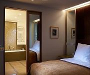
Crowne Plaza LONDON - BATTERSEA
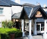
The Dukes Head Hotel
Best Western Plus London Croydon Aparthotel
onefinestay - Clapham private homes
The Wimbledon
Southfields B&B Studios
Brewers Inn Hotel
Holiday Inn LONDON - SUTTON
Kato London Haus
TRAVELODGE LONDON BALHAM
Videos from this area
These are videos related to the place based on their proximity to this place.
Steve Morrison - Going Up The Country - feat: Alan Glen
Steve Morrison - Going Up The Country - feat: Alan Glen - Recorded Live at BBs Blues Club, The Colour House Theatre, Merton Abbey Mills. - Written By - Al Wilson - Steve Morrison - Vocals /...
Trams at Morden Road
another video with Fowler7F https://www.youtube.com/user/Fowler7F/ we went to Morden Hall Park and found a level crossing from where we could see Morden Road stop ...
Snow In Morden
The view out of the windscreen of the cab we took home (Morden to Carshalton) on February 1st.
Croydon Tramlink
A dél-londoni Croydon Tramlink (ma már London Tramlink) villamosa fedélzetén haladunk Morden Road és Phipps Bridge között, 2008. április 11-én. http://ice76.hu/croydon.htm On board...
London Fire Brigade - H361 Mitcham
Mitcham's pump ladder turns out to an AFA actuating. Find more @ www.lfbsite.com.
Videos provided by Youtube are under the copyright of their owners.
Attractions and noteworthy things
Distances are based on the centre of the city/town and sightseeing location. This list contains brief abstracts about monuments, holiday activities, national parcs, museums, organisations and more from the area as well as interesting facts about the region itself. Where available, you'll find the corresponding homepage. Otherwise the related wikipedia article.
Mitcham tram stop
Mitcham tram stop is a Tramlink stop in Mitcham in the London Borough of Merton. The stop is on Tramlink route 3 between Belgrave Walk and Mitcham Junction. It was formerly Mitcham railway station, whose station closed in 1997. The modern stop consists of twin platforms accessible by ramps at either end.
Mitcham and Morden (UK Parliament constituency)
Mitcham and Morden is constituency in Greater London represented in the House of Commons of the UK Parliament since 1997 by Siobhain McDonagh of the Labour Party.
Municipal Borough of Mitcham
Mitcham was a local government district in north east Surrey from 1915 to 1965 around the town of Mitcham. It was created in 1915 as an urban district from part of the abolished Croydon Rural District. It gained the status of municipal borough in 1934.
Eagle House, London
Eagle House is a Queen Anne house built in the Dutch style. It is on London Road, Mitcham, in the London Borough of Merton, the grounds forming a triangle bounded by London Road, Bond Road and Western Road. The building dates back to 1705, having been commissioned by the Marrano doctor Fernando Mendes (1647–1724), former physician to Charles II, and in whose family it remained for three generations.
Mitcham Library
Mitcham Library is a public library in Mitcham, England, being one of the libraries of the London Borough of Merton. It was built in 1933 on land donated by a local builder, Mr Joseph Owen. In April 1932 he donated £4,025 towards its construction. The original building was 60 feet wide and 66 feet long, and was built on the London Road in Mitcham, opposite the Holborn Schools. The reference library itself was 36 feet by 25 feet, and the lending library 66 by 25 feet .
Sunshine Way
Sunshine Way is the name of a crescent-shaped street in Mitcham, England, built in 1936 for families from overcrowded areas of inner London, and including specially-designed houses to suit the needs of tuberculosis (TB) patients. The houses date from a period of nationwide effort to build better accommodation for poorer people, and a growing awareness of the link between bad housing and health problems.
Belgrave Walk tram stop
Belgrave Walk tram stop is a stop on the Tramlink service near Mitcham in the London Borough of Merton. The stop is named after Belgrave Walk, an adjacent residential street to the north. The tram stop consists of an island platform which is accessed by pedestrian level crossings at both ends of the platform. The crossing at the western end only serves the north side of the line, whilst the one at the eastern end forms a path connecting neighbourhoods on either side of the line.
Figges Marsh
Figges Marsh is a park in the London Borough of Merton. It's located in Mitcham, close to Tooting railway station. Originally, the park was located next to a toll road into London. It was named after William Figge who occupied the land from 1357.
A237 road
The A237 is an A road in South London. It runs from the west side of Mitcham Common to Coulsdon. It crosses through 2 London Boroughs which includes the start inside the London Borough of Merton and the ending of the road inside the London Borough of Croydon. The road ends at a busy junction with the A23 which soon carries on to the M23. The road passes 3 mainline train stations, Mitcham Junction station (also a Tramlink stop), Hackbridge railway station and Wallington railway station.
Mitcham Cricket Green
Mitcham Cricket Green is a cricket ground in Mitcham, south London. It is the home of Mitcham Cricket Club and is reportedly the oldest cricket ground still in use, having been used for cricket since 1685.
Wandle Trail
The Wandle Trail is a walking and cycling trail that follows the River Wandle from Croydon to Wandsworth in south-west London
Imperial Fields
Imperial Fields is a football stadium in Morden, south London that is home to Tooting & Mitcham United F.C. and formerly Chelsea L.F.C.. The stadium opened in 2002 and has a total capacity of 3,500 (612 seated). Tooting & Mitcham United moved in 2002 from an all-wooden facility at Sandy Lane in Tooting, which had been declared a fire hazard. The stadium hosted the first ever game of the FA WSL on Wednesday 13 April 2011. Arsenal beat Chelsea 1–0 with a goal from Gilly Flaherty.


