Safety Score: 3,0 of 5.0 based on data from 9 authorites. Meaning we advice caution when travelling to United Kingdom.
Travel warnings are updated daily. Source: Travel Warning United Kingdom. Last Update: 2024-04-27 08:23:39
Discover North Cheam
The district North Cheam of in Greater London (England) is a district in United Kingdom a little south-west of London, the country's capital city.
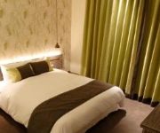
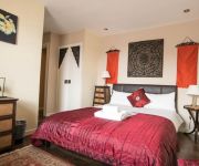
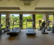
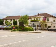
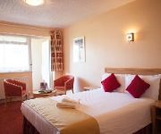
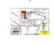
Looking for a place to stay? we compiled a list of available hotels close to the map centre further down the page.
When in this area, you might want to pay a visit to some of the following locations: Sutton, Morden, Kingston, Wandsworth and Headley. To further explore this place, just scroll down and browse the available info.
Local weather forecast
Todays Local Weather Conditions & Forecast: 6°C / 42 °F
| Morning Temperature | 10°C / 49 °F |
| Evening Temperature | 7°C / 45 °F |
| Night Temperature | 5°C / 42 °F |
| Chance of rainfall | 2% |
| Air Humidity | 93% |
| Air Pressure | 1004 hPa |
| Wind Speed | Moderate breeze with 12 km/h (7 mph) from North-East |
| Cloud Conditions | Overcast clouds, covering 100% of sky |
| General Conditions | Light rain |
Monday, 29th of April 2024
13°C (56 °F)
8°C (47 °F)
Light rain, moderate breeze, overcast clouds.
Tuesday, 30th of April 2024
15°C (59 °F)
11°C (51 °F)
Overcast clouds, moderate breeze.
Wednesday, 1st of May 2024
18°C (64 °F)
13°C (55 °F)
Light rain, gentle breeze, broken clouds.
Hotels and Places to Stay
Bosco
The Wimbledon
Warren House
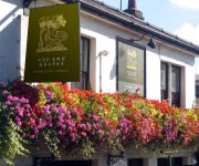
Fox and Grapes
Brook Kingston Lodge Hotel
WARREN HOUSE
Greyhound Hotel
Antoinette Kingston
New England Hotel
Pelican London Hotel and Residence
Videos from this area
These are videos related to the place based on their proximity to this place.
Morden Test Route 1
A short look at one possible set of roads examiners at Morden Driving Test Centre could use and suggestions on how to navigate the route and pass the driving exam at Morden. http://www.wimbledondr ...
Driving lessons in Morden Helped Komathy Selva Pass Her Driving Test
Congratulations to Komathy Selva for passing her driving test, thanks in no small part to the excellent driving lessons in Morden she received from the Wimbledon Driving School. http://bit.ly/1tuY...
gutter cleaning Morden
Wilsons Window Cleaning 139 Aragon Road Morden, Surrey, SM4 4QG 07746 203015 info@wilsonswindowcleaners.co.uk http://www.wilsonswindowcleaners.co.uk/ Wilsons Window Cleaning are the ...
Morden Park Bliss 18 Dec 2010 Nokia N8 HD
Shot at 720p in Morden Park, Morden, UK with Nokia N8 mounted on a tripod.
Traditional 3 bedroom house with off street private parking and private garden situated in Morden
Let My Roof would like to present a 3 bedroom house with private off street parking and private garden situated on Central Road, Morden SM4. The house benefits from a traditional spacious...
window cleaners Wimbledon
Wilsons Window Cleaning 139 Aragon Road Morden, Surrey, SM4 4QG 07746 203015 info@wilsonswindowcleaners.co.uk http://www.wilsonswindowcleaners.co.uk/ Wilsons Window Cleaning are the ...
gutter cleaning Wimbledon
Wilsons Window Cleaning 139 Aragon Road Morden, Surrey, SM4 4QG 07746 203015 info@wilsonswindowcleaners.co.uk http://www.wilsonswindowcleaners.co.uk/ Wilsons Window Cleaning are the ...
Bus Rally North Cheam
Summer 2008, Old Buses, London Transport, London Country, Shot using a Sony HC3 and edited using imovie 06.
Destiny Walkthrough Part 21 - The Buried City - Mars Mission
Destiny Walkthrough Part 21 - The Buried City - Mars Mission! More Destiny Campaign Gameplay to come! From the Creators of Halo and the company that brought you Call of Duty. In Destiny you...
Destiny Walkthrough Part 7 - The Sword Of Crota - Moon Mission
Destiny Walkthrough Part 7 - The Sword Of Crota - Moon Mission! More Destiny Campaign Gameplay to come! From the Creators of Halo and the company that brought you Call of Duty. In Destiny...
Videos provided by Youtube are under the copyright of their owners.
Attractions and noteworthy things
Distances are based on the centre of the city/town and sightseeing location. This list contains brief abstracts about monuments, holiday activities, national parcs, museums, organisations and more from the area as well as interesting facts about the region itself. Where available, you'll find the corresponding homepage. Otherwise the related wikipedia article.
London Borough of Sutton
The London Borough of Sutton is a London borough in South London, England and forms part of Outer London. It covers an area of 43 km and is the 80th largest local authority in England by population. It is one of the southernmost boroughs of London. It is south of the London Borough of Merton, west of the London Borough of Croydon and east of the Royal Borough of Kingston Upon Thames. The local authority is Sutton London Borough Council.
Nonsuch Palace
Nonsuch Palace was a Tudor royal palace, built by Henry VIII in Surrey, England; it stood from 1538 to 1682–3. Its ruins are in Nonsuch Park.
Sutton and Cheam (UK Parliament constituency)
Sutton and Cheam is a constituency represented in the House of Commons of the UK Parliament since Paul Burstow, a Liberal Democrat.
Alexander Maconochie (penal reformer)
Alexander Maconochie (11 February 1787 – 25 October 1860) was a Scottish naval officer, geographer, and penal reformer.
North East Surrey College Of Technology
The North East Surrey College Of Technology (NESCOT) is a large further education and higher education college in Epsom and Ewell, Surrey, England that began as Ewell Technical College in the 1950s.
A217 road
The A217 is a road in the United Kingdom. It runs south from Kings Road in Fulham, London, crossing the Thames at Wandsworth Bridge, then passing through Wandsworth, Tooting, Mitcham, Cheam, Banstead, crossing the M25 motorway at Junction 8, then passing through Reigate and terminating shortly before reaching Gatwick Airport.
A232 road
The A232 is a road running west-east across South London, which connects the A24 in Ewell with the A224 Orpington bypass. Between Croydon and Ewell the road runs close to the Sutton & Mole Valley Line. London Buses route X26 bus runs along the road between Waddon and Cheam.
St Mary's Church, Ewell
The Anglican Church of St Mary the Virgin, Ewell is the civic church of the borough of Epsom and Ewell in the county of Surrey in South East England.
Municipal Borough of Sutton and Cheam
Sutton and Cheam was a local government district in north east Surrey, England from 1882 to 1965. Sutton Local Government District was formed on 20 December 1882, when the parish of Sutton adopted the Local Government Act 1858. Sutton Local Board was formed to govern the area. The Local Government Act 1894 reconstituted the local government district as Sutton Urban District and an urban district council replaced the local board.
Raynes Park Vale F.C
Raynes Park Vale Football Club is a semi-professional football club based in Raynes Park in the London Borough of Merton, England. They play in the Combined Counties League Premier Division.
Worcester Park F.C
Worcester Park Football Club is a football club based in Worcester Park in the London Borough of Sutton, England and part of the Worcester Park Athletic Club. The name WPAC is a bit misleading as there is no athletics track on the sports field and the only other sporting sections (apart from football) consist of cricket (Surrey Championship Division 2) and tennis.
Worcester Park House
Worcester Park House, built in 1607, whose ruins are in Surrey, in the United Kingdom was one of the residences of the 4th Earl of Worcester, who was appointed Keeper of the Great Park in 1606. In 1670 a long lease of the house and park was granted to Sir Robert Long, 1st Baronet by Charles II. The area known as Worcester Park was once part of a Great Park surrounding the Nonsuch Palace of Henry VIII, and was used extensively for hunting.
Nonsuch Mansion
Nonsuch Mansion is a Grade II listed house located within Nonsuch Park in north Surrey, England. In medieval times it was part of the three thousand acre manor of Cuddington. The mansion was built in 1731-43 by Joseph Thompson and later bought by Samuel Farmer in 1799. He employed Jeffry Wyattville to rebuild it in a Tudor Gothic style in 1802-6. Farmer was succeeded by his grandson in 1838 under whom the gardens became famous.
Cannon Hill Common
Cannon Hill Common is a public park in the London Borough of Merton. It is situated near Raynes Park and Morden. It is also the location of a Local Nature Reserve and the Paddock Allotments.
Whitehall (Sutton)
Whitehall is an historic house museum in Cheam, Sutton, England. Built around 1500, the Tudor period timber-framed house features a period kitchen, and house details from the Georgian, Victorian and Edwardian eras. One room features a display about Nonsuch Palace, a nearby former palace built by King Henry VII that was pulled down in the 1680s.
Borough Sports Ground
The Borough Sports Ground is the home of Sutton United F.C.. It is also known as Gander Green Lane or simply GGL because of its location on that road. The record attendance for the Borough Sports Ground is 14,000 when Sutton United lost 6–0 to Leeds United in the fourth round of the 1969–70 FA Cup. In recent times, the pitch has played host to England C team and FA Sunday Cup matches.
Cuddington, Surrey
Cuddington was a village in Surrey which was demolished to make way for Henry VIII's Nonsuch Palace near Cheam. Cuddington lay within the Copthorne hundred, an administrative division devised by the Saxons. Within the current Nonsuch Park, a little to the south of where the palace once stood, there remains a small rise of land to mark the northern side of the old Cuddington Parish church.
Ewell Castle School
Ewell Castle School is a British independent day school for boys aged 3 to 18 and girls aged 3 – 11 and, from September 2013, 16 - 18 also. Founded in 1926 by Mr Herbert Budgell originally as a boarding school, it is located in Ewell, Surrey. The school consists of the Main House (affectionately known by Ewellians as 'The Castle'), Glyn House and Chessington Lodge. Headteachers are Mr M Holder-Williams (MA) of the Senior School, Mrs.
Collingwood Recreation Ground
Collingwood Recreation Ground is a grassed open space, with entrances in Collingwood Road and Gander Green Lane, in the London Borough of Sutton. It has a ball park, a playground and a small skate park.
Cheam Road
Cheam Road is a cricket ground in Sutton, London. The first recorded match on the ground was in 1940, when Sutton United Tramps played London Counties. The ground held a single match in the 1955 Minor Counties Championship when the Surrey Second XI played the Warwickshire Second XI. More recently, the ground has held Surrey Second XI matches in the Second XI Championship and the Second XI Trophy.
Cheam Cricket Club Ground
Cheam Cricket Club Ground is a cricket ground in Cheam, London. The first recorded match on the ground was in 1940, when Cheam played London Counties. More recently, the ground has held Surrey Second XI matches in the Second XI Championship and the Second XI Trophy. In 1968, the ground held a game for John Edrich against the International Cavaliers. The game attracted 8,000 people and was the first cricket match to be televised in colour by the BBC.
Malden Manor
Malden Manor is a manor house located in the Old Malden area in the borough of Kingston Upon Thames, London, England. The Grade II listed Manor House, next to St John's, is also mentioned in the Domesday Book. In 1264 Walter de Merton, Bishop of Rochester, founded a college here that was later moved to Oxford as Merton College. The house was later used as a court in the reign of Henry VIII, and in the mid 18th century the house was the home of Captain Cook.
Sutton Common
Sutton Common is a common located in Sutton, London. It is served by Sutton Common railway station.
Sutton Life Centre
Sutton Life Centre is a community centre in Sutton, South London. It is an £8 million facility designed to make youths more streetwise. Its key feature – the lifezone – is a virtual street, a room with screens on all walls showing real-life scenes from Sutton's streets. It also has a library, a cafe, a climbing wall, and community, eco, sports, youth and media zones. It tries to encourage community engagement and involvement. It was opened on 27 October 2010 by Deputy Prime Minister Nick Clegg.
Lumley Chapel
Lumley Chapel is a redundant Anglican church in the suburban village of Cheam, in the London Borough of Sutton, England. It has been designated by English Heritage as a Grade II* listed building, and is under the care of the Churches Conservation Trust. The chapel is located in the churchyard of St Dunstan's Church in Church Road, off Malden Road, the A2043.


