Safety Score: 3,0 of 5.0 based on data from 9 authorites. Meaning we advice caution when travelling to United Kingdom.
Travel warnings are updated daily. Source: Travel Warning United Kingdom. Last Update: 2024-05-10 08:04:54
Discover Mawneys
The district Mawneys of Dagenham in Greater London (England) is a district in United Kingdom about 13 mi north-east of London, the country's capital city.
Looking for a place to stay? we compiled a list of available hotels close to the map centre further down the page.
When in this area, you might want to pay a visit to some of the following locations: Romford, Ilford, East Ham, Bexleyheath and Woolwich. To further explore this place, just scroll down and browse the available info.
Local weather forecast
Todays Local Weather Conditions & Forecast: 20°C / 67 °F
| Morning Temperature | 12°C / 54 °F |
| Evening Temperature | 20°C / 68 °F |
| Night Temperature | 11°C / 53 °F |
| Chance of rainfall | 0% |
| Air Humidity | 56% |
| Air Pressure | 1024 hPa |
| Wind Speed | Gentle Breeze with 6 km/h (4 mph) from West |
| Cloud Conditions | Overcast clouds, covering 99% of sky |
| General Conditions | Overcast clouds |
Saturday, 11th of May 2024
19°C (66 °F)
12°C (54 °F)
Broken clouds, gentle breeze.
Sunday, 12th of May 2024
20°C (68 °F)
14°C (58 °F)
Light rain, gentle breeze, overcast clouds.
Monday, 13th of May 2024
17°C (63 °F)
13°C (55 °F)
Light rain, moderate breeze, broken clouds.
Hotels and Places to Stay
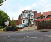
TRAVELODGE LONDON ROMFORD
Harefield Manor
Gidea Park Hotel
O'Grady's
The Blue Boar
Holiday Inn Express LONDON - NEWBURY PARK
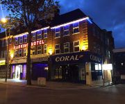
Barking Hotel
TRAVELODGE LONDON BARKING
Romview
Premier Inn London Romford Central
Videos from this area
These are videos related to the place based on their proximity to this place.
Deepa & Amit ::: Hindu Wedding // City Pavillion, Romford // Shaadi Video
A beautiful Hindu Wedding expertly organised by the wonderful team at Amore Weddings & Events Shaadi Video www.shaadi-video.com.
Welcome to FootAsylum Romford
Check out 'A day in the life' working in the Romford Foot Asylum Store. FootAsylum is one of the leading high street retailers in the UK, trading now at 30 stores nationwide. For the latest...
Early Days - Romford Skatepark '96
Hitting 'The Rom' Skatepark in Romford, England sometime in 1996, with Greg Finch and Brenton Dawber aka Pinga. Greg was ruling it. Goodtimes as always.
Joey The Clown - Fiction Romford - Halloween Weekender
From Thursday 30th October to Saturday 1st November, do you dare to enter Fiction Romford…. Joey The Clown and his Circus Freaks take over Fiction for one Halloween Weekender you won't forget!
Romford Accountants - Self Assessment Tax Returns
http://www.holgatecourtaccountants.co.uk/self-assessment/self-assessment-help Holgate Court Accountants in Romford strongly advise that businesses file and pay tax on time to avoid hefty fines...
Joey The Clown - Fiction Romford - Halloween Weekender
From Thursday 30th October to Saturday 1st November, do you dare to enter Fiction Romford…. Joey The Clown and his Circus Freaks take over Fiction for one Halloween Weekender you won't forget!
Advanced Baton Duo (UKFM Regional Competitions 2012)
Mine and Charley's advanced baton duo from the 2012 UKFM regional competitions. Found out on the day we were entered for this so made up in about half hour :) Not a bad effect!
Patio Cleaning 07920 754 997 Only £2.50 per sq m Romford Essex Driveway Cleaning
https://zonalm.leadpages.net/essexjetwash1/ http://www.patio-cleaning.com Having a Clean Driveway and Patio is one of the Important Things You Need to Consider as a Homeowner!
Videos provided by Youtube are under the copyright of their owners.
Attractions and noteworthy things
Distances are based on the centre of the city/town and sightseeing location. This list contains brief abstracts about monuments, holiday activities, national parcs, museums, organisations and more from the area as well as interesting facts about the region itself. Where available, you'll find the corresponding homepage. Otherwise the related wikipedia article.
William Benjamin Carpenter
William Benjamin Carpenter MD CB FRS (29 October 1813 – November 19, 1885) was an English physician, invertebrate zoologist and physiologist. He was instrumental in the early stages of the unified University of London.
Romford Market
Romford Market is a large open market with 270 stalls, located in Romford, London Borough of Havering, Greater London, England. The market is open on Wednesdays, Fridays and Saturdays from 8.30 am to 4.30 pm (5 pm on Saturdays). There is a farmers' market at the site from 10 am to 3 pm on the second and fourth Sundays of the month.
The Liberty
The Liberty, is a covered shopping centre located in the London Borough of Havering. It is the largest shopping centre in Romford, a metropolitan centre of Outer London. It was originally built in 1968 as the Liberty Shopping Centre and underwent a four-year redevelopment completed in 2004. The centre takes its name from the former Liberty of Havering and is owned by the Cosgrave Property Group.
Barking and Dagenham College
Barking and Dagenham College, formerly Barking College, is a secondary education college with approximately 3000 full-time students located in the London Borough of Barking and Dagenham in Dagenham east London, England. Barking College Further and Higher Education College is located in Dagenham Road, Rush Green, London, UK. The college offers many courses at many levels, such as A-Levels, HNC/HND, BTEC and many more.
Havering Palace
Havering Palace was one of the many royal residences in England. It was located in the village of Havering-atte-Bower in what is now the London Borough of Havering. It stood just to the north and west of the existing parish church of St John the Evangelist, which was built on the site of one of the palace’s chapels.
Romford (UK Parliament constituency)
Romford is a constituency represented in the House of Commons of the UK Parliament since 2001 by Andrew Rosindell, a Conservative.
Municipal Borough of Dagenham
Dagenham was a local government district in south west Essex, England from 1926 to 1965 covering the parish of Dagenham. Initially created as an urban district, it was incorporated as a municipal borough in 1938. It was established to deal with the increase in population and the change from rural to urban area caused by the building of the Becontree estate by the London County Council and the subsequent movement of people from Inner London.
Municipal Borough of Romford
Romford was a local government district in southwest Essex from 1851 to 1965. It was significantly expanded in 1934 and gained the status of municipal borough in 1937. The population density of the district consistently increased during its existence and its former area now corresponds to the northern part of the London Borough of Havering in Greater London.
Romford Greyhound Stadium
Romford Greyhound Stadium is a dog track located in Romford in the London Borough of Havering in east London which is owned by the Gala Coral Group. The stadium has a capacity for over 4,300 people. The stadium has won several awards including Winner of the British Greyhound Racing Board's 'Racecourse of the Year' award in 1998 and again in 2003. Several Underworld tracks are named after greyhounds that ran at the stadium, including Born Slippy, Sappy's Curry, and Pearl's Girl.
Romford Ice Arena
Romford Ice Arena is an ice rink located in Romford in the London Borough of Havering, England. The venue was built in the 1980s and at the time of opening in 1987 was equipped with a full range of facilities, including a cafe and arcade games. It is the home of the Romford Raiders ice hockey team. In addition to ice hockey, the arena has resident professional figure skating coaches. The rink is also used for public skating, as a conference centre and a party venue.
Oldchurch Hospital
Oldchurch Hospital was a hospital in London, United Kingdom, located in Romford, in the London Borough of Havering and part of the Barking, Havering and Redbridge Hospitals NHS Trust. The hospital incorporated the buildings of the former Romford Union Workhouse, built in 1838. The hospital closed in December 2006 with functions moved to the new, state of the art Queen's Hospital, located nearby and to King George Hospital in Chadwell Heath.
Queen's Hospital
Queen's Hospital is a hospital in Romford, in the London Borough of Havering, England. It was built on the site of the former Oldchurch Park, a short distance south of the town centre. Construction began in June 2003 and was completed in October 2006. Queen's is the flagship hospital of the Barking, Havering and Redbridge Hospitals NHS Trust and replaced both Harold Wood Hospital and Oldchurch Hospital when it opened in December 2006. It has a standard bed capacity of 939.
Star Brewery
The Star Brewery was a brewery in Romford, England. For much of its history, it was a main industry and a significant employer in the area. It was closed in 1993. The site was redeveloped as a shopping centre named The Brewery, which opened in 2001. The brewery produced John Bull Bitter.
Chase Cross
Chase Cross is a district of the London Borough of Havering in London, England. Chase Cross lies 0.8 miles (1.2 km) East of Collier Row and just under 2 miles North of {{#invoke:Coordinates|coord}}{{#coordinates:51.6062|0.1768|type:city_region:GB-HAV|||||| |primary |name= }}Romford
Crowlands Heath Golf Club
Crowlands Heath Golf Club is a golf course located in Chadwell Heath in London, United Kingdom.
The Mercury Mall
The Mercury Mall is a enclosed shopping centre in Romford, in the London Borough of Havering, Greater London. It opened in June 1990 as Liberty 2. From 2006 to August 2010 it was owned by The Mall Fund and was known as The Mall Romford. It is—along with The Liberty and The Brewery—one of the three main shopping centres in Romford.
Rise Park
See all Rise Park, Beverley, home of the ancestral Bethells http://www. bethellj. plus. com/notrise. htm Rise Park is an area of Romford, a district in the London Borough of Havering. The park is one of a series of parks which stretch northwards from the railway line at Romford. The southern entrance to Rise Park is just north of the A12 Eastern Avenue, and the northern entrance is on Lower Bedfords Road.
Raphael Park
Raphael Park is a public park in Romford, London Borough of Havering, one of a series of parks stretching northwards from the railway line at Romford. The name of this park is commonly pronounced by locals as "ray-fel" as opposed to "raff-ahy-al" (as in the name, Raphael). The southern entrance to Raphael Park is on Main Road in Romford, and the northern entrance is just south of the A12 Eastern Avenue.
Marshalls (house)
Marshalls was a house, located in Romford in the historic parish and Royal liberty of Havering, whose former area today forms the north eastern extremity of Greater London, England. The name Marshalls dates back to 1213 when Gilbert, son of Roger Marschal is recorded as leasing land in Havering to the house of Canons at St Bernard, and in 1321 Richard le Marescall owned land near the eventual site of the house.
Bower House
The Bower House is a grade I listed Palladian mansion in Havering-atte-Bower, England. It was built in 1729 by Henry Flitcroft. The stable block is separately grade I listed. It incorporated architectural items salvaged from the ruined Havering Palace. It remained a private home until 1976 when it was purchased by the Ford Motor Company. It is currently used as a religious training centre. It forms part of the Open House London weekend.
Havering Country Park
Havering Country Park is a varied environment open space in northeast London, England. It includes 100 acres of woodland. It is one of three large parklands in Havering-atte-Bower, the others are Bedfords Park and Pyrgo Park. The area of the park was formerly part of the estate of Havering Palace. The land was purchased by the Greater London Council and opened to the public in 1975, with ownership transferring the Havering London Borough Council in 1986.
The Brewery (shopping centre)
The Brewery is a shopping and leisure centre in Romford, in the London Borough of Havering, England. It is located on the site of the former Star Brewery, and it opened in 2001. It is—along with The Liberty and The Mercury—one of the three main shopping centres in Romford. In 2010, a 25% stake in the complex was sold by the Henderson Group to Prudential Property Investment Managers for £44.25m.
Bower Park School
Bower Park School is a secondary school with academy status in the London Borough of Havering for 11 to 16 year olds. The school gained its specialist Arts College (media) in 2010.
Crowlands railway station
Crowlands railway station is an unopened station on the Great Eastern Main Line between Chadwell Heath and Romford. It was to have been sited just west of Jutsums Lane, where the railway passes over the road on a narrow bridge. It was first proposed in 1900 by the Great Eastern Railway, and platform foundations were constructed, but the station never opened.
Becontree Heath bus station
Becontree Heath Bus Station is a bus station in East London, UK. It has lost most of its routes as all buses serving the area no longer stop in the bus station, rather several new stops built along the road nearby. The only bus to use the bus station is 150, which terminates in the bus station. It is the alighting point only and you will have to pick it up on the main road nearby.


