Safety Score: 3,0 of 5.0 based on data from 9 authorites. Meaning we advice caution when travelling to United Kingdom.
Travel warnings are updated daily. Source: Travel Warning United Kingdom. Last Update: 2024-08-13 08:21:03
Delve into Shirley
Shirley in Greater London (England) is located in United Kingdom a little south of London, the country's capital town.
Current time in Shirley is now 03:33 PM (Wednesday). The local timezone is named Europe / London with an UTC offset of one hour. We know of 8 airports close to Shirley, of which 5 are larger airports. The closest airport in United Kingdom is London Biggin Hill Airport in a distance of 5 mi (or 8 km), South-East. Besides the airports, there are other travel options available (check left side).
There are several Unesco world heritage sites nearby. The closest heritage site in United Kingdom is Palace of Westminster and Westminster Abbey including Saint Margaret’s Church in a distance of 11 mi (or 18 km), North-East. Also, if you like playing golf, there are some options within driving distance. We encountered 4 points of interest near this location. If you need a hotel, we compiled a list of available hotels close to the map centre further down the page.
While being here, you might want to pay a visit to some of the following locations: Croydon, Bromley, Catford, Camberwell and Poplar. To further explore this place, just scroll down and browse the available info.
Local weather forecast
Todays Local Weather Conditions & Forecast: 15°C / 60 °F
| Morning Temperature | 10°C / 50 °F |
| Evening Temperature | 13°C / 55 °F |
| Night Temperature | 10°C / 51 °F |
| Chance of rainfall | 0% |
| Air Humidity | 75% |
| Air Pressure | 1032 hPa |
| Wind Speed | Gentle Breeze with 6 km/h (4 mph) from North |
| Cloud Conditions | Scattered clouds, covering 31% of sky |
| General Conditions | Scattered clouds |
Thursday, 24th of October 2024
15°C (60 °F)
15°C (59 °F)
Sky is clear, moderate breeze, clear sky.
Friday, 25th of October 2024
10°C (50 °F)
9°C (48 °F)
Moderate rain, moderate breeze, overcast clouds.
Saturday, 26th of October 2024
11°C (52 °F)
8°C (46 °F)
Light rain, gentle breeze, clear sky.
Hotels and Places to Stay
Westciti Caroco Aparthotel
Croham Park Bed & Breakfast
De Vere Selsdon Estate
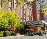
Croydon Park
Hilton London Croydon
Best Western Plus London Croydon Aparthotel
Hallmark Croydon
TRAVELODGE LONDON CRYSTAL PALACE
Grand Sapphire Hotel
TRAVELODGE LONDON BROMLEY
Videos from this area
These are videos related to the place based on their proximity to this place.
Driving School in Croydon Helped Ansuka Pass Her Driving Test
Congratulations to Ansuka for passing her driving test, thanks in no small part to the excellent lessons she received from her driving school in Croydon: the Wimbledon Driving School. http://bit.l...
Mountain bike riding in the snow, Croydon UK
http://www.mbr.co.uk/ Andy Waterman headed out into the UK's record snowfall this January 2010 aboard a Tomac Snyper.
Eden Park to Hayes on Southeastern 465014
The journey from Eden Park to Hayes aboard Southeastern Networker 465014 working 2V27 1030 London Cannon Street to Hayes (Kent) on Saturday 9th March 2013.
Beckenham Town 4 - 2 Ashford Utd 08/03/14
Southern Counties East Football League - 08/03/14 at Eden Park Avenue. The players come out for the 2nd half, followed by some of the 2nd half action - including Beckenham going 2-1 ahead,...
LumFlum - Looking Back
a Mini-Tage by LumFlum Here. http://www.youtube.com/user/TheLumFlum comment, like, fav.
Beckenham Dry Cleaners. Welcome to the Best Dry Cleaners in Beckenham 0208 658 5470
http://www.MeritDryCleaners.co.uk 0208 658 5470 Beckenham Dry Cleaners are located at 293 Upper Elmers End Rd,Beckenham BR3 3QP Dry Cleaners in Beckenham are not happy that...
Beckenham Town 1-5 Bromley
Highlights from Bromley's pre-season friendly against Beckenham Town on 17th July 2012. Filmed and edited by Mark Dickins.
Indian Restaurant Beckenham Video Beckenham Indian Restaurant 0208 658 4444
http://www.TheAmberFort.com 0208 658 4444 Indian Restaurant Beckenham 166 Upper Elmers End Rd BR3 3DY Welcome to the BEST INDIAN RESTAURANT IN LONDON! Come and check out...
Croydon Roofers - How To Find The Right Roofers In Croydon
Croydon Roofers - 0208-144-6840 - How to choose the best Croydon roofing company for your property? Search for terms like Croydon roofers, Croydon roofing contractors, roof repairs Compton,...
Nanis winning goal against man city-celebration
celebrations of the man united boys in extra time of the community shield.............oh wat a game!!!!!!!
Videos provided by Youtube are under the copyright of their owners.
Attractions and noteworthy things
Distances are based on the centre of the city/town and sightseeing location. This list contains brief abstracts about monuments, holiday activities, national parcs, museums, organisations and more from the area as well as interesting facts about the region itself. Where available, you'll find the corresponding homepage. Otherwise the related wikipedia article.
Croydon Central (UK Parliament constituency)
Croydon Central is a borough constituency represented in the House of Commons of the Parliament of the United Kingdom. It elects one Member of Parliament (MP) by the first past the post system of election. The current MP is Conservative Gavin Barwell, who won by 2,969 votes in May 2010.
Arena tram stop
Arena tram stop is a light rail stop in the Woodside area of South Norwood in the London Borough of Croydon in the southern suburbs of London. The stop is located by the Croydon Sports Arena and serves the council estates of Longheath Gardens Estate and Tollgate Estate.
Woodside tram stop
For other stations of the same name, see Woodside railway station. {{#invoke:Coordinates|coord}}{{#coordinates:51.386987|-0.065566||||||| |primary |name= }} Woodside tram stop is a light rail stop situated between Woodside Green and Ashburton Park in the London Borough of Croydon in the southern suburbs of London. The stop is located on the site of the former Woodside railway station of the Woodside and South Croydon Railway; the old station buildings survive, though not used by Tramlink.
Addington Hills
Addington Hills is a park in Upper Shirley, London, England. It is managed by the London Borough of Croydon. It was part of the old parish of Addington before the suburb of Shirley was developed in the 1930s. The site consists largely of woodland on a gravel bed, with London's largest area of heathland at its heart. It is a Site of Metropolitan Importance. It is a peaceful area with many pathways close to central Croydon.
Ashburton Playing Fields
Ashburton Playing Fields is a playing field located in Woodside, London. It is managed by the London Borough of Croydon. Monks Orchard, the playing fields run from Bywood Avenue in the north to Chaucer Green in the west and Woodville Avenue in the east, the houses in Stroud Green Way back onto the western boundary. Tramlink service for the park are Arena and Woodside - Route 1 and Route 2. It covers an area of 49.5 acres .
Ashburton (ward)
Ashburton is a ward in the London Borough of Croydon, in London in the United Kingdom. The ward is wider than the Ashburton area, covering the main retail area of Addiscombe, the Stroud Green, Tollgate and Longheath Garden estates, and large parts of northern Shirley. The ward currently forms part of the Croydon Central constituency, which is one of the most marginal in the country, 75 votes separating the Conservatives and Labour.
Woodside (London) railway station
Woodside railway station was opened by July 1871 by the Mid-Kent Railway, to serve a nearby race course. A ramp facilitated the loading of racehorses. After the course closed in 1890, use of the station decreased. The former down bay platform fell into disuse in 1917 following closure of the line to Selsdon. The line to Selsdon was reopened upon electrification in 1935 with through services to London. By the early 1960s patronage of the station was in decline .
St. John's Church of England Primary School, Croydon
St. John's Church of England Primary School is a primary school in Spring Park Road, Shirley, Croydon, South London. It takes a single form of entry (about 30 pupils) each year, from 'Reception' (ages 4–5) to 'Class 6' (ages 10–11). It is linked to the neighbouring St John's Church in Shirley. Its school crest includes the Shirley Poppy, developed by one of that church's vicars.


