Safety Score: 3,0 of 5.0 based on data from 9 authorites. Meaning we advice caution when travelling to United Kingdom.
Travel warnings are updated daily. Source: Travel Warning United Kingdom. Last Update: 2024-07-26 08:00:33
Touring Pimlico
The district Pimlico of London in Greater London (England) is a subburb located in United Kingdom and is a district of the nations capital.
Need some hints on where to stay? We compiled a list of available hotels close to the map centre further down the page.
Being here already, you might want to pay a visit to some of the following locations: City of Westminster, Camberwell, City of London, Camden Town and Kensington. To further explore this place, just scroll down and browse the available info.
Local weather forecast
Todays Local Weather Conditions & Forecast: 22°C / 72 °F
| Morning Temperature | 15°C / 58 °F |
| Evening Temperature | 21°C / 69 °F |
| Night Temperature | 17°C / 63 °F |
| Chance of rainfall | 0% |
| Air Humidity | 38% |
| Air Pressure | 1014 hPa |
| Wind Speed | Gentle Breeze with 8 km/h (5 mph) from South-East |
| Cloud Conditions | Scattered clouds, covering 31% of sky |
| General Conditions | Scattered clouds |
Sunday, 28th of July 2024
25°C (76 °F)
20°C (67 °F)
Sky is clear, gentle breeze, clear sky.
Monday, 29th of July 2024
27°C (80 °F)
21°C (70 °F)
Scattered clouds, gentle breeze.
Tuesday, 30th of July 2024
27°C (81 °F)
22°C (72 °F)
Broken clouds, gentle breeze.
Hotels and Places to Stay
Dolphin House
The Grange Rochester A Grange Hotel
The Belgrave
Victoria One
Victoria One
Grange Wellington A Grange Hotel
Holiday Inn Express LONDON - VICTORIA
The Tudor Inn Hotel
St George's Inn Victoria
Welcome INN Victoria
Videos from this area
These are videos related to the place based on their proximity to this place.
London tourism - England - United Kingdom - Great Britain travel video
Europe Video Production travel video: discover the tourism of London the capitalo of England / United Kingdom. London, leading European travel destination with Big Ben, Tower Bridge, Buckingham...
Eurocentres London Central
The Eurocentres London Central is set in a beautiful garden square close to Victoria Station. 17 classrooms, a teacher supported learning centre and Wi-Fi access throughout the school provide...
Energising the city (18 Nov 2010)
UCL Lunch Hour Lecture: Energising the city Professor Yvonne Rydin (UCL Bartlett School of Planning) The hunt is on for how to make sure that energy consumption in urban areas is reduced...
Pimlico Flats - Daily Supervision and Management
Pimlico Flats - the Daily Supervision and Management is all "Action". Pimlico, with the prestigious SW1 postcode & situated in Zone 1, is one of the secrets of London, quiet and crime free,...
(4K)Travel to London 2014 - Westminster Abbey ウェストミンスター寺院
Travel guide Channel,travel to uk 2014.trip UK Westminster Abbey, formally titled the Collegiate Church of St Peter at Westminster, is a large, mainly Gothic, church in the City of Westminster,...
Victoria to Forest Hill, 185 Bus Journey.
theo harpik, http://youtu.be/5GCIan5ucTA Journey from Victoria to Forest Hill through South East London filmed from the top deck of number 185 bus. Passing through Vauxhall, Kennington, Camberwell ...
Victoria Tube station - your future journey - Tube improvements [no audio]
Work to improve Victoria Tube station will result in fewer delays, less congestion, step-free access and quicker journeys in and out of the station. Journey through the future station complete...
The Royal Mews at Buckingham Palace - Time To Travel
The Royal Mews at Buckingham Palace is a living link with history. The Mews was built in 1765 and ever since has been where the horses, coaches and motor cars that serve the Royal family are...
Victoria Serviced Apartments by City Marque
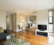
The Victoria apartments by City Marque are a selection of well-appointed one and two bedroom properties located within the heart of London's historical, political and business district. The...
Train Simulator 2015 (TS 2015) - South London Network - Southern Trains Class 456 - By JMCV 2015
My Computer: ASUS ROG G551JK - Intel i5-4200H - NVIDIA GTX 850M * Some of London's busiest railway routes serving two of the City's busiest termini are featured in this stunning new South...
Videos provided by Youtube are under the copyright of their owners.
Attractions and noteworthy things
Distances are based on the centre of the city/town and sightseeing location. This list contains brief abstracts about monuments, holiday activities, national parcs, museums, organisations and more from the area as well as interesting facts about the region itself. Where available, you'll find the corresponding homepage. Otherwise the related wikipedia article.
Chelsea College of Art and Design
Chelsea College of Art and Design, the erstwhile Chelsea School of Art, is a constituent college of the University of the Arts London, and is a leading British art and design institution with an international reputation. It offers further and higher education courses in fine art, graphic design, interior design, spatial design and textile design up to PhD level.
Dolphin Square
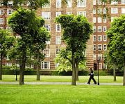
Dolphin Square is a block of private apartments and business complex built near the River Thames at Pimlico in London, between 1935 and 1937. At one time, the huge development was home to more than 70 MPs, and at least 10 Lords. At the time of their construction the development was billed, according to Sir Nikolaus Pevsner as the "largest self-contained block of flats in Europe" and, to an extent, their design has been a model for later municipal developments.
Buddhist Society
The Buddhist Society is a UK registered charity with the stated aim to: [... ... ] publish and make known the principles of Buddhism and to encourage the study and practice of those principles. The Buddhist Society is an inter-denominational and non-sectarian lay organization. It offers talks and classes on the teachings of all the different major mainstream Buddhist schools and traditions, as well as a structured programme of courses on general Buddhism, for both the public and members.
Roman Catholic Archdiocese of Westminster
The Roman Catholic Archdiocese of Westminster is an archdiocese of the Latin Rite of the Roman Catholic Church in England. The archdiocese consists of all of London north of the River Thames and west of the River Lea, together with the borough of Spelthorne and the county of Hertfordshire, which lies immediately to London's north.
Millbank Prison
Millbank Prison was a prison in Millbank, Pimlico, London, originally constructed as the National Penitentiary, and which for part of its history served as a holding facility for convicted prisoners before they were transported to Australia. It was opened in 1816 and closed in 1890.
Cardinal Place
Cardinal Place is a retail and office development in London, near Victoria Station and opposite Westminster Cathedral. The site consists of three buildings covering over a million square feet on Victoria Street next door to Portland House, and was designed by EPR Architects and built by Sir Robert McAlpine. The topping out ceremony was held in December 2004, and performed by Cardinal Cormac Murphy-O'Connor, Lord McAlpine, and Ian J.
Vincent Square
Vincent Square is a large grass-covered square in Westminster, London, England, covering 13 acres. It provides playing fields for Westminster School, which privately owns it. It was created by Dean Vincent, Headmaster of Westminster School, a few hundred yards away, who, on seeing that development was beginning to encroach on the wastelands of Tothill Fields (which was a former plague pit), paid for a bank and ditch to enclose a suitable playing area for the schoolboys.
Windsor House, London
Windsor House, London is an office building in Victoria Street, City of Westminster, London, England. The complex, built in 1973, consists of an eighteen storey tower, a two storey block (Butler Place) and residential accommodation (Christchurch House) above an underground car park and basement. The structure stands 70 m (230 ft). Butler Place also houses Lloyds TSB at ground level. The eighteen storey tower is solely occupied by staff from Transport for London.
Grey Coat Hospital
The Grey Coat Hospital is a Church of England secondary school with academy status for girls in Westminster, London, England.
Tothill Fields Bridewell
Tothill Fields Bridewell (also known as Tothill Fields Prison and Westminster Bridewell) was a prison located in the Westminster area of central London between 1618 and 1884. It was named 'Bridewell' after the Bridewell Palace, which during the 16th century had become one of the City of London's most important prisons. Tothill Fields later became the Westminster House of Correction.
Grosvenor School of Modern Art
Situated at 33 Warwick Square in Pimlico, London,The Grosvenor School of Modern Art was a British Art School founded by the printmakers and linocut artists Claude Flight, Iain MacNab, Cyril Edward Power and Sybil Andrews in 1925.
Horseferry Road
Horseferry Road is a street in the City of Westminster in central London running between Millbank and Greycoat Place. It is perhaps best known as the site of City of Westminster Magistrates' Court (which until 2006 was called Horseferry Road Magistrates' Court). The ubiquity of the Magistrates' Court in newspaper crime reports means that the road name has wide recognition in the UK.
Northern line extension to Battersea
The Northern line extension to Battersea is a planned extension of the London Underground Northern line to Battersea in South West London, from Kennington to Battersea Power Station. The extension will form a continuation of the Charing Cross branch of the line. The extension is a partially privately funded project by the site developers, SP Setia and Sime Darby, with contributions from other sources such as the new US embassy.
Lillington and Longmoore Gardens
Lillington Gardens is an estate in the Pimlico area of Westminster, London, constructed in phases between 1961 and 1980 to a plan by Darbourne & Darke. The estate was among the last of the high-density public housing schemes built in London during the postwar period, and is referred to as one of the most distinguished.
Belgrave Road
Belgrave Road is a street in the Pimlico area of London. It is situated in the city of Westminster and runs between Eccleston Bridge to the northwest and Lupus Street to the southeast. The street and the adjacent area were developed by Thomas Cubitt in the 1840s, who considered it as dwellings for the middle class, as opposed to those he had developed in Belgravia for the more affluent. The width of the properties were comparatively narrow.
St George's Square
St George's Square is a long narrow garden square in Pimlico, London SW1, England. At the northern end is Lupus Street, with Pimlico tube station close by via Belgrave Road to the east. At the southern end is Grosvenor Road running along the River Thames.
St Gabriel's, Warwick Square
St Gabriel's, Warwick Square is an Anglo-Catholic church in Pimlico. It lies within the Deanery of Westminster (St Margaret) within the Diocese of London. It was constructed as part of Thomas Cubitt's 1840-1860 development of the area on behalf of the Marquess of Westminster. Along with the nearby St Saviour's, St Gabriel's was designed by Cubitt's foreman, Thomas Cundy, in the Gothic style and built in ragstone to emphasise the contrast with the Classical stucco of its secular neighbours.
Churchill Gardens
Churchill Gardens is a large housing estate in the Pimlico area of Westminster, London. The estate was developed between 1946 and 1962 to a design by the architects Powell and Moya, replacing Victorian terraced houses extensively damaged during the Blitz. Comprising 1,600 homes in 32 blocks, the estate is notable as the only housing project completed under the ambitious Abercrombie Plan to redevelop the capital on more "efficient" lines.
St James the Less, Pimlico
St James the Less is an Anglican church in Pimlico, in the evangelical/charismatic tradition. It is Grade I listed. Since 1961, the church has been surrounded by the Lillington and Longmoore Gardens estate.
St Saviour, Pimlico
St Saviour's is an Anglo-Catholic church in Pimlico, located at the north end of St George's Square. It was constructed in the 1860s as part of Thomas Cubitt's development of the area on behalf of the Marquess of Westminster. The church was designed by Thomas Cundy, who had previously built St Gabriel's Pimlico a short distance away.
Millbank Distillery
Millbank Distillery was a London gin distillery owned and operated by Seager Evans and Co.. It was located on Grosvenor Road on the North bank of the River Thames in Pimlico. The company's best known product, Seagers Gin, was produced here up until the early 20th century. Millbank Distillery is often confused with Thames Bank Distillery a slightly older distillery, founded in 1797 and located further west along the river.
Westminster Pit
The Westminster Pit was a well-known blood sport arena in nineteenth-century London, England. It reached a zenith of popularity between 1820 and 1830, and hosted such spectacles as dog-fighting, cock-fighting, bear-baiting, badger-baiting, monkey-baiting, and rat-baiting. A legal enterprise at the time, the Westminster Pit openly declared its activities, ushering notoriety on the district in which it existed. The Westminster Pit was located on Duck Lane, Orchard Street (since renamed St.
Strutton Ground Market
Strutton Ground Market is a small street market held on weekdays near Victoria, London. This market is one of the most centrally located street markets in London. It is just a few minutes walk from the Palace of Westminster, Westminster Abbey and Parliament Square to the east (0.6 km); Victoria Train Station (0.6 km)to the west; and Buckingham Palace (0.6 km) along Buckingham Gate to the north-east. The market is open weekdays from 1000 to 1600.
Lawrence Hall, London
Lawrence Hall in Greycoat Street, Westminster was the newer of the two Royal Horticultural Halls owned by R.H.S. Enterprises Limited, which is part of the Royal Horticultural Society charity in central London. The other is Lindley Hall in Elverton Street; both are close to the RHS' headquarters in Vincent Square. The site of Lawrence Hall incorporates a self-contained purpose-built conference centre above the main hall.
Lindley Hall, London
Lindley Hall in Elverton Street, Westminster is the older of the two Royal Horticultural Halls owned by the R.H.S. Enterprises Limited which is part of the charity Royal Horticultural Society in central London. The other is Lawrence Hall; both are close to Vincent Square. Lindley Hall is noted for its classic Edwardian architecture. It was built in 1904 of red brick with stone dressings and banding, with Arts and Crafts features and Renaissance details.





!['Victoria Tube station - your future journey - Tube improvements [no audio]' preview picture of video 'Victoria Tube station - your future journey - Tube improvements [no audio]'](https://img.youtube.com/vi/iZNXFD2vz1M/mqdefault.jpg)


