Safety Score: 3,0 of 5.0 based on data from 9 authorites. Meaning we advice caution when travelling to United Kingdom.
Travel warnings are updated daily. Source: Travel Warning United Kingdom. Last Update: 2024-07-26 08:00:33
Explore Lambeth
The district Lambeth of London in Greater London (England) with it's 6,000 inhabitants Lambeth is located in United Kingdom and is a district of the nations capital.
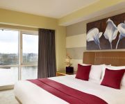
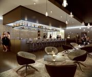
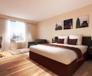
If you need a place to sleep, we compiled a list of available hotels close to the map centre further down the page.
Depending on your travel schedule, you might want to pay a visit to some of the following locations: City of Westminster, City of London, Camberwell, Islington and Camden Town. To further explore this place, just scroll down and browse the available info.
Local weather forecast
Todays Local Weather Conditions & Forecast: 22°C / 72 °F
| Morning Temperature | 15°C / 58 °F |
| Evening Temperature | 21°C / 69 °F |
| Night Temperature | 17°C / 63 °F |
| Chance of rainfall | 0% |
| Air Humidity | 38% |
| Air Pressure | 1015 hPa |
| Wind Speed | Gentle Breeze with 9 km/h (5 mph) from South-East |
| Cloud Conditions | Scattered clouds, covering 49% of sky |
| General Conditions | Scattered clouds |
Sunday, 28th of July 2024
24°C (76 °F)
19°C (66 °F)
Few clouds, gentle breeze.
Monday, 29th of July 2024
27°C (81 °F)
21°C (70 °F)
Sky is clear, gentle breeze, clear sky.
Tuesday, 30th of July 2024
28°C (83 °F)
22°C (72 °F)
Overcast clouds, gentle breeze.
Hotels and Places to Stay
Plaza on the River London
London Marriott Hotel County Hall
Park Plaza London Waterloo
Southwark Serviced Apartments
Marlin Aparthotel Waterloo
Novotel London Blackfriars
H10 London Waterloo
Park Plaza London Riverbank
Park Plaza County Hall London
Novotel London Waterloo
Videos from this area
These are videos related to the place based on their proximity to this place.
London English Afternoon Tea; From Twinings to Delaunays
Visit http://www.breakslondon.com for more. Enjoy our video guide to afternoon tea in central London. Transcription: It says here, we're right outside Twinings. It says Thomas Twining founded...
View of London City from The London Eye Capsule
View of London City around 3pm from The London Eye Capsule. See the great HDR pictures of london at my Google+ photo album: ...
Libraries Change Lives Award 2012 - The Digital Bazaar®
CILIP Libraries Change Lives Award nominees 2012. One Saturday morning each month, the community around Tate South Lambeth Library join their local library team to explore all things digital...
The Gym Waterloo - The Gym Group
http://www.thegymgroup.com/find-a-gym/gym/the-gym-waterloo/ No contract and we're open 24 hours a day. Join online today!
Fantastic Train Announcements at London Waterloo 30 July 2014
Its here! Waterloo station and the great train announcements from Phil Sayer. The video also includes some live announcements from station staff. This was recorded during the evening of Wednesday...
Goodbye Waterloo Hello St Pancras
The last Eurostar train departs from Waterloo International Statiom and, the following day, the first Euostars arrive at St Pancras.
Long Live Southbank: The Book
Coming in at 400 pages, the Long Live Southbank book encapsulates the spirit of the community that has resided under the Queen Elizabeth Hall for 4 decades, as well as the 17 month long campaign.
Nick Jensen on the Southbank Undercroft pt 1
http://www.llsb.com/ Nick Jensen is a Professional Skateboarder and artist in his own right. He started skating at Southbank when he was 11 years old and 17 years later continues to enjoy an...
London - South Bank
A walk from the Houses of Parliament, across Westminster Bridge to the South Bank, past the London Eye and back across the Thames via the Hungerford Bridge. Why bother to spend a fortune on...
Videos provided by Youtube are under the copyright of their owners.
Attractions and noteworthy things
Distances are based on the centre of the city/town and sightseeing location. This list contains brief abstracts about monuments, holiday activities, national parcs, museums, organisations and more from the area as well as interesting facts about the region itself. Where available, you'll find the corresponding homepage. Otherwise the related wikipedia article.
United Kingdom
The United Kingdom of Great Britain and Northern Ireland, commonly known as the United Kingdom (UK) and Britain, is a sovereign state located off the north-western coast of continental Europe. The country includes the island of Great Britain, the north-eastern part of the island of Ireland and many smaller islands. Northern Ireland is the only part of the UK that shares a land border with another state—the Republic of Ireland.
A23 road
The A23 road is a major road in the United Kingdom between London and Brighton, East Sussex, England. It is managed by Transport for London for the section inside the Greater London boundary, Surrey County Council and West Sussex County Council for the section shadowed by the M23 motorway, the Highways Agency between the M23 and Patcham, and by Brighton and Hove Council from the A27 to the centre of Brighton.
Lower Marsh Market
Lower Marsh Market is a street market in Lower Marsh district, in the Waterloo neighbourhood adjacent to Waterloo railway station in the London Borough of Lambeth. It was named after the 'Lower Marsh', since until the early 19th century much of north Lambeth (now known as the South Bank) was mostly marsh, hence the street's and market's names. Lower Marsh and The Cut formed the commercial heart of the area from the early 19th century.
Roman Catholic Archdiocese of Southwark
The Roman Catholic Archdiocese of Southwark (Br) is a Latin Rite Roman Catholic archdiocese in England. The archepiscopal see is St. George's Cathedral, Southwark and is headed by the Archbishop of Southwark. The archdiocese is part of the Metropolitan Province of Southwark, which covers the South of England.
Morley College
Morley College is an adult education college in London. It was founded in the 1880s and has a student population of 10,806 adult students. It offers courses in a wide variety of fields including science, languages, drama, dance, music, computing, exercise and health and humanities. Morley College is located in the Waterloo District of London, on the South Bank, close to the city's arts centre.
Lambeth Walk
Lambeth Walk is a street in Lambeth, London, England, off Lambeth Road. It was an old street market and housing area. After some bomb damage during the Blitz in World War II on 18 September 1940, the area became rather run down and was subsequently rebuilt. Some older buildings are still present, including the Henry Moore Sculpture Studios, image adjacent.
Lambeth Road
Lambeth Road is a road in Lambeth (to the west) and Southwark (to the east), London running between Lambeth Bridge over the River Thames at the western end and St George's Circus at the eastern end. The road is designated the A3203. Lambeth Palace, the London base of the Archbishop of Canterbury and the Museum of Garden History are to the north towards the west by the river. St George's Cathedral Southwark is on the north side.
Westminster Bridge Road
Westminster Bridge Road is a short, but busy, road in London, England. It runs on an east-west axis and passes through the boroughs of Lambeth and Southwark. Between 1740–46, the Commissioners of Westminster Bridge bought land from the Archbishop of Canterbury and ground in Lambeth Marsh from the Lord Mayor and Commonalty of the City of London for the approach to the bridge on the southern Surrey side. This was the start of Westminster Bridge Road.
Waterloo Road, London
Waterloo Road is a road straddling Lambeth and Southwark, London, England. It runs between Westminster Bridge Road close to St George's Circus at the south-east end and Waterloo Bridge across the River Thames towards London's West End district at the north-west end. At the northern end near the river are the Queen Elizabeth Hall and the Hayward Gallery to the west, the National Film Theatre below the road, and the Royal National Theatre to the east.
Baylis Road
Baylis Road is a thoroughfare in Lambeth, London SE1, England running between Westminster Bridge Road to the South-West and Waterloo Road to the North-East. At its northern end Baylis Road continues North-East as The Cut. The Old Vic Theatre is located on The Cut where the roads meet. Waterloo Station is to the north. To the South the road crosses Westminster Bridge Road and continues as Kennington Road. Lambeth North tube station is located at this junction.
Kennington Road
Kennington Road is a long straight road, approximately a mile in length, in the London Borough of Lambeth in London, England, running south from Westminster Bridge Road (at the junction with Baylis Road to the north-east) to Kennington Park Road. The road is designated as the A23. Formerly open land, in 1751, a year after Westminster Bridge was opened, it was constructed by the Turnpike Trustees to improve communication from the bridge to routes south of the river Thames.
St George's Road
St George's Road is a road in Southwark, London running between Westminster Bridge Road to the northwest and Elephant and Castle to the southeast. Its name derives from its crossing of St George's Fields, being an open rural area of the parish of St George the Martyr, Southwark.
Hercules Road
Hercules Road runs north from Lambeth Road near Lambeth Palace, on the site of Penlington Place, in the London Borough of Lambeth, south London, England. The road is named after Hercules Hall, which was built by and was the home of Philip Astley (1742–1814), riding instructor, horse-trainer, and acknowledged as the inventor of the modern circus.
West Square
West Square is a historic square in south London, England, just south from St George's Road. The square is within the London Borough of Southwark, but as it is located in postcode SE11, it is commonly said to be in Lambeth. Immediately to the west is the Imperial War Museum. To the south is the Imperial War Museum Annex (which used to be an orphans' home) in Austral Street.
Lower Marsh
Lower Marsh is a street in the Waterloo neighbourhood of London, England. It is the location of Lower Marsh Market. Until the early 19th century much of north Lambeth (now known as the South Bank) was mostly marsh. The settlement of Lambeth Marsh was built on a raised through road over the marsh lands, potentially dating back to Roman times. The land on which it stands was owned by the church of England, with Lambeth Palace nearby.
A3036 road
The A3036 is an A road in London, England. It starts at the southern tip of the County Hall roundabout, where the A302 Westminster Bridge, York Road and A23 Westminster Bridge Road all intersect. This stretch of the route is called Lambeth Palace Road and heads southwest, past St Thomas' Hospital and the Palace itself, at the roundabout junction with the A3203 at Lambeth Bridge, where it runs along the south side of the Thames.
Centre for Young Musicians
London's Centre for Young Musicians, or CYM, is a Saturday music centre for children up to 18 who play an instrument, currently run by Stephen Dagg. Anyone other than an absolute beginner is eligible for it, although there is an audition process. A standard timetable consists of a 30-minute lesson (some students have a 45 or 60 minute lesson), choir, musicianship, and where applicable, an instrumental ensemble.
Notre Dame High School (Southwark)
Notre Dame High School is an all-girls' Roman Catholic comprehensive school situated in Elephant and Castle, in south London in the UK. Girls attend the school from ages 11–16. The current headteacher is Sister Anne Marie Niblock, SND. Previous Headteachers include Sister Myra Poole, SND and Sister Rosemary O'Callaghan, SND. Sister Rosemary O' Callaghan is now acting as the school chaplain. The school was founded by the Sisters of Notre Dame de Namur.
Lincoln Memorial Tower
The Lincoln Memorial Tower or Lincoln Tower is a Gothic revival tower in London, housing small meeting rooms, that was opened in 1876 in memory of Abraham Lincoln, and paid for partly by Americans. Once part of a complex of nineteenth century philanthropic institutions sited alongside a Congregational chapel, it is all that now remains of the original design.
Christ Church, Lambeth
Christ Church, Lambeth, was founded by the Rev Dr Christopher Newman Hall in the 1870s as a Congregational chapel forming part of a complex of new mission buildings, including the Lincoln Tower and a new premises for Hawkstone Hall. On Newman Hall's retirement, it passed to F.B. Meyer. Christopher Newman Hall's Christ Church took its congregation largely from his previous chapel, the famous independent Methodist and Congregational Surrey Chapel that had been founded by the Rev.
Bishop's (ward)
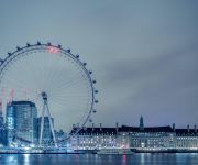
Bishop's ward is an administrative division of the London Borough of Lambeth, United Kingdom. It is located in the north of the borough, bounded by the river Thames, and contains many well known London sites including the Southbank Centre, the London Eye, the Old and New Vic theatres, County Hall and Lambeth Palace. It also contains Waterloo station and St Thomas Hospital.
Prince's (ward)
Prince's ward is an administrative division of the London Borough of Lambeth, England. It is located in the North of the borough, bounded by the river Thames and Kennington Park Road. It is made up of much of Kennington and Vauxhall. Prince's ward is located in the Vauxhall parliamentary constituency and is one of four wards in the borough's north Lambeth division.
The Marine Society College of the Sea
The Marine Society College of the Sea is a distance learning further education college for those who make their living at sea. The college is owned and operated by The Marine Society, and is located at 202 Lambeth Road, in the London Borough of Lambeth.
Feminist Library
The Feminist Library was founded as the Women’s Research and Resources Centre in 1975 by a group of women concerned about the future of the Fawcett Library to ensure that the history of the women's liberation movement survived.
Geraldine Mary Harmsworth Park
Geraldine Mary Harmsworth Park is a public park in Southwark, south London. It is maintained by the London Borough of Southwark and bounded by Lambeth Road, Kennington Road, St George's Road and Brook Drive.


