Safety Score: 3,0 of 5.0 based on data from 9 authorites. Meaning we advice caution when travelling to United Kingdom.
Travel warnings are updated daily. Source: Travel Warning United Kingdom. Last Update: 2024-07-26 08:00:33
Explore Middlesex
The district Middlesex of in Greater London (England) is located in United Kingdom a little west of London, the country's capital.
If you need a place to sleep, we compiled a list of available hotels close to the map centre further down the page.
Depending on your travel schedule, you might want to pay a visit to some of the following locations: Wembley, Ealing Broadway, Ealing, Hammersmith and Harrow. To further explore this place, just scroll down and browse the available info.
Local weather forecast
Todays Local Weather Conditions & Forecast: 22°C / 71 °F
| Morning Temperature | 14°C / 57 °F |
| Evening Temperature | 20°C / 69 °F |
| Night Temperature | 17°C / 62 °F |
| Chance of rainfall | 0% |
| Air Humidity | 39% |
| Air Pressure | 1015 hPa |
| Wind Speed | Gentle Breeze with 7 km/h (5 mph) from South-East |
| Cloud Conditions | Broken clouds, covering 51% of sky |
| General Conditions | Broken clouds |
Sunday, 28th of July 2024
24°C (76 °F)
19°C (67 °F)
Few clouds, light breeze.
Monday, 29th of July 2024
27°C (80 °F)
22°C (71 °F)
Sky is clear, gentle breeze, clear sky.
Tuesday, 30th of July 2024
29°C (83 °F)
23°C (73 °F)
Broken clouds, gentle breeze.
Hotels and Places to Stay
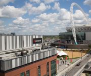
Holiday Inn LONDON - WEMBLEY
Crowne Plaza LONDON - EALING
Hilton London Wembley
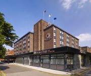
DoubleTree by Hilton London - Ealing
St George's
Hotel 55
The Kings Head Hotel
Park Plaza Park Royal
TRAVELODGE LONDON WEMBLEY
TRAVELODGE LONDON PARK ROYAL
Videos from this area
These are videos related to the place based on their proximity to this place.
3 Tours at Acton Main Line 09/03/2013.
Saturday the 9th of March 2013 At Acton Main Line station we had 3 rail tours the 1st was the Amman Valley Ranger top & tailed by 2 66's (Paddington Newport Paddington) the next was The Cathedral.
Hastings DEMU 1001 Cabview Acton Wells - Dudding Hill Norfolk Navigator
Cabview between Acton Wells and Dudding Hill during the Norfolk Navigator railtour. Taken from Power Car 60118. Engine vibration still an issue causing flickering picture quality at times....
Mayflower returns to the Mainline - LNER B1 61306 'Mayflower' at Acton Central
LNER B1 61306 'Mayflower' at Acton Central working "The Royal Norfolkman" Railtour from Norwich to Windsor & Eton Riverside.
North Acton Contrasts
Using footage from 1990, 2010 and 2011 this film shows North Acton Central Line station and the little used New North Main Line (NNML) alongside it as seen from the road bridge to its east,...
34067 Tangmere, on the West Somerset Steam Express. North Acton, 21 July 2012.
Tube trains and an engineers train come and go in the strong sunlight. Tangmere eventually passes on the high level line (03:55). Shot from Chase Road, North Acton looking down onto the Central...
FGW HST at Acton Main Line 1730 BRI-PAD (1A27) 12/10/13
43191 powering through Acton Main Line with a friend at the controls - unsure of rear power car number.
7Z58 - Colas Railfreight 47727 'Rebecca' passing Acton Central Station 22/10/2013
Colas Railfreight Class 47 Diesel Locomotive 47727 'Rebecca' hauls brand new Class 458 Electric Multiple Unit 458531 through Acton Central Station working 7Z58 Doncaster Wabtec - Wimbledon...
0Z33 - West Coast Railway Company 33029 powers through Acton Central Station 22/10/2013
West Coast Railway Company Class 33 'Crompton' Diesel Locomotive 33029 powers through Acton Central Station working 0Z33 Southall WCR - Farnham light engine move on 22/10/2013.
0Z20 - 20142 leads 20189 & 20227 East through Acton Mainline Station 7/5/2013
Preserved Class 20 Diesel Locomotive 20142 in BR Blue leads sister locomotives 20189 in London Transport Maroon Livery & 20229 in London Underground livery along the goods line at Acton ...
A night at Ace Cafè London by Metzeler
Ace Cafe, London, 15th March 2013 - Metzeler has announced a Road Racing Summer spectacular as the German tyre brand celebrates it's 150th Anniversary, with a full line-up of events and racing...
Videos provided by Youtube are under the copyright of their owners.
Attractions and noteworthy things
Distances are based on the centre of the city/town and sightseeing location. This list contains brief abstracts about monuments, holiday activities, national parcs, museums, organisations and more from the area as well as interesting facts about the region itself. Where available, you'll find the corresponding homepage. Otherwise the related wikipedia article.
The Fall and Rise of Reginald Perrin
The Fall and Rise of Reginald Perrin is a series of novels which developed into a British sitcom starring Leonard Rossiter in the title role. Both the books and television series were written by David Nobbs, and the screenplay for the first series was adapted by Nobbs from the novel, though subplots in the novel were considered too dark or risqué for television and toned down or omitted, an example being the relationship between Perrin's daughter and his brother-in-law.
Hanger Lane gyratory
The Hanger Lane gyratory is a large, complex roundabout system at the intersection of Western Avenue, the North Circular and Hanger Lane in the borough of Ealing in west London. It covers an area of about 30,000 square metres. At rush hour it carries nearly 10,000 vehicles per hour. An above-ground section of the London Underground Central Line passes under the roundabout. The island in the middle contains Hanger Lane tube station and a nature reserve.
Western Avenue, London
Western Avenue, some 10 miles (16 km) in length, is one of the major roads leading out of London, England. It is part of the A40, leaving the city in a north-westerly direction. The A40 is named as Western Avenue from its junction with Old Oak Common Lane in East Acton; the junction now has traffic lights, but its name Savoy Circus commemorates the roundabout which once formed the junction. East of this point is Westway, part of the A40 Central London link from Paddington.
West London Line
The West London Line is a short railway in inner West London which links lines at Clapham Junction in the south to lines near Willesden Junction in the north. It has always been an important cross-London link especially for freight services. Regular passenger services on it, detailed below, are provided by Southern and by London Overground on whose network it is the shortest line.
Hanger Lane
Hanger Lane is a major road in the Ealing and Park Royal areas of London. It forms the westernmost part of the A406 North Circular as it runs north from Gunnersbury Avenue as it crosses the A4020 Uxbridge Road at Ealing Common to meet the A40 Western Avenue at the Hanger Lane Gyratory System. This complex and busy junction incorporates the Hanger Lane tube station on the London Underground.
Brent South (UK Parliament constituency)
Brent South was a parliamentary constituency represented in the House of Commons of the Parliament of the United Kingdom; it was replaced by Brent Central for the 2010 general election. It elected one Member of Parliament (MP) by the first past the post system of election. Since its creation in 1974, the constituency consistently elected Labour MPs with large majorities.
Ealing, Acton and Shepherd's Bush (UK Parliament constituency)
Ealing, Acton and Shepherd's Bush was a parliamentary constituency represented in the House of Commons of the Parliament of the United Kingdom. It elected one Member of Parliament (MP) by the first past the post system of election. The constituency was abolished at the 2010 general election when it was divided between the new seats of Ealing Central and Acton and Hammersmith.
Park Royal & Twyford Abbey tube station
Park Royal & Twyford Abbey is a closed station on the route of the Piccadilly Line of the London Underground. It was located near Twyford Abbey Road a short distance north of the current Park Royal station which replaced it on 6 July 1931. The station was opened on 23 June 1903 by the Metropolitan District Railway on a new branch line to South Harrow and the Metropolitan Line tracks at Rayners Lane.
Municipal Borough of Acton
Acton was a local government district in Middlesex, England from 1865 to 1965. In 1865 the Local Government Act 1858 was adopted by the parish of Acton, and a twelve-member local board of health was formed to govern the area. The Local Government Act 1894 constituted the area an urban district, and an urban district council of fifteen councillors replaced the local board. The number of councillors was increased to sixteen in 1906.
Stonebridge Park, London
The Stonebridge Park is a junction at the intersection of North Circular Road, and the A404, located in northwest London. The junction is located between Tokyngton to the west, and Stonebridge to the east. The Stonebridge Park station is a local station, very nearby, and takes its name from this junction. Buses that run through the junction include routes 18, 112, PR2 and N18.
Ace Cafe London
The Ace Cafe London is a transport cafe in Stonebridge, north west London, England. It is a notable venue in motorcycle culture which originally operated from 1938 until 1969, then re-opened on the original site in 1997.
Ealing Central and Acton (UK Parliament constituency)
Ealing Central and Acton is a constituency represented in the House of Commons of the UK Parliament since 2010 by Angie Bray of the Conservative Party.
North Pole depot
North Pole depot was the London depot for Eurostar from 1994 until 2007. The depot code is NP. It was used for maintaining and stabling the fleet of British Rail Class 373 trains. It is named after the nearby North Pole Road.
Churchfield Road
For the area in Sandwell, West Midlands see Churchfield, Sandwell Churchfield Road, Acton, runs north of and parallel to Acton High Street. At the eastern end is the level crossing of Acton Central railway station after which it becomes East Churchfield Road. The western end forms a junction of which the northern road is Horn Lane, the southern Market Place and the western, the now pedestrianised King Street. St. Mary's Burial Ground lies on the southern side of the centre section of the road.
Old Oak Common TMD
Old Oak Common TMD is situated to the west of London, in Old Oak Common. The Traction Maintenance Depot is the main facility for the storage and servicing of locomotives and multiple-units which utilise Paddington Station. The depot codes are 'OC' for the diesel depot, and 'OO' for the carriage shed. In steam days the shed code was 81A.
Ealing Acton (UK Parliament constituency)
Ealing Acton was a parliamentary constituency in West London, which returned one Member of Parliament (MP) to the House of Commons of the Parliament of the United Kingdom from 1983 until it was abolished for the 1997 general election.
Central Middlesex Hospital
Central Middlesex hospital (CMH) is in the centre of the Park Royal business estate, on the border of two London boroughs, Brent and Ealing.
Old Oak Lane Halt railway station
Old Oak Lane Halt railway station was the first station on the New North Main Line of the Great Western Railway. It served the area between North Acton and Old Oak Common, and was in use between 1906 and 1947.
Library for Iranian Studies (London)
Library for Iranian Studies is a major Persian library in Acton district of London, England. It has over 30,000 books in the Persian language, as well as English and other languages. The library receives no governmental funding and is voluntary controlled.
London Welsh School
The London Welsh School, or Ysgol Gymraeg Llundain in Welsh, is a Welsh medium primary school in London, England. The Welsh language is the language of instruction for all classes and activities. The London Welsh School's origins date back to language classes taught in 1955, and a dedicated school set up some two years later. Its official name is "The Welsh School, London".
Willesden railway station
Willesden railway station was a station on Acton Lane in Harlesden, north-west London, opened in 1841 by the London and Birmingham Railway (L&BR) on what became the West Coast Main Line (WCML). It was five or six furlongs south of the original village of Willesden. It closed later the same year, reopened in 1844 and closed finally when the L&BR's successor, the London and North Western Railway (LNWR), opened Willesden Junction station about half a mile to the southeast on 1 September 1866.
West Twyford
West Twyford (also known as Twyford Abbey) was a small extra-parochial area, and later civil parish, in the county of Middlesex, England. The area of West Twyford is part of the London Borough of Ealing. It is bounded by the Hanger Lane Gyratory to the west, the A406 North Circular to the north, Park Royal to the south and Willesden to the east.
Bang Radio
BANG Radio is a community radio station specialising in Urban Music, based in and serving London, United Kingdom. The station broadcasts on 103.6 FM within London, as well as online worldwide via its official website www. WeAreBang. com.
Braybrook Street
Braybrook Street is a residential street in Shepherd's Bush, London, but locally known as East Acton. It runs along the side of Wormwood Scrubs and also Wormwood Scrubs prison. The street is notable as the location of the Massacre of Braybrook Street where three police officers were murdered by Harry Roberts and John Duddy in August 1966.
Harlesden (Midland) railway station
Harlesden (Midland) railway station was a station in northwest London on the south side of the southern section of a road called Craven Park, which is part of the A404 Harrow Road between Paddington and Wembley. The station was sometimes known as Harrow Road or as Stonebridge Park. It was opened by the Midland Railway on the Dudding Hill Line in 1875, partly to service the neighbouring exclusive Craven Park Estate.


