Safety Score: 3,0 of 5.0 based on data from 9 authorites. Meaning we advice caution when travelling to United Kingdom.
Travel warnings are updated daily. Source: Travel Warning United Kingdom. Last Update: 2024-07-26 08:00:33
Delve into Brentford
Brentford in Greater London (England) with it's 10,750 habitants is a city located in United Kingdom a little west of London, the country's capital town.
Current time in Brentford is now 02:59 AM (Saturday). The local timezone is named Europe / London with an UTC offset of one hour. We know of 9 airports closer to Brentford, of which 5 are larger airports. The closest airport in United Kingdom is London Heathrow Airport in a distance of 7 mi (or 11 km), West. Besides the airports, there are other travel options available (check left side).
There are several Unesco world heritage sites nearby. The closest heritage site in United Kingdom is Tower of London in a distance of 17 mi (or 27 km), East. Also, if you like playing golf, there are some options within driving distance. We saw 6 points of interest near this location. In need of a room? We compiled a list of available hotels close to the map centre further down the page.
Since you are here already, you might want to pay a visit to some of the following locations: Ealing, Ealing Broadway, Twickenham, Hounslow and Wembley. To further explore this place, just scroll down and browse the available info.
Local weather forecast
Todays Local Weather Conditions & Forecast: 22°C / 71 °F
| Morning Temperature | 14°C / 57 °F |
| Evening Temperature | 20°C / 69 °F |
| Night Temperature | 17°C / 62 °F |
| Chance of rainfall | 0% |
| Air Humidity | 39% |
| Air Pressure | 1015 hPa |
| Wind Speed | Gentle Breeze with 7 km/h (5 mph) from South-East |
| Cloud Conditions | Broken clouds, covering 51% of sky |
| General Conditions | Broken clouds |
Sunday, 28th of July 2024
24°C (76 °F)
19°C (67 °F)
Few clouds, light breeze.
Monday, 29th of July 2024
27°C (80 °F)
22°C (71 °F)
Sky is clear, light breeze, clear sky.
Tuesday, 30th of July 2024
29°C (84 °F)
23°C (73 °F)
Broken clouds, gentle breeze.
Hotels and Places to Stay
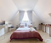
Hilton London Syon Park
Best Western Maitrise Suites
Novotel London Brentford
Kew Gardens BandB
Urban Villa Brentford
Hotel Xanadu
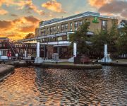
Holiday Inn LONDON - BRENTFORD LOCK
ON HOLD OSTERLEY PARK HOTEL
TRAVELODGE LONDON KEW BRIDGE
ibis Styles London Ealing (Opening May 2018)
Videos from this area
These are videos related to the place based on their proximity to this place.
Small Urban London City garden
This garden in Ealing, West London was designed and landscaped by DaiZy gardens.
Brentford Dock - The Inland Waterways Connection
In 2009 residents of Brentford Dock staged a weekend of activites to celebrate 150 years of Brunel's dock besides the River Thames. Brentford Dock - The Waterways Connection was complied...
Cylob: Brentford to Little Venice - Spring
Walking in London from Brentford to Little Venice along the canal path, a distance of 18 miles / 28 km. Pictures taken every 10 seconds. More info: http://www.cylob.com *** You may download...
Swanage Belle hissing past Brentford, 04 June 2014
Again we start with a preceding electric unit, calling and departing Brentford. Then 44932, rushes through, but the leaking/sticking cylinder drain cock drowns out what could have been a very...
Benham and Reeves Lettings | Property to rent on Kew Bridge Road, Brentford TW8
A luxury two bedroom apartment (approx 1011sq ft) set in the brand new Kew Bridge development, situated moments from a wealth of amenities and the river Thames, set around a European style...
35028 'Clan Line' & the VSOE at Brentford.
Merchant Navy Class Steam Locomotive 35028 'Clan Line' chuffs through Brentford Station working the VSOE from London Victoria to Bristol on the Venice Simplon Orient Express Excurison tour....
The Royal Kitchens at Kew: an introduction
An introduction to Historic Royal Palaces' £1.7 million project to open the George III's amazing Royal Kitchens at Kew Palace to the public. Opening 18 May 2012. Filmed in March 2011, before...
Videos provided by Youtube are under the copyright of their owners.
Attractions and noteworthy things
Distances are based on the centre of the city/town and sightseeing location. This list contains brief abstracts about monuments, holiday activities, national parcs, museums, organisations and more from the area as well as interesting facts about the region itself. Where available, you'll find the corresponding homepage. Otherwise the related wikipedia article.
Syon Monastery
(Also known as Syon Abbey, but see discussion below) Syon Monastery (or Sion), was a monastery of the Bridgettine Order founded in 1415 which stood until its demolition in the 16th century on the left (northern) bank of the River Thames within the parish of Isleworth, in the county of Middlesex, on or near the site of the present Georgian mansion of Syon House. It was named after the Biblical Holy “City of David which is Zion”, built on the eponymous Mount Zion (or Sion, Syon, etc.).
River Brent
The Brent is a river in Greater London and a tributary of the River Thames, 17.9 miles (29 km) long, rising in the Borough of Barnet running south west which joins the Tideway stretch of the Thames at Brentford Dock, Brentford.
Syon House
Syon House, with its 200-acre park, is situated in west London, England. It belongs to the Duke of Northumberland and is now his family's London residence. The family's traditional central London residence was Northumberland House. The eclectic interior of the house as is famous today was designed by the architect Robert Adam in the 1760s.
Griffin Park
Griffin Park is a football ground, in Brentford, which is situated in the London Borough of Hounslow, west London. It has been the home ground of League One side Brentford since it was built in 1904. It is known for being the only English league football ground to have a pub on each corner, and is situated in a predominantly residential area. The ground gets its name from the griffin, in the logo of Fuller's Brewery, which at one point owned the orchard on which the stadium was built.
Watermans Arts Centre
Watermans Art Centre is a multipurpose arts centre. It is located in Brentford, alongside the banks of the River Thames overlooking Kew Gardens. It includes a 239 seat theatre and a 125 seat cinema.
Brentford Urban District
Brentford was a local government district in the county of Middlesex, England from 1874 to 1927. Brentford Local Government District was created in 1874 under the Local Government Act 1858 and covered the civil parish of New Brentford and the chapelry of Old Brentford in the parish of Ealing. The district was governed by a local board of twelve members.
Battle of Brentford (1016)
The Battle of Brentford (1016) was fought in 1016 some time between 9 May and 18 October (the date of the later Battle of Ashingdon) between the English led by Edmund Ironside and the Danes led by Canute. It was one of a series of battles fought between Edmund and Canute, ultimately resulting in the lands held by Edmund's father Ethelred the Unready being divided between the two.
Battle of Brentford (1642)
The Battle of Brentford was a small pitched battle which took place on 12 November 1642, between a detachment of the Royalist army, (predominantly horse with one regiment of Welsh foot) under the command of Prince Rupert and two infantry regiments of Parliamentarians with some horse in support. The result was a victory for the Royalists.
Lot's Ait
Lot's Ait is an ait in the River Thames. It is on the Tideway near Brentford, in the Borough of Hounslow, London, England, and its size is approximately 51,000 square feet . Lot's Ait is often grouped with the adjacent Brentford Ait. It was formerly used for the growing of grass and osiers: basket willows, used for basketry, furniture, and cart-making, as well as cattle fodder. It was once known as Barbel Island, as this was a particularly fruitful area for fishing.
Brentford railway station (GWR)
Brentford railway station opened in 1860 on the Brentford Branch Line (the only line of the Great Western and Brentford Railway Company) which had opened in 1859 from Southall to Brentford Dock. It stood immediately north of Brentford High Street (the A315 road) on the embankment leading to the viaduct into the dock.
Brentford Dock
Brentford Dock in, Brentford, west London was a major trans-shipment point between the Great Western Railway (GWR) and barges on the River Thames. The building of Brentford Dock was started in 1855 and it was formally opened in 1859. The former dock yard was redeveloped in 1972 and is now Brentford Dock Marina and Brentford Dock Estate.
Brentford End
Brentford End is a small area located in the borough of Hounslow, London to the west of Brentford.


