Safety Score: 3,0 of 5.0 based on data from 9 authorites. Meaning we advice caution when travelling to United Kingdom.
Travel warnings are updated daily. Source: Travel Warning United Kingdom. Last Update: 2024-07-26 08:00:33
Explore Walworth
The district Walworth of London in Greater London (England) is located in United Kingdom and is a district of the nations capital.
If you need a place to sleep, we compiled a list of available hotels close to the map centre further down the page.
Depending on your travel schedule, you might want to pay a visit to some of the following locations: Camberwell, City of Westminster, City of London, Islington and Camden Town. To further explore this place, just scroll down and browse the available info.
Local weather forecast
Todays Local Weather Conditions & Forecast: 22°C / 72 °F
| Morning Temperature | 15°C / 58 °F |
| Evening Temperature | 21°C / 69 °F |
| Night Temperature | 17°C / 63 °F |
| Chance of rainfall | 0% |
| Air Humidity | 38% |
| Air Pressure | 1015 hPa |
| Wind Speed | Gentle Breeze with 9 km/h (5 mph) from South-East |
| Cloud Conditions | Scattered clouds, covering 49% of sky |
| General Conditions | Scattered clouds |
Sunday, 28th of July 2024
24°C (76 °F)
19°C (66 °F)
Few clouds, gentle breeze.
Monday, 29th of July 2024
27°C (81 °F)
21°C (70 °F)
Sky is clear, gentle breeze, clear sky.
Tuesday, 30th of July 2024
28°C (83 °F)
22°C (72 °F)
Overcast clouds, gentle breeze.
Hotels and Places to Stay
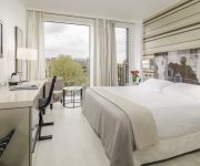
H10 London Waterloo
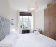
Kennington B&B
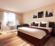
Marlin Aparthotel Waterloo
Lambeth North One
CITY MARQUE LAMBETH NORTH
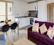
Marlin Apartments Empire Square
Park Plaza London Waterloo
TRAVELODGE LONDON CENTRAL SOUTHWARK
Eurotraveller Premier @Tower Bridge, Southwark
Hampton by Hilton London Waterloo
Videos from this area
These are videos related to the place based on their proximity to this place.
The Best London Pubs - An Alternative Guide
An alternative guide to the best pubs and bars to go for a drink in London, England. Whether you're local or visiting on your holidays, we showcase the best real pubs, avoiding those soulless...
London English Afternoon Tea; From Twinings to Delaunays
Visit http://www.breakslondon.com for more. Enjoy our video guide to afternoon tea in central London. Transcription: It says here, we're right outside Twinings. It says Thomas Twining founded...
4K London Peckham
Trip through London Peckham in 4K resolution using a GoPro 4 on the top of a Range Rover Evoque.
Cyclists filter through traffic when lights have just turned green
I just don't think this is a wise move. I stopped where I did as I felt I had space and wouldn't want to sneak up on cars who are more focused on going as the lights have just changed.
Transformation of Space: African Diaspora in London
Influences, Patterns and Inclusion. The socio-economic and cultural fabric of diasporan communities in the city of London [2007] A film by Robert van Kats with Bukka www.bukka.org.uk.
South/Central London RIG 1
This talk was given by Prof. Cathie Wallace, UCL IoE, at the first meeting of NALDIC's South and Central London Regional Interest Group on March 19, 2015 at St Gabriel's College, Lambeth. In...
For Club and Community
Rushan and Omar, whose lives have been changed for the better by Southwark City Tennis Club, talk about the next step for the club and community.
TfL. Sort out Camberwell bus drivers.
Update: Reported to TfL. Spotting a stationary bus ahead with its hazards on I shoulder check, indicate and move out to the second lane. As I approach the driver turns off the hazard warning...
Sugar cane water from Brixton market - London
A Carribean special juice made right in front of you (£3 the small bottle). You can have it plain or with lime and ginger (which I had). It is very refreshing and the sugary taste is not strong...
Red light jumper gets pulled over at Elephant and Castle
A red light jumper gets pulled over at Elephant and Castle.
Videos provided by Youtube are under the copyright of their owners.
Attractions and noteworthy things
Distances are based on the centre of the city/town and sightseeing location. This list contains brief abstracts about monuments, holiday activities, national parcs, museums, organisations and more from the area as well as interesting facts about the region itself. Where available, you'll find the corresponding homepage. Otherwise the related wikipedia article.
Metropolitan Borough of Southwark
The Metropolitan Borough of Southwark (Br) was a metropolitan borough in the County of London from 1900 to 1965. It was created to cover the western section of the ancient borough of Southwark and formed the northwestern part of the current London Borough of Southwark. In common with the rest of inner London, the borough experienced a steady decline in population throughout its existence. The borough council made an unsuccessful attempt to gain city status in 1955.
John Smith House (Southwark)
John Smith House is the former Labour Party headquarters at 144-152 Walworth Road in South London. It was renamed after John Smith, a former leader of the Labour Party who died in office in 1994.
Kennington Park
Kennington Park is in Kennington in London, England, and lies between Kennington Park Road and St Agnes Place. It was opened in 1854. Previously the site had been Kennington Common. This is where the Chartists gathered for their biggest 'monster rally' on 10 April 1848. Soon after this demonstration the common was enclosed and, sponsored by the royals, made into a public park. Kennington Common was a site of public executions until 1800 as well as being an area for public speaking.
Cuming Museum
The Cuming Museum in Walworth Road, within the London Borough of Southwark, London, England, houses the collection of the Cuming family and is also a museum of Southwark's history. The collection was gifted by Henry Syer Cuming in 1902 and the museum opened in 1906. As described in Cuming's will it comprised, "My Museum illustrative of Natural History, Archaeology and Ethnology with my coins and medals and… other curios".
St Agnes Place
St Agnes Place was a squatted street in Kennington, South London, which resisted eviction orders for more than 30 years.
Newington Butts
Newington Butts is a former village, now an area of the London Borough of Southwark, that gives its name to a segment of the A3 road running south-west from the Elephant and Castle junction. The road forks left into Kennington Park Road and right into Kennington Lane, leading to Kennington and Vauxhall Bridge respectively. It is popularly believed to take its name from an archery butts, or practice field, but there is no evidence for such activity.
Camberwell Green
Camberwell Green is a small area of common land in Camberwell, South London. It lies at the intersection of Camberwell Road and Camberwell New Road/Camberwell Church Street. At the North-East of the green is Camberwell Magistrate's Court, and at the North West is a home for the elderly. To the South West, and overlooking the Green, is a parade of shops including banks, restaurants and GT Stewart Solicitors.
St Peter's Church, Walworth
St Peter's Church, Walworth, London is an Anglican parish church in the Woolwich Episcopal Area of the Anglican Diocese of Southwark. It was built between 1823–25 and was the first church designed by Sir John Soane, in the wave of the church-building following the Napoleonic wars. It is the best preserved of Soane's churches. It is a Commissioners' church, receiving a grant under the Church Building Act 1818 towards the cost of its construction.
Kennington Common
Kennington Common was one of the earliest London cricket venues and is known to have been used for major cricket matches from 1724 to 1785. Cricket on Kennington Common provided an alternative spectacle to public executions. The common was in effect the south London equivalent of Tyburn and there are records of executions all through the time of cricket's tenure. The gallows was where St. Mark's Church now stands, not far from Oval tube station.
Kennington Park Road
Kennington Park Road is a main road in south-east London, England, and is part of the A3 trunk road. It runs from Newington Butts at its Y-junction with Kennington Lane, south-west to the Oval, where the A3 continues as Clapham Road, towards Stockwell. At this crossroads junction, Camberwell New Road and Kennington Oval head towards Camberwell Green and Vauxhall respectively. Heading south, the street first passes Kennington station and then Kennington Park.
Pullens buildings
The Pullens buildings, also known as the Pullens Estate, are some of the last Victorian tenement buildings surviving in London, England. In the Walworth, Newington area, they are near Elephant and Castle and Kennington Underground stations. Located in Amelia Street, Crampton Street, Iliffe Street, Penton Place and Peacock Street, they are protected by Conservation Area status granted by Southwark Council.
A202 road
The A202 is a primary A road in London. It runs from New Cross Gate to London Victoria station. The section forming part of the London Inner Ring Road is known as Vauxhall Bridge Road.
A215 road
The A215 is an A road in South London, from Elephant and Castle to Shirley. It runs through the London Boroughs of Lambeth, Southwark and Croydon. Beginning as Walworth Road, the A215 becomes Camberwell Road—much of which is a conservation area—after entering the former Metropolitan Borough of Camberwell. Crossing the A202, the A215 becomes Denmark Hill, originally known as Dulwich Hill, but renamed in 1683 to commemorate the marriage of Princess Anne to Prince George of Denmark.
St John the Divine, Kennington
St John the Divine, Kennington is an Anglican church in London. The parish of Kennington is within the Anglican Diocese of Southwark. The church was designed by the architect George Edmund Street in the Decorated Gothic style, and was built between 1871 and 1874. Today it is a grade I listed building. The church stands on Vassall Road, Kennington, in Vassall Ward in the London Borough of Lambeth. It is near Oval tube station and the Oval Cricket Ground.
Lorrimore Square
Lorrimore Square is a square in Southwark, south London, England. A 1681 map of Walworth made for Dean and Chapter of Canterbury Cathedral shows a common called "Lattam-more" (or Lower Moor), which is now the location for Lorrimore Square. St Paul's Church is located in the centre of the square. Lorrimore Square was hit by incendiary bombs during World War II in 1940 and the original church burned down leaving only the steeple.
Walworth Road railway station
Walworth Road railway station was a railway station in Walworth Road, Southwark, south London, England, on the London Chatham & Dover Railway, which opened in 1863 on the route of the company's ambitious plan to extend into the City of London. It was originally known as Camberwell Gate before changing its name in 1865. Along with many other London stations, World War I wartime restraints forced it to close in 1916.
Camberwell railway station
Camberwell railway station was a railway station on the London, Chatham and Dover Railway (LC&DR). It opened in 1862 as part of the company's ambitious second London railway. In 1863 the name was changed to Camberwell New Road but in 1908 reverted to Camberwell. As with many other London stations wartime restraints forced it to close in 1916. The station was mentioned in the 1956 film Private's Progress as a good place to get off a train and avoid paying a fare.
White Bear Theatre
The White Bear Theatre Club is a fringe theatre venue, established in 1988 in the White Bear pub in Kennington, London Borough of Lambeth. It is run by Artistic Director Michael Kingsbury. Theatre practitioners who have worked at The White Bear include Joe Penhall, Hugh Allison, Mark Little, Emily Watson, Tamzin Outhwaite, Kwame Kwei-Armah, Vicky Featherstone, Torben Betts, Lucinda Coxon, Adam Spreadbury-Maher (Associate director 2008 - 2009) and Chris Loveless (Associate Director, 2009 -).
City and Guilds of London Art School
The City and Guilds of London Art School is an art college in London, England, United Kingdom. It is one of the country's longest established art colleges, and offers courses ranging from Foundation, through B.A. degree, Postgraduate Diploma and M.A. degree levels. The Art School is housed in a row of Georgian buildings in London's Kennington district, close to the south bank of the river Thames.
Heygate Estate
The Heygate Estate is a large housing estate located in Walworth, Southwark, south London. The estate is currently being demolished as part of the regeneration of the Elephant and Castle area. It was home to more than 3,000 people. The Heygate is well known for being one of the starkest examples of post-war urban decay in the United Kingdom. Its notoriety has led to it being used frequently as a filming location for music videos and movies.
Cinema Museum (London)
The Cinema Museum (London) is a charitable organisation founded in 1986 by Ronald Grant and Martin Humphries from their own private collection of cinema history and memorabilia. First established in 1986 in Raleigh Hall in Brixton, the museum later moved to Kennington; since 1998 it has been based at 2 Dugard Way in the London Borough of Lambeth, the administration block of the former Lambeth Workhouse, in a building owned by the South London and Maudsley NHS Foundation Trust.
Myatt's Fields Park
Myatt's Fields Park is a Victorian park in the London Borough of Lambeth. It is located in Camberwell, SE5. It was designed by Fanny Wilkinson.
Blue Elephant Theatre
The Blue Elephant Theatre is a 50 seat fringe theatre situated in the borough of Southwark in London. It was established in 1999 by Antonio Ribeiro. The Artistic Director is Jasmine Cullingford. The theatre has an eclectic programme, promoting cross-art-form work and all forms of theatre from physical and dance theatre to new writing and classics. Its aim is to nurture new and emerging artists across the performing arts.
Naval Enlisted Reserve Association
Naval Enlisted Reserve Association (NERA) is a military advocacy group in the United States, who specifically address the agenda of sea-service reservists. Their stated mission is to protect the rights and benefits of enlisted sea-service reservists such as promotion, pay, retirement benefits, personnel strength, and equipment. NERA is a prominent member of a powerful coalition of military advocacy groups dedicated to fighting for service members in the Nation's Capitol.
Addington Square
Addington Square is a Georgian and Regency garden square in Camberwell in the London Borough of Southwark. It was named after Henry Addington, Prime Minister in the early c19th.


