Safety Score: 3,0 of 5.0 based on data from 9 authorites. Meaning we advice caution when travelling to United Kingdom.
Travel warnings are updated daily. Source: Travel Warning United Kingdom. Last Update: 2024-04-25 08:17:04
Delve into Silvertown
The district Silvertown of City of London in Greater London (England) is a subburb in United Kingdom a little east of London, the country's capital town.
If you need a hotel, we compiled a list of available hotels close to the map centre further down the page.
While being here, you might want to pay a visit to some of the following locations: Woolwich, East Ham, Poplar, Ilford and Catford. To further explore this place, just scroll down and browse the available info.
Local weather forecast
Todays Local Weather Conditions & Forecast: 11°C / 51 °F
| Morning Temperature | 4°C / 39 °F |
| Evening Temperature | 11°C / 52 °F |
| Night Temperature | 7°C / 45 °F |
| Chance of rainfall | 0% |
| Air Humidity | 49% |
| Air Pressure | 1004 hPa |
| Wind Speed | Gentle Breeze with 7 km/h (4 mph) from West |
| Cloud Conditions | Broken clouds, covering 79% of sky |
| General Conditions | Broken clouds |
Saturday, 27th of April 2024
9°C (48 °F)
9°C (49 °F)
Light rain, gentle breeze, overcast clouds.
Sunday, 28th of April 2024
10°C (50 °F)
7°C (45 °F)
Light rain, moderate breeze, overcast clouds.
Monday, 29th of April 2024
15°C (58 °F)
9°C (47 °F)
Sky is clear, gentle breeze, clear sky.
Hotels and Places to Stay
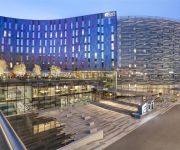
DoubleTree by Hilton London Excel
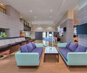
Aloft London Excel
Crowne Plaza LONDON DOCKLANDS
Good Hotel
Sunborn London Royal Victoria Dock
Novotel London Excel
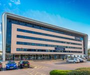
TRAVELODGE LONDON CITY AIRPORT
The Pilot
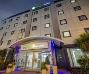
DOCKLANDS Holiday Inn Express LONDON-ROYAL DOCKS
London Beckton
Videos from this area
These are videos related to the place based on their proximity to this place.
Barking, Rainham HS1, Elm Park & London City Airport (27-06-2012)
We start at Barking, where a train of D78 stock heads westbound. We then observe HS1 around Rainham before heading to London City Airport via Elm Park.
**Special** Flybe Purple Dash8 G-JECF London City
Watch in FULL HD The majority of you in my last video asked for the 'Special' one. So here we have it. On September the 11th 2014, whilst in London I decided to visit London City Airport whilst I was.
Plane Spotting at London City Airport - Part 1 - BA CityFlyer E190 Take Off Landing [1080p HD]
The first of two plane spotting videos at London City Airport (LCY/EGLC). The second video can be found here: http://youtu.be/XmDktMtb7CY MORE INFO: 0:11 Airline: BA CityFlyer Aircraft: Embraer...
Underground Trains & London City Airport Planes (29-04-2012)
The Metropolitan A Stock dates from 1960 but is now being quickly replaced by new S Stock. Here we see some of the last remaining examples and then head to London City Airport to watch some...
Plane Spotting at London City Airport - Part 2 - BA CityFlyer E190 Cityjet Luxair [1080p HD]
The second of two plane spotting videos at London City Airport (LCY/EGLC). The first video can be found here: http://youtu.be/83ByLQonoHA MORE INFO: 0:13 Airline: BA CityFlyer Aircraft: Embraer...
London City Airport landing over central London inc Shard of Glass
The view above central London. You can see the Shard of Glass, London Bridge Station, Tower Bridge and Canary Wharf.
Travel Bloggers at World Travel Market 2012
http://davidsbeenhere.com/ While at World Travel Market 2012, I had a chance to meet up with some travel bloggers to discuss with them why they have chosen to visit WTM 2012. I want to give...
British Airways Airbus A318 G-EUNA Take Off at London City Airport [1080p HD]
A British Airways Airbus A318 taking off from London City Airport (LCY / EGLC). MORE INFO: Airline: British Airways Aircraft: Airbus A318-112 Reg: G-EUNA Flight Number: BA003 Route: London...
Interactive augmented reality travel Trinidad and Tobago
Interactive augmented reality travel with with printed personalised postcards UNIKI uni.capture // for Trinidad and Tobago, WTM2013, Excel London //
Videos provided by Youtube are under the copyright of their owners.
Attractions and noteworthy things
Distances are based on the centre of the city/town and sightseeing location. This list contains brief abstracts about monuments, holiday activities, national parcs, museums, organisations and more from the area as well as interesting facts about the region itself. Where available, you'll find the corresponding homepage. Otherwise the related wikipedia article.
Thames Barrier
The Thames Barrier is the world's second-largest movable flood barrier and is located downstream of central London, United Kingdom. Its purpose is to prevent London from being flooded by exceptionally high tides and storm surges moving up from the sea. It needs to be raised (closed) only during high tide; at ebb tide it can be lowered to release the water that backs up behind it.
London Borough of Newham
The London Borough of Newham Listen/ˈnjuːəm/ is a London borough formed from the former Essex county boroughs of West Ham and East Ham, within East London. It is situated 5 miles east of the City of London, and is north of the River Thames. Newham was one of the six host boroughs for the 2012 Summer Olympics and contains most of the Olympic Park including the Olympic Stadium.
Port of London
The Port of London lies along the banks of the River Thames from London, England to the North Sea. Once the largest port in the world, it is currently the United Kingdom's second largest port, after Grimsby & Immingham. The port is governed by the Port of London Authority (PLA), a public trust established in 1908, whose responsibility extends over the Tideway of the River Thames.
Royal Docks
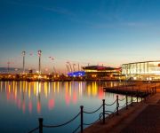
The Royal Docks comprise three docks in east London - the Royal Albert Dock, the Royal Victoria Dock and the King George V Dock. They are more correctly called the Royal Group of Docks to distinguish them from the Royal Dockyards, Royal being due to their naming after royal personages rather than Crown ownership. The three docks collectively formed the largest enclosed docks in the world, with a water area of nearly 250 acres and an overall estate of 1,100 acres .
Royal Victoria Dock
The Royal Victoria Dock is the largest of three docks in the Royal Docks of east London, now part of the redeveloped Docklands.
Silvertown railway station
Silvertown railway station was a station in Silvertown, east London. It was in Travelcard Zone 3, and located between Custom House and North Woolwich, the eastern terminus of the North London Line until the line closure from Stratford to North Woolwich on 9 December 2006. It was opened on 19 June 1863 by the Great Eastern Railway, and was situated on the route of the former Eastern Counties and Thames Junction Railway, with two tracks and platforms.
ExCeL London
ExCeL London (Exhibition Centre London) (often referred to as the ExCeL Exhibition Centre) is an exhibitions and international convention centre in the London Borough of Newham, England. It is located on a 100-acre site on the northern quay of the Royal Victoria Dock in London Docklands, between Canary Wharf and London City Airport.
Royal Victoria Dock Bridge
The Royal Victoria Dock Bridge is a signature high-level footbridge crossing the Royal Victoria Dock in the Docklands area of east London designed by London-based architects and designers Lifschutz Davidson Sandilands. The bridge provides a direct link from Eastern Quay and Britannia Village, a residential development to the south of the dock, to the ExCeL Exhibition Centre and Custom House station, both situated to the north of the dock.
Thames Barrier Park
The Thames Barrier Park is a 34.6 acres park in London's docklands, named after its location on the north side of the River Thames next to the Thames Barrier. It is intended to aid the regeneration of the area by creating an attractive public space alongside residential and commercial developments. It is adjacent to Pontoon Dock DLR station in the Silvertown area of the London Borough of Newham. Alain Provost of Groupe Signes won the international competition to design the park in 1995.
Albert Dock Seamen's Hospital
The Albert Dock Seamen's Hospital was a hospital provided by the Seamen's Hospital Society for the care of ex-members of the Merchant navy, the fishing fleets and their dependents. It was opened in 1890 as a branch of the Dreadnought Seamen's Hospital, Greenwich. The London School of Tropical Medicine was established here in October 1899, by Sir Patrick Manson with assistance from the British Secretary of State for the Colonies.
Maryon Park
Maryon Park is an urban public park located in Charlton in the Royal Borough of Greenwich. It is situated on the A206 south of the Thames Barrier. There is access from Woolwich Road, Charlton Lane and Thorntree Road.
Eastern Quay
Eastern Quay Apartments is in Royal Victoria Dock, East London Constructed between April 2002 and November 2003, Eastern Quay Apartments were built at a cost of £10.75m. The building sits adjacent to the site once earmarked for Silvertown Quays - a now-defunct regeneration project which was intended to include Britain's first purpose-built national aquarium, Biota! - and the failed London Pleasure Gardens. Eastern Quay was designed by Gardner Stewart Architects, and constructed by Morrisons.
West Ham Stadium
West Ham Stadium was a stadium that existed between 1928 and 1972 in Custom House, in east London (it was in the County Borough of West Ham, in the county of Essex, at the time of the stadium's construction). The stadium was built in 1928 on Prince Regent Lane, near the site of the present-day Prince Regent DLR station. The stadium had no connection at all with West Ham United football club, who have played at the nearby Boleyn Ground, Upton Park since 1904.
Connaught Road railway station
Connaught Road railway station was a station located on Connaught Road, north of the channel joining the Royal Victoria and Royal Albert Docks in east London, on the Eastern Counties and Thames Junction Railway (EC&TJR). It opened on August 3, 1880. The station was located very close to the junction where the EC&TJR split into three branches, between Canning Town and Central stations on the Gallions branch.
London Triathlon
The London Triathlon (currently known as the "Virgin Active London Triathlon", and previously the Mazda London Triathlon, and before that the Michelob ULTRA London Triathlon, for sponsorship reasons) is the largest Triathlon in the world. Held annually in London, the race attracts a world class field of elite athletes and in excess of 13,000 competitors and 30,000 spectators to the ExCeL Exhibition Centre, in the London Docklands. The 2011 event was held on 30-31 July.
New Charlton
New Charlton is the area along the south bank of the River Thames at Charlton, London, and forms part of the Royal Borough of Greenwich. It was historically primarily an industrial zone.
Biota!
Biota! was a proposed aquarium in the Silvertown Quays redevelopment, on the site of Millennium Mills adjacent to the Royal Victoria Dock, part of the wider Thames Gateway regeneration project for East London. The £80 million building by Terry Farrell & Partners architects was given outline planning permission in March 2005 and was initially expected to be completed in 2008.
London Regatta Centre
The London Regatta Centre is a rowing centre located in the heart of the Docklands area in the East End of London. It is built at the west end on the north of the historic Royal Albert Dock directly opposite London City Airport. The site is owned by the Royal Albert Dock Trust, and is home to the Royal Docks Rowing Club, Raging Dragons Dragon Boat Club, Thames Dragons, and Typhoon DBC.
MV Royal Iris
The MV Royal Iris is a twin screw, diesel-electric, former Mersey Ferry. The vessel was built by William Denny & Brothers of Dumbarton (Yard No. 1448) and launched in December 1950, costing £256,000. Her engines were produced by Ruston & Hornsby Metropolitan-Vickers. Propulsion: 4 oil 4SA, each six cylinders driving four generators, each 300 kW/300v DC-connected to two electric motors, each 730shp and 2 shafts. Her maximum speed is 12 knots. Her weight is 1,234 gross tonnes.
Brick Lane Music Hall
Brick Lane Music Hall is a music hall entertainment based in the former St Mark's Church, Silvertown, in the London Borough of Newham. Music hall was popular throughout the British Isles in the Victorian and Edwardian eras. Although a handful of purpose built music hall theatres remain, this is the only venue presenting traditional music hall on a nightly basis.
Barrier Gardens Pier
Barrier Gardens Pier is a pier on the River Thames near the Thames Barrier. It is owned and managed by the Port of London Authority (PLA) which took over the pier and adjoining Unity House from the Environment Agency and Sargent Brothers in 2009. The PLA use the pier as a base for their Driftwood craft and upper river harbour patrol vessels. The pier is also used by external companies to moor at and embark/disembark passengers to the Thames Barrier Visitor Centre.
Raging Dragons
Raging Dragons is a Dragon Boat club based in London, UK. The club trains on the Royal Albert Dock at the London Regatta Centre. The club was formed in 2002 as a charity crew called Chinese Professionals, and later Dragonflies. The club was originally based at the Docklands Sailing and Watersports Centre in Millwall dock.
Millennium Mills
The Millennium Mills is a derelict turn of 20th century flour mill in West Silvertown on the south side of the Royal Victoria Dock, between the Thames Barrier and the ExCel exhibition centre alongside the newly built Britannia village, in Newham, London, England. Along with Millennium Mills, there remains a small section of the now destroyed Rank Hovis Premier Mill and a restored grade II listed grain silo, labelled the ‘D’ silo.
Beckton District Park South
Beckton District Park South is a public park in Beckton in the London Borough of Newham. Beckton District Park and Newham City Farm are a Site of Borough Importance for Nature Conservation, Grade II. It has two parts, separated by the Will Thorne Pavilion and a car park. The south-eastern part is a large grassed area with football pitches, a children's playground and a small pond. North-west is a hilly area managed for nature conservation with a wildflower meadow and woods.
Gilbert's Pit
Gilbert's Pit is a 5.2 hectare geological Site of Special Scientific Interest in Charlton in the Royal Borough of Greenwich. It was notified in 1985 and was formerly known as Charlton Sand Pit. It is also part of the 'Maryon Wilson Park and Gilbert's Pit' Local Nature Reserve. It adjoins Maryon Park and is close to Maryon Wilson Park.







!['Plane Spotting at London City Airport - Part 1 - BA CityFlyer E190 Take Off Landing [1080p HD]' preview picture of video 'Plane Spotting at London City Airport - Part 1 - BA CityFlyer E190 Take Off Landing [1080p HD]'](https://img.youtube.com/vi/83ByLQonoHA/mqdefault.jpg)


!['Plane Spotting at London City Airport - Part 2 - BA CityFlyer E190 Cityjet Luxair [1080p HD]' preview picture of video 'Plane Spotting at London City Airport - Part 2 - BA CityFlyer E190 Cityjet Luxair [1080p HD]'](https://img.youtube.com/vi/XmDktMtb7CY/mqdefault.jpg)


!['British Airways Airbus A318 G-EUNA Take Off at London City Airport [1080p HD]' preview picture of video 'British Airways Airbus A318 G-EUNA Take Off at London City Airport [1080p HD]'](https://img.youtube.com/vi/qcS78wqNmI8/mqdefault.jpg)


