Safety Score: 3,0 of 5.0 based on data from 9 authorites. Meaning we advice caution when travelling to United Kingdom.
Travel warnings are updated daily. Source: Travel Warning United Kingdom. Last Update: 2024-04-19 08:03:45
Explore Rotherhithe
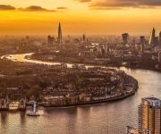
The district Rotherhithe of City of London in Greater London (England) is located in United Kingdom a little east of London, the country's capital.
If you need a place to sleep, we compiled a list of available hotels close to the map centre further down the page.
Depending on your travel schedule, you might want to pay a visit to some of the following locations: Poplar, Hackney, Camberwell, Catford and Islington. To further explore this place, just scroll down and browse the available info.
Local weather forecast
Todays Local Weather Conditions & Forecast: 12°C / 54 °F
| Morning Temperature | 9°C / 49 °F |
| Evening Temperature | 10°C / 50 °F |
| Night Temperature | 6°C / 43 °F |
| Chance of rainfall | 1% |
| Air Humidity | 60% |
| Air Pressure | 1017 hPa |
| Wind Speed | Moderate breeze with 11 km/h (7 mph) from South-East |
| Cloud Conditions | Broken clouds, covering 78% of sky |
| General Conditions | Light rain |
Saturday, 20th of April 2024
9°C (48 °F)
5°C (41 °F)
Scattered clouds, moderate breeze.
Sunday, 21st of April 2024
8°C (47 °F)
5°C (42 °F)
Light rain, gentle breeze, overcast clouds.
Monday, 22nd of April 2024
9°C (49 °F)
5°C (41 °F)
Light rain, moderate breeze, overcast clouds.
Hotels and Places to Stay
Canary Riverside Plaza Hotel
Olive Níké Apartments
Marlin Apartments Limehouse
Algate Apartment
Holiday Inn LONDON - WHITECHAPEL
DoubleTree by Hilton London Docklands
PREMIER SUITES London
City Gate Serviced Apartments
Marlin Apartments Canary Wharf
Circus Apartments By BridgeStreet
Videos from this area
These are videos related to the place based on their proximity to this place.
Virtual Fly-over of The City of London Academy (Southwark)
Virtual tour of the City of London Academy building.
Expat Explore Travel | Great Britain Tour Video
http://expatexplore.com/tours/great-britain/. Join Expat Explore on our 7-day Coach Tour of Great Britain and explore the attractions of the UK! We are specialists in UK travel, with years...
Urban Mobility in the Future City
This talk took place at the RE.WORK Cities Summit at the Tobacco Dock, London on 13 December 2013. Speakers: Frauke Behrendt, Senior Lecturer, University of Brighton Smart E-Bikes Research...
The Journey
http://veterans-aid.net Three ex-Servicemen who faced personal crises tell how the charity Veterans Aid restored their confidence and gave them the tools to rebuild their lives.
Crossrail Archaeology: Stepney City Farm Community Dig, July 2013
Ninety volunteers became amateur archaeologists for the week as they took part in Crossrail's community dig at Stepney City Farm, during the UK-wide Festival of Archaeology in July 2013. The...
Canary Wharf to Greenland Pier by Thames Clipper - Crossing the Thames No 7
The sixth crossing of the Thames between and including Tower Bridge and QEII Bridge Dartford.
GoPro HD HERO2 Timelapse River Thames, Canary Wharf, London
Testing timelapse function on GoPro HD Hero2 from my balcony overlooking the Thames and Canary Wharf one early Sunday morning. Settings, 5 photos per second, 11mp, 1080HD. Edited in iMovie,.
London City Flat To Let Near Limehouse Station
SHORT TO LONG TERM SERVICE APARTMENT TO LET TOP FLOOR WITH VIEW OF THE CITY.ALL BILLS INLCLUDED. Gorgeous very large studio apartment (750sq ft) in secure gated development ...
Office Space South East London - Canada Water Offices
http://www.searchofficespace.com/uk/office-space/se16-serviced-offices.html Facilities at this serviced office space include; kitchen and recycling facilities; disabled access; site and building...
A Stock on the East London Line part 1 - A film by Fred Ivey
On March 24th 1995 Fred Ivey filmed the running of A stock trains on London's East London Line. This was the last day of operation before the line was closed for modernisation and the construction...
Videos provided by Youtube are under the copyright of their owners.
Attractions and noteworthy things
Distances are based on the centre of the city/town and sightseeing location. This list contains brief abstracts about monuments, holiday activities, national parcs, museums, organisations and more from the area as well as interesting facts about the region itself. Where available, you'll find the corresponding homepage. Otherwise the related wikipedia article.
Prospect of Whitby
The Prospect of Whitby is a historic public house on the banks of the Thames at Wapping in the London Borough of Tower Hamlets. It lays claim to being the site of the oldest riverside tavern, dating from around 1520. It was formerly known as the Devil’s Tavern, on account of its dubious reputation. Before that it was officially called "The Pelican". All that remains from the building’s earliest period is the 400 year old stone floor.
Battle of Cable Street
The Battle of Cable Street took place on Sunday 4 October 1936 in Cable Street in the East End of London. It was a clash between the Metropolitan Police, overseeing a march by the British Union of Fascists, led by Oswald Mosley, and anti-fascists, including local Jewish, socialist, anarchist, Irish and communist groups. The majority of both marchers and counter-protesters travelled into the area for this purpose.
Thames Tunnel
The Thames Tunnel is an underwater tunnel, built beneath the River Thames in London, United Kingdom, connecting Rotherhithe and Wapping. It measures 35 feet (11 m) wide by 20 feet (6 m) high and is 1,300 feet (396 m) long, running at a depth of 75 feet (23 m) below the river's surface (measured at high tide).
Rotherhithe Tunnel
The Rotherhithe Tunnel is a road tunnel crossing beneath the River Thames in East London. It connects the Ratcliff district of Limehouse in the London Borough of Tower Hamlets north of the river to Rotherhithe in the London Borough of Southwark south of the river. It is designated as the A101. It was formally opened in 1908 by George Prince of Wales (later King George V), and Richard Robinson, Chairman of the London County Council.
London Docks
The London Docks were one of several sets of docks in the historic Port of London. They were constructed in Wapping downstream from the City of London between 1799 and 1815, at a cost exceeding £5½ million. Traditionally ships had docked at wharves on the River Thames, but by this time, more capacity was needed. They were the closest docks to the City of London, until St Katharine Docks were built two decades later.
Ratcliff
Ratcliff or Ratcliffe is a former hamlet lying by the north bank of the River Thames between Shadwell and Limehouse. It is now a district in the London Borough of Tower Hamlets, and is located to the south of Stepney.
Greenland Dock
Greenland Dock is the oldest of London's riverside wet docks, located in Rotherhithe in the area of the city now known as Docklands. It used to be part of the Surrey Commercial Docks, most of which have by now been filled in. Greenland Dock is now used purely for recreational purposes; it is one of only two functioning enclosed docks on the south bank of the River Thames.
Canada Water
Canada Water is a freshwater lake and wildlife refuge in Rotherhithe in the Docklands in south-east London. Canada Water tube, Overground and bus station is named after the lake, and lies immediately to the north, while Surrey Quays Shopping Centre is also adjacent, sitting immediately to the south. The surrounding area, which forms the town centre of Rotherhithe, is now increasingly known as Canada Water, after the transport interchange as much as the lake itself.
The Highway
The Highway, formerly known as the Ratcliffe Highway, is a road in the East End of London. The route dates back to Roman times. In the 19th century it had a notorious reputation for vice and crime and was the location of the infamous Ratcliff Highway murders. The name 'Ratcliffe' literally means 'red cliff', referring to the red sandstone cliffs which descended from the plateau on which the road was situated down to the Wapping Marshes to the south.
Stave Hill
Stave Hill is an artificial hill adjacent to the 5.2-acre Stave Hill Ecological Park, it is part of Russia Dock Woodland, and is located in Rotherhithe, London. The woodland park occupies land that was previously Russia Dock and Stave Dock, both part of the Surrey Commercial Docks, which were filled in during the mid-1980s and then redeveloped by the London Docklands Development Corporation.
St Paul's Church, Shadwell
St Paul's Church, Shadwell, is a historic church, located between The Highway and Shadwell Basin, on the edge of Wapping, in the East End of London, England. The church has had varying fortunes over many centuries, and is now very active, having been supported recently by Holy Trinity Brompton Church.
Execution Dock
Execution Dock was used for more than 400 years in London to execute pirates, smugglers and mutineers that had been sentenced to death by Admiralty courts. The "dock", which consisted of a scaffold for hanging, was located near the shoreline of the River Thames at Wapping. Its last executions were in 1830.
Bluegate Fields
Bluegate Fields (also known as Blue Gate Fields) was one of the worst slum areas that once existed just north of the old, east London docks during the Victorian era. Two streets in the area had actually been named Bluegate Fields at different times – present-day Dellow St. (along the eastern edge of the St. George’s-in-the-East church yard) is one of them – Cable Street (along the northern edge of the church yard) is the other.
Brunel Museum
The Brunel Museum is a museum in the Brunel Engine House, Rotherhithe, London Borough of Southwark. The Engine House was designed by Sir Marc Isambard Brunel to be part of the infrastructure of the Thames Tunnel.
Russia Dock Woodland
Russia Dock Woodland is a long narrow park in Rotherhithe, London, created by the infilling of one of the former Surrey Commercial Docks. The former Russia Dock was originally used for the importing of timber from Norway, Russia and Sweden. The soft wood, known as "deal wood", was mostly used for newsprint and for manufacturing furniture. Following the closure of the docks in the 1970s, the area was redeveloped by the London Docklands Development Corporation (LDDC).
Wapping Hydraulic Power Station
The Wapping Hydraulic Power Station (built 1890) was originally run by the London Hydraulic Power Company in Wapping, London, England. Originally it operated using steam and later it was converted to use electricity. It was used to power machinery, including lifts (elevators), across London. The Tower Subway was used to transfer the power, and steam, to districts south of the river.
Wapping Wall
Wapping Wall is a street located in the East End of London at Wapping. It runs parallel to the northern bank of the River Thames, with many converted warehouses facing the river. On this street is the Wapping Hydraulic Power Station, built in 1890 and closed in 1977. It is now run as an arts centre and restaurant. Opposite on the south side of the street and next to the river is The Prospect of Whitby, a historic public house.
Spa Road Junction rail crash
The Spa Road Junction rail crash was an accident on the British railway system which occurred during the peak evening rush hour of 8 January 1999 at Spa Road Junction in Bermondsey, southeast London.
St Olave's Hospital
St Olave's Hospital was a general hospital serving the Rotherhithe area of London until its closure in 1985.
Southwark Park
Southwark Park is located in Rotherhithe, in central South East London, and is managed by the London Borough of Southwark. It first opened in 1869 by the Metropolitan Board of Works as one of its first parks. It was designed by Alexander McKenzie and covers 63 acres . http://www. southwark. gov. uk/YourServices/ParksSection/AZParks/southwarkparkhistory. html It received £2.5 million from the National Lottery's Heritage Lottery Fund in 1998 which enabled large parts of the park to be refurbished.
Southwark Park railway station
Southwark Park railway station was in southeast London on the Greenwich Line between Spa Road and Deptford. It was opened by the South Eastern and Chatham Railway on 1 October 1902, on approximately the same site as the then long-closed Commercial Dock railway station. It was close to the southern end of Southwark Park, from which it took its name. South Bermondsey on the Inner South London Line is nearby.
Canada Water bus station
Canada Water bus station serves the Surrey Quays area of the London Borough of Southwark, London, England. The station is owned and maintained by Transport for London. The bus station is easily accessed by escalator from Canada Water Station below. It is also very near to the Surrey Quays Shopping Centre. The bus station was opened in 1999 at the same time as the Jubilee Line extension to Stratford reached Canada Water. The glass-roofed bus station was designed by Eva Jiřičná.
Commercial Dock railway station
Commercial Dock railway station was in Rotherhithe on the Greenwich Line of the South Eastern Railway, on approximately the same site as the later Southwark Park railway station. It was opened in 1856 and closed in 1867, though an alternative source quotes 1859 for the opening date. No visible trace remains.
London Bridge – Greenwich Railway Viaduct
The London Bridge – Greenwich Railway Viaduct consists of a series of nineteen brick railway viaducts linked by road bridges between London Bridge railway station and Deptford Creek, which together make a single structure 3.45 miles in length. The structure carries the former London and Greenwich Railway line and consists of 851 semi-circular arches and 27 skew arches or road bridges.
King's Stairs Gardens
King's Stairs Gardens is a park in London.


