Safety Score: 3,0 of 5.0 based on data from 9 authorites. Meaning we advice caution when travelling to United Kingdom.
Travel warnings are updated daily. Source: Travel Warning United Kingdom. Last Update: 2024-04-26 08:02:42
Discover Brook Green
The district Brook Green of Shepherds Bush in Greater London (England) is a district in United Kingdom a little west of London, the country's capital city.
Looking for a place to stay? we compiled a list of available hotels close to the map centre further down the page.
When in this area, you might want to pay a visit to some of the following locations: Hammersmith, Kensington, Wandsworth, Ealing Broadway and Ealing. To further explore this place, just scroll down and browse the available info.
Local weather forecast
Todays Local Weather Conditions & Forecast: 11°C / 52 °F
| Morning Temperature | 3°C / 38 °F |
| Evening Temperature | 12°C / 54 °F |
| Night Temperature | 7°C / 45 °F |
| Chance of rainfall | 0% |
| Air Humidity | 45% |
| Air Pressure | 1004 hPa |
| Wind Speed | Gentle Breeze with 7 km/h (4 mph) from West |
| Cloud Conditions | Broken clouds, covering 67% of sky |
| General Conditions | Broken clouds |
Saturday, 27th of April 2024
9°C (49 °F)
10°C (49 °F)
Moderate rain, gentle breeze, overcast clouds.
Sunday, 28th of April 2024
9°C (49 °F)
6°C (43 °F)
Light rain, moderate breeze, overcast clouds.
Monday, 29th of April 2024
14°C (58 °F)
10°C (49 °F)
Sky is clear, gentle breeze, clear sky.
Hotels and Places to Stay
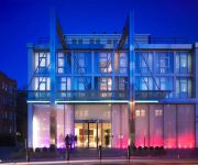
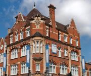
Hilton London Kensington
K West Hotel & Spa
So Park Battersea Aparthotel
W12 Rooms
Lamington Hammersmith Serviced Apartments
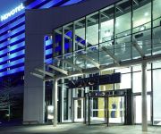
Novotel London West
St Paul's
Dorsett Shepherds Bush
Shepherd's Bush Boutique hotel
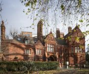
Brook Green Hotel
Videos from this area
These are videos related to the place based on their proximity to this place.
W453 UGY Hammersmith & Fulham Community Transport Project minibus cuts in on me
Coming along Shepherds Bush Road in London when a minibus from the Hammersmith & Fulham Community Transport Project cuts in on me, nearly making contact and forcing me to stop. Registration ...
Crazy Liittle Thing Called Love The Queen Extravaganza, O2 Shepherd's Bush Empire
The Queen Extravaganza, O2 Shepherd's Bush Empire 13.09.2014.
BETA: British Youth Travel Awards 2013
These awards are our industry's opportunity to reward our high achievers, gain recognition, and raise the profile of the work and individual successes of organisations engaged in youth, student...
BeatFox: Amazing Beatboxing in Westfield (White City)
Excuse all the effects, I was trying out an app on my iPhone.
47727 passes Kensington Olympia, 02/04/09
Colas Rail's 47727 "Rebecca" passes Kensington Olympia while working 6Z48 Burton West Yard-Dollands Moor Steel working. 02/04/09.
Responsive Web Design to Get More Traffic - Whitehat Shepherds Bush London
http://www.whitehat-seo.co.uk Whitehat tells us why you need a Responsive Web Design. You need a Responsive Website to make your website accessible to a growing number of mobile users to grow ...
The Subways - With You (O2 Empire Shepherds Bush. 02/04/2015)
With You The Subways O2 Empire Shepherds Bush. 2nd April, 2015 Testing a new phone. Not up to the normal standard. Apologies. but if you were there, it won't matter much! :)
The Subways - My Heart Is Pumping (O2 Empire Shepherds Bush. 02/04/2015)
My Heart Is Pumping To A Brand New Beat The Subways O2 Empire Shepherds Bush. 2nd April, 2015 Testing a new phone. Not up to the normal standard. Apologies. but if you were there, it won't...
Kyary Pamyu Pamyu Shepherds Bush 29/4/14
Kyary Pamyu Pamyu performing Yumeno Hajima Ring Ring at Shepherds Bush in London. The end of the Nanda Collection World Tour...
A creative gem in Shepherds Bush, London || Kite Studios
Today we meet Auriol Herford from Kite Studios. Auriol started Kite Studios in Shepherds Bush 10 years ago as an art studio offering a wide range of art classes for toddlers to adults.
Videos provided by Youtube are under the copyright of their owners.
Attractions and noteworthy things
Distances are based on the centre of the city/town and sightseeing location. This list contains brief abstracts about monuments, holiday activities, national parcs, museums, organisations and more from the area as well as interesting facts about the region itself. Where available, you'll find the corresponding homepage. Otherwise the related wikipedia article.
Circle line (London Underground)
The Circle line is a London Underground service that forms a spiral from Hammersmith to Edgware Road and then a loop around central London. The railway is underground in the central section and the loop east of Paddingdon, and unlike London's deep level tube railways, the railway tunnels are just below the surface and of similar size to those on British main lines. Coloured yellow on the tube map, the 17-mile line serves 36 stations, including most of London's main line railway termini.
Hammersmith & City line
The Hammersmith & City line is a London Underground service that runs between Hammersmith and Barking. Coloured salmon pink on the tube map, the line serves 29 stations inBad rounding here{{#invoke:Math|precision_format| 25.5*1,000/1,609.344 | 1-1 }} miles (25.5 km). The railway is underground in the central section between Paddington and Bow Road; between Farringdon and Aldgate East this section skirts the City of London, the capital's financial heart.
Lime Grove Studios
Lime Grove Studios was a film studio complex built by the Gaumont Film Company in 1915 situated in a street named Lime Grove, in Shepherd's Bush, west London, north of Hammersmith and described by Gaumont as "the finest studio in Great Britain and the first building ever put up in this country solely for the production of films". From 1949 to 1991 the complex was used by the BBC. Lime Grove Studios was closed in 1991 and demolished in 1993.
Holland Road, London
Holland Road, Holland Park, London W14 is a road in Kensington London, England, which connects Kensington High Street with the Holland Park roundabout. The southernmost section is one -way (northbound only, returning via Addison Road) and forms part of the Kensington/Earl's Court one-way system. The Road forms part of the A3220 road. To the east is Addison Road and Holland Park. To the west is West Kensington and Kensington (Olympia) station.
Shepherds Bush Empire
The O2 Shepherd's Bush Empire (sometimes O2 Shepherds Bush Empire) is a music venue in Shepherd's Bush, London, England, run by the Academy Music Group. It was built in 1903, as a music hall, and in 1953 became the BBC Television Theatre. Since 1991, it has operated as a music venue.
St Paul's Girls' School
This article is about the school in London. For the school in Edgbaston, Birmingham, see St Paul's School for Girls St Paul's Girls' School {{#invoke:InfoboxImage|InfoboxImage|image=St_Paul's_Girls'_School_logo.
Cardinal Vaughan Memorial School
The Cardinal Vaughan Memorial School is a Roman Catholic voluntary-aided comprehensive school in Holland Park, Kensington and Chelsea, London, England. And formerly one of several Selective Catholic Schools in England. The current headmaster is Paul Stubbings. The School has Specialist Status in science, mathematics and information technology. Mr Stubbings still ensures the same high standards set over 90 years ago are still demanded of the Vaughan’s pupils.
Cadby Hall
Cadby Hall was a major office and factory complex in Hammersmith, London which was the headquarters of pioneering catering company Joseph Lyons and Co. for almost a century.
Shepherd's Bush railway station (L&SWR)
Shepherd's Bush is a closed London and South Western Railway (L&SWR) station in Shepherd's Bush, west London. The station was situated on the L&SWR's line between Richmond and the West London Joint Railway (WLJR). It was between Hammersmith (Grove Road) station and Addison Road (now Kensington Olympia) station.
Westfield London
Westfield London is a shopping centre in White City, London, United Kingdom, in the London Borough of Hammersmith and Fulham. The centre was developed by the Westfield Group at a cost of £1.6bn, on a site bounded by the West Cross Route, the Westway and Wood Lane, and opened on 30 October 2008. The site is part of the White City district, where several other large scale development projects are under way or in the planning stages.
Shepherd's Bush Green
Shepherds Bush Green (also known as Shepherds Bush Common), is an approximately 8-acre triangular area of open grass surrounded by trees and roads with shops in Shepherd's Bush, an area of West London which takes its name from the Green.
Shepherd's Bush Market
Shepherd's Bush Market is a street market in Shepherd's Bush, London. The market is located on the east side of the railway viaduct for the Hammersmith and City Tube line, and is bordered on the north side by the Uxbridge Road, and on the south by the Goldhawk Road. The market sits on land owned by Transport for London and is the subject of a regeneration plan by the London Borough of Hammersmith and Fulham.
Caterham High School
Caterham High School is a mixed, comprehensive 11-18 school in Clayhall, London. The school holds specialist Sports College status. There are 1100 students in the school. The school is supported by the Arts Council. It had a newly built school building in 2006 at a cost of £1.4 million.
Hammersmith Palais
The Hammersmith Palais de Danse, later simply the Hammersmith Palais, was a ballroom and entertainment venue in London that operated from 1919 until 2007. In 2009, the Hammersmith Palais was named by the Brecon Jazz Festival as one of 12 venues which had made the most important contributions to jazz music in the United Kingdom. The Palais occupied a large site on the A219 at 242 Shepherd's Bush Road, London W6, near the circular system under the A4 Hammersmith flyover.
Royal Crescent, London
The Royal Crescent is a Grade II* listed street in Holland Park, west London, England, consisting of two curved facing terraces in a crescent shape. The crescent is located on the north side of Holland Park Avenue, west of Addison Avenue, and to the east of the Holland Park Roundabout. Between the facing terraces is a landscaped communal garden with expansive lawns and numerous trees.
White City bus station
White City bus station serves the White City area of West London and Westfield London shopping centre. The bus station was opened on Saturday 29 November 2008 to serve the brand new shopping centre. The station has been built around the Grade II listed Dimco buildings, originally the power station for the Central London Railway, which date from 1898. The bus station is 100 metres away from the new Wood Lane tube station on the Hammersmith & City Line.
Addison Road, London
Addison Road is a road in London, England, which connects Kensington High Street with Notting Hill and Holland Park Avenue and runs nearby to Holland Park.
Elizabeth Finn Care
Elizabeth Finn Care, established by Elizabeth Anne Finn in 1897 as the Distressed Gentlefolk's Aid Association, is a British charity providing help and assistance to relieve the problems of old age, illness, social isolation and disability.
Blythe House
Blythe House is a listed building located at 23 Blythe Road, West Kensington, London Borough of Hammersmith and Fulham, UK. Originally built as the headquarters of the Post Office Savings Bank, it is now used as a store and archive by the Victoria and Albert, Science and British Museums.
Passmore Edwards Public Library, Shepherd's Bush
The Passmore Edwards Public Library on the Uxbridge Road, Shepherd's Bush, London, was built in 1895 and funded by the journalist and philanthropist Passmore Edwards. It is one of a number of public libraries that still bear his name today. In 2008 a new library was built in Shepherd's Bush, part of the substantial Westfield London development, and the Passmore Edwards library fell into disuse. In October 2011 it re-opened as the new home of the Bush Theatre.
Dimco Buildings
The Dimco buildings are a historic structure in White City, London, just north of Shepherd's Bush. Originally built in 1898, they were constructed as a shed for the Central Line London Underground power station. Today the Dimco Buildings house a bus station. They are Grade II listed red brick buildings. The Dimco buildings were used as a filming location for the ‘Acme Factory’ in the 1988 film Who Framed Roger Rabbit?, and later served as the interior of the British Museum in The Mummy Returns.
Shepherd's Bush Pavilion
The Shepherd's Bush Pavilion is a Grade II listed building, formerly a cinema and bingo hall, in Shepherd's Bush, London. Built in 1923 and currently disused, it has planning permission for conversion into a luxury hotel, with work scheduled to begin in 2012.
Shepherd's Bush Palladium
The Shepherd's Bush Palladium (alternatively Shepherds Bush Palladium) is a former cinema in Shepherd's Bush, London, originally built in 1910 as the Shepherd's Bush Cinematograph Theatre. The building has had a number of owners over the years and finally stopped showing films in 1981. After standing empty for some time, it was eventually converted into a pub, now owned and operated by the Walkabout chain of Australasian-themed bars.
West 12 Shepherds Bush
West 12 Shepherds Bush is a shopping centre in Shepherds Bush in the London Borough of Hammersmith and Fulham. The development borders the south side of Shepherd's Bush Green and was designed in the 1960s in an unapologetically modern style.
Shepherd's Bush Village Hall
Shepherd's Bush Village Hall is a Victorian building located on Wood Lane in Shepherd's Bush, London, built in 1898. It was originally constructed as a drill hall for the 1st City of London Volunteer Artillery, but now serves the community as a village hall. It was owned by the London Borough of Hammersmith and Fulham until March 2012 when it was sold to Wigoder Family Foundation.


