Safety Score: 3,0 of 5.0 based on data from 9 authorites. Meaning we advice caution when travelling to United Kingdom.
Travel warnings are updated daily. Source: Travel Warning United Kingdom. Last Update: 2024-04-18 08:12:24
Discover West Holland Park
The district West Holland Park of Shepherds Bush in Greater London (England) is a district in United Kingdom a little west of London, the country's capital city.
Looking for a place to stay? we compiled a list of available hotels close to the map centre further down the page.
When in this area, you might want to pay a visit to some of the following locations: Hammersmith, Kensington, Wandsworth, Camden Town and London. To further explore this place, just scroll down and browse the available info.
Local weather forecast
Todays Local Weather Conditions & Forecast: 12°C / 54 °F
| Morning Temperature | 10°C / 50 °F |
| Evening Temperature | 10°C / 50 °F |
| Night Temperature | 6°C / 43 °F |
| Chance of rainfall | 1% |
| Air Humidity | 55% |
| Air Pressure | 1016 hPa |
| Wind Speed | Moderate breeze with 12 km/h (7 mph) from South-East |
| Cloud Conditions | Broken clouds, covering 66% of sky |
| General Conditions | Light rain |
Saturday, 20th of April 2024
9°C (48 °F)
5°C (41 °F)
Scattered clouds, gentle breeze.
Sunday, 21st of April 2024
9°C (47 °F)
6°C (43 °F)
Overcast clouds, moderate breeze.
Monday, 22nd of April 2024
11°C (53 °F)
7°C (44 °F)
Light rain, moderate breeze, clear sky.
Hotels and Places to Stay
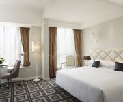
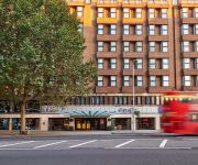
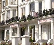
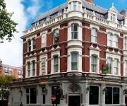
Hilton London Kensington
So Park Battersea Aparthotel
K West Hotel & Spa
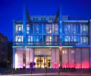
Dorsett Shepherds Bush
Simply Rooms & Suites
W12 Rooms
St Paul's
Hilton London Olympia
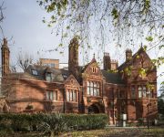
Kensington Suites
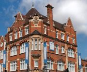
Brook Green Hotel
Videos from this area
These are videos related to the place based on their proximity to this place.
Trains at Kensington Olympia Summer 1994 a film by Fred Ivey
London's Kensington Olympia station on the West London Line is a good place to spend summer days watching trains . Fred caught on camera the "Haggis Belle", Class 73 E6003 "Sir Herbert Walker"...
Freight Trains at Kensington Olympia 20 March 2013
A series of freight trains pass through Kensington Olympia station in West London during the early afternoon of Wednesday 20 March 2013.
London Overground Class 378, Kensington Olympia, 20/07/12.
An early morning London Overground 378 (37218) arriving a departing from Kensington Olympia with a service from Clapham Juction to Stratford Regional via the West London and North London Line.
Freight Trains at Kensington Olympia 17 March 2015
The video shows four freight trains passing through Kensington Olympia station during the early afternoon of Tuesday 17 March 2015.
Whole Food in High Street Kensington, London, UK
I recommend to see this video. Most expensive food shop in UK.
W453 UGY Hammersmith & Fulham Community Transport Project minibus cuts in on me
Coming along Shepherds Bush Road in London when a minibus from the Hammersmith & Fulham Community Transport Project cuts in on me, nearly making contact and forcing me to stop. Registration ...
Kyoto Pond - Holland Park
The pond in Holland Park West London - Filmed on a Lumix TZ6 still camera. - Wikipedia entry about the park and Lord Holland (a leading Whig) http://en.wikipedia.org/wiki/Holland_Park.
GBBF 2014 Beercast 6 - The Journey of a Pint
It's time to take a journey, as we follow the story of a single pint of beer from the Great British Beer Festival back to the brewery. Beercaster Mark Phillips visits Sambrook's Brewery in...
Videos provided by Youtube are under the copyright of their owners.
Attractions and noteworthy things
Distances are based on the centre of the city/town and sightseeing location. This list contains brief abstracts about monuments, holiday activities, national parcs, museums, organisations and more from the area as well as interesting facts about the region itself. Where available, you'll find the corresponding homepage. Otherwise the related wikipedia article.
Holland House, London
Holland House, originally known as Cope Castle, was one of the first great houses built in Kensington in London, and is situated in Holland Park. Created in 1605 for the diplomat Sir Walter Cope, the building later passed to the powerful Rich family, then the Fox family, under whose ownership it became a noted gathering-place for Whigs in the 19th century.
Olympia (London)
Olympia is an exhibition centre and conference centre in West Kensington, on the boundary between the Royal Borough of Kensington and Chelsea and the London Borough of Hammersmith and Fulham, London, W14 8UX, England. It opened in the 19th century and was originally known as the National Agricultural Hall. Opened in 1886, and built by Andrew Handyside of Derby it covered an area of 4 acres .
London Academy of Music and Dramatic Art
The London Academy of Music and Dramatic Art (LAMDA) is a leading British drama school in west London. It prepares actors, directors, designers, stage managers and technicians for careers in the industry. It also helps more than 83,000 candidates worldwide develop their communication and performance skills through LAMDA Examinations, the UK's leading statutory awarding body for speech and drama.
Holland Road, London
Holland Road, Holland Park, London W14 is a road in Kensington London, England, which connects Kensington High Street with the Holland Park roundabout. The southernmost section is one -way (northbound only, returning via Addison Road) and forms part of the Kensington/Earl's Court one-way system. The Road forms part of the A3220 road. To the east is Addison Road and Holland Park. To the west is West Kensington and Kensington (Olympia) station.
Shepherds Bush Empire
The O2 Shepherd's Bush Empire (sometimes O2 Shepherds Bush Empire) is a music venue in Shepherd's Bush, London, England, run by the Academy Music Group. It was built in 1903, as a music hall, and in 1953 became the BBC Television Theatre. Since 1991, it has operated as a music venue.
St Paul's Girls' School
This article is about the school in London. For the school in Edgbaston, Birmingham, see St Paul's School for Girls St Paul's Girls' School {{#invoke:InfoboxImage|InfoboxImage|image=St_Paul's_Girls'_School_logo.
Cardinal Vaughan Memorial School
The Cardinal Vaughan Memorial School is a Roman Catholic voluntary-aided comprehensive school in Holland Park, Kensington and Chelsea, London, England. And formerly one of several Selective Catholic Schools in England. The current headmaster is Paul Stubbings. The School has Specialist Status in science, mathematics and information technology. Mr Stubbings still ensures the same high standards set over 90 years ago are still demanded of the Vaughan’s pupils.
Cadby Hall
Cadby Hall was a major office and factory complex in Hammersmith, London which was the headquarters of pioneering catering company Joseph Lyons and Co. for almost a century.
Shepherd's Bush railway station (L&SWR)
Shepherd's Bush is a closed London and South Western Railway (L&SWR) station in Shepherd's Bush, west London. The station was situated on the L&SWR's line between Richmond and the West London Joint Railway (WLJR). It was between Hammersmith (Grove Road) station and Addison Road (now Kensington Olympia) station.
Westfield London
Westfield London is a shopping centre in White City, London, United Kingdom, in the London Borough of Hammersmith and Fulham. The centre was developed by the Westfield Group at a cost of £1.6bn, on a site bounded by the West Cross Route, the Westway and Wood Lane, and opened on 30 October 2008. The site is part of the White City district, where several other large scale development projects are under way or in the planning stages.
Shepherd's Bush Green
Shepherds Bush Green (also known as Shepherds Bush Common), is an approximately 8-acre triangular area of open grass surrounded by trees and roads with shops in Shepherd's Bush, an area of West London which takes its name from the Green.
Roberson Wine
Roberson Wine is a fine wine merchant based at 348 Kensington High Street in central London. Established in 1991, Roberson specialises in wines from Bordeaux and Burgundy. Holding regular tastings of fine wine in its Kensington cellars, its trading division, based in Fulham, deals with on-trade sales, en primeur sales of fine wines and wine broking. Roberson Wine was named "London Wine Merchant of the Year" in 2008 and "Retailer of the Year" in 2009 for The Drinks Business Magazine.
Caterham High School
Caterham High School is a mixed, comprehensive 11-18 school in Clayhall, London. The school holds specialist Sports College status. There are 1100 students in the school. The school is supported by the Arts Council. It had a newly built school building in 2006 at a cost of £1.4 million.
Little Holland House
For Frank Dickinson's house of the same name, see Little Holland House, Carshalton. Little Holland House was the dower house of Holland House in Kensington, England. It was at one point occuppied by Charles Richard Fox and his wife, Lady Mary Fox, daughter of King William IV. Henry Thoby Prinsep, a director of East India Company family, gained a 21-year lease on it from Henry Fox, 4th Baron Holland thanks to the painter George Frederic Watts, a friend of both the Hollands and the Prinseps.
Gwendwr Garden
Gwendwr Garden is a small park in West Kensington. In 1948 the area was donated to Fulham Council by the Gunter Estate for a memorial to the victims of German air raids in the area, particularly the Operation Steinbock raid on the night of 20 February 1944. The park contains a sunken area with a pond, lawns and a commemorative plaque.
Royal Crescent, London
The Royal Crescent is a Grade II* listed street in Holland Park, west London, England, consisting of two curved facing terraces in a crescent shape. The crescent is located on the north side of Holland Park Avenue, west of Addison Avenue, and to the east of the Holland Park Roundabout. Between the facing terraces is a landscaped communal garden with expansive lawns and numerous trees.
Holland Park Avenue
Holland Park Avenue is a street located in the Royal Borough of Kensington and Chelsea, in west central London. The street runs from Notting Hill Gate in the east to the Holland Park Roundabout in the west, forms a part of the old west road connecting London with Oxford and the west of England, and is designated part of the A402 road. Holland Park Avenue's present design was laid out in the 19th century.
Pottery Lane
Pottery Lane is a street in Notting Hill, west London. Today it forms part of one of London's most fashionable and expensive neighbourhoods, but in the mid-19th century it lay at the heart of a wretched and notorious slum known as the "Potteries and the Piggeries". The slum came to the attention of Londoners with the building of the Hippodrome in 1837 by entrepreneur John Whyte.
Talgarth Road
Talgarth Road is a dual carriageway in The London Borough of Hammersmith and Fulham and is a designated part of the A4, running through West London, England on the road to Heathrow Airport. It starts in Earl's Court, and runs past West Kensington and Barons Court tube stations, and the Ark and West London Courthouse, before ending at Hammersmith Broadway, where a Flyover continues the A4.
Addison Road, London
Addison Road is a road in London, England, which connects Kensington High Street with Notting Hill and Holland Park Avenue and runs nearby to Holland Park.
Blythe House
Blythe House is a listed building located at 23 Blythe Road, West Kensington, London Borough of Hammersmith and Fulham, UK. Originally built as the headquarters of the Post Office Savings Bank, it is now used as a store and archive by the Victoria and Albert, Science and British Museums.
Shepherd's Bush Pavilion
The Shepherd's Bush Pavilion is a Grade II listed building, formerly a cinema and bingo hall, in Shepherd's Bush, London. Built in 1923 and currently disused, it has planning permission for conversion into a luxury hotel, with work scheduled to begin in 2012.
West 12 Shepherds Bush
West 12 Shepherds Bush is a shopping centre in Shepherds Bush in the London Borough of Hammersmith and Fulham. The development borders the south side of Shepherd's Bush Green and was designed in the 1960s in an unapologetically modern style.
The ClementJames Centre
The ClementJames Centre is a UK education charity (number 1009253) based in North Kensington, a deprived area in London.
Embassy of Ukraine, London
The Ukrainian Embassy in London is the diplomatic mission of Ukraine to the United Kingdom. It is located in 60 Holland Park, London W11 3SJ.


