Safety Score: 3,0 of 5.0 based on data from 9 authorites. Meaning we advice caution when travelling to United Kingdom.
Travel warnings are updated daily. Source: Travel Warning United Kingdom. Last Update: 2024-05-10 08:04:54
Touring Croxteth
The district Croxteth of in Liverpool (England) is a subburb located in United Kingdom about 178 mi north-west of London, the country's capital place.
Need some hints on where to stay? We compiled a list of available hotels close to the map centre further down the page.
Being here already, you might want to pay a visit to some of the following locations: Melling, Knowsley, Liverpool, Prescot and Thornton. To further explore this place, just scroll down and browse the available info.
Local weather forecast
Todays Local Weather Conditions & Forecast: 20°C / 68 °F
| Morning Temperature | 15°C / 58 °F |
| Evening Temperature | 19°C / 67 °F |
| Night Temperature | 16°C / 61 °F |
| Chance of rainfall | 0% |
| Air Humidity | 55% |
| Air Pressure | 1020 hPa |
| Wind Speed | Gentle Breeze with 8 km/h (5 mph) from North-West |
| Cloud Conditions | Overcast clouds, covering 100% of sky |
| General Conditions | Overcast clouds |
Sunday, 12th of May 2024
20°C (68 °F)
13°C (56 °F)
Moderate rain, moderate breeze, overcast clouds.
Monday, 13th of May 2024
16°C (61 °F)
12°C (54 °F)
Light rain, gentle breeze, overcast clouds.
Tuesday, 14th of May 2024
11°C (53 °F)
11°C (52 °F)
Light rain, moderate breeze, overcast clouds.
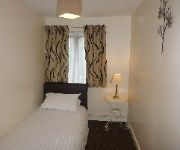
Hotels and Places to Stay
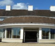
Suites Knowsley
Beech Mount
Trivelles Liverpool
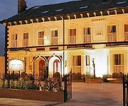
Sefton Park Hotel
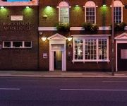
The Blackburne Arms
Arinza Apartment Kingsley Court
Grove Suites
The Park Hotel
Ullet Suites - Guest House
Orrell Park Hotel
Videos from this area
These are videos related to the place based on their proximity to this place.
Knowsley's new primary schools
Knowsley children, school staff and parents talk about what they they would like to see in the borough's new primary schools.
Driving Along Spencer's Lane & Waddicar Lane, Liverpool, England 11th November 2012
Driving along Spencer's Lane & Waddicar Lane, Liverpool, England. Videoed on Sunday, 11th November 2012 Playlist: http://www.youtube.com/playlist?list=PLNhQ1cvxqm55wdbj2XrgzQfv3auDsfjEX ...
*RARE* 37 604 Thrashes Out of Kirkby Station With Tones 13/03/14
Here we have a rather rare clip of 37 604 giving it some beans as it departs Kirkby Station on a test train from Crewe 13/03/14 Please excuse the shaking as I am a bit of a noob to filming...
First Flight Kirkby using H3-3D DJI Phantom 2 and Gopro Hero3+
First Flight Kirkby using H3-3D DJI Phantom 2 and Gopro Hero3+. Watch in HD. Enjoy.
Phil the Bin tackles littering in Kirkby
See Kirkby residents' reactions to Knowsley's latest weapon against littering - radio-controlled robot Phil the Bin.
Keylink Communications, Kirkby, Liverpool, UK
A terrible, terrible video me and some others made in 1993 in Keylink Communications, Kirkby. I have other clips of Kirkby stuff from around that time, I may put them up on here sometime if...
First Greater Manchester N652 CDB (Preserved)
1152 a Dennis Dart 9.8M with Plaxton Pointer body on a free service 96 to Kirkby Station for the North West Vehicle Restoration Trust Running Day 2012.
MERSEYSIDE FIRE& RESCUE DENNIS SS APPLIANCES.
TWO MERSEYSIDE DENNIS SS APLLIANCES IN THE TRAINING SCHOOL YARD ON A DEMO WITH THE YOUTH ENGAGEMENT TEAM.
Videos provided by Youtube are under the copyright of their owners.
Attractions and noteworthy things
Distances are based on the centre of the city/town and sightseeing location. This list contains brief abstracts about monuments, holiday activities, national parcs, museums, organisations and more from the area as well as interesting facts about the region itself. Where available, you'll find the corresponding homepage. Otherwise the related wikipedia article.
Croxteth Hall
Croxteth Hall is the former country estate and ancestral home of the Molyneux family, the Earls of Sefton. After the death of the 7th and last Earl in 1972 the estate passed to Liverpool City Council, which now manages the remainder of the estate, following the sale of approximately half of the grounds. The remaining grounds, Croxteth Park, were at one time a hunting chase of the Molyneux family and are now open to the public.
Manor Court House, West Derby
Manor Court House, West Derby, Liverpool, England. The present building is the result of a rebuilding in 1586 by Queen Elizabeth I. There has been a courthouse in West Derby for over 1,000 years since Wapentake court of the Viking.
St Mary's Church, West Derby, Liverpool
St Mary's Church, is situated in West Derby, Liverpool, England. It was built in 1853, and designed by Sir George Gilbert Scott. It is a Grade II* Listed building built of red sandstone with Yorkshire stone pillars and is situated in the heart of West Derby Village at the entrance to Croxteth Park. It is regarded as a fine example of Scott's work and has windows by Clayton and Bell, together with some fine woodwork in the chancel and sanctuary.
The Village Cross, West Derby
The Village Cross, West Derby, Liverpool, England designed by William Eden Nesfield between 1861 and 1870. The carved capital, of what appears to be a column rather than a cross, is supposedly of John of England, during his reign West Derby would have been an important castle.
Liverpool West Derby (UK Parliament constituency)
Liverpool, West Derby is a constituency represented in the House of Commons of the UK Parliament since 2010 by Stephen Twigg of the Labour Party and Co-operative Party.
West Derby Cemetery
West Derby Cemetery, Lower House Lane, Croxteth. Opened in January 1884 it has been used for Church of England, Roman Catholic and Jewish burials. Various buildings at the cemetery are Grade II listed buildings. The cemetery contains 108 Commonwealth service war graves of World War I and 129 of World War II, scattered in the different denominational plots. Casualties whose graves could not be marked by CWGC headstones are listed on the two denominational Screen Wall memorials.
Walton Centre
The Walton Centre, formerly known as The Walton Centre for Neurology and Neurosurgery; is a neurology hospital located in the suburb of Fazakerley, in the city of Liverpool, England. It is the only specialist neurosciences NHS trust in the United Kingdom dedicated to providing comprehensive neurological, neurosurgical and pain management services.
Melwood
Melwood, in West Derby, Liverpool, is home to Liverpool Football Club's training ground. It is not attached to The Academy, which is in Kirkby. The ground previously belonged to St Francis Xavier, a local school. The area was used as a playing field for the school and Father Melling and Father Woodlock who taught at the school spent hours helping the young boys play football.
Gwalia, Liverpool
Gwalia in Liverpool, England is a Grade II listed building. It was built between 1851 and 1857 for Joseph Edwards and was formerly known as Sandfield Tower.
Alder Hey Children's Hospital
Alder Hey Children's Hospital is a children's hospital in West Derby, Liverpool. It is run by the Alder Hey Children's NHS Foundation Trust as part of the National Health Service in England. The hospital forms a key component of the undergraduate medical curriculum at the University of Liverpool School of Medicine.
Clubmoor railway station
Clubmoor railway station was a station located on the North Liverpool Extension Line at Broad Lane, Norris Green, Liverpool, England, it opened on 14 April 1927. This was part of the Cheshire line link from Halewood to Southport. It now forms part of the Transpennine trail which runs from Kingsdon-Upon-Hull in the East to Southport in the west. It closed to passengers on 7 November 1960, it was used by freight trains until 1975. Even though the tracks were not lifted until early 1979.
West Derby railway station
West Derby railway station was a station located on the North Liverpool Extension Line to the south of Mill Lane, West Derby, Liverpool, England, it opened on 1 December 1879. It closed to passengers on 7 November 1960, it was used by freight trains until 1975, even though the tracks were not lifted until early 1979. This station was about 2 miles away from Croxteth Hall which was the home of Lord Sefton.
The Kirkby Project
The Kirkby Project was a proposed new football stadium in Kirkby, England for Everton. The plan originated in 2006, was the subject of a Public Inquiry in December 2008, but was eventually rejected by central government in November 2009. The stadium had a planned all-seated capacity of 50,401 with a provision to be expanded to 60,000.
The Casbah Coffee Club
The Casbah Coffee Club was a rock and roll music venue in West Derby, Liverpool, started by Mona Best in 1959 in the cellar of the family home. The Casbah, as it became widely known, was planned as a members-only club for Best's sons Pete, his younger brother, Rory, and their friends. Mona came up with the idea of the club after watching a TV report about The 2i's Coffee Bar in London's Soho where several singers had been discovered.
Bellefield
Bellefield, in West Derby, Liverpool, is Everton FC's former training ground. Bellefield had been Everton FC's training ground since 1946. It was purchased in 1965 from landowner Mr Tyson and Everton developed it so it was ready by summer of 1966. On 12 July 1966 it was officially opened by Mr J Richards, the president of the Football League. At the time it was so advanced that the Brazilian national football team used it as a training base in the 1966 World Cup.
ROF Fazakerley
ROF Fazakerley was a Royal Ordnance Factory rifle manufacturing plant in Fazakerley, Liverpool; which manufactured weapons such as the Sten and Sterling submachine guns and Lee-Enfield rifle during and after World War II. ROF Fazakerley and ROF Maltby were established before World War II to increase arms production facilities in areas less vulnerable to aerial attack. The main Royal Small Arms Factory for rifle manufacture was in Enfield, London.
Stonebridge Park, Liverpool
Stonebridge Park is a new business park under construction in Gillmoss on the outskirts of Liverpool. Create by St. Modwen Properties with the help of Liverpool Vision. The park lies close to the East Lancs Road the A580 road on the border of the Fazakerley and Croxteth areas of the city.
West Derby (ward)
West Derby is a Liverpool City Council ward within the Liverpool West Derby Parliamentary constituency. It was formed for the 2004 Municipal elections comprising most of the pre-2004 Croxteth ward, incorporating small parts of Gilmoss and Broadgreen wards. It is centred around West Derby village and incorporates Blackmoor Park Junior school, St. Paul's primary school, St. Mary's primary school and Holly Lodge secondary school.
Norris Green (ward)
Norris Green is a Liverpool City Council Ward in the Liverpool West Derby Parliamentary constituency. It was formed for the 2004 Municipal elections from the former Pirrie, Clubmoor, Fazakerley and Gillmoss wards.
Kirkdale (ward)
Kirkdale is a Liverpool City Council Ward in the Liverpool Riverside Parliamentary constituency. It was formed for the 2004 Municipal elections from most of the former Vauxhall and Melrose wards and a small part of Everton ward.
Fazakerley (ward)
Fazakerley is a Liverpool City Council Ward in the Liverpool Walton Parliamentary constituency. The ward boundary was changed in 2004 when the number of councillors was reduced. In 2010 a by-election was held following the death of Councillor Jack Spriggs.
Croxteth (ward)
Croxteth is a Liverpool City Council Ward in the Liverpool West Derby Parliamentary constituency. The ward boundary was changed in 2004 when the number of councillors was reduced.
Clubmoor (ward)
Clubmoor is a Liverpool City Council Ward in the Liverpool Walton Parliamentary constituency. The ward boundary was changed at the 2004 municipal elections.
Norris Green Park
Norris Green Park in Norris Green, Liverpool, England is a city park situated between Broad Lane and Lorenzo Drive.
Church of St Christopher, Norris Green
The Church of St Christopher, Norris Green, is located in Lorenzo Drive, Norris Green, Liverpool, Merseyside, England. It is designated by English Heritage as a Grade II* listed building, and is an active Anglican parish church in the diocese of Liverpool, the archdeaconry of Liverpool, and the deanery of West Derby.


