Safety Score: 3,0 of 5.0 based on data from 9 authorites. Meaning we advice caution when travelling to United Kingdom.
Travel warnings are updated daily. Source: Travel Warning United Kingdom. Last Update: 2024-04-25 08:17:04
Delve into Bootle
Bootle in Sefton (England) with it's 57,791 habitants is a town located in United Kingdom about 182 mi (or 293 km) north-west of London, the country's capital town.
Time in Bootle is now 04:35 PM (Thursday). The local timezone is named Europe / London with an UTC offset of one hour. We know of 9 airports closer to Bootle, of which 4 are larger airports. The closest airport in United Kingdom is Liverpool John Lennon Airport in a distance of 11 mi (or 18 km), South-East. Besides the airports, there are other travel options available (check left side).
There are several Unesco world heritage sites nearby. The closest heritage site in United Kingdom is Pontcysyllte Aqueduct and Canal in a distance of 35 mi (or 56 km), South. Also, if you like the game of golf, there are some options within driving distance. In need of a room? We compiled a list of available hotels close to the map centre further down the page.
Since you are here already, you might want to pay a visit to some of the following locations: Thornton, Ince Blundell, Wallasey, Liverpool and Hightown. To further explore this place, just scroll down and browse the available info.
Local weather forecast
Todays Local Weather Conditions & Forecast: 9°C / 49 °F
| Morning Temperature | 7°C / 45 °F |
| Evening Temperature | 8°C / 46 °F |
| Night Temperature | 5°C / 41 °F |
| Chance of rainfall | 1% |
| Air Humidity | 72% |
| Air Pressure | 1003 hPa |
| Wind Speed | Moderate breeze with 12 km/h (7 mph) from South-East |
| Cloud Conditions | Scattered clouds, covering 40% of sky |
| General Conditions | Light rain |
Friday, 26th of April 2024
9°C (48 °F)
6°C (42 °F)
Light rain, gentle breeze, few clouds.
Saturday, 27th of April 2024
10°C (50 °F)
6°C (43 °F)
Light rain, gentle breeze, overcast clouds.
Sunday, 28th of April 2024
9°C (48 °F)
8°C (46 °F)
Overcast clouds, moderate breeze.
Hotels and Places to Stay
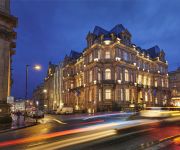
Mercure Liverpool Atlantic Tower Hotel
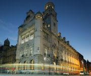
DoubleTree by Hilton Hotel - Spa Liverpool
Aloft Liverpool
Titanic Hotel Liverpool
Liverpool City Centre
Throstles Nest Hotel
Liverpool Radisson Blu Hotel
Malmaison Liverpool
BW Premier Collection The Richmond
PREMIER SUITES Liverpool
Videos from this area
These are videos related to the place based on their proximity to this place.
Canal Footbridge at Litherland
Footbridge over the Leeds & Liverpool Canal at Litherland, Liverpool, Merseyside, England. The Victorian iron bridge dates from the 1880s and is also used to carry gas, water and electricity...
Mixed City & Island (FMV) Cut Scenes
Mixed City & Island (FMV) Cut Scenes Im kinda gutted its still not smooth enough for my liking Please subscribe and maybe follow our blog :) http://www.livin...
Boneshaker - Renegade @ The Priory, Litherland, 28th Nov 2009
Southport based classic rock band performing Renegade at The Priory in Litherland. You can also add them as a friend on Facebook.... Boneshaker Theband... for more info, gig dates etc..
Boneshaker - Here I Go Again @ The Priory, Litherland, 28th Nov 2009
Southport based classic rock band performing Here I Go Again at The Priory in Litherland. You can also add them as a friend on Facebook.... Boneshaker Theband... for more info, gig dates etc..
It's My Hair Tag!
I was tagged by the lovely powderblush intagram@ndidi grace Faacebook@ndidi kolawole. The questions: 1. Why did you start your hair journey? 2. How long have you been on your hair journey?...
Liverpool Waterloo & Victoria derelict Tunnels Urban Explore
Disused Railway tunnel (one of many!) that runs under Liverpool close to the city center. Bit of a mooch about to see the place in full. Quite different to the usual tunnels! Bit of history...
Saying Goodby To Beach Road Primary School 1 (30/1/2015)
January 30th 2015, i took a walk around my old school, from the nursery through 4 years of Infants then juniors before leaving for Litherland High School (which was further from home and formerly...
Logo - Intro - Credits (Work In progress).m2t
WORK IN PROGRESS NO SPELL CHECKING NEITHER!!! 1280x720 16:9 FULL SCREEN Be sure to check out the other videos and our facebook Time Line page going back to 1908 ...
Barton Road by Benn Pollard at Liverpool Exhibition April 2014
Barton Road by Benn Pollard representing the Western Region of British Railways in the 1970s. Seen at the Liverpool MRS Exhibition at Old Christ Church, Crosby, April 2014. A video by Black...
The Grave of Walter Franklin Tomkins
Was really sad shooting this video because after i finally found the grave, i then had to walk back to the gates and walk back in (to shoot the video) It took a good 30 to 45 mins to find...
Videos provided by Youtube are under the copyright of their owners.
Attractions and noteworthy things
Distances are based on the centre of the city/town and sightseeing location. This list contains brief abstracts about monuments, holiday activities, national parcs, museums, organisations and more from the area as well as interesting facts about the region itself. Where available, you'll find the corresponding homepage. Otherwise the related wikipedia article.
Seaforth Dock
Seaforth Dock (also known as the Royal Seaforth Dock) is a purpose-built dock and container terminal, on the River Mersey, England, at Seaforth, to the north of Liverpool. As part of the Port of Liverpool and Liverpool Freeport, it is operated by the Mersey Docks and Harbour Company. Situated at the northern end of the dock system, it is connected to Gladstone Dock to the south, which via its lock entrance provides maritime access to Seaforth Dock from the river.
Gladstone Dock
Gladstone Dock is a dock on the River Mersey, England and part of the Port of Liverpool. It is situated in the northern dock system in Bootle. The dock is connected to the Royal Seaforth Dock to the north and what remains of Hornby Dock to the south. Part of Liverpool Freeport, Gladstone Dock is operated by the Mersey Docks and Harbour Company.
Seaforth Battery
Not to be confused with Seaforth Armoury Seaforth Battery, Seaforth, Merseyside, England. was built to protect shipping on the River Mersey. Constructed as part of the defences of the Mersey Docks, the battery was designed to engage ships using the Rock Channel head on as well as the other shipping channels. The battery supported Fort Perch Rock, which was located opposite on the Wirral bank of the river. In 1875 a battery of seven saluting guns was erected in the fort.
Gladstone Dock railway station
Gladstone Dock railway station was a station in Bootle, England, located on the North Mersey Branch. Situated west of Rimrose Road within the Mersey Docks and Harbour Board Estate, it was named after the nearby Gladstone Dock. It opened on 7 September 1914 and closed on 7 July 1924. Although closed to passengers, the line remained in use for freight up until 1971. However, the embankment on which the single platform station was situated has long since been demolished.
Gladstone Dock (LOR) railway station
Gladstone Dock was a station located on the Liverpool Overhead Railway, west of Rimrose Road, within the MDHC Dock Estate, named after nearby Gladstone Dock. It was opened on 16 June 1930, the last station to open on the network. The station closed, along with the rest of the line on 30 December 1956. No evidence of the station remains.
Seaforth Sands railway station
Seaforth Sands was a terminus station located on the Liverpool Overhead Railway at Seaforth, west of Crosby Road South, Knowsley Road and Rimrose Road junctions. The station opened on 30 April 1894, as a northern extension from Alexandra Dock (LOR). With the LOR's second northern extension to Seaforth & Litherland on 2 July 1905, a 'through' station was opened by the same name, the former station then only being used at peak times.
Waterloo with Seaforth Urban District
Waterloo with Seaforth was an Urban District in the administrative county of Lancashire until 1937 when it was annexed to the municipal borough of Crosby, Merseyside. It included the settlements of Seaforth and Waterloo.
Rimrose Valley
Rimrose Valley is a 3.5 km country park and valley which forms a border between Crosby and Litherland in the borough of Sefton, Merseyside, England. It is the most southerly part of the West Lancashire Coastal Plain. The Leeds and Liverpool Canal flows through the park.
Seaforth House
Seaforth House was a mansion in Seaforth, Merseyside England built in 1813 for Sir John Gladstone, father of William Ewart Gladstone who was Prime Minister of the United Kingdom four times. Sir John had lived on Rodney Street, Liverpool and decided that he wanted to move his young family away from the city centre. The mansion was built on 100 acres of Litherland marsh, four miles (6 km) north-northwest of Liverpool.
Old Christ Church, Waterloo
Old Christ Church, Waterloo, is a redundant Anglican church located in Waterloo Road, Waterloo, Merseyside, England. The church has been designated by English Heritage as a Grade II* listed building, and is under the care of the Churches Conservation Trust. It was declared redundant in 1982, and its functions have been replaced by a new Christ Church at the junction of Crosby Road South and Alexandra Road, Waterloo.
Lathom Hall
Lathom Hall is a former cinema and music venue in Seaforth, Liverpool. Built in 1884, the venue became synonymous with Merseybeat in the 1960s.
Our Lady Star of the Sea, Seaforth
Our Lady Star of the Sea, Seaforth is a Roman Catholic church in Seaforth, Merseyside, England. Its building is listed.


