Safety Score: 3,0 of 5.0 based on data from 9 authorites. Meaning we advice caution when travelling to United Kingdom.
Travel warnings are updated daily. Source: Travel Warning United Kingdom. Last Update: 2024-04-25 08:17:04
Delve into West Derby
West Derby in Liverpool (England) is located in United Kingdom about 177 mi (or 285 km) north-west of London, the country's capital town.
Current time in West Derby is now 10:41 PM (Thursday). The local timezone is named Europe / London with an UTC offset of one hour. We know of 9 airports close to West Derby, of which 4 are larger airports. The closest airport in United Kingdom is Liverpool John Lennon Airport in a distance of 7 mi (or 12 km), South. Besides the airports, there are other travel options available (check left side).
There are several Unesco world heritage sites nearby. The closest heritage site in United Kingdom is Pontcysyllte Aqueduct and Canal in a distance of 32 mi (or 51 km), South. Also, if you like playing golf, there are some options within driving distance. If you need a hotel, we compiled a list of available hotels close to the map centre further down the page.
While being here, you might want to pay a visit to some of the following locations: Melling, Knowsley, Liverpool, Prescot and Thornton. To further explore this place, just scroll down and browse the available info.
Local weather forecast
Todays Local Weather Conditions & Forecast: 9°C / 48 °F
| Morning Temperature | 7°C / 44 °F |
| Evening Temperature | 8°C / 47 °F |
| Night Temperature | 4°C / 40 °F |
| Chance of rainfall | 1% |
| Air Humidity | 75% |
| Air Pressure | 1003 hPa |
| Wind Speed | Moderate breeze with 9 km/h (6 mph) from South-East |
| Cloud Conditions | Broken clouds, covering 52% of sky |
| General Conditions | Light rain |
Friday, 26th of April 2024
8°C (46 °F)
5°C (41 °F)
Light rain, gentle breeze, scattered clouds.
Saturday, 27th of April 2024
11°C (51 °F)
6°C (43 °F)
Overcast clouds, gentle breeze.
Sunday, 28th of April 2024
6°C (42 °F)
6°C (43 °F)
Moderate rain, gentle breeze, overcast clouds.
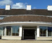
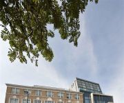
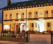
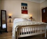
Hotels and Places to Stay
Suites Knowsley
Hope Street Hotel
Beech Mount
Ullet Suites - Guest House
Sefton Park Hotel
Grove Suites
Sefton Park Hotel
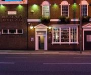
The Blackburne Arms
Orrell Park Hotel
The Penny Lane Hotel
Videos from this area
These are videos related to the place based on their proximity to this place.
Knowsley's new primary schools
Knowsley children, school staff and parents talk about what they they would like to see in the borough's new primary schools.
MERSEYSIDE FIRE& RESCUE DENNIS SS APPLIANCES.
TWO MERSEYSIDE DENNIS SS APLLIANCES IN THE TRAINING SCHOOL YARD ON A DEMO WITH THE YOUTH ENGAGEMENT TEAM.
Driving Along Stopgate Lane, Long Lane & Hall Lane, Liverpool 18th February 2011
Driving along Stopgate Lane (B5187), Long Lane (B5187) & Hall Lane, Liverpool, England Videoed on Friday, 18th February 2011 Playlist: ...
falling paul
filmed on dannys stag do at jungle park liverpool . i just could not hold onto the rope.
Driving Along East Lancashire Road & Lower Lane, Liverpool, England 4th April 2012
Driving along East Lancashire Road (A580) & Lower Lane, Liverpool, Merseyside, England. Videoed on Wednesday, 4th April 2012 Playlist: ...
Night Drive On Valley Road, Longmoor Lane & Hall Lane, Liverpool, Merseyside, England
Driving at night along Valley Road A506, Longmoor Lane A506 & Hall Lane, Liverpool, Merseyside, England Videoed on Friday, 21st November 2014 Playlist: ...
Driving On The M57 Motorway From J1 To J6 Fazakerley, Merseyside, England 9th November 2012
Driving on the M57 motorway from junction1 Huyton to junction 6 (A506 Fazakerley Kirrby), Merseyside, England Videoed on Friday, 9th November 2012 Playlist: http://www.youtube.com/playlist?list=PL ...
Driving Along Longmoor Lane & Valley Road A506, Liverpool, England Monday, 6th May 2013
Driving along Longmoor Lane (stopping briefly at the Shell petrol station) & Valley Road (A506), Liverpool, Merseyside, England. Videoed on Monday, 6th May 2013 Playlist: http://www.youtube.com/pl...
Driving Along Longmoor Lane & Valley Road A506, Liverpool, England 12th February 2012
Driving along Longmoor Lane (A506) & Valley Road (A506), Liverpool, Merseyside, England. Videoed on Sunday,12th February 2012 ...
Videos provided by Youtube are under the copyright of their owners.
Attractions and noteworthy things
Distances are based on the centre of the city/town and sightseeing location. This list contains brief abstracts about monuments, holiday activities, national parcs, museums, organisations and more from the area as well as interesting facts about the region itself. Where available, you'll find the corresponding homepage. Otherwise the related wikipedia article.
Manor Court House, West Derby
Manor Court House, West Derby, Liverpool, England. The present building is the result of a rebuilding in 1586 by Queen Elizabeth I. There has been a courthouse in West Derby for over 1,000 years since Wapentake court of the Viking.
St Mary's Church, West Derby, Liverpool
St Mary's Church, is situated in West Derby, Liverpool, England. It was built in 1853, and designed by Sir George Gilbert Scott. It is a Grade II* Listed building built of red sandstone with Yorkshire stone pillars and is situated in the heart of West Derby Village at the entrance to Croxteth Park. It is regarded as a fine example of Scott's work and has windows by Clayton and Bell, together with some fine woodwork in the chancel and sanctuary.
The Village Cross, West Derby
The Village Cross, West Derby, Liverpool, England designed by William Eden Nesfield between 1861 and 1870. The carved capital, of what appears to be a column rather than a cross, is supposedly of John of England, during his reign West Derby would have been an important castle.
Church of St Paul, Liverpool
The Church of St Paul, Liverpool, is located in Derby Lane, Stoneycroft, Liverpool, Merseyside, England. It is an active Anglican parish church in the diocese of Liverpool, the archdeaconry of Liverpool, and the deanery of West Derby. Its benefice is united with that of St Anne, Stanley. The church is designated by English Heritage as a Grade II* listed building. It was designed by Giles Gilbert Scott, who also designed the Anglican Liverpool Cathedral.
Melwood
Melwood, in West Derby, Liverpool, is home to Liverpool Football Club's training ground. It is not attached to The Academy, which is in Kirkby. The ground previously belonged to St Francis Xavier, a local school. The area was used as a playing field for the school and Father Melling and Father Woodlock who taught at the school spent hours helping the young boys play football.
Gwalia, Liverpool
Gwalia in Liverpool, England is a Grade II listed building. It was built between 1851 and 1857 for Joseph Edwards and was formerly known as Sandfield Tower.
West Derby railway station
West Derby railway station was a station located on the North Liverpool Extension Line to the south of Mill Lane, West Derby, Liverpool, England, it opened on 1 December 1879. It closed to passengers on 7 November 1960, it was used by freight trains until 1975, even though the tracks were not lifted until early 1979. This station was about 2 miles away from Croxteth Hall which was the home of Lord Sefton.
The Casbah Coffee Club
The Casbah Coffee Club was a rock and roll music venue in West Derby, Liverpool, started by Mona Best in 1959 in the cellar of the family home. The Casbah, as it became widely known, was planned as a members-only club for Best's sons Pete, his younger brother, Rory, and their friends. Mona came up with the idea of the club after watching a TV report about The 2i's Coffee Bar in London's Soho where several singers had been discovered.
Bellefield
Bellefield, in West Derby, Liverpool, is Everton FC's former training ground. Bellefield had been Everton FC's training ground since 1946. It was purchased in 1965 from landowner Mr Tyson and Everton developed it so it was ready by summer of 1966. On 12 July 1966 it was officially opened by Mr J Richards, the president of the Football League. At the time it was so advanced that the Brazilian national football team used it as a training base in the 1966 World Cup.
West Derby (ward)
West Derby is a Liverpool City Council ward within the Liverpool West Derby Parliamentary constituency. It was formed for the 2004 Municipal elections comprising most of the pre-2004 Croxteth ward, incorporating small parts of Gilmoss and Broadgreen wards. It is centred around West Derby village and incorporates Blackmoor Park Junior school, St. Paul's primary school, St. Mary's primary school and Holly Lodge secondary school.
Norris Green Park
Norris Green Park in Norris Green, Liverpool, England is a city park situated between Broad Lane and Lorenzo Drive.
Church of St Christopher, Norris Green
The Church of St Christopher, Norris Green, is located in Lorenzo Drive, Norris Green, Liverpool, Merseyside, England. It is designated by English Heritage as a Grade II* listed building, and is an active Anglican parish church in the diocese of Liverpool, the archdeaconry of Liverpool, and the deanery of West Derby.


