Safety Score: 3,0 of 5.0 based on data from 9 authorites. Meaning we advice caution when travelling to United Kingdom.
Travel warnings are updated daily. Source: Travel Warning United Kingdom. Last Update: 2024-04-18 08:12:24
Explore Sefton
Sefton in Sefton (England) is located in United Kingdom about 183 mi (or 294 km) north-west of London, the country's capital.
Local time in Sefton is now 05:53 AM (Friday). The local timezone is named Europe / London with an UTC offset of one hour. We know of 9 airports in the wider vicinity of Sefton, of which 4 are larger airports. The closest airport in United Kingdom is Liverpool John Lennon Airport in a distance of 13 mi (or 21 km), South-East. Besides the airports, there are other travel options available (check left side).
There are several Unesco world heritage sites nearby. The closest heritage site in United Kingdom is Pontcysyllte Aqueduct and Canal in a distance of 37 mi (or 59 km), South. Also, if you like golfing, there are multiple options in driving distance. We found 1 points of interest in the vicinity of this place. If you need a place to sleep, we compiled a list of available hotels close to the map centre further down the page.
Depending on your travel schedule, you might want to pay a visit to some of the following locations: Thornton, Ince Blundell, Melling, Hightown and Liverpool. To further explore this place, just scroll down and browse the available info.
Local weather forecast
Todays Local Weather Conditions & Forecast: 10°C / 51 °F
| Morning Temperature | 9°C / 47 °F |
| Evening Temperature | 10°C / 50 °F |
| Night Temperature | 6°C / 44 °F |
| Chance of rainfall | 0% |
| Air Humidity | 73% |
| Air Pressure | 1020 hPa |
| Wind Speed | Fresh Breeze with 16 km/h (10 mph) from South-East |
| Cloud Conditions | Scattered clouds, covering 28% of sky |
| General Conditions | Light rain |
Saturday, 20th of April 2024
10°C (50 °F)
6°C (43 °F)
Scattered clouds, gentle breeze.
Sunday, 21st of April 2024
9°C (48 °F)
6°C (42 °F)
Overcast clouds, gentle breeze.
Monday, 22nd of April 2024
11°C (51 °F)
7°C (45 °F)
Broken clouds, gentle breeze.
Hotels and Places to Stay
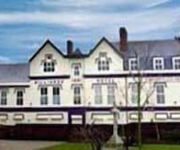
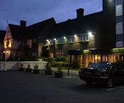
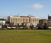
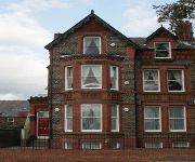
Throstles Nest Hotel
Titanic Hotel Liverpool
Formby Hall Golf Resort & Spa
The Park Hotel
Orrell Park Hotel
The Royal Hotel
Trivelles Liverpool
Sheil Suites
Liverpool (Aintree)
TRAVELODGE LIVERPOOL STONEDALE PARK
Videos from this area
These are videos related to the place based on their proximity to this place.
Rampworx Skatepark BMX Halloween Allnighter 2014
Every year Rampworx Skatepark hosts a BMX Allnighter on Halloween, this event has become a staple event in the BMX calendar over the last 8 years with riders traveling from all over the country...
redcrestedpochard
male Red-crested Pochard of dubious origin on Leeds-Liverpool Canal at Litherland, Liverpool on 8th April 2015. Paired up with female Mallard.
Merseyside Fire and Rescue Authority Policy and Rescources 23rd September 2014 Part 1
Merseyside Fire and Rescue Authority Policy and Rescources 23rd September 2014 Part 1 Temporary Meeting Room (Multi Agency Support), 1st Floor, Merseyside Fire and Rescue Headquarters, ...
Driving Along Park Lane, Dunnings Bridge Road & Church Road, Bootle, Liverpool, UK 15th April 2012
Driving along Park Lane, Dunnings Bridge Road (A5036) & Church Road (A5036), Bootle, Liverpool, Merseyside, England Videoed on Sunday,15th April 2012 Playlist: ...
Merseyside Fire and Rescue Authority Consultation & Negotiation Sub Committee 2/9/14 Part 1
Merseyside Fire and Rescue Authority Consultation and Negotiation Sub Committee 2nd September 2014 Part 1 A public meeting held in the Temporary Conference Room, Merseyside Fire and ...
Mersey Fire and Rescue Authority Policy and Resources Committee 27th November 2014
Mersey Fire and Rescue Authority Policy and Resources Committee 27th November 2014 Temporary Meeting Room, 1st Floor, Merseyside Fire and Rescue Headquarters, Bridle Road, Bootle starting...
2 red ferrari's on monaco formula 1 race track/monte carlo 2008
cruise 19th to 26th june 2008 whilst on a cruise on the thomson destiny,,,trip to visit monaco race circuit.
Driving Along Hawthorne Road, Church Road & Dunnings Bridge Road, Liverpool, Merseyside, England
Driving along Hawthorne Road A5090 (stopping at the Tesco supermarket), Church Road (A5036) & Dunnings Bridge Road (A5036), Liverpool, Merseyside, England Videoed on Tuesday, 22nd ...
Small Creatures (Official Trailer 2012)
Now available on iTunes https://itunes.apple.com/gb/movie/small-creatures/id692285007 Nominated for the 2012 Michael Powell Awards for Best British Feature and Best Performance Jealousy...
Maghull Radio - Security Takeover
One night after hours - when the presenters had left, security guards Bev and Joan took an opportunity to sneak into the studios and have a try and broadcasting for themselves. Luckily our...
Videos provided by Youtube are under the copyright of their owners.
Attractions and noteworthy things
Distances are based on the centre of the city/town and sightseeing location. This list contains brief abstracts about monuments, holiday activities, national parcs, museums, organisations and more from the area as well as interesting facts about the region itself. Where available, you'll find the corresponding homepage. Otherwise the related wikipedia article.
Switch Island
Switch Island is a road junction south of Maghull and near Aintree in Merseyside, England on the Liverpool rural-urban fringe. The junction is at the western terminus of both the M57 and M58 motorways, which converge on the A59 trunk road, the north-south route from Liverpool. The junction is also the terminus of the A5036, a road which serves the Port of Liverpool.
Sefton Central (UK Parliament constituency)
Sefton Central is a constituency represented in the House of Commons of the UK Parliament since its 2010 creation by Bill Esterson, a member of of the Labour Party.
A5036 road
The A5036 is a road in Merseyside, England, which comprises two separate sections separated by a gap of 1.6 miles . The northern section is a 4-mile section of trunk road, travelling from Seaforth through Litherland before terminating at the Switch Island junction in Netherton. It is an important artery for road freight between the docks and the motorway network.
St Helen's Church, Sefton
St. Helen's is the Anglican parish church in the village of Sefton, Merseyside, England, and is an active parish church in the Diocese of Liverpool, the Archdeaconry of Liverpool and the Deanery of Sefton. The church has been described as the "Cathedral of the Fields" and "Jewel of South West Lancashire", and is noteworthy as the only Grade I listed building in the Metropolitan Borough of Sefton.
Sefton and Maghull railway station
Sefton and Maghull railway station was a station located on the Southport & Cheshire Lines Extension Railway on Sefton Lane, Maghull, Merseyside. The station first closed in 1917, along with all other stations on the extension line, due to WWI economy measures. The station was reopened on 1 April 1919, and continued in use until 7 January 1952, when the SCLER was closed to passengers from Aintree Central to Southport Lord Street.
Holy Family Catholic High School, Merseyside
Holy Family Catholic High School is a Catholic comprehensive school situated in Thornton, Merseyside, England, catering for mixed pupils aged 11-18. The current intake at the school is 885, of which 156 are aged 16-18 pursuing further education in the school's own sixth form, with student attainment Year 13 above average in 2004, compared with all sixth forms nationally.
Maghull North railway station
Maghull North was a proposed new railway station at the north end of Maghull, Merseyside, England was planned to be constructed as a modular station. It would have primarily served as the main station for Moss Side, Ashworth Hospital and a planned new prison. It was announced in December 2010 that the planned prison and the proposed new railway station had been axed by Government spending cutbacks. Preceding station National Rail National Rail Following station Maghull Merseyrail Town Green
St Benet's Chapel, Netherton
St Benet's Chapel, Netherton, is a redundant Roman Catholic chapel in Chapel Lane, Netherton, Liverpool, Merseyside, England. The chapel and the attached priest's house have been designated by English Heritage as a Grade II* listed building. In the National Heritage List for England it is described as "an important example of an early Catholic church and is one of the best preserved examples in the north-west". It is managed by the Historic Chapels Trust.


