Safety Score: 3,0 of 5.0 based on data from 9 authorites. Meaning we advice caution when travelling to United Kingdom.
Travel warnings are updated daily. Source: Travel Warning United Kingdom. Last Update: 2024-04-19 08:03:45
Explore Lydiate
Lydiate in Sefton (England) is located in United Kingdom about 183 mi (or 295 km) north-west of London, the country's capital.
Local time in Lydiate is now 09:57 AM (Friday). The local timezone is named Europe / London with an UTC offset of one hour. We know of 9 airports in the wider vicinity of Lydiate, of which 4 are larger airports. The closest airport in United Kingdom is Liverpool John Lennon Airport in a distance of 14 mi (or 23 km), South. Besides the airports, there are other travel options available (check left side).
There are several Unesco world heritage sites nearby. The closest heritage site in United Kingdom is Pontcysyllte Aqueduct and Canal in a distance of 39 mi (or 62 km), South. Also, if you like golfing, there are multiple options in driving distance. We found 1 points of interest in the vicinity of this place. If you need a place to sleep, we compiled a list of available hotels close to the map centre further down the page.
Depending on your travel schedule, you might want to pay a visit to some of the following locations: Thornton, Melling, Ince Blundell, Hightown and Formby. To further explore this place, just scroll down and browse the available info.
Local weather forecast
Todays Local Weather Conditions & Forecast: 10°C / 51 °F
| Morning Temperature | 9°C / 47 °F |
| Evening Temperature | 10°C / 50 °F |
| Night Temperature | 6°C / 44 °F |
| Chance of rainfall | 0% |
| Air Humidity | 73% |
| Air Pressure | 1020 hPa |
| Wind Speed | Fresh Breeze with 16 km/h (10 mph) from South-East |
| Cloud Conditions | Scattered clouds, covering 28% of sky |
| General Conditions | Light rain |
Saturday, 20th of April 2024
10°C (50 °F)
6°C (43 °F)
Scattered clouds, gentle breeze.
Sunday, 21st of April 2024
9°C (48 °F)
6°C (42 °F)
Overcast clouds, gentle breeze.
Monday, 22nd of April 2024
11°C (51 °F)
7°C (45 °F)
Broken clouds, gentle breeze.
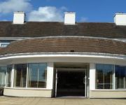
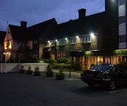
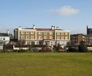
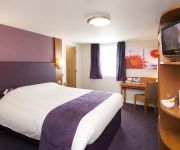
Hotels and Places to Stay
Suites Knowsley
The Park Hotel
Orrell Park Hotel
The Royal Hotel
JCT.4 Holiday Inn Express LIVERPOOL - KNOWSLEY M57
Liverpool (Aintree)
TRAVELODGE LIVERPOOL STONEDALE PARK
Southport (Ormskirk)
Videos from this area
These are videos related to the place based on their proximity to this place.
Driving Along Turnpike Road, Formby Lane, Birch's Brow & Broad Lane, Ormskirk, Lancashire, UK
Driving along Turnpike Road, Formby Lane (B5195), Birch's Brow (B5195), Formby Lane (B5195) & Broad Lane (B5195), Aughton, Ormskirk, Lancashire, England Videoed on Sunday, 11th November ...
2 red ferrari's on monaco formula 1 race track/monte carlo 2008
cruise 19th to 26th june 2008 whilst on a cruise on the thomson destiny,,,trip to visit monaco race circuit.
Small Creatures (Official Trailer 2012)
Now available on iTunes https://itunes.apple.com/gb/movie/small-creatures/id692285007 Nominated for the 2012 Michael Powell Awards for Best British Feature and Best Performance Jealousy...
Maghull Radio - Security Takeover
One night after hours - when the presenters had left, security guards Bev and Joan took an opportunity to sneak into the studios and have a try and broadcasting for themselves. Luckily our...
Driving On The A5147 From Downholland Cross, Lancashire To Maghull, Merseyside, England
Driving along the A5147 (Mairscough Lane, Southport Road & Liverpool Road North) from Downholland Cross, Ormskirk, Lancashire to Maghull, Merseyside, England Videoed on Sunday, 11th ...
Time-lapse of Traffic in Maghull at Night
A short time-lapse taken with a Canon 100D of traffic at a junction in Maghull by the Town Hall.
Two Storey Extension - Extension Plans In Maghull, Liverpool
http://www.theplancentre.co.uk Extension Plans in Maghull by The Plan Centre. This short video shows the inital property in Maghull which is to receive a two storey extension to the side...
Maghull Kickboxing and Self Defence Club Introduction
To book classes Tel:- 07787832 011 Email. maghullkickboxing@yahoo.co.uk Established in 1997, Building Confidence and Ability in the local community,. Little Ninjas Age 4 to...
Last day!
A new found app has caused havoc in the studio. We show you the fun we had with it in this video complication. Enjoy and all the best for the new year From the Maghull Radio Team.
Videos provided by Youtube are under the copyright of their owners.
Attractions and noteworthy things
Distances are based on the centre of the city/town and sightseeing location. This list contains brief abstracts about monuments, holiday activities, national parcs, museums, organisations and more from the area as well as interesting facts about the region itself. Where available, you'll find the corresponding homepage. Otherwise the related wikipedia article.
Scotch Piper Inn
The Scotch Piper Inn, Lydiate, Merseyside, England is the oldest pub of the historic county of Lancashire. The building dates from 1320 and is a Grade II* listed building. It was originally known as "The Royal Oak", and sections of the trunk of the oak tree around which it was built are visible from the tap room. The building retains a thatched roof. It is located on the A5147, 10 miles from Liverpool and 10 miles from Southport.
Downholland Cross
Downholland Cross is a small village in the county of Lancashire on the West Lancashire Coastal Plain. It is to the north of Lydiate on the A5147 and the Leeds and Liverpool Canal. The Downholland cross was reinstated by the Parish Council on the suggestion by Stephen Henders to mark the millennium. Stephen was at the time a parish councillor and Andrew Johnson was the chairman who supported the idea.
Lydiate railway station
Lydiate railway station was a station located on the Southport & Cheshire Lines Extension Railway off Carr Lane, Lydiate. The Merseyside and Lancashire border runs down the stream alongside Altcar Lane, which runs parallel to the line. The station first closed in 1917, along with all other stations on the extension line, due to WW1 economy measures.
Sefton and Maghull railway station
Sefton and Maghull railway station was a station located on the Southport & Cheshire Lines Extension Railway on Sefton Lane, Maghull, Merseyside. The station first closed in 1917, along with all other stations on the extension line, due to WWI economy measures. The station was reopened on 1 April 1919, and continued in use until 7 January 1952, when the SCLER was closed to passengers from Aintree Central to Southport Lord Street.
Maghull F.C
Maghull F.C. are an English association football club based in Maghull, Merseyside. They currently play in the West Cheshire League. The 1st team is currently managed by John Brownrigg who stepped up from the reserve team role when Jimmy Williams resigned in September 2009, the reserve team is now managed by Mike Cummins who still plays for the club.
Maghull North railway station
Maghull North was a proposed new railway station at the north end of Maghull, Merseyside, England was planned to be constructed as a modular station. It would have primarily served as the main station for Moss Side, Ashworth Hospital and a planned new prison. It was announced in December 2010 that the planned prison and the proposed new railway station had been axed by Government spending cutbacks. Preceding station National Rail National Rail Following station Maghull Merseyrail Town Green
Park (Sefton ward)
Park is a Metropolitan Borough of Sefton ward in the Sefton Central Parliamentary constituency that covers the villages of Sefton, Lunt, Lydiate and the western part of the town of Maghull.
St Thomas' Church, Lydiate
St Thomas' Church, Lydiate, is located in Church Lane, Lydiate, Sefton, Merseyside, England. It is an active Anglican parish church in the deanery of Ormskirk, the archdeaconry of Warrington, and the diocese of Liverpool. Its benefice has been combined with that of St Cuthbert, Halsall. The church has been designated by English Heritage as a Grade II listed building.


