Safety Score: 3,0 of 5.0 based on data from 9 authorites. Meaning we advice caution when travelling to United Kingdom.
Travel warnings are updated daily. Source: Travel Warning United Kingdom. Last Update: 2024-05-05 08:24:42
Discover Napsbury Park
The district Napsbury Park of St Albans in Hertfordshire (England) is a district in United Kingdom about 17 mi north-west of London, the country's capital city.
Looking for a place to stay? we compiled a list of available hotels close to the map centre further down the page.
When in this area, you might want to pay a visit to some of the following locations: Potters Bar, Harrow, Hendon, Wembley and Luton. To further explore this place, just scroll down and browse the available info.
Local weather forecast
Todays Local Weather Conditions & Forecast: 18°C / 64 °F
| Morning Temperature | 7°C / 45 °F |
| Evening Temperature | 14°C / 57 °F |
| Night Temperature | 9°C / 49 °F |
| Chance of rainfall | 0% |
| Air Humidity | 51% |
| Air Pressure | 1008 hPa |
| Wind Speed | Gentle Breeze with 8 km/h (5 mph) from North |
| Cloud Conditions | Few clouds, covering 20% of sky |
| General Conditions | Light rain |
Monday, 6th of May 2024
15°C (60 °F)
9°C (48 °F)
Light rain, light breeze, few clouds.
Tuesday, 7th of May 2024
16°C (60 °F)
11°C (52 °F)
Broken clouds, light breeze.
Wednesday, 8th of May 2024
14°C (57 °F)
12°C (53 °F)
Light rain, light breeze, overcast clouds.
Hotels and Places to Stay
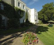
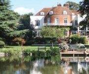
Sopwell House Hotel & Country Club
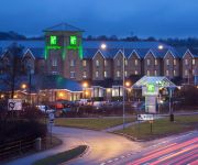
JCT.23 Holiday Inn LONDON-ELSTREE M25
Clarion Collection St Albans
Laura Ashley The Manor
Mercure St Albans Noke Hotel
Beales Hatfield A Beales Hotel
St Michaels Manor Hotel
Mercure London Watford Hotel
Hilton Watford
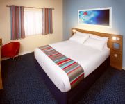
TRAVELODGE BOREHAMWOOD STUDIO WAY
Videos from this area
These are videos related to the place based on their proximity to this place.
ST ALBANS BUSES JULY 2010
Buses in St Albans July 2010 a trailer for www.pmpfilms.com the world's largest range of transport hobby films, see website for shopping, links and list.
St Albans Abbey Station (17/11/12) Part 1 Of 3
I was waiting for a Class 321 but it was running late it was taking too long and it wasted half of my Battery but enjoy the video.
Plumber in St Albans | On Tap Plumbers | 0800 316 8601
Visit On Tap Plumbers site: http://www.ontapplumbers.com Or phone them: 0800 3168601 This video was recorded during a video workshop showing business owners how to start using video to ...
Radlett Estate Agent | 3 bed Flat | Watling Mansions Radlett | Call 01923 852333
Radlett Estate Agent 3 bed Flat Watling Mansions Radlett Call 01923 852333 http://martinallsuch.co.uk Martin Allsuch & Co One of Radletts Leading Estate Agents are delighted to present to...
GR8Drive-SHENLEY/RADLETT WD7 MOTORING SCHOOL CALL 07791 674 839
At GR8Drive near Radlett WD7 we pride ourselves in offering professional Driving Lessons at affordable prices in Radlett by DSA qualified Driving Instructors starting from as little as £9.90...
Jenny and Alistair at the Grove
The Grove calls itself "London's country estate" and with good reason. The grounds are stunning and the drive up to through the golf course over a narrow canal bridge is beautiful. This was...
Fire Cage, Crystal Casket, Fire Spiker - Jonathan Summerfield
Fire Cage, Crystal Casket and Fire Spiker performed by Jonathan Summerfield. 9th November 2014, Radlett Centre, Hertfordshire. Big thanks to assistant Amy, Orli and Adam Forman. Huge gratitude...
Fire Cage Magic Illusion - Jonathan Summerfield
Fire cage illusion performed by Jonathan Summerfield and Amy. 9th November 2014 Radlett Centre.
Videos provided by Youtube are under the copyright of their owners.
Attractions and noteworthy things
Distances are based on the centre of the city/town and sightseeing location. This list contains brief abstracts about monuments, holiday activities, national parcs, museums, organisations and more from the area as well as interesting facts about the region itself. Where available, you'll find the corresponding homepage. Otherwise the related wikipedia article.
Campaign for Real Ale
The Campaign for Real Ale (CAMRA) is an independent voluntary consumer organisation based in St Albans, England, whose main aims are promoting real ale, real cider and the traditional British pub. It is now the largest single-issue consumer group in the UK, and is a founding member of the European Beer Consumers' Union (EBCU).
River Ver
The Ver is a river in Hertfordshire, England. The river begins in the grounds of Markyate Cell, and flows south for 12 miles (20 km) alongside Watling Street through Flamstead, Redbourn, St Albans and Park Street, and joins the River Colne at Bricket Wood. The Romans built the city of Verulamium alongside it at a time when it was navigable, expressing their preference for building in valleys rather than on hills.
St Albans Abbey railway station
St Albans Abbey railway station in St Albans, Hertfordshire, England is about 0.6 miles south of the city centre in the St Stephen's area. It is the terminus of the Abbey Line from Watford Junction, part of the London Midland franchise. It is one of two stations in St Albans, the other being the much larger and busier St Albans City. The unstaffed station consists of a single open-air platform and a car park. Improvement works were carried out in 2008.
A5183 road
The A5183 road is a de-trunked section of the A5. It covers the section between Junction 9 of the M1 motorway and Edgware in north London, largely along Watling Street. The renumbering was to prevent drivers of heavy southbound vehicles assuming that a low number '5' indicated a superior quality road which this stretch is not as it is narrow in many places. The main beneficiary of this renumbering is the city of St Albans that used to be 'host' to both the A5 and the A6.
St Albans (UK Parliament constituency)
St Albans is a constituency represented in the House of Commons of the UK Parliament since 2005 by Anne Main, a Conservative. This article also describes the parliamentary borough (1554-1852) of the same name, consisting only of the city of St Albans, which elected two MPs by the bloc vote system.
Sopwell Priory
Sopwell Priory (also known as Sopwell Nunnery) was built c. 1140 in Hertfordshire, England by the Benedictine abbot of St Albans Abbey, Geoffrey de Gorham. It was founded as the Priory of St Mary of Sopwell and was a cell of St Albans Abbey. Juliana Berners was the prioress during the 15th century, believed to be the author of the Boke of St Albans published in 1486.
London Colney F.C
London Colney F.C. are a football club based in London Colney, near St. Albans, England. They play in the Spartan South Midlands League Premier Division.
How Wood (Hertfordshire) railway station
How Wood railway station is in the village of How Wood, Hertfordshire, England. It is the fourth station on the Abbey Line, 4+⁄2 miles from Watford Junction. Like all the other stations on the branch, it is a simple unstaffed halt. It was opened in October 1988 to coincide with the overhead electrification of the line.
Oaklands College
Oaklands College is a further education college in Hertfordshire, England in the United Kingdom, established in 1991.
Colney Street
Colney Street is a hamlet in the English county of Hertfordshire. It lies on the A5183 road, this was formerly the A5 road and, before that, Roman Britain's Watling Street. In addition its northern boundary is delineated by the M25 motorway. These location advantages have led to it becoming a primarily industrial and business area. Colney Street forms part of St Albans district.
Sopwell House
Sopwell House is a historic Georgian country house, now a luxurious 129 room hotel, country club & spa in the southern part of St Albans, Hertfordshire, England. It gained fame as the gathering place for the England national football team before international football events, as well as welcoming club football teams from the world since the nineties.
Clarence Park, St Albans
Clarence Park is a park containing a multi-use stadium in St Albans, England. It is located close to St Albans City railway station. The park was laid out in early 1894, and comprises a 16-acre municipal sports ground and a 9-acre public park and pleasure ground.
Salvation Army Halt railway station
Salvation Army Halt railway station was initially a private non-timetabled halt for the staff of Messrs Sander & Sons which had established an orchid-growing business in the Camp district of St Albans. A private siding (known as "Sander's Sidings") also led directly to the firm's greenhouses, enabling the swift dispatch of orchids to the market.
Hill End railway station
Hill End railway station was situated on the Great Northern Railway branch from Hatfield to St Albans in Hertfordshire, England.
Napsbury railway station
Napsbury railway station was built by the Midland Railway in 1905 on its line to St Pancras station. It was never more than an island platform between the slow lines, with a siding serving the Middlesex County Asylum at Napsbury, and closed in 1959.
Holywell House, Hertfordshire
Holywell House was a house in St Albans, Hertfordshire, England. The manor house was originally called Hallywell (the later known spelling, Holywell, is probably a corruption of this original spelling).
Dacorum Borough Council
Dacorum Borough Council is the local authority for the Dacorum non-metropolitan district of England, the United Kingdom. Dacorum is located in the north-west of Hertfordshire, in the East of England region. The Council itself is based in Hemel Hempstead, the largest settlement in the district. The Council consists of 51 elected councillors, representing twenty-five electoral wards. 14 of the wards elect two councillors each. Six, denoted below, elect three councillors each.
St Albans City Council
St Albans City Council, also known as St Albans City and District Council or St Albans District Council, is the local authority for the St Albans non-metropolitan district of England, the United Kingdom. St Albans is located to the west of Hertfordshire, in the East of England region. The council itself is based in St Albans, the largest settlement in the district. The council consists of 58 elected members, representing twenty electoral wards. 18 of the wards elect three councillors each.
All Saints Pastoral Centre
All Saints Pastoral Centre is a conference and retreat centre on the southern outskirts of St Albans, Hertfordshire, England. The All Saints building was designed by Leonard Stokes in 1899 and built in 1901, originally as a convent for the All Saints sisters. The building was acquired by the Roman Catholic Archdiocese of Westminster in 1973 and converted to its present use.
St Albans Rural District
St Albans was, from 1894 to 1974, a rural district in the administrative county of Hertfordshire, England. The district was formed by the Local Government Act 1894 from the area of the existing St Albans rural sanitary district. An elected rural district council replaced the rural sanitary authority which had consisted of the poor law guardians of the area. The rural district comprised an area surrounding St Albans, but did not include the city, which was an independent municipal borough.
Tyttenhanger House
Tyttenhanger House is a 17th century country mansion, now converted into commercial offices, at Tyttenhanger, near St Albans, Hertfordshire. It is a Grade I listed building. The Tyttenhanger estate was owned by the Abbey of St Albans until the Dissolution of the Monasteries and was then granted by the Crown in 1547 to Sir Thomas Pope, founder of Trinity College, Oxford.
Shenley Training Centre
The Shenley Training Centre is the state-of-art training ground of the Premier League club Arsenal FC. Located in Shenley, Hertfordshire, the multi-million pound project opened in 1999. Further upgrades have since been implemented and include an indoor training facility. In August 2006 an artillery shell was found near the site during development work, leading to the surrounding area being evacuated.
Denis Compton Oval
The Denis Compton Oval is a cricket ground located at the Shenley Cricket Centre. The centre is in Shenley, Hertfordshire. The ground was opened by Denis Compton and the main ground was named in his honour. At the heart of the centre is the 19th century pavilion, originally designed by the legendary cricketer W. G. Grace.
First Battle of St Albans
The First Battle of St Albans, fought on 22 May 1455 at St Albans, 22 miles (35 km) north of London, traditionally marks the beginning of the Wars of the Roses. Richard, Duke of York and his ally, Richard Neville, Earl of Warwick, defeated the Lancastrians under Edmund, Duke of Somerset, who was killed. York also captured Henry VI, who appointed him Constable of England.
Kingsley Green
Kingsley Green is a mental health and learning disabiity site located in Hertfordshire, England, just southeast of the village of London Colney. Located on Harper Lane, Shenley, Herts WD7 9HQ, it was known as Harperbury Hospital for 61 years and has been a fixture of the area's mental health scene since 1928. It had two sister institutions, Shenley Hospital and Napsbury Hospital, within a few miles of its location.


