Safety Score: 3,0 of 5.0 based on data from 9 authorites. Meaning we advice caution when travelling to United Kingdom.
Travel warnings are updated daily. Source: Travel Warning United Kingdom. Last Update: 2024-04-22 08:01:33
Delve into Elstree
Elstree in Hertfordshire (England) with it's 1,835 habitants is a city located in United Kingdom a little north-west of London, the country's capital town.
Current time in Elstree is now 08:49 AM (Tuesday). The local timezone is named Europe / London with an UTC offset of one hour. We know of 9 airports closer to Elstree, of which 5 are larger airports. The closest airport in United Kingdom is RAF Northolt in a distance of 8 mi (or 13 km), South-West. Besides the airports, there are other travel options available (check left side).
There are several Unesco world heritage sites nearby. The closest heritage site in United Kingdom is Tower of London in a distance of 18 mi (or 30 km), South-East. Also, if you like playing golf, there are some options within driving distance. We saw 4 points of interest near this location. In need of a room? We compiled a list of available hotels close to the map centre further down the page.
Since you are here already, you might want to pay a visit to some of the following locations: Harrow, Wembley, Hendon, Ealing Broadway and Ealing. To further explore this place, just scroll down and browse the available info.
Local weather forecast
Todays Local Weather Conditions & Forecast: 9°C / 48 °F
| Morning Temperature | 5°C / 42 °F |
| Evening Temperature | 8°C / 46 °F |
| Night Temperature | 4°C / 39 °F |
| Chance of rainfall | 1% |
| Air Humidity | 72% |
| Air Pressure | 1023 hPa |
| Wind Speed | Moderate breeze with 12 km/h (7 mph) from South |
| Cloud Conditions | Overcast clouds, covering 100% of sky |
| General Conditions | Light rain |
Wednesday, 24th of April 2024
7°C (44 °F)
3°C (37 °F)
Broken clouds, moderate breeze.
Thursday, 25th of April 2024
9°C (49 °F)
7°C (44 °F)
Overcast clouds, gentle breeze.
Friday, 26th of April 2024
12°C (54 °F)
8°C (46 °F)
Light rain, gentle breeze, overcast clouds.
Hotels and Places to Stay
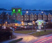
JCT.23 Holiday Inn LONDON-ELSTREE M25
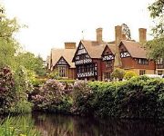
Laura Ashley The Manor
Hilton Watford
BEST WESTERN PLUS GRIMS DYKE
Apple House Guesthouse Wembley
Mercure London Watford Hotel
Mercure St Albans Noke Hotel
Crescent Hotel
The Brent Hotel
Kingsland Hotel
Videos from this area
These are videos related to the place based on their proximity to this place.
GR8Drive-BOREHAMWOOD WD6 DRIVING CLASSES-CALL 07791 674 839
At GR8Drive near Borehamwood WD6 we pride ourselves in offering professional Driving Lessons at affordable prices in Borehamwood by DSA qualified Driving Instructors starting from as little...
Office Space Borehamwood
Serviced Offices in Borehamwood http://www.searchofficespace.com/uk/office-space/borehamwood-serviced-offices.html Kinetic Business Centre provides fully managed four star luxury furnished...
DRS 37259+37605 top and tail a NR test train at Elstree & Borehamwood 05/01/2013
Direct Rail Services 37259 and 37605 top and tail a Network Rail test train past Elstree & Borehamwood on the Midland Mainline.
First steps!
Lambing here at Aldenham Country Park has begun in earnest! This little one was born at around 11 am this morning and immediately started trying to get up and walk. This ability is of huge...
Robinson R44 Helicopter Taking Off at Elstree
A quick shot of a Robinson R44 helicopter taking off from Elstree Aerodrome near London, on its way over the capital on a sightseeing tour http://www.ultimatehelicopters.co.uk/london-sightseeing-f...
Corner House Cosmetic Dental Practice REVIEW Elstree Hertfordshire
Corner House Cosmetic Dental Practice REVIEW Elstree Hertfordshire At Cornerhouse Dental Care our focus is on customer satisfaction in terms of the care and quality of treatment we provide....
Videos provided by Youtube are under the copyright of their owners.
Attractions and noteworthy things
Distances are based on the centre of the city/town and sightseeing location. This list contains brief abstracts about monuments, holiday activities, national parcs, museums, organisations and more from the area as well as interesting facts about the region itself. Where available, you'll find the corresponding homepage. Otherwise the related wikipedia article.
Bushey
Bushey (population 24,000) is a town in the Hertsmere borough of Hertfordshire in the East of England. Bushey Heath is a large neighbourhood south east of Bushey on the boundary with the London Borough of Harrow reaching elevations of 165 metres above sea level.
Haberdashers' Aske's School for Girls
Haberdashers' Aske's School for Girls is an independent day school in Elstree, Hertfordshire. It is often referred to as “Habs” or “Habs Girls” to distinguish it from the neighbouring Haberdashers' Aske's Boys' School. The school was founded in 1875 by the Worshipful Company of Haberdashers, one of the Great Twelve Livery Companies of the City of London.
Royal National Orthopaedic Hospital
This page is about the hospital in London. For the hospital in Birmingham, England; see Royal Orthopaedic Hospital. 50x40pxThis article needs additional citations for verification. Please help improve this article by adding citations to reliable sources. Unsourced material may be challenged and removed.
Brockley Hill tube station
Brockley Hill tube station is an unbuilt London Underground station in the Brockley Hill area of north London. The planned location was close to Edgwarebury Park and the north side of the junction of the A41 (Watford Bypass) and the A410 roads.
Elstree South tube station
Elstree South tube station (usually just Elstree on Underground maps) was an unbuilt London Underground station in Elstree, Hertfordshire. It was designed by Charles Holden. The planned location of the station was adjacent to the A5183 north of the junction with the A41 and to where junction 4 of the M1 motorway was subsequently built.
Edgwarebury Park
Edgwarebury Park is a 22 hectare park in Edgware in the London Borough of Barnet. It was once part of the manor of Earlsbury, which was first mentioned in 1216. In the later Middle Ages it was owned by All Souls College, Oxford, and there is still evidence of the older landscape of fields and woodland. Hendon Rural District and Middlesex County Council bought the land in two parts in 1929 and 1932, and the park opened in the latter year. It is now owned and managed by Barnet Council.
Deacon's Hill
Deacon's Hill is an area of Elstree, Hertfordshire, England. It is the part of the town which lies to the immediate west of the railway line and is informally known as being part of Elstree by its residents, even though it is geographically separate from the village of that name. Deacon's Hill includes a residential area and the Deacon's Hill open space. The main road through the area is Allum Lane which connects Borehamwood with Elstree village.
Aldenham Reservoir
Aldenham Reservoir is situated in the the parish of Elstree and Borehamwood in Hertfordshire, England, about one mile (1.6 km) to the west of the village of Elstree. Originally, it was 65 acres in extent [now 55 acres after repairs to the dam] and was built by the Grand Union Canal Company to control the water levels in the River Colne following the construction of the Grand Union Canal. It was hand dug by French prisoners of war between 1795 and 1797.
List of United Kingdom locations: De-Dee
Aldenham Country Park
Aldenham Country Park is a 175-acre parkland and woodland, including the 65-acre Hilfield Reservoir, created in 1971, and Aldenham Reservoir. It is now part of the Watling Chase Community Forest, located near Elstree, Hertfordshire, England. Aldenham Reservoir was excavated by French prisoner of war in 1795 to help maintain local river levels after the Grand Union Canal was built. It is held as a reserve public water supply as is Hilfield Reservoir.
Edgware Way Grassland
Edgware Way Grassland or Edgware Way Rough is a 6.7 hectare Site of Metropolitan Importance for Nature Conservation in Edgware in the London Borough of Barnet. It is traversed by Edgwarebury Brook and includes an old railway embankment. The embankment was part of a proposed railway between Edgware and Bushey, which was cancelled when the introduction of the introduction of the Green Belt after the Second World War led to the cancellation of the developments which the railway was to serve.
Edgwarebury Brook
Edgwarebury Brook is a small stream in Edgware in the London Borough of Barnet. It is a tributary of Deans Brook, which is a tributary of the Silk Stream, which is a tributary of the River Brent, which is tributary of the River Thames. The brook rises near Bury Farm on Edgwarebury Lane. It flows south to skirt the western edge of Edgwarebury Park and then goes under Edgware Way and through Edgware to join Deans Brook behind Brook Avenue.


