Safety Score: 3,0 of 5.0 based on data from 9 authorites. Meaning we advice caution when travelling to United Kingdom.
Travel warnings are updated daily. Source: Travel Warning United Kingdom. Last Update: 2024-04-26 08:02:42
Delve into South Woodford
The district South Woodford of Woodford Green in Greater London (England) is a subburb in United Kingdom a little north-east of London, the country's capital town.
If you need a hotel, we compiled a list of available hotels close to the map centre further down the page.
While being here, you might want to pay a visit to some of the following locations: Walthamstow, Ilford, East Ham, Hackney and Poplar. To further explore this place, just scroll down and browse the available info.
Local weather forecast
Todays Local Weather Conditions & Forecast: 11°C / 51 °F
| Morning Temperature | 2°C / 35 °F |
| Evening Temperature | 9°C / 49 °F |
| Night Temperature | 4°C / 40 °F |
| Chance of rainfall | 0% |
| Air Humidity | 52% |
| Air Pressure | 1004 hPa |
| Wind Speed | Gentle Breeze with 6 km/h (4 mph) from West |
| Cloud Conditions | Few clouds, covering 20% of sky |
| General Conditions | Few clouds |
Saturday, 27th of April 2024
6°C (43 °F)
9°C (48 °F)
Moderate rain, gentle breeze, overcast clouds.
Sunday, 28th of April 2024
10°C (50 °F)
8°C (46 °F)
Moderate rain, gentle breeze, overcast clouds.
Monday, 29th of April 2024
13°C (56 °F)
9°C (47 °F)
Light rain, moderate breeze, scattered clouds.
Hotels and Places to Stay
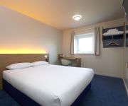
TRAVELODGE LONDON SNARESBROOK
TRAVELODGE LONDON ILFORD GANTS HILL
The Beehive
Holiday Inn Express LONDON CHINGFORD-NTH CIRCULAR
The Lion & Key Hotel
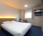
TRAVELODGE LONDON WALTHAMSTOW
ibis Styles London Leyton
Best Western Plus Epping Forest
TRAVELODGE LONDON CHIGWELL
The Hub
Videos from this area
These are videos related to the place based on their proximity to this place.
1974 - Woodford Green Prep School - West Linton - France
Sports Day at Woodford Prep School; Penny Day, Mrs Greaves, Mrs Rosser, Mrs Heavens, Mrs Gwynne West Linton, the Day's house; Andrew and Robert Day, Patrick and Charles Latham Holiday in...
Epping MTB Trails - Woodford Green to Connaught Waters
Woodford Green to Connaught Waters(Graded Blue/Intermediate), a great way to ride into the forest from London. Often over-looked for High Beech, Woodford is a great starting point to ride from....
Avaya IP Office 500 Telephone System | For a demo please call 020 8498 8700
Dataphone Communications Ltd Providers of Avaya IP Office Telephone Systems. For a Demo or more information please call 020 8498 8700. Dataphone Communications Ltd Riverside House ...
Laminate Flooring Fitters London - 020 3322 7001 - Laminate Flooring Fitters In East London
Laminate Flooring Fitters London - 020 3322 7001 - Laminate Flooring Fitters In East London http://flooringfitterslondon.org.uk/ Laminate Flooring Fitters London offer a full professional...
All Saints Woodford Wells Construction Timelapse
Based in Woodford Wells Essex, on the borders of east London near to the Olympic Park All Saints is a growing and vibrant church. In 1874 local residents gave generously to build the church...
Lightning strikes South Woodford - June 23 2007
Lightning strike (51 secs in) as I film a storm over South Woodford, North East London.
WOHAA South Woodford Library Bake Sale
Team Live2Learn would like to thank every single person who contributed to raising an amazing £314.23 for The Wings of Hope Children's Charity at our (over 6 hour long) bake sale, outside...
Domino's DeLiVeRiNg Pizza Hut.
So @ Domino's we are so good even our main competitors who are on same road (Snakes lane east Woodford IG8) are our regular and satisfied customer....
Stagecoach London On Route 179
Route 179 South Woodford to Ilford Staion. This route operates between Ilford and Chingford Station by Stagecoach. Enjoy :) (NOTE: THIS VIDEO SHOULD OF BEEN UPLOADED BEFORE THE ...
Videos provided by Youtube are under the copyright of their owners.
Attractions and noteworthy things
Distances are based on the centre of the city/town and sightseeing location. This list contains brief abstracts about monuments, holiday activities, national parcs, museums, organisations and more from the area as well as interesting facts about the region itself. Where available, you'll find the corresponding homepage. Otherwise the related wikipedia article.
London Borough of Redbridge
The London Borough of Redbridge is a London borough in north-east London, England. Its administrative headquarters is at Redbridge Town Hall in Ilford. The local authority is Redbridge London Borough Council.
Walthamstow Village
Walthamstow Village is an ancient nucleus of present day Walthamstow, located in North East London. Designated a Conservation Area by the London Borough of Waltham Forest in 1967, it centres around St. Mary's Church, which was founded in the 12th century. Across the road from this is a 15th century timber-framed "hall house" which locals have dubbed "The Ancient House".
Leyton and Wanstead (UK Parliament constituency)
Leyton and Wanstead is a constituency represented in the House of Commons of the UK Parliament since 2010 by John Cryer of the Labour Party.
Chartered Insurance Institute
The Chartered Insurance Institute (also known as the CII) is a United Kingdom based professional organisation for those working in the insurance and financial services industries. The Institute provides accreditation and professional qualifications to UK and international members. Current (designated) qualifications include (in ascending level order): Cert CII, Dip CII, Advanced Dip CII (ACII - previously called Associateship CII) & Fellowship CII (FCII).
Whipps Cross University Hospital
Whipps Cross University Hospital is an NHS-run University Hospital in Whipps Cross, Waltham Forest, London, United Kingdom which housed London's first Hyperbaric Unit. The hospital is geographically close to the site of the 2012 Olympics, has one of the largest and busiest A&E departments in the UK and serves a diverse community from Chigwell to Leyton. The hospital also has the lowest MRSA rates in London for three years running as of 2008.
Municipal Borough of Wanstead and Woodford
Wanstead and Woodford was a local government district from 1934 to 1965 in southwest Essex, England. A merger of two former urban districts, it was suburban to London and part of the Metropolitan Police District.
Woodford Urban District
Woodford was a local government district in the county of Essex, England from 1873 to 1934, corresponding to the London suburb of Woodford. The parish of Woodford St Mary adopted the Local Government Act 1858 in 1873, setting up a local board of nine members. The Local Government Act 1894 reconstituted its area as an urban district, governed by an urban district council. St Mary's church is a thriving Anglican parish today.
Whipps Cross
Whipps Cross is an area of the London Borough of Waltham Forest in London, England. It is most famous for Whipps Cross University Hospital.
Wanstead Park
Wanstead Park is a grade II listed municipal park covering an area of about 140 acres (57 hectares), located in Wanstead, in the London Borough of Redbridge, historically within the county of Essex. It is bordered to the north by the A12 road, to the east by the River Roding and A406 North Circular Road, to the south by the Aldersbrook Estate and the City of London Cemetery and Crematorium and to the west by Wanstead Golf Course.
M12 motorway
The M12 motorway was a planned motorway starting in north-east London and joining the A12 road in Essex. The 1960s scheme would have started at a junction with the M11 motorway and North Circular and ended near Brentwood, Chelmsford or at the proposed new Maplin Sands airport; the motorway was part of the ambitious London Ringways plan to build motorways throughout London.
Wanstead Hospital
Wanstead Hospital was a former NHS hospital situated on Hermon Hill in Snaresbrook, not far from Wanstead in north-east London.
Old Foresters F.C
The Old Foresters Football Club is an Association Football club made up exclusively of former pupils of Forest School, located in Snaresbrook, near Walthamstow, London, England. The Old Foresters Football Club is probably one of the half dozen or so oldest "soccer" clubs in the world. It has a continuous and proud history going back before its own formal constitution in 1876 and the founding of The Football Association in 1863.
A104 road (England)
The A104 is an A road in London, England. It runs from Islington Green to Epping. It takes in Essex Road, Balls Pond Road, Dalston Lane(part of), Pembury Road, Cricketfield Road, Downs Road(part of), Lower Clapton Road(part of) and Lea Bridge Roundabout(both shared with A107), Lea Bridge Road, Whipps Cross Roundabout, Woodford New Road, High Road Woodford Green, and Epping New Road ending at the Wake Arms Roundabout before Epping.
Beal High School
Beal High School is a secondary school in Redbridge, Greater London, England. Now ajoined to the failing Hainult Forest High School, the school has over 1600 students and over 100 teachers with around 100 support assistants. The school begins at Year 7 and continues with compulsory schooling through to Year 11. Years 12 and 13 form the optional 6th form. The school gained specialist school status in September 2004, becoming a Media Arts College.
Thorpe Coombe Hospital
Thorpe Coombe Hospital is a psychiatric unit and former maternity hospital in Walthamstow, north-east London, and part of North East London NHS Mental Health Trust.
Barclay Primary School
Barclay Primary School is located in Leyton, east London, England; Leyton is part of the London Borough of Waltham Forest, but before 1965, was a Municipal Borough in Essex. The school provides education for some 1,500 children aged up to 11, and operates a nursery taking children from the age of 3; on entry to main-school reception classes, children are between 4 and 5 years old.
Waltham Forest Guardian
The Waltham Forest Guardian is a local paper sold every Thursday in the London Borough of Waltham Forest. The paper is part of the Guardian Series of newspapers, the other titles in the group being the Chingford Guardian, Wanstead and Woodford Guardian, and Epping Forest Guardian. The paper is printed by Newsquest which also prints dozens of local and regional papers across the UK. The offices for the Waltham Forest Guardian are in Epping, Essex.
Monkhams
Monkhams is an area in the London Borough of Redbridge, at the northern end of Woodford Bridge. It also forms the part of Buckhurst Hill to the eastern side of the Central Line. The Monkhams Estate is an affluent area consisting mainly of large, detached homes. {{#invoke:Coordinates|coord}}{{#coordinates:51.617|0.026|type:landmark_region:GB-RDB|||||| |primary |name= }} The manor of Monkhams alias Buckhurst alias Munckenhill was a small estate extended into Chigwell.
Leytonstone Business and Enterprise Specialist School
Leytonstone Business and Enterprise Specialist School is a mixed, comprehensive 11-16 school on Colworth Road in Leytonstone, London.
491 Gallery
The 491 Gallery was a squatted social centre and multi-disciplinary gallery in Leytonstone, London, England, that operated from 2001 to 2013. Taking its name from its street number, 491 Grove Green Road, the former factory was home to a community-led art organisation and served as an exhibition space for a diverse range of artists of different origins working in varied media. It contained a range of art and music studios, which were used to host workshops, classes and musical rehearsals.
Warwick School for Boys
Warwick School for Boys was an all-boys school in The London Borough of Waltham Forest. Warwick was one of only two boys' schools in the Borough. The school had two sites (North and South). The North site was a combination of two Victorian buildings and two newer buildings. The South site was just one newer building. there were 2 playgrounds.
Woodford Wells
Woodford Wells is an old hamlet now part of the northern suburbs of London, England, in the district of Woodford, about 0.5 miles north of Woodford Green and on the edge of Epping Forest. The name is first shown on a map in 1805, and refers to mineral water wells. In the 18th century briefly the hamlet was a small spa but by the 1870s the wells had been long neglected and Woodford Wells was become a "straggle of hamlets".
Our Lady of Lourdes, Wanstead
Our Lady Of Lourdes church is the Catholic parish church of Wanstead, and is part of the Diocese of Brentwood.
Ilford Animal Cemetery
Ilford Animal Cemetery is an animal cemetery in Ilford, London, England, containing over three thousand burials. It was founded in the 1920s and is operated by the PDSA. The cemetery was closed to new burials in the 1960s and gradually became neglected and overgrown. In the early twenty first century it was restored with the assistance of a £50,000 grant from the National Lottery.
Leytonstone bus station
Leytonstone Bus Station is separated into two separate bus stations. To access one from the other you have to walk through Leytonstone tube station.


