Safety Score: 3,0 of 5.0 based on data from 9 authorites. Meaning we advice caution when travelling to United Kingdom.
Travel warnings are updated daily. Source: Travel Warning United Kingdom. Last Update: 2024-05-02 08:23:34
Explore Lickey End
Lickey End in Worcestershire (England) is located in United Kingdom about 100 mi (or 161 km) north-west of London, the country's capital.
Local time in Lickey End is now 03:29 AM (Friday). The local timezone is named Europe / London with an UTC offset of one hour. We know of 9 airports in the wider vicinity of Lickey End, of which 5 are larger airports. The closest airport in United Kingdom is Birmingham International Airport in a distance of 13 mi (or 20 km), North-East. Besides the airports, there are other travel options available (check left side).
There are several Unesco world heritage sites nearby. The closest heritage site in United Kingdom is Blaenavon Industrial Landscape in a distance of 56 mi (or 90 km), South-West. Also, if you like golfing, there are multiple options in driving distance. We found 1 points of interest in the vicinity of this place. If you need a place to sleep, we compiled a list of available hotels close to the map centre further down the page.
Depending on your travel schedule, you might want to pay a visit to some of the following locations: Oldbury, Dudley, Birmingham, Tidbury Green and Dickens Heath. To further explore this place, just scroll down and browse the available info.
Local weather forecast
Todays Local Weather Conditions & Forecast: 9°C / 48 °F
| Morning Temperature | 10°C / 50 °F |
| Evening Temperature | 8°C / 46 °F |
| Night Temperature | 7°C / 45 °F |
| Chance of rainfall | 8% |
| Air Humidity | 95% |
| Air Pressure | 1007 hPa |
| Wind Speed | Moderate breeze with 10 km/h (7 mph) from North-East |
| Cloud Conditions | Overcast clouds, covering 100% of sky |
| General Conditions | Moderate rain |
Saturday, 4th of May 2024
14°C (57 °F)
9°C (47 °F)
Scattered clouds, gentle breeze.
Sunday, 5th of May 2024
16°C (60 °F)
8°C (46 °F)
Light rain, gentle breeze, clear sky.
Monday, 6th of May 2024
14°C (57 °F)
9°C (48 °F)
Light rain, gentle breeze, overcast clouds.
Hotels and Places to Stay
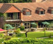
Golf and Country Club Abbey Hotel
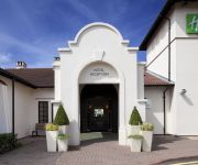
Holiday Inn BIRMINGHAM - BROMSGROVE
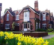
Hillscourt
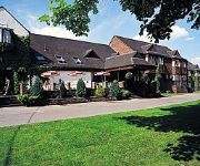
The Westmead
Holiday Inn Express BIRMINGHAM - REDDITCH
Redditch West (A448)
TRAVELODGE BIRMINGHAM FRANKLEY M5 SOUTHB
TRAVELODGE BROMSGROVE
Bromsgrove Central
TRAVELODGE BIRMINGHAM HALESOWEN
Videos from this area
These are videos related to the place based on their proximity to this place.
I run away from Boarding School part 2 -Third attempt to get home at seven
Having tried twice, unsuccessfully, to run away from Hunter's Hill Open Air School, Blackwell will I at seven be able to overcome all the obstacles without telling a lie? One of the biggest...
Beacon Hill - Lickey Hills Country Park - view of Birmingham skyline
View of the skyline from Beacon Hill at the Lickey Hills Country Park in Birmingham. Near the border of Bromsgrove District (Lickey, Cofton Hackett and Rubery all nearby). Closest Birmingham...
Bournville College to Rubery - Beacon Hill - Lickey Hills Country Park
A closer zoom from the Lickey Hills Country Park on Beacon Hill. From Bournville College, we pass the City Centre, University of Birmingham, Queen Elizabeth Hospital Birmingham, towards Rubery.
Kate Angel's Head Shave for Cancer Research UK
Saturday 5th March 2011 Kate Angel took part in a charity event for Cancer Research UK, by having her hair shaved off outside St. Chads in Rubery. If you would like to donate to Kate's...
Survival Island #6 : Upgades
This is the sixth episode of the survival island series which we will try to upload every day at 6pm UK time. ft. Repo x Snake , Repo x Boss , Repo x Beast. Follow us on twitter : https://twitter....
Inter Counties Cross Country 2014 - Cofton Park, Birmingham
Footage features Mens U'20's and Boys' Under 13's, with a focus on Norfolk.
DJI Phantom 2 FPV Hero 3 - Aerial Flight over Lickey Hills Worcestershire
DJI Phantom 2 FPV Hero 3 - Aerial Flight over Lickey Hills Worcestershire. Phantom 2 with Zenmuse Gimbal H3 3D and Hero 3+ 1080p 30 fps using FPV.
Survival Island #4 : The Diamond Sword Of Doom
Sorry for the late upload upload. This is the fouth episode of the survival island series which will be uploaded every day at 6pm UK time. ft Repo x Snake , Repo x Boss , Repo x Beast. Follow...
Videos provided by Youtube are under the copyright of their owners.
Attractions and noteworthy things
Distances are based on the centre of the city/town and sightseeing location. This list contains brief abstracts about monuments, holiday activities, national parcs, museums, organisations and more from the area as well as interesting facts about the region itself. Where available, you'll find the corresponding homepage. Otherwise the related wikipedia article.
Lickey Hills
The Lickey Hills (known locally as simply The Lickeys) are a range of hills in Worcestershire, England, 11 miles to the south-west of the centre of Birmingham near the villages of Lickey and Barnt Green. The hills are a popular country park area and they afford panoramic views over much of the surrounding countryside.
Barnt Green House
Barnt Green House is a building at Barnt Green, Worcestershire, England. It is a Grade II listed building. It was once a residence of the local nobles, the Earls of Plymouth. Queen Victoria is reputed to have spent the night there. The house was bought by Other Archer Windsor, 6th Earl of Plymouth in 1811, from the previous occupants, the Yates family.
Lydiate Ash
Lydiate Ash is a hamlet, consisting of a few houses and the road gritting depot for Bromsgrove District Council. area of North Worcestershire, England. It is in the district of Bromsgrove, to the south-west of Birmingham. The site is now best known for the Lydiate Ash roundabout, where the A38 and A491 main roads connect to the M5 motorway at the latter's junction 4.
Lickey Grange
Lickey Grange is a Victorian private house and estate near Birmingham, England; important because of its association with the renowned automobile designer Herbert Austin, who once owned it and lived there for 31 years. It later became a residential school and was recently redeveloped for private housing. Lickey Grange is located in the village of Lickey, and is accessed directly from the Old Birmingham Road (B4096).
Bilberry Hill
Bilberry Hill is one of the Lickey Hills in northern Worcestershire, England, 10.3 miles (16.5 kilometres) south west of Birmingham and 24 miles (38.5 kilometres) north east of Worcester. It stands above and to the west of the village of Cofton Hackett, and is part of the Lickey Hills Country Park. The three hilltops comprising The Lickeys - Bilberry Hill, Rednal Hill and Cofton Hill - form the northern extremity of the Lickey Ridge, a formation of hard quartzite.
Blackwell railway station
Blackwell railway station was a railway station serving Blackwell in the English county of Worcestershire. It was opened by the Birmingham and Gloucester Railway in 1841 a year after the line opened. In 1846 it became part of the Midland Railway which had been formed two years before.
Rubery railway station
Rubery railway station was a railway station in the district of Rubery, South Birmingham, England, on the Great Western Railway & Midland Railway's Joint Halesowen Railway line from Old Hill to Longbridge. The station was the location of the only passing loop between Halesowen and Longbridge.
Cofton reservoir
Cofton Reservoir is a canal feeder reservoir, south of the village of Cofton Hackett, Worcestershire in the United Kingdom. The reservoir is situated at the base of the Lickey Hills, 8.5 miles south west of Birmingham. It is the highest of four Worcester and Birmingham Canal reservoirs in the upper catchments of the River Arrow. It was originally built in 1815 as a compensation reservoir for watermills, which would have otherwise been affected by the construction of the canal.





!['[HD] Highlights from Lickey Hills [6th Nov 2011]' preview picture of video '[HD] Highlights from Lickey Hills [6th Nov 2011]'](https://img.youtube.com/vi/8osX2H66en0/mqdefault.jpg)


