Safety Score: 3,0 of 5.0 based on data from 9 authorites. Meaning we advice caution when travelling to United Kingdom.
Travel warnings are updated daily. Source: Travel Warning United Kingdom. Last Update: 2024-04-27 08:23:39
Delve into Clent
Clent in Worcestershire (England) is located in United Kingdom about 105 mi (or 169 km) north-west of London, the country's capital town.
Current time in Clent is now 02:27 AM (Sunday). The local timezone is named Europe / London with an UTC offset of one hour. We know of 9 airports close to Clent, of which 5 are larger airports. The closest airport in United Kingdom is Birmingham International Airport in a distance of 15 mi (or 25 km), East. Besides the airports, there are other travel options available (check left side).
There are several Unesco world heritage sites nearby. The closest heritage site in United Kingdom is Pontcysyllte Aqueduct and Canal in a distance of 51 mi (or 82 km), North-West. Also, if you like playing golf, there are some options within driving distance. We encountered 1 points of interest near this location. If you need a hotel, we compiled a list of available hotels close to the map centre further down the page.
While being here, you might want to pay a visit to some of the following locations: Dudley, Oldbury, Wolverhampton, Stourport-on-Severn and Walsall. To further explore this place, just scroll down and browse the available info.
Local weather forecast
Todays Local Weather Conditions & Forecast: 4°C / 40 °F
| Morning Temperature | 2°C / 35 °F |
| Evening Temperature | 8°C / 47 °F |
| Night Temperature | 4°C / 39 °F |
| Chance of rainfall | 16% |
| Air Humidity | 97% |
| Air Pressure | 1004 hPa |
| Wind Speed | Fresh Breeze with 13 km/h (8 mph) from South |
| Cloud Conditions | Overcast clouds, covering 100% of sky |
| General Conditions | Rain and snow |
Monday, 29th of April 2024
13°C (55 °F)
9°C (49 °F)
Light rain, fresh breeze, broken clouds.
Tuesday, 30th of April 2024
15°C (58 °F)
9°C (49 °F)
Light rain, fresh breeze, overcast clouds.
Wednesday, 1st of May 2024
14°C (58 °F)
11°C (52 °F)
Light rain, gentle breeze, overcast clouds.
Hotels and Places to Stay
Copthorne Merry Hill Dudley
Brockencote Hall
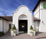
Holiday Inn BIRMINGHAM - BROMSGROVE
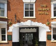
The Talbot Hotel
RAMADA OLDBURY BIRMINGHAM
Travellers Inn
TRAVELODGE BIRMINGHAM HALESOWEN
TRAVELODGE BROMSGROVE MARLBROOK
TRAVELODGE BIRMINGHAM DUDLEY
Bromsgrove Central
Videos from this area
These are videos related to the place based on their proximity to this place.
Class 172 @ Stourbridge Junction, 16 April 2012.
172 217 & 172 344 head West from Stourbridge Junction. These units started work in the West Midlands in 2011. They have one MTU 485HP engine and ZF 6-speed automatic gearbox in each car, and ...
Class 139 no. 139002 arriving at Stourbridge Junction on 7/8/13
Class 139 no. 139002 arriving at Stourbridge Junction on 7/8/13 Like this video then why not subscribe so you do missing more in the future. All Video's Taken on my Mobile Phone ( Samsung...
16 Redlake Road, Pedmore, Stourbridge. DY9 0RY
FULL DETAILS AT www.waltonandhipkiss.co.uk OR CALL 01384 392371 Walton and Hipkiss are pleased to offer For Sale this three bedroom detached home having versatile accommodation and ...
Class 172 no. 172344 Departing from Stourbridge Junction on 7/8/13
Class 172 no. 172344 Departing from Stourbridge Junction on 7/8/13 Like this video then why not subscribe so you do missing more in the future. All Video's Taken on my Mobile Phone ( Samsung...
Class 172 no. 172344 arriving at Stourbridge Junction on 7/8/13
Class 172 no. 172344 arriving at Stourbridge Junction on 7/8/13 Like this video then why not subscribe so you do missing more in the future. All Video's Taken on my Mobile Phone ( Samsung...
4936 Kinlet Hall through Stourbridge Station
4936 Kinlet Hall passing through Stourbridge Station Sunday 23d September 07.
The Stourbridge Lion & Cameo Plaque Project SLCGP 6
This is SLCGP 6 the making of My Stourbridge Lion out of scrounged and salvaged bits. Wile waiting for DMBC and Centro to decide whether to embrace or reject the full scale Stourbridge...
Videos provided by Youtube are under the copyright of their owners.
Attractions and noteworthy things
Distances are based on the centre of the city/town and sightseeing location. This list contains brief abstracts about monuments, holiday activities, national parcs, museums, organisations and more from the area as well as interesting facts about the region itself. Where available, you'll find the corresponding homepage. Otherwise the related wikipedia article.
Bromsgrove (UK Parliament constituency)
Bromsgrove is a constituency represented in the House of Commons of the Parliament of the United Kingdom since 2010 by Sajid Javid of the Conservative Party.
Clent Hills
The Clent Hills lie 10 miles south-west of Birmingham city centre in Clent, Worcestershire, England. The closest towns are Stourbridge and Halesowen, both in the West Midlands conurbation. The Clent Hills range consists of, in order from north-west to south-east: Wychbury Hill, Clent Hill (and Adams Hill), and Walton Hill (and Calcot Hill). The north Worcestershire range of hills continues eastwards to include Romsley Hill, Waseley Hills and the Lickey Hills.
Wychbury Hill
Wychbury Hill is a hill situated off the A456 Birmingham Road, at Hagley, Stourbridge, on the border of West Midlands and Worcestershire. It is divided between the parish of Hagley and former parish of Pedmore. It is one of the Clent Hills. The hill offers good views across the Severn Valley as far as the Malvern Hills and Clee Hills.
Wychbury Obelisk
The Hagley Obelisk (also known as the Wychbury Obelisk and locally as Wychbury Monument) stands close to the summit of Wychbury Hill in Hagley, Worcestershire, and is only about 150 metres from the border of the West Midlands. The obelisk is a Grade II* listed building. It is 84 feet high, and can be seen for many miles around, as far as Shropshire, and the hill if not the monument on its summit from the Malverns.
Walton Hill
At 316 metres above sea level, Walton Hill is the highest point in the range of hills in northern Worcestershire known as the Clent Hills. It is the highest point for 21 miles in all directions, and as such commands an excellent panorama. Its neighbours include Clent Hill, Wychbury Hill (which is hidden from view by Clent Hill), Calcot Hill, and Romsley Hill. The summit of the hill is open grassland and heath, which was commonland of the manor of Clent.
Castle in Hagley Park
The folly castle in the park of Hagley Hall is a Grade II* listed building and the largest building in Hagley Park. {{#invoke:Footnotes|sfn}} It was designed by Sanderson Miller for George Lyllelton in the middle of the 18th century to look like a small ruined medieval castle.
Clent Castle
Clent Castle is a sham ruin castellated folly in the grounds of Clent Grove (the site of Sunfield Children's Home) that is situated opposite the Fountain Inn on Adams Hill in Clent England. {{#invoke:Footnotes|sfn}} It was built in the late 18th century and it has been designated by English Heritage as a Grade II listed building.
Castlebourne folly
The Castlebourne folly in the parish of Belbroughton England, was built as a sham castle towards the end of the eighteenth century and is similar in age and design to Clent Castle another folly about 2.2 miles away in an adjacent parish of Clent. In the middle nineteenth century a house, Castlebourne (originally Castle Bourne) was built in a Gothic castle style close to the folly and connected by a wall about 20 yards long and 5 yards high with an archway.


