Safety Score: 3,0 of 5.0 based on data from 9 authorites. Meaning we advice caution when travelling to United Kingdom.
Travel warnings are updated daily. Source: Travel Warning United Kingdom. Last Update: 2024-04-28 08:22:10
Discover West Hagley
West Hagley in Worcestershire (England) is a city in United Kingdom about 107 mi (or 172 km) north-west of London, the country's capital city.
Local time in West Hagley is now 05:19 PM (Sunday). The local timezone is named Europe / London with an UTC offset of one hour. We know of 9 airports in the vicinity of West Hagley, of which 5 are larger airports. The closest airport in United Kingdom is Birmingham International Airport in a distance of 17 mi (or 28 km), East. Besides the airports, there are other travel options available (check left side).
There are several Unesco world heritage sites nearby. The closest heritage site in United Kingdom is Pontcysyllte Aqueduct and Canal in a distance of 50 mi (or 80 km), North-West. Also, if you like golfing, there are a few options in driving distance. We discovered 1 points of interest in the vicinity of this place. Looking for a place to stay? we compiled a list of available hotels close to the map centre further down the page.
When in this area, you might want to pay a visit to some of the following locations: Dudley, Stourport-on-Severn, Oldbury, Romsley and Wolverhampton. To further explore this place, just scroll down and browse the available info.
Local weather forecast
Todays Local Weather Conditions & Forecast: 8°C / 47 °F
| Morning Temperature | 4°C / 39 °F |
| Evening Temperature | 9°C / 48 °F |
| Night Temperature | 4°C / 39 °F |
| Chance of rainfall | 8% |
| Air Humidity | 84% |
| Air Pressure | 1004 hPa |
| Wind Speed | Moderate breeze with 11 km/h (7 mph) from South-East |
| Cloud Conditions | Overcast clouds, covering 100% of sky |
| General Conditions | Moderate rain |
Monday, 29th of April 2024
12°C (53 °F)
10°C (50 °F)
Light rain, fresh breeze, overcast clouds.
Tuesday, 30th of April 2024
16°C (60 °F)
10°C (50 °F)
Scattered clouds, fresh breeze.
Wednesday, 1st of May 2024
15°C (59 °F)
10°C (50 °F)
Light rain, light breeze, overcast clouds.
Hotels and Places to Stay
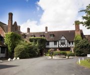
Brockencote Hall
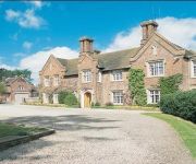
Hogarths Stone Manor
Dunsley Hall Hotel
Copthorne Merry Hill Dudley
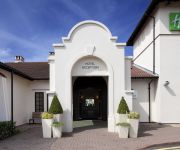
Holiday Inn BIRMINGHAM - BROMSGROVE
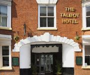
The Talbot Hotel
The Granary
TRAVELODGE BIRMINGHAM DUDLEY
TRAVELODGE BIRMINGHAM KINGWINSFORD
Stourbridge Town Centre
Videos from this area
These are videos related to the place based on their proximity to this place.
Stourbridge Cycling Club - Easter Sunday Cycling Treasure Hunt 2012
A fun cycle ride held on Easter Sunday in which riders went in pairs around Stourbridge and the local rural area in search of obscure clues set by the evil touring secretary.
Class 172 @ Stourbridge Junction, 16 April 2012.
172 217 & 172 344 head West from Stourbridge Junction. These units started work in the West Midlands in 2011. They have one MTU 485HP engine and ZF 6-speed automatic gearbox in each car, and ...
Class 139 no. 139002 arriving at Stourbridge Junction on 7/8/13
Class 139 no. 139002 arriving at Stourbridge Junction on 7/8/13 Like this video then why not subscribe so you do missing more in the future. All Video's Taken on my Mobile Phone ( Samsung...
16 Redlake Road, Pedmore, Stourbridge. DY9 0RY
FULL DETAILS AT www.waltonandhipkiss.co.uk OR CALL 01384 392371 Walton and Hipkiss are pleased to offer For Sale this three bedroom detached home having versatile accommodation and ...
Class 172 no. 172344 Departing from Stourbridge Junction on 7/8/13
Class 172 no. 172344 Departing from Stourbridge Junction on 7/8/13 Like this video then why not subscribe so you do missing more in the future. All Video's Taken on my Mobile Phone ( Samsung...
Class 172 no. 172344 arriving at Stourbridge Junction on 7/8/13
Class 172 no. 172344 arriving at Stourbridge Junction on 7/8/13 Like this video then why not subscribe so you do missing more in the future. All Video's Taken on my Mobile Phone ( Samsung...
Videos provided by Youtube are under the copyright of their owners.
Attractions and noteworthy things
Distances are based on the centre of the city/town and sightseeing location. This list contains brief abstracts about monuments, holiday activities, national parcs, museums, organisations and more from the area as well as interesting facts about the region itself. Where available, you'll find the corresponding homepage. Otherwise the related wikipedia article.
Wychbury Hill
Wychbury Hill is a hill situated off the A456 Birmingham Road, at Hagley, Stourbridge, on the border of West Midlands and Worcestershire. It is divided between the parish of Hagley and former parish of Pedmore. It is one of the Clent Hills. The hill offers good views across the Severn Valley as far as the Malvern Hills and Clee Hills.
Blakedown railway station
Blakedown railway station serves the English village of Blakedown, Worcestershire. It was opened (as Churchill station) in 1852, and was later known as Churchill & Blakedown before adopting its current name (the signal box still uses the old name, as shown above). The station is unstaffed, with only a basic shelter on each platform.
Oldswinford
The name Oldswinford is now used for a small area of Stourbridge, close to the parish church.
Churchill Forge Mill
Churchill Forge Mill is a water powered forge mill. It is situated in the village of Churchill, which is near Hagley, in the English county of Worcestershire. Until the early 1970s was operated as a working business, producing metal tools such as spades, shovels and ladles. It is one of the last water powered forge mills remaining in an intact state in the UK and as such is an important example of the industrial heritage of the West Midlands.
King's Norton and Northfield Urban District
King's Norton and Northfield Urban District was a local government administrative district in north Worcestershire, England, from 1898 until 1911. Much of its area was afterwards absorbed into the neighbouring Borough of Birmingham, under the Greater Birmingham Scheme, and now constitutes most of the City’s southern and southwestern suburban environs.
Pedmore
Pedmore is a residential suburb of Stourbridge in the West Midlands of England. It was originally a village in the Worcestershire countryside until extensive housebuilding during the interwar years saw it gradually merged into Stourbridge.
Hackmans Gate
Hackmans Gate is a hamlet in the parish of Broome, and the district of Wyre Forest District of Worcestershire, England.
Iverley
Iverley is an area of the parish of Kinver in Staffordshire that has no road link to the rest of the parish. Iverley lies in a corner of Stafforshire, with Churchill, Worcestershire to the south and Norton, Stourbridge, Pedmore, and Hagley to the east. The eastern boundary is approximately the Roman road from Droitwich to Greensforge.


