Safety Score: 3,0 of 5.0 based on data from 9 authorites. Meaning we advice caution when travelling to United Kingdom.
Travel warnings are updated daily. Source: Travel Warning United Kingdom. Last Update: 2024-04-24 08:14:40
Delve into Romsley
Romsley in Worcestershire (England) with it's 1,360 habitants is a city located in United Kingdom about 104 mi (or 167 km) north-west of London, the country's capital town.
Current time in Romsley is now 03:11 AM (Thursday). The local timezone is named Europe / London with an UTC offset of one hour. We know of 9 airports closer to Romsley, of which 5 are larger airports. The closest airport in United Kingdom is Birmingham International Airport in a distance of 13 mi (or 21 km), East. Besides the airports, there are other travel options available (check left side).
There are several Unesco world heritage sites nearby. The closest heritage site in United Kingdom is Pontcysyllte Aqueduct and Canal in a distance of 52 mi (or 84 km), North-West. Also, if you like playing golf, there are some options within driving distance. We saw 1 points of interest near this location. In need of a room? We compiled a list of available hotels close to the map centre further down the page.
Since you are here already, you might want to pay a visit to some of the following locations: Dudley, Oldbury, Birmingham, Wolverhampton and Walsall. To further explore this place, just scroll down and browse the available info.
Local weather forecast
Todays Local Weather Conditions & Forecast: 9°C / 48 °F
| Morning Temperature | 3°C / 37 °F |
| Evening Temperature | 8°C / 46 °F |
| Night Temperature | 4°C / 39 °F |
| Chance of rainfall | 0% |
| Air Humidity | 63% |
| Air Pressure | 1004 hPa |
| Wind Speed | Gentle Breeze with 6 km/h (4 mph) from East |
| Cloud Conditions | Overcast clouds, covering 88% of sky |
| General Conditions | Light rain |
Friday, 26th of April 2024
8°C (46 °F)
6°C (43 °F)
Overcast clouds, gentle breeze.
Saturday, 27th of April 2024
5°C (42 °F)
7°C (45 °F)
Moderate rain, moderate breeze, overcast clouds.
Sunday, 28th of April 2024
9°C (49 °F)
9°C (48 °F)
Moderate rain, moderate breeze, overcast clouds.
Hotels and Places to Stay
Copthorne Merry Hill Dudley
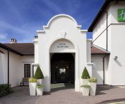
Holiday Inn BIRMINGHAM - BROMSGROVE
RAMADA OLDBURY BIRMINGHAM
Travellers Inn
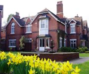
Hillscourt
Jct2) Birmingham Oldbury (M5
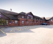
TRAVELODGE BIRMINGHAM OLDBURY
JCT.2 Holiday Inn Express BIRMINGHAM OLDBURY M5
TRAVELODGE BIRMINGHAM HALESOWEN
TRAVELODGE BIRMINGHAM FRANKLEY M5 SOUTHB
Videos from this area
These are videos related to the place based on their proximity to this place.
HALESOWEN ABBEY AND PARTS OF THE ILLEY WALK
THIS IS PART OF THE ILLEY AND LAPAL WALK NEAR AND AROUND HALESOWEN ABBEY WHERE THERE ARE TO MANY PATHWAYS TO WALK FOR MORE INFORMATION PLEASE CLICK ON ...
LEASOWES PARK HALESOWEN
LEASOWES PARK HALESOWEN http://www.dudley.gov.uk/community-and-living/town-centre-management/halesowen-town-centre/the-leasowes-project http://en.wikipedia.org/wiki/Halesowen ...
Bus congestion in Halesowen!
Not something you see every day. Funny how a 297 stopping to unload can cause a tailback of buses blocking the high street. Unusual to see this many in a row at night in Halesowen.
GoPro at Teamworks Karting Halesowen
GoPro at Teamworks Karting Halesowen 23rd October 2014 (part 1)
Teamworks Halesowen Track Showcase
A few laps showing one of our regular indoor tracks, Teamworks Halesowen. Driver: https://www.youtube.com/channel/UCDTzMlNeVrrAQq9SVYqztkQ Track Website: ...
GoPro at Teamworks Karting Halesowen
GoPro at Teamworks Karting Halesowen 23rd October 2014 (part 2)
Friday Night Track League, Halesowen Athletic and Cycling Club, 4 Jun 2010
Friday Night Track League Halesowen Athletic and Cycling Club 4 Jun 2010.
35 Romsley Hill Grange, Farley Lane, Romsley, Halesowen, West Midlands, B62 0LN
A well presented ground floor two bedroom apartment situated in a popular location and comprising: Hall, Sitting Room with views to the rear, Kitchen, Shower Room, Two Bedrooms. Outside: Garage...
James Morris MP volunteers at Black Country Food Bank during Volunteers Week 2012
James spent a couple of hours volunteering at the Black Country Food Bank storehouse in Halesowen, as part of Volunteers Week 2012.
Videos provided by Youtube are under the copyright of their owners.
Attractions and noteworthy things
Distances are based on the centre of the city/town and sightseeing location. This list contains brief abstracts about monuments, holiday activities, national parcs, museums, organisations and more from the area as well as interesting facts about the region itself. Where available, you'll find the corresponding homepage. Otherwise the related wikipedia article.
Gannow Green
Gannow Green is an area of Birmingham, England, located just north of Rubery and part of the civil parish of New Frankley.
Waseley Hills Country Park
Waseley Hills Country Park is 150 acres a Country Park, owned and managed by Worcestershire County Council's Countryside Service. It consists of rolling open hills with old hedgerows, pastures and small pockets of woodland with panoramic views over Worcestershire, England. It is just south-west of Birmingham, close to Junction 4 of the M5 Motorway, from which it is signposted. The North Worcestershire Path and Illey Way long distance paths run through the park.
Seth Somers Park
Seth Somers Park in Halesowen, West Midlands was used for first-class cricket by Worcestershire on two occasions in the 1960s, at which time Halesowen lay in Worcestershire. In 1964 they beat Cambridge University by ten wickets, and five years later they beat the same opposition by an identical margin.
List of United Kingdom locations: Has-Hd
Dowery Dell
Dowery Dell, near Hunnington in Worcestershire, was notable for a cast iron railway viaduct that carried the Halesowen to Longbridge railway until it was dismantled in 1964.
Hayley Green, West Midlands
Hayley Green is a suburb of Halesowen in the Metropolitan Borough of Dudley, West Midlands, England, located to the south-west of Halesowen town centre. Its focal point is the 'Harvester' public house and restaurant and a row of small shops on the A456/B4183 roundabout. It boasts predominantly owner-occupied housing stock, including Causey Farm estate, St Kenelms Avenue and Squirrels Estate, with a small 1940s municipal housing development to the east off Uffmoor Lane.
Hunnington railway station
Hunnington railway station was a railway station in the village of Hunnington, near Halesowen, England, on the Great Western Railway & Midland Railway's Joint Halesowen Railway line from Old Hill to Longbridge. The station had only a single platform but had its own sidings, which served the now closed Blue Bird Toffee Factory. Unlike most of the other former stations and infrastructure of the Halesowen Railway, Hunnington station building still remains as a private residence.
Uffmoor Wood
Uffmoor Wood is a semi-natural woodland in Worcestershire, in the English Midlands. It is one of over a thousand woods cared for by the Woodland Trust. The wood has an area of 84.84 hectares, and grid reference SO952811. Sitting at the foot of the Clent Hills and about 3 km southwest of Halesowen, Uffmoor Wood is a popular recreational destination for local people.


