Safety Score: 3,0 of 5.0 based on data from 9 authorites. Meaning we advice caution when travelling to United Kingdom.
Travel warnings are updated daily. Source: Travel Warning United Kingdom. Last Update: 2024-04-17 08:01:42
Delve into Lye
Lye in Dudley (England) is located in United Kingdom about 107 mi (or 172 km) north-west of London, the country's capital town.
Current time in Lye is now 03:44 AM (Thursday). The local timezone is named Europe / London with an UTC offset of one hour. We know of 8 airports close to Lye, of which 5 are larger airports. The closest airport in United Kingdom is Birmingham International Airport in a distance of 16 mi (or 25 km), East. Besides the airports, there are other travel options available (check left side).
There are several Unesco world heritage sites nearby. The closest heritage site in United Kingdom is Pontcysyllte Aqueduct and Canal in a distance of 49 mi (or 78 km), North-West. Also, if you like playing golf, there are some options within driving distance. We encountered 1 points of interest near this location. If you need a hotel, we compiled a list of available hotels close to the map centre further down the page.
While being here, you might want to pay a visit to some of the following locations: Dudley, Oldbury, Wolverhampton, Walsall and Romsley. To further explore this place, just scroll down and browse the available info.
Local weather forecast
Todays Local Weather Conditions & Forecast: 11°C / 52 °F
| Morning Temperature | 1°C / 34 °F |
| Evening Temperature | 8°C / 47 °F |
| Night Temperature | 8°C / 47 °F |
| Chance of rainfall | 0% |
| Air Humidity | 49% |
| Air Pressure | 1024 hPa |
| Wind Speed | Moderate breeze with 11 km/h (7 mph) from East |
| Cloud Conditions | Broken clouds, covering 52% of sky |
| General Conditions | Broken clouds |
Friday, 19th of April 2024
11°C (51 °F)
7°C (44 °F)
Overcast clouds, fresh breeze.
Saturday, 20th of April 2024
11°C (51 °F)
5°C (42 °F)
Scattered clouds, gentle breeze.
Sunday, 21st of April 2024
6°C (44 °F)
5°C (41 °F)
Overcast clouds, gentle breeze.
Hotels and Places to Stay
Copthorne Merry Hill Dudley
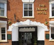
The Talbot Hotel
Quality Hotel Dudley
Village Hotel Birmingham Dudley
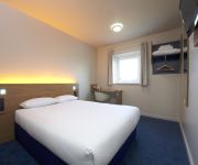
TRAVELODGE BIRMINGHAM DUDLEY
Station
TRAVELODGE BIRMINGHAM KINGWINSFORD
TRAVELODGE BIRMINGHAM HALESOWEN
Stourbridge Town Centre
Hagley
Videos from this area
These are videos related to the place based on their proximity to this place.
Timelapse Canals: Dudley to Windmill End
Timelapse film of our cruise by narrowboat from Dudley (Merry Hill) on the Dudley No. 1 Canal to Windmill End on the Dudley No. 2 Canal.
Parrys People Mover at Stourbridge
Parry People Mover aka Class 139. These vehicles operate the branch from Stourbridge Jcn to Stourbridge Town. The class of 2 vehicles is unique as it uses flywheel technology for its engine...
The Stourbridge Lion & Cameo Glass Plaque Project SLCGP 1
The Stourbridge Lion & Cameo Glass Plaque Project (Inspired by the Stourbridge 2012 Portland vase project) Conceived on 18/8/2011 by Robert Merlyn Farwell (born in Bott La Lye 18/11/1946...
Class 172 @ Stourbridge Junction, 16 April 2012.
172 217 & 172 344 head West from Stourbridge Junction. These units started work in the West Midlands in 2011. They have one MTU 485HP engine and ZF 6-speed automatic gearbox in each car, and ...
STOUR VALLEY FROM QUARRY BANK TO STOURBRIDGE WALK
STOUR VALLEY FROM QUARRY BANK TO STOURBRIDGE WALK http://www.dudley.gov.uk/index.asp?pgid=14212 http://www.stourbridge.com/htm/welcome.htm.
The Stourbridge Lion & Cameo Plaque Project SLCGP 3
Wile waiting for DMBC and Centro, I am making My Stourbridge Lion Glassmaking demonstration unit. The Stourbridge Lion & Cameo Glass Plaque Project Conceived on 18/8/2011 by Robert...
The Stourbridge Lion n Cameo Plaque Project SLCGP 8
This is SLCGP 8 The End Product WORKING with Fire in the belly Wile waiting for DMBC and Centro to decide whether to embrace or reject the full scale Stourbridge Lion. I am making My Stourbrid...
Videos provided by Youtube are under the copyright of their owners.
Attractions and noteworthy things
Distances are based on the centre of the city/town and sightseeing location. This list contains brief abstracts about monuments, holiday activities, national parcs, museums, organisations and more from the area as well as interesting facts about the region itself. Where available, you'll find the corresponding homepage. Otherwise the related wikipedia article.
Stourbridge (UK Parliament constituency)
Stourbridge is a constituency represented in the House of Commons of the UK Parliament since 2010 by Margot James, a Conservative.
Lye Town F.C
Lye Town F.C. is a football club based in the Black Country suburban town of Lye, West Midlands, England. The club was established in 1930. In the 1995–96 season, they reached the 4th round of the FA Vase. They are currently members of the West Midlands (Regional) League Premier Division.
Stourbridge Junction railway station
Stourbridge Junction railway station serves the town of Stourbridge, in the Metropolitan Borough of Dudley in the West Midlands, England. It lies on the Birmingham to Worcester via Kidderminster Line and is the junction for the Stourbridge Town Branch Line, said to be the shortest operational branch line in Europe. The nearest railway stations are Hagley, Stourbridge Town and Lye.
Lye railway station
Lye railway station serves the Lye area of Stourbridge, in the West Midlands of England. The station is managed by London Midland, who provide the majority of train services; Chiltern Railways also operate a small number of trains. It is situated on the Birmingham-Stourbridge line.
Stambermill Viaduct
Stambermill Viaduct is a viaduct situated in Stourbridge, West Midlands, England. It was constructed in 1850 to carry the new railway between Stourbridge and Walsall across the River Stour, and was open to passenger trains until 1964. It is still in use for goods trains, as the railway is still is use as far as Round Oak Steel Terminal at Brierley Hill (though trains have not travelled beyond that point since 1993). Freight trains can still be seen passing over the viaduct.
Pedmore
Pedmore is a residential suburb of Stourbridge in the West Midlands of England. It was originally a village in the Worcestershire countryside until extensive housebuilding during the interwar years saw it gradually merged into Stourbridge.
Withymoor Village
Withymoor Village is a residential area of Brierley Hill, West Midlands, England. On this present day, Withymoor Village is a local housing estate that consists of approximately 2000 houses but Withymoor was not always a housing estate. In 1971 the site of Withymoor was an open cast colliery. The collieries were called the Plants Hollow and Gayfield Colleries which are now names of streets on the estate.
Wollescote
Wollescote is a residential area of Stourbridge, West Midlands, England. It is administered by the Metropolitan Borough of Dudley. It is situated two miles east of the town centre, near the border with Halesowen. The area was predominantly rural until the 1920s, when it was developed as a dense residential area. It now includes a varied mix of private and council housing, most of which was built after the Second World War.
Thorns Community College
Thorns Community College is a secondary school located in Brierley Hill, West Midlands, England.
Lye and Wollescote Cemetery
The Lye and Wollescote Cemetery is an actively used 9.45 acres cemetery in Lye, West Midlands, England.


