Safety Score: 3,0 of 5.0 based on data from 9 authorites. Meaning we advice caution when travelling to United Kingdom.
Travel warnings are updated daily. Source: Travel Warning United Kingdom. Last Update: 2024-04-16 08:26:06
Delve into Madeley
Madeley in Telford and Wrekin (England) is located in United Kingdom about 125 mi (or 201 km) north-west of London, the country's capital town.
Current time in Madeley is now 11:00 AM (Tuesday). The local timezone is named Europe / London with an UTC offset of one hour. We know of 9 airports close to Madeley, of which 5 are larger airports. The closest airport in United Kingdom is Birmingham International Airport in a distance of 31 mi (or 50 km), South-East. Besides the airports, there are other travel options available (check left side).
There are several Unesco world heritage sites nearby. The closest heritage site in United Kingdom is Pontcysyllte Aqueduct and Canal in a distance of 31 mi (or 49 km), North-West. Also, if you like playing golf, there are some options within driving distance. If you need a hotel, we compiled a list of available hotels close to the map centre further down the page.
While being here, you might want to pay a visit to some of the following locations: Telford, Ryton, Wellington, Eyton upon the Weald Moors and Tong. To further explore this place, just scroll down and browse the available info.
Local weather forecast
Todays Local Weather Conditions & Forecast: 9°C / 48 °F
| Morning Temperature | 6°C / 43 °F |
| Evening Temperature | 7°C / 44 °F |
| Night Temperature | 2°C / 36 °F |
| Chance of rainfall | 0% |
| Air Humidity | 58% |
| Air Pressure | 1016 hPa |
| Wind Speed | Strong breeze with 18 km/h (11 mph) from South-East |
| Cloud Conditions | Clear sky, covering 9% of sky |
| General Conditions | Sky is clear |
Wednesday, 17th of April 2024
8°C (47 °F)
2°C (36 °F)
Light rain, moderate breeze, broken clouds.
Thursday, 18th of April 2024
11°C (51 °F)
6°C (43 °F)
Light rain, light breeze, broken clouds.
Friday, 19th of April 2024
11°C (51 °F)
6°C (43 °F)
Light rain, moderate breeze, overcast clouds.
Hotels and Places to Stay
Ironbridge View Townhouse
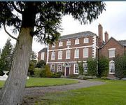
Park House Hotel
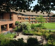
TELFORD GOLF AND SPA-QHOTELS
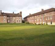
Mercure Telford Madeley Court Hotel
Holiday Inn TELFORD - IRONBRIDGE
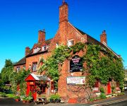
Hundred House
Ramada Telford Ironbridge
Park Inn By Radisson Telford
Days Inn Telford Iron Bridge Welcome Break Service Area
Haughton Hall
Videos from this area
These are videos related to the place based on their proximity to this place.
Telford parkrun #95 21/02/2015
Very lovely parkrun course with downhill at the start and clay trails. http://www.parkrun.org.uk/telford/results/weeklyresults/?runSeqNumber=95.
Driving Along Queensway A442, Telford and Wrekin, England 19th February 2011.
Driving along Queensway (A442), Telford , Telford & Wrekin, England Videoed on Saturday, 19th February 2011 Playlist: http://www.youtube.com/view_play_list?p=546D03AE1B80846B.
Telford Schools Race 2014
Racers from Midland Ski Club, Heart of England School and Solihull School racing in the 2014 Telford Schools Ski Race.
Guildex 2010 - Telford
Brief film made up of short video clips of some of the layouts & displays, taken during Guildex Show at Telford, 5th Sept 2010.
Driving Along Brockton Way A442, Madeley, Telford and Wrekin, England 26th August 2013
Driving along Brockton Way A442, Madeley, Telford & Wrekin, England Videoed on Monday, 26th August 2013 Playlist: ...
Blists Hill Ironworks, Ironbridge April 2008
Blists Hill Victorian Town is one of the ten Ironbridge Gorge Museums sites. The ironworks is used to recycle scrap wrought iron, in this case heavy mooring chain. Wrought iron is almost pure...
Tours-TV.com: Ironbridge Gorge
Great Britain : England : Liverpool. (アイアンブリッジ峡谷). See on map http://tours-tv.com/en/Ironbridge-Gorge .
Ironbridge Torch Crossing
Lyndon Flavell carries torch across world famous Ironbridge. Help us caption & translate this video! http://amara.org/v/sEI/
Tarmac homes - Punta Verde,Spanish village,Telford, Part two Tour 2011
New homes historian looks at one of Telford`s most unique housing estates, Punta Verde was constructed in 1989 by the former Tarmac homes and shows The Telford development corporation `s ...
Videos provided by Youtube are under the copyright of their owners.
Attractions and noteworthy things
Distances are based on the centre of the city/town and sightseeing location. This list contains brief abstracts about monuments, holiday activities, national parcs, museums, organisations and more from the area as well as interesting facts about the region itself. Where available, you'll find the corresponding homepage. Otherwise the related wikipedia article.
Blists Hill Victorian Town
Blists Hill is an open air museum, one of ten museums operated by the Ironbridge Gorge Museum Trust, built on a former industrial complex located in the Madeley area of Telford, Shropshire, England. The museum attempts to recreate the sights, sounds and smells of a Victorian Shropshire town in the late 19th and early 20th centuries.
Hay Inclined Plane
The Hay Inclined Plane is a canal inclined plane in the Ironbridge Gorge in Shropshire, with a height of 207 feet (63 m). It was located on a short stretch of the Shropshire Canal that linked the industrial area of Blists Hill with the River Severn. The inclined plane was in operation from 1792 to 1894. It can be visited as part of the Blists Hill Victorian Town and is also a waypoint on the South Telford Heritage Trail.
Coalport
Coalport is a village in Shropshire, now part of the new town of Telford. It is located on the River Severn at grid reference SJ700021, a mile downstream of Ironbridge. It lies predominantly on the north bank of the river; on the other side is Jackfield. The settlement was planned as a canal–river interchange and a complete "new town" by ironmaster William Reynolds, who between 1788 and 1796 built warehouses, workshops, factories and workers accommodation in Coalport.
Tar Tunnel
The Tar Tunnel is located on the north bank of the River Severn in the Ironbridge Gorge at Coalport, England. Miners struck a gushing spring of natural bitumen, a black treacle-like substance, when digging a canal tunnel for the Coalport Canal in 1787. The plan was to connect the canal alongside the River Severn to the lower galleries of the mines below the Blists Hill area. After digging some 3,000ft into the hill the canal project was abandoned in favour of bitumen extraction.
Coalport China Museum
The Coalport China Museum is one of the Ironbridge Gorge Museums based in the village of Coalport within the Ironbridge Gorge at Ironbridge, Coalbrookdale on the bank of the River Severn in Shropshire, England. It is located in a World Heritage Site, the birthplace of the Industrial Revolution. The museum presents the history of Coalport China, a manufacturer of fine English chinaware which was based on the site between 1795 and 1926.
St James' Church, Stirchley
St James' Church, Stirchley, is a redundant Anglican church in Stirchley, Shropshire, England. Stirchley was formerly a separate village but is now part of the new town of Telford. The church has been designated by English Heritage as a Grade I listed building, and is under the care of the Churches Conservation Trust. The church and its churchyard are designated as Scheduled ancient monuments.
The Werps, Jackfield, Shropshire
The lost village of Werps was one of a group of small settlements which later became collectively known as Jackfield in the Broseley Parish in Shropshire. The Werps lay on the south side of the river Severn, opposite the Old Coalport China Works and records indicate either three or four public houses, although it is unclear as to whether any of their names are renames of the same building or whether re-built on the same site.
Preens Eddy
The history of Preens Eddy, near Jackfield, Shropshire, England at the heart of the industrial revolution.


