Safety Score: 3,0 of 5.0 based on data from 9 authorites. Meaning we advice caution when travelling to United Kingdom.
Travel warnings are updated daily. Source: Travel Warning United Kingdom. Last Update: 2024-04-27 08:23:39
Delve into Fairfield
Fairfield in Worcestershire (England) is located in United Kingdom about 102 mi (or 165 km) north-west of London, the country's capital town.
Current time in Fairfield is now 07:28 AM (Sunday). The local timezone is named Europe / London with an UTC offset of one hour. We know of 9 airports close to Fairfield, of which 5 are larger airports. The closest airport in United Kingdom is Birmingham International Airport in a distance of 15 mi (or 24 km), North-East. Besides the airports, there are other travel options available (check left side).
There are several Unesco world heritage sites nearby. The closest heritage site in United Kingdom is Blaenavon Industrial Landscape in a distance of 54 mi (or 87 km), South-West. Also, if you like playing golf, there are some options within driving distance. We encountered 1 points of interest near this location. If you need a hotel, we compiled a list of available hotels close to the map centre further down the page.
While being here, you might want to pay a visit to some of the following locations: Dudley, Oldbury, Stourport-on-Severn, Birmingham and Wolverhampton. To further explore this place, just scroll down and browse the available info.
Local weather forecast
Todays Local Weather Conditions & Forecast: 9°C / 49 °F
| Morning Temperature | 4°C / 39 °F |
| Evening Temperature | 9°C / 49 °F |
| Night Temperature | 4°C / 38 °F |
| Chance of rainfall | 12% |
| Air Humidity | 70% |
| Air Pressure | 1005 hPa |
| Wind Speed | Moderate breeze with 10 km/h (6 mph) from South-East |
| Cloud Conditions | Overcast clouds, covering 100% of sky |
| General Conditions | Moderate rain |
Monday, 29th of April 2024
13°C (55 °F)
10°C (50 °F)
Light rain, fresh breeze, overcast clouds.
Tuesday, 30th of April 2024
15°C (59 °F)
11°C (52 °F)
Broken clouds, fresh breeze.
Wednesday, 1st of May 2024
16°C (60 °F)
13°C (55 °F)
Light rain, gentle breeze, broken clouds.
Hotels and Places to Stay
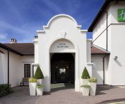
Holiday Inn BIRMINGHAM - BROMSGROVE
Brockencote Hall
Hillscourt
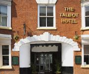
The Talbot Hotel
TRAVELODGE BROMSGROVE MARLBROOK
Bromsgrove Central
TRAVELODGE BROMSGROVE
TRAVELODGE BIRMINGHAM FRANKLEY M5 SOUTHB
TRAVELODGE BIRMINGHAM HALESOWEN
JCT.5 Holiday Inn Express DROITWICH M5
Videos from this area
These are videos related to the place based on their proximity to this place.
35 Romsley Hill Grange, Farley Lane, Romsley, Halesowen, West Midlands, B62 0LN
A well presented ground floor two bedroom apartment situated in a popular location and comprising: Hall, Sitting Room with views to the rear, Kitchen, Shower Room, Two Bedrooms. Outside: Garage...
Challenge Your Limits
Too many times people are training & on their journey to achieving their goals but just plod along. You have to push yourself and really challenge your body & mind to the limits! A quick video...
Volvo S60 T5 (HLM RR Day)
A S60 2.4 T5 takes to the road at the HLM RR Day with the vpcuk and T5owners. the car made i think 340+ hp at the flywheel.
FCA London Routemaster Bus in Bromsgrove
London Routemaster Bus in Bromsgrove.... not something you see every day !! Advertising the FCA - Financial Conduct Authority.
American Bull dog Busta and Staffie bitch Diesel play fighting.
American Bull dog Busta and Staffie bitch Diesel play fighting.
English Setter Otis & Cocoa Labrador at A & B Dogs Boarding & Training Kennels.
http://www.dogtrainers.co.uk PROPER Dog Training and Boarding kennels fully licensed and insured, set in 13.5 acres of Worcestershire countryside open 365 days. Individual heated rooms. Close...
German Shepherd China (Tide's Puppy) at A & B Dogs Boarding & Training Kennels.
http://www.dogtrainers.co.uk PROPER Dog Training and Boarding kennels fully licensed and insured, set in 13.5 acres of Worcestershire countryside open 365 days. Individual heated rooms. Close...
English Bull Terrier (STUPENDIOUSSSS example of the breed!) Bailey.
http://www.dogtrainers.co.uk PROPER Dog Training and Boarding kennels fully licensed and insured, set in 13.5 acres of Worcestershire countryside open 365 days. Individual heated rooms. Close...
Cyclocross ,WMCCL 4, Sanders Park, 4/10/2009
west midlands cyclocross league round 4 Start of the Seniors race.
German Shepherd Working Dog.
Dog Training and Boarding kennels fully licensed, set in 13.5 acres of Worcestershire countryside open 365 days. Individual heated/air conditioned rooms. Close to M5, M40, M42 and M6 motorways....
Videos provided by Youtube are under the copyright of their owners.
Attractions and noteworthy things
Distances are based on the centre of the city/town and sightseeing location. This list contains brief abstracts about monuments, holiday activities, national parcs, museums, organisations and more from the area as well as interesting facts about the region itself. Where available, you'll find the corresponding homepage. Otherwise the related wikipedia article.
Bromsgrove (UK Parliament constituency)
Bromsgrove is a constituency represented in the House of Commons of the Parliament of the United Kingdom since 2010 by Sajid Javid of the Conservative Party.
Lydiate Ash
Lydiate Ash is a hamlet, consisting of a few houses and the road gritting depot for Bromsgrove District Council. area of North Worcestershire, England. It is in the district of Bromsgrove, to the south-west of Birmingham. The site is now best known for the Lydiate Ash roundabout, where the A38 and A491 main roads connect to the M5 motorway at the latter's junction 4.
A491 road
The A491 is an A road in Zone 4 of the Great Britain numbering scheme.
Barnsley Hall Hospital
Barnsley Hall Hospital was a psychiatric facility located in Bromsgrove, Worcestershire, on a 324-acre site purchased by the County Council in 1899. It opened in 1907, to relieve pressure on the county's only existing asylum, Powick Hospital near Malvern and to serve the northern part of the county. By 1929 it had reached its capacity of around 720 patients.
A448 road
The A448 is a main road in England running between Studley in Warwickshire and Kidderminster in Worcestershire.
Rosedene
Rosedene is a cottage built as part of the Great Dodford Chartist settlement. It is the best preserved example of a Chartist cottage built by the National Land Company is a listed building, and is owned by the National Trust.
Castlebourne folly
The Castlebourne folly in the parish of Belbroughton England, was built as a sham castle towards the end of the eighteenth century and is similar in age and design to Clent Castle another folly about 2.2 miles away in an adjacent parish of Clent. In the middle nineteenth century a house, Castlebourne (originally Castle Bourne) was built in a Gothic castle style close to the folly and connected by a wall about 20 yards long and 5 yards high with an archway.
Church of St John the Baptist, Bromsgrove
The Church of St John the Baptist, Bromsgrove is a Grade I listed parish church in the Church of England in Bromsgrove.


