Safety Score: 3,0 of 5.0 based on data from 9 authorites. Meaning we advice caution when travelling to United Kingdom.
Travel warnings are updated daily. Source: Travel Warning United Kingdom. Last Update: 2024-05-04 08:22:41
Delve into Hasbury
Hasbury in Dudley (England) is located in United Kingdom about 105 mi (or 169 km) north-west of London, the country's capital town.
Current time in Hasbury is now 03:47 AM (Sunday). The local timezone is named Europe / London with an UTC offset of one hour. We know of 8 airports close to Hasbury, of which 5 are larger airports. The closest airport in United Kingdom is Birmingham International Airport in a distance of 14 mi (or 22 km), East. Besides the airports, there are other travel options available (check left side).
There are several Unesco world heritage sites nearby. The closest heritage site in United Kingdom is Pontcysyllte Aqueduct and Canal in a distance of 51 mi (or 81 km), North-West. Also, if you like playing golf, there are some options within driving distance. We encountered 1 points of interest near this location. If you need a hotel, we compiled a list of available hotels close to the map centre further down the page.
While being here, you might want to pay a visit to some of the following locations: Dudley, Oldbury, Wolverhampton, Walsall and Birmingham. To further explore this place, just scroll down and browse the available info.
Local weather forecast
Todays Local Weather Conditions & Forecast: 16°C / 61 °F
| Morning Temperature | 8°C / 47 °F |
| Evening Temperature | 11°C / 52 °F |
| Night Temperature | 10°C / 51 °F |
| Chance of rainfall | 0% |
| Air Humidity | 59% |
| Air Pressure | 1007 hPa |
| Wind Speed | Gentle Breeze with 7 km/h (4 mph) from North |
| Cloud Conditions | Scattered clouds, covering 33% of sky |
| General Conditions | Scattered clouds |
Monday, 6th of May 2024
17°C (63 °F)
11°C (53 °F)
Light rain, gentle breeze, overcast clouds.
Tuesday, 7th of May 2024
17°C (63 °F)
10°C (50 °F)
Light rain, gentle breeze, scattered clouds.
Wednesday, 8th of May 2024
15°C (60 °F)
10°C (49 °F)
Overcast clouds, light breeze.
Hotels and Places to Stay
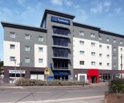
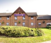
Copthorne Merry Hill Dudley
Village Hotel Birmingham Dudley
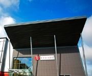
RAMADA OLDBURY BIRMINGHAM
Travellers Inn
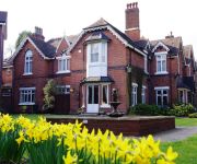
Hillscourt
Quality Hotel Dudley
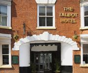
The Talbot Hotel
TRAVELODGE BIRMINGHAM HALESOWEN
West Bromwich
TRAVELODGE BROMSGROVE MARLBROOK
Videos from this area
These are videos related to the place based on their proximity to this place.
Bus congestion in Halesowen!
Not something you see every day. Funny how a 297 stopping to unload can cause a tailback of buses blocking the high street. Unusual to see this many in a row at night in Halesowen.
GoPro at Teamworks Karting Halesowen
GoPro at Teamworks Karting Halesowen 23rd October 2014 (part 1)
Teamworks Halesowen Track Showcase
A few laps showing one of our regular indoor tracks, Teamworks Halesowen. Driver: https://www.youtube.com/channel/UCDTzMlNeVrrAQq9SVYqztkQ Track Website: ...
GoPro at Teamworks Karting Halesowen
GoPro at Teamworks Karting Halesowen 23rd October 2014 (part 2)
James Morris MP volunteers at Black Country Food Bank during Volunteers Week 2012
James spent a couple of hours volunteering at the Black Country Food Bank storehouse in Halesowen, as part of Volunteers Week 2012.
Windsor Sixth Form Introduction (HD)
Introduction to Windsor Sixth Form, part of Windsor High School & Sixth Form in Halesowen (West Midlands, United Kingdom).
James Morris MP Video Diary 18th July 2014
James talks about David Cameron's visit to Halesowen College to announce the new £138million Black Country Growth Deal and George Osborne's visit to Rowley Regis Hospital, where he ...
Videos provided by Youtube are under the copyright of their owners.
Attractions and noteworthy things
Distances are based on the centre of the city/town and sightseeing location. This list contains brief abstracts about monuments, holiday activities, national parcs, museums, organisations and more from the area as well as interesting facts about the region itself. Where available, you'll find the corresponding homepage. Otherwise the related wikipedia article.
Halesowen Town F.C
Halesowen Town is an English association football club formed in 1873, that play in Halesowen and as of 2012 will be playing in the Northern Premier League Division One South. The team is nicknamed "The Yeltz".
Hasbury
Hasbury is a suburb of Halesowen in the Metropolitan Borough of Dudley in West Midlands, England. Its main focal point is the small shopping centre at the Wassell Road/Hagley Road junction, surrounded to the north by municipal housing development (Albrighton Road and Philip Road) and with owner-occupier housing estates located to the south (the Huntlands) and west (Rosemary Road).
Windsor High School (Halesowen)
Windsor High School is a secondary School with academy status located on Richmond Street, Halesowen, in England.
Hawne
Hawne is a residential area approximately one mile from Halesowen town centre in the West Midlands of England. It includes Newfield Park Primary School, Earls High School and Halesowen College. There is a mix of private and council housing in the area, much built between 1950 and 1980, but with many terraced houses from circa 1890. Another landmark in the area is The Grove, home of non-league football team Halesowen Town.
Squirrels Estate
Squirrels Estate is a residential area of Halesowen in the West Midlands conurbation of England. It is situated approximately two miles south-west of the town centre, bordering onto countryside in the direction of Kidderminster. It is located in the Hayley Green & Cradley South ward of Dudley Metropolitan Borough.
List of United Kingdom locations: Has-Hd
Richmond Boys School
Richmond Boys School was a secondary school located in Halesowen, West Midlands, England. It was built during the 1930s as a Secondary modern boys school to serve the expanding Black Country town of Halesowen, and in September 1985 merged with Walton Girls School to form Windsor High School. The school initially opened to pupils aged 11 upwards, before becoming a 13-18 comprehensive in September 1972 when three-tier education was introduced in Halesowen.
Hayley Green, West Midlands
Hayley Green is a suburb of Halesowen in the Metropolitan Borough of Dudley, West Midlands, England, located to the south-west of Halesowen town centre. Its focal point is the 'Harvester' public house and restaurant and a row of small shops on the A456/B4183 roundabout. It boasts predominantly owner-occupied housing stock, including Causey Farm estate, St Kenelms Avenue and Squirrels Estate, with a small 1940s municipal housing development to the east off Uffmoor Lane.
Halesowen bus station
Halesowen bus station is a bus station in the town of Halesowen in the West Midlands conurbation of the United Kingdom. The station is located on Queensway in front of the Cornbow Centre, which houses the new Asda superstore plus many other shops, and opposite Halesowen’s Jobcentre Plus and Norman Church. Originally, Halesowen had no bus station.


