Safety Score: 3,0 of 5.0 based on data from 9 authorites. Meaning we advice caution when travelling to United Kingdom.
Travel warnings are updated daily. Source: Travel Warning United Kingdom. Last Update: 2024-04-28 08:22:10
Touring Kinver
Kinver in Staffordshire (England) with it's 4,723 residents is a town located in United Kingdom about 111 mi (or 178 km) north-west of London, the country's capital place.
Time in Kinver is now 11:58 PM (Sunday). The local timezone is named Europe / London with an UTC offset of one hour. We know of 9 airports nearby Kinver, of which 5 are larger airports. The closest airport in United Kingdom is Birmingham International Airport in a distance of 20 mi (or 33 km), East. Besides the airports, there are other travel options available (check left side).
There are several Unesco world heritage sites nearby. The closest heritage site in United Kingdom is Pontcysyllte Aqueduct and Canal in a distance of 46 mi (or 74 km), North-West. Also, if you like the game of golf, there are several options within driving distance. We collected 1 points of interest near this location. Need some hints on where to stay? We compiled a list of available hotels close to the map centre further down the page.
Being here already, you might want to pay a visit to some of the following locations: Romsley, Stourport-on-Severn, Dudley, Wolverhampton and Albrighton. To further explore this place, just scroll down and browse the available info.
Local weather forecast
Todays Local Weather Conditions & Forecast: 9°C / 48 °F
| Morning Temperature | 4°C / 39 °F |
| Evening Temperature | 9°C / 48 °F |
| Night Temperature | 4°C / 38 °F |
| Chance of rainfall | 7% |
| Air Humidity | 85% |
| Air Pressure | 1004 hPa |
| Wind Speed | Moderate breeze with 11 km/h (7 mph) from East |
| Cloud Conditions | Overcast clouds, covering 100% of sky |
| General Conditions | Moderate rain |
Monday, 29th of April 2024
12°C (53 °F)
10°C (50 °F)
Light rain, fresh breeze, overcast clouds.
Tuesday, 30th of April 2024
16°C (60 °F)
9°C (48 °F)
Scattered clouds, fresh breeze, broken clouds.
Wednesday, 1st of May 2024
14°C (57 °F)
10°C (50 °F)
Light rain, light breeze, overcast clouds.
Hotels and Places to Stay
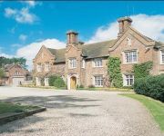
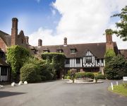
Dunsley Hall Hotel
Hogarths Stone Manor
Mercure Bewdley The Heath Hotel
Gainsborough House
TRAVELODGE KIDDERMINSTER
TRAVELODGE BIRMINGHAM KINGWINSFORD
Kidderminster
Dudley (Kingswinford)
Videos from this area
These are videos related to the place based on their proximity to this place.
Timelapse Canals: Stourton Junction to Dudley via Stourbridge
Timelapse film of our cruise by narrowboat from Stourton Junction up the Stourbridge Canal to Dudley. On the way we detoured to Stourbridge along the Stourbridge Town Arm; carried straight...
CUSTOM & CLASSIC CAR & TRUCK SHOW NASSA 11
EARLY MORNING ARRIVALS AT THE NASSA 11CUSTOM & CLASSIC CAR & TRUCK SHOW.
Llandegla Northshore Ski Jump - Ninette Nukeproof Mega Pro Am October 2012
Llandegla Northshore Ski Jump - Ninette on a Nukeproof Mega Pro Am October 2012.
Kidderminster Station
Aerial view of Kidderminster station on the Severn Valley Railway. Filmed while the railway was closed.
Airsofting at the Asylum - Kidderminster - 11/08/2013
A short video of me airsofting the first quarter of the day at the Asylum - Kidderminster.
Domestic Cleaners Kidderminster | Well Done Cleaning Services
http://www.welldonecleaningservice.co.uk Are you looking for Domestic Cleaners in Kidderminster? Well you are in luck. Well Done Cleaning Service are a professional cleaning company based in...
Spencer Street & Greatfield Road Kidderminster under snow 1982
Spencer Street & Greatfield Road Kidderminster under snow 1982 From old Betamax recording.
Driving On The B4190 From Kidderminster To Bewdley, Worcestershire, England 26th August 2013
Sorry but my camera was not focusing properly during some parts of this journey. Driving along the B4190 (Habberley Lane, Habberley Road & Kidderminster Road) from Kidderminster to Bewdley,...
Fire In Kidderminster Town Centre (Haven, Lavines, Wilkinson's, BHF & Iceland) [HD]
Fire In Kidderminster Town Centre (Haven, Lavines, Wilkinson's, BHF & Iceland) [HD]
Videos provided by Youtube are under the copyright of their owners.
Attractions and noteworthy things
Distances are based on the centre of the city/town and sightseeing location. This list contains brief abstracts about monuments, holiday activities, national parcs, museums, organisations and more from the area as well as interesting facts about the region itself. Where available, you'll find the corresponding homepage. Otherwise the related wikipedia article.
Kinver Edge
Kinver Edge is a high heath and woodland escarpment just west of Kinver, about four miles west of Stourbridge, and four miles north of Kidderminster, and is on the border between Worcestershire and Staffordshire, England. It is now owned by the National Trust.
Kinver
Kinver is a large village in South Staffordshire district, Staffordshire, England. It is in the far south-west of the county, at the end of the narrow finger of land surrounded by the counties of Shropshire, Worcestershire and the West Midlands. The nearest towns are Stourbridge in the West Midlands, and Kidderminster in Worcestershire. The Staffordshire and Worcestershire Canal passes through, running close to the course of the meandering River Stour.
Drakelow Tunnels
The Drakelow Tunnels are a former underground military complex beneath the Kingsford Country Park north of Kidderminster, Worcestershire, covering 250,000 sq ft . The tunnels, which have a total length of 3.5 mi to 4 mi, have a very interesting past and are a historical monument to the military history of the United Kingdom.
Kingsford Country Park
Kingsford Country Park is located in Worcestershire, England, U.K.. It is next to Kinver Edge, Staffordshire, which can be accessed via multiple paths. The country park covers 200 acres, consisting mainly of pine and broadleaved woodland with some heathland and a small section of grassland.
Great Fountain, Enville
The Great Fountain, Enville, was a fountain created in the mid-19th century by the Earl of Stamford in the middle of a lake on his estate, Enville Hall, in Enville, Staffordshire, England. The fountain was described this way by English artist, E.
Dunsley, Staffordshire
Dunsley is a hamlet in Kinver, Staffordshire. The settled part of the hamlet is the part of the village of Kinver, lying east of the river Stour.
Drakelow Hillfort
Drakelow Hillfort, is a small multivallate Iron Age hillfort, located on a promontory (known as Drakelow Hill) at the southern end of Kinver Edge, in the civil parish of Wolverley and Cookley, Worcestershire. {{#invoke:Footnotes|sfn}}
Kinver Edge Hillfort
Kinver Edge Hillfort, is a univallate Iron Age hillfort with a massive rampart and outer ditch along the south-west and south-east sides, with natural defences on the remaining sides. The fort is located on at the northern end of Kinver Edge, in the civil parish of Kinver, Staffordshire. {{#invoke:Footnotes|sfn}}


!['Fire In Kidderminster Town Centre (Haven, Lavines, Wilkinson's, BHF & Iceland) [HD]' preview picture of video 'Fire In Kidderminster Town Centre (Haven, Lavines, Wilkinson's, BHF & Iceland) [HD]'](https://img.youtube.com/vi/gsOCwZd4iTo/mqdefault.jpg)
