Safety Score: 3,0 of 5.0 based on data from 9 authorites. Meaning we advice caution when travelling to United Kingdom.
Travel warnings are updated daily. Source: Travel Warning United Kingdom. Last Update: 2024-04-27 08:23:39
Delve into Swindon
Swindon in Staffordshire (England) is a town located in United Kingdom about 112 mi (or 181 km) north-west of London, the country's capital town.
Time in Swindon is now 02:17 PM (Saturday). The local timezone is named Europe / London with an UTC offset of one hour. We know of 8 airports closer to Swindon, of which 5 are larger airports. The closest airport in United Kingdom is Birmingham International Airport in a distance of 20 mi (or 32 km), East. Besides the airports, there are other travel options available (check left side).
There are several Unesco world heritage sites nearby. The closest heritage site in United Kingdom is Pontcysyllte Aqueduct and Canal in a distance of 43 mi (or 69 km), North-West. Also, if you like the game of golf, there are some options within driving distance. We saw 1 points of interest near this location. In need of a room? We compiled a list of available hotels close to the map centre further down the page.
Since you are here already, you might want to pay a visit to some of the following locations: Wolverhampton, Dudley, Romsley, Albrighton and Ryton. To further explore this place, just scroll down and browse the available info.
Local weather forecast
Todays Local Weather Conditions & Forecast: 9°C / 48 °F
| Morning Temperature | 4°C / 38 °F |
| Evening Temperature | 7°C / 44 °F |
| Night Temperature | 6°C / 43 °F |
| Chance of rainfall | 0% |
| Air Humidity | 72% |
| Air Pressure | 1005 hPa |
| Wind Speed | Moderate breeze with 11 km/h (7 mph) from South-West |
| Cloud Conditions | Overcast clouds, covering 100% of sky |
| General Conditions | Overcast clouds |
Sunday, 28th of April 2024
5°C (41 °F)
4°C (40 °F)
Heavy intensity rain, moderate breeze, overcast clouds.
Monday, 29th of April 2024
12°C (54 °F)
7°C (45 °F)
Light rain, moderate breeze, scattered clouds.
Tuesday, 30th of April 2024
15°C (59 °F)
11°C (52 °F)
Light rain, fresh breeze, overcast clouds.
Hotels and Places to Stay
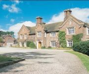
Dunsley Hall Hotel
Mount Hotel & Conference Centre
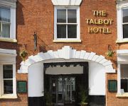
The Talbot Hotel
RAMADA PARK HALL HOTEL & CONFERENCE CTR
Mercure Wolverhampton Goldthorn Hotel
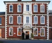
The York Hotel
Quality Hotel Wolverhampton
Ely House Hotel
Britannia Wolverhampton
Holiday Inn WOLVERHAMPTON - RACECOURSE
Videos from this area
These are videos related to the place based on their proximity to this place.
Thai Banana Leaf Kingswinford
Thai Banana Leaf Thai restaurant kingswinford Birmingham. Great Thai Food to eat in or take away. Video advert by pro business photos contact http://www.probusinessphotos.co.uk we can help...
kingswinford railway walk to south staffordshire railway walk
kingswinford and Pensnett railway walk to southstaffordshire railway walk http://www.kingswinford.org/ http://www.sstaffs.gov.uk/default.aspx?page=14875 http://www.dudley.gov.uk/environment--plann.
Bar South, Kingswinford - 20th September 2008
apologies for the poor quality, but you'll get the idea :-)
Mbrick Productions 2 Year Anniversary Special (MMCE9)
When I created this account, I never expected to be making videos two years on. I could have not have done it without my subscribers, friends and everyone else who has ever watched my videos,...
Glassmaking -- Cane Pulling - Peter Holmes at Broadfield House Museum - June 2010.
Glassmaking -- Cane Pulling - Peter Holmes at Broadfield House Museum - June 2010. Peter giving a demonstration at the glasshouse attached to Broadfield House Museum, Dudley, UK, ably...
Original Paintings Of Himley Hall Park By Roger Turner
Set in the grounds of Himley Hall, Himley Park was created in the 1970s and is now visited by over 200000 visitors each year. It features a large lake and h...
CUSTOM & CLASSIC CAR & TRUCK SHOW NASSA 11
EARLY MORNING ARRIVALS AT THE NASSA 11CUSTOM & CLASSIC CAR & TRUCK SHOW.
Llandegla Northshore Ski Jump - Ninette Nukeproof Mega Pro Am October 2012
Llandegla Northshore Ski Jump - Ninette on a Nukeproof Mega Pro Am October 2012.
Videos provided by Youtube are under the copyright of their owners.
Attractions and noteworthy things
Distances are based on the centre of the city/town and sightseeing location. This list contains brief abstracts about monuments, holiday activities, national parcs, museums, organisations and more from the area as well as interesting facts about the region itself. Where available, you'll find the corresponding homepage. Otherwise the related wikipedia article.
Himley Hall
Himley Hall is a country house situated in Staffordshire, England. It is situated in the south of the county in the small village of Himley, near to the town of Dudley and the city of Wolverhampton.
Himley railway station
Himley was a station on the Wombourne Branch Line. Unlike other stops along the route, it was deemed worthy of full station status. It was opened by the Great Western Railway in 1925 and closed in 1932. It served the community around Himley Hall. A picnic area now stands on the site of the station. Preceding station Disused railways Following station Wombourn Great Western Railway Gornal Halt
Wombourn railway station
Wombourn railway station was the main intermediate station on the Wombourne Branch Line, situated at the Bratch. It was opened by the Great Western Railway in 1925 and closed in 1932. It was a grandiose affair with a goods yard and many station amenities. This, however, didn't stop poor patronage which led to the station's closure a mere seven years after opening. It remained in use for freight traffic until the line passing through the station was closed on 24 June 1965.
Ounsdale High School
Ounsdale High School is an 11-18 mixed comprehensive secondary school located in Wombourne, Staffordshire, England. It is situated on Ounsdale Road in the west of the village, and stands on an adjacent site to the local leisure centre. It also has a sixth form for 16-19 year olds, which has a recently built 6th form centre which was opened by the pop star Beverly Knight. In September 2002, the school was granted specialist school status as an Arts College.
Holbeche House
Holbeche House (also, in some texts, Holbeach or Holbeache) is a mansion located approximately 1 mile north of Kingswinford, now in the Metropolitan Borough of Dudley but historically in Staffordshire. Some of the main protagonists in the Gunpowder Plot were either killed or captured at Holbeche House in 1605.
Wom Brook
The Wom Brook is a stream/brook located within South Staffordshire, England. It flows through the large village of Wombourne, and has played an important part in its industrial history. It is an important tributary of the River Smestow and part of the Severn catchment.
Himley Cricket Club Ground
Himley Cricket Club Ground is a cricket ground in Himley, Staffordshire. The first recorded match on the ground was in 1889, when Himley played Tividale. A combined Minor Counties team has used the ground for 4 first-class matches, the first of which came in 1959 against the touring Indians. The last first-class match held on the ground came in 1972 and saw the Minor Counties play the touring Australians. The ground hosted a single match in the 1986 ICC Trophy between Kenya and Malaysia.
Trysull & Seisdon
Trysull & Seisdon is a conjoined civil parish in the South Staffordshire District, in the county of Staffordshire, England. It is in the lowest tier of local government below districts and counties. It is both an administrative parish, and an ecclesiastical parish formed from the two historic villages of Trysull and Seisdon.


