Safety Score: 3,0 of 5.0 based on data from 9 authorites. Meaning we advice caution when travelling to United Kingdom.
Travel warnings are updated daily. Source: Travel Warning United Kingdom. Last Update: 2024-04-26 08:02:42
Delve into Haringey
The district Haringey of Harringay in Greater London (England) is a subburb in United Kingdom a little north of London, the country's capital town.
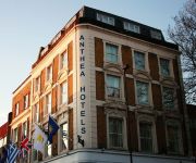
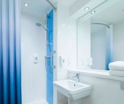
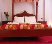
If you need a hotel, we compiled a list of available hotels close to the map centre further down the page.
While being here, you might want to pay a visit to some of the following locations: Wood Green, Hackney, Islington, Walthamstow and Enfield Town. To further explore this place, just scroll down and browse the available info.
Local weather forecast
Todays Local Weather Conditions & Forecast: 10°C / 50 °F
| Morning Temperature | 3°C / 37 °F |
| Evening Temperature | 11°C / 51 °F |
| Night Temperature | 7°C / 44 °F |
| Chance of rainfall | 0% |
| Air Humidity | 48% |
| Air Pressure | 1004 hPa |
| Wind Speed | Gentle Breeze with 7 km/h (4 mph) from West |
| Cloud Conditions | Broken clouds, covering 77% of sky |
| General Conditions | Broken clouds |
Saturday, 27th of April 2024
8°C (46 °F)
9°C (47 °F)
Light rain, gentle breeze, overcast clouds.
Sunday, 28th of April 2024
10°C (49 °F)
6°C (43 °F)
Light rain, moderate breeze, overcast clouds.
Monday, 29th of April 2024
14°C (58 °F)
9°C (48 °F)
Sky is clear, gentle breeze, clear sky.
Hotels and Places to Stay
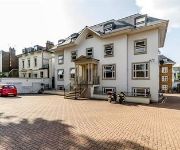
Windsor Holiday Apartments
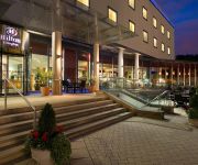
Hilton London Angel Islington
Go Native Camden
Crompton Court Serviced Apartments
Lodge Drive Serviced Apartments
Kadimah
Hotel Makedonia
TRAVELODGE LONDON EDMONTON
TRAVELODGE LONDON HACKNEY
Islington Inn
Videos from this area
These are videos related to the place based on their proximity to this place.
Video Postcard. LONDON. Lordship Rec to Bounds Green - pc01.
London - Over Lordship Recreation Ground towards Bounds Green. February 8th 2007. Video postcards in this series include: Barrowby, Denton, Little Ponton, Antons Gowt nr. Boston, Crowland,...
Rubbish Removal in London From Premier Waste
http://www.PremierWasteLondon.co.uk - Rubbish removal in London, house clearances, office clearances, garden clearance, builders waste, and more Premier Waste 79 Westbury Avenue, Wood ...
UK Buses in the mid-1980s (audio)
AUDIO RECORDING ONLY - no video! The eighth in a series of audios, where the pictures give an idea of what you are listening to throughout the recording. (The Leyland Leopard pictured is the...
Cleaning Prices London | 020 3322 8261 | Window Cleaning | Cleaners | Cleaning Company
http://www.fastwindowcleaninglondon.co.uk Cleaning Prices London 020 3322 8261. The Fast Window Cleaning is your perfect cleaning solutions. We offer superb cleaning services at affordable...
Cleaning Companies London | 020 3322 8261 | London | Window Cleaning | Cleaners | How To
http://www.fastwindowcleaninglondon.co.uk . Cleaning Companies London 020 3322 8261. The Fast Window Cleaning is known as a notable cleaning company in Londo...
Commercial Window Cleaner London | 020 3322 8261 | Window Cleaning Service | How To Clean
http://www.fastwindowcleaninglondon.co.uk . Commercial Window Cleaner London 020 3322 8261. The Fast Window Cleaning offers an astounding commercial window c...
Living Under One Sun - Doors
In the cold winter of 2013, in Tottenham, London, a team of thirteen local residents were trained and employed by Living Under One Sun, supported by LB Haringey, to door knock 10000 homes...
Deltic 55022 Royal Scots Grey. Finsbury Park/Emirates Stadium/St Pancras. 2/6/12
Deltic ear blaster special. Finsbury Park-Emirates Stadium-Copenhagen & Gas Works tunnels-St Pancras. The Deltic engines drown out the noise from Arsenal's Emirates Stadium. Deltic thrashes...
Last 1967 Victoria Line Train
After 43 years in service the '67 stock Victoria Line trains are being replaced. 30th June 2011 was the last scheduled serviced, for two trips between Seven Sisters and Brixton. So we dispatched...
4M87 - Freightliner 70019 dragging 90016 west through South Tottenham Station 16/10/2013
Following a freight train derailment at Camden Road Station on the North London Line, a majority of freight trains were diverted along the Gospel Oak - Barking Line from Stratford to Gospel...
Videos provided by Youtube are under the copyright of their owners.
Attractions and noteworthy things
Distances are based on the centre of the city/town and sightseeing location. This list contains brief abstracts about monuments, holiday activities, national parcs, museums, organisations and more from the area as well as interesting facts about the region itself. Where available, you'll find the corresponding homepage. Otherwise the related wikipedia article.
Tottenham Green (ward)
Tottenham Green is an electoral ward within the London Borough of Haringey in Greater London, England. According to the 2001 Census, the population of Tottenham Green is around 12,000, in around 5,500 homes. Around 2,900 homes do not own a car. Just under 2,000 of the population are Muslims.
West Green railway station
West Green railway station was on the abandoned Palace Gates Line in North London. It was in West Green on the north side of West Green Road, west of the junction with Philip Lane, and near the Black Boy public house. The Great Eastern Railway opened it on 1 January 1878.
South Tottenham
South Tottenham is an area of the London Borough of Haringey, North London.
Harringay Stadium
Harringay Stadium was a major greyhound racing and motorcycle speedway venue in Harringay, North London. It was built and opened in 1927 and closed in 1987.
Harringay Arena
Harringay Arena was a sporting and events venue on Green Lanes in Harringay, North London, England. Built in 1936, it lasted as a venue until 1958.
Municipal Borough of Tottenham
Tottenham was a local government district in north east Middlesex from 1850 to 1965. It was part of the London postal district and Metropolitan Police District. In 1850 a local board of health was established for the civil parish of Tottenham and in 1875 the local board became an urban sanitary authority, without change of name. The ancient parish had included Wood Green and in 1888 the district was divided, with Wood Green gaining its own local board.
New River (ward)
New River is a ward in the London Borough of Hackney and forms part of the Hackney North and Stoke Newington constituency. Consisting of an area of Stamford Hill the ward also incorporates the large council estate Woodberry Down currently under redevelopment. The ward returns three councillors to Borough Council, with elections every four years. At the previous election on 6 May 2010 Maureen Middleton; and Labour Party candidates Michael Jones and Sean Mulready were returned.
Lordship (ward)
Lordship is a ward in the London Borough of Hackney and area forms part of the Hackney North and Stoke Newington constituency. The ward returns three councillors to Hackney London Borough Council, with elections every four years. At the previous election on 6 May 2010 Bernard Aussenberg, and Labour Party candidates Edward Brown and Daniel Stevens, were returned. Turnout was 62%; with 4,803 votes cast. In 2001, Lordship ward had a total population of 11,288.
Bruce Grove
Bruce Grove is a ward in Tottenham, enclosed by Lordship Recreation Ground, Lordship Lane, Philip Lane, and the High Road. The Bruce Grove area of the Tottenham High Road has received a £1m grant from the Heritage Lottery Fund to restore the historic Victorian and Edwardian buildings to their original grandeur under the Bruce Grove Townscape Heritage Initiative (THI) project. Nearby Bruce Castle was named after Robert the Bruce of Scottish history.
St Ann's Road railway station
St Ann's Road railway station was opened by the Tottenham & Hampstead Junction Railway on 2 October 1882. It was at the corner of St Ann's Road and Seven Sisters Road in N15, in south west Tottenham, London. It comprised two wooden platforms, accessed by a footbridge and stairs, and a brick building.
The Salisbury
The Salisbury is a Grade II* listed pub on Grand Parade in Harringay, north London.
St Ann's Church, South Tottenham
St Ann's Church, South Tottenham is an Evangelical Anglican church in the St Ann's neighbourhood near South Tottenham, London, UK, a part of the Church of England. The current incumbent is the Reverend John M. Wood.
Getter's Talmud Torah
Getter's Talmud Torah also known as Beis Shlomo Cheder is an orthodox Jewish primary school in Stamford Hill, London. The school is associated with the Union of Orthodox Hebrew Congregations and caters for boys aged 3 to 13. The head of the school is Rabbi Menachem Mendel Kahana, the Spinka Rebbe of London.
Chestnuts Park
Chestnuts Park is a park between West Green and the St. Ann's neighbourhood in the London Borough of Haringey. It is 5 hectares in size and is located on St. Ann's Road and Black Boy Lane, close to St. Ann's Hospital. The park contains a café, community centre and tennis courts, and has recently undergone renovation under the New Deal for Communities programme.
Downhills Park
Downhills Park is a 12 hectare park in the West Green area of Haringey. It comprises an open recreation space and a managed garden area that includes a rose garden, tennis courts and basket-ball courts. The park had a bowling-green but this is no longer maintained or serviceable. In 2006 and 2007, it won Green Flag awards for maintaining excellent standards for public parks. There is a Sunday League football team named after the park who play in the Edmonton and District Sunday Football League.
Mecca Dance Hall Tottenham
For 94 years 415-419 High Road Tottenham, London, N17 was a leading North London entertainment venue. The building started life as a roller skating rink in 1910 but the following year was refitted as the Canadian Rink Cinema. In 1925 it was converted into a dance hall known as the Tottenham Palais and became a popular jazz venue.
South Hornsey
South Hornsey was a local government district in Middlesex, England from 1865 to 1900. The district was formed in 1865 when the Local Government Act 1858 was adopted in the southern part of the parish of Hornsey. South Hornsey Local Board was formed to govern the area. The majority of the district (172 acres) consisted of the Brownswood Park area south east of Finsbury Park.
The College of Haringey, Enfield and North East London
The College of Haringey, Enfield and North East London is a college of further and higher education, based over two centres in Tottenham and Enfield in North London, England. The college was created on 1 August 2009, as a result of a merger between Enfield College and The College of North East London.
Tottenham Outrage
The Tottenham Outrage is the name given to an armed robbery and double murder which took place in Tottenham, Middlesex and Walthamstow, Essex, on 23 January 1909, which was carried out by two anarchists, Paul Helfeld and Jacob Lepidus (sometimes spelt Lapidus), both Jewish immigrants from the Russian Empire. The "Outrage" became a cause célèbre in Edwardian London, with the route of the murdered policeman's funeral cortège being lined by a crowd of half a million people.
St Ann's Hospital
St Ann's Hospital is a hospital located opposite Chestnuts Park, on the border of West Green & Harringay in Haringey, north London. The hospital has until recently been largely a mental health care facility; however, it now also provides outpatient services, which include MRI and ophthalmological services. It also houses the headquarters for the Barnet, Enfield and Haringey Mental Health NHS Trust and formerly housed the Haringey NHS PCT.
Woodberry Down School
Woodberry Down Compehensive School was located off the Seven Sisters Road in the Manor House area of North London. The now defunct secondary school verges on three boroughs Hackney, Haringey and Islington. The school was opened in 1955, closing in 1981 when it was amalgamated with Clissold School and renamed Stoke Newington School. The new school was founded in 1982 in the building of the former Clissold School.
Lordship Recreation Ground
Lordship Recreation Ground is a public park in Tottenham, London Borough of Haringey. It is over 20 hectares in size. Access is from Lordship Lane and from opposite Downhills Park in Downhills Park Road. It stretches approximately 750m north-south. The River Moselle runs through the park from west to east. There is also a small lake. It opened in 1932, and includes a variety of recreational facilities, including tennis courts and a small theatre.
St Benet Fink Church, Tottenham
St Benet Fink, Tottenham is an Anglican church in Tottenham, London.
Bernie Grant Arts Centre
The Bernie Grant Arts Centre (BGAC) is a £15 million purpose-built multi-arts centre, which includes a 274-seat auditorium, studio/rehearsal space, café/bar, enterprise centre and open spaces. It is located next to the Town Hall in Tottenham, North London. The centre was designed by David Adjaye and opened in September 2007.
St Ignatius Church, Stamford Hill
St Ignatius Church in Stamford Hill, is a Roman catholic parish church in the Archdiocese of Westminster served by the Society of Jesus. It was founded by the Jesuits in 1894. It is situated on the corner of Tottenham High Road and St. Ann's Road in the London Borough of Hackney close to the border with Haringey, in north-west London.


