Safety Score: 3,0 of 5.0 based on data from 9 authorites. Meaning we advice caution when travelling to United Kingdom.
Travel warnings are updated daily. Source: Travel Warning United Kingdom. Last Update: 2024-04-26 08:02:42
Delve into Land Side
The district Land Side of in Wigan (England) is a subburb in United Kingdom about 170 mi north-west of London, the country's capital town.
If you need a hotel, we compiled a list of available hotels close to the map centre further down the page.
While being here, you might want to pay a visit to some of the following locations: Croft, Winwick, Warrington, Lymm and Partington. To further explore this place, just scroll down and browse the available info.
Local weather forecast
Todays Local Weather Conditions & Forecast: 10°C / 50 °F
| Morning Temperature | 3°C / 37 °F |
| Evening Temperature | 8°C / 46 °F |
| Night Temperature | 5°C / 42 °F |
| Chance of rainfall | 2% |
| Air Humidity | 56% |
| Air Pressure | 1006 hPa |
| Wind Speed | Gentle Breeze with 6 km/h (4 mph) from West |
| Cloud Conditions | Scattered clouds, covering 34% of sky |
| General Conditions | Light rain |
Saturday, 27th of April 2024
12°C (53 °F)
6°C (42 °F)
Broken clouds, gentle breeze.
Sunday, 28th of April 2024
8°C (46 °F)
5°C (42 °F)
Light rain, gentle breeze, overcast clouds.
Monday, 29th of April 2024
13°C (56 °F)
9°C (49 °F)
Light rain, gentle breeze, broken clouds.
Hotels and Places to Stay
pentahotel Warrington
Holiday Inn Express LEIGH - SPORTS VILLAGE
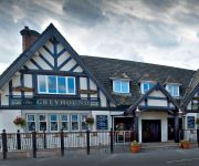
Greyhound Restaurant & Hotel
Holiday Inn WARRINGTON
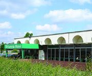
Britannia Bolton
TRAVELODGE WARRINGTON LOWTON
Warrington North East
Warrington (M6/J21)
J9) Warrington (A49/M62
Warrington Central North
Videos from this area
These are videos related to the place based on their proximity to this place.
Simon's Away Days - Leigh Sports Village
The first 'Away Day' of the year came in January as Simon visited Leigh Sports Village for the pre season friendly between Leigh Centurions and Wigan Warriors in Paul Prescott's Testimonial.
2010 Australian Universities Rugby League England Tour, Game 2
Relive the 2010 Australian Universities Rugby League England Tour, played between Australian Universities and Great Britain Students at Leigh Sports Village, December 8 2010. To find out more...
Leigh college vs Salford college - first half
After going a try behind in the first ten minutes Leigh college came back to finish the game 40-14 and are still unbeaten.
#CruTV Crusaders V Leigh friendly Review
CruTV spoke to head coach Anthony Murray and North Wales Crusaders player Karl Ashall, after the friendly game against Leigh Centurions. Leigh ran out as winners with a score of 42-22.
AirReal: Scotland - Fife
Footage from my trip to Fife - Scotland, Kelty, Benarty Hill, Lochore Meadows Country Park.
Carlease UK Video Blog | Chevrolet Spark | Car Leasing Deals
The Chevrolet Spark is one of the many fantastic car leasing deals available at http://carlease.uk.com If you are looking to lease a car or van, please feel free to visit our website and keep...
Carlease UK Video Blog | Peugeot 107 | Car Leasing Deals
The Peugeot 107 is one of the many fantastic car leasing deals available at http://www.carlease.uk.com If you are looking to lease a car or van, please feel free to visit our website and keep...
Health Walk 070512
Think Ahead Raising Stroke Awareness Week started with a health walk at Pennington Country Park organised by Active Living.
Videos provided by Youtube are under the copyright of their owners.
Attractions and noteworthy things
Distances are based on the centre of the city/town and sightseeing location. This list contains brief abstracts about monuments, holiday activities, national parcs, museums, organisations and more from the area as well as interesting facts about the region itself. Where available, you'll find the corresponding homepage. Otherwise the related wikipedia article.
Leigh (UK Parliament constituency)
Leigh is a constituency in Greater Manchester represented in the House of Commons of the UK Parliament since 2001 by Andrew Burnham of the Labour Party.
Pennington Flash Country Park
Pennington Flash Country Park is a 200-hectare country park located between Lowton and Pennington, Leigh in Greater Manchester, England. The flash is a 70-hectare lake created at the turn of the 20th century by coal mining subsidence, mainly from Bickershaw Colliery, and flooding. Now an extensive nature reserve with several bird hides and a network of tracks and footpaths, Pennington Flash Country Park is nationally renowned for its birdlife and is a classic example of natural regeneration.
Municipal Borough of Leigh
The Municipal Borough of Leigh was, from 1899 to 1974, a local government district of the administrative county of Lancashire, England, consisting of the townships of Pennington, Westleigh, Bedford and part of the township of Atherton and named after the ancient ecclesiastcal parish. The area contained the market town town of Leigh that served as its administrative centre until its dissolution in 1974. The borough council built Leigh Town Hall which was completed in 1907.
A572 road
The A572 is a main road serving the Greater Manchester and Merseyside areas, running from Swinton to St Helens via Leigh and Newton-le-Willows.
Red Rose Forest
Red Rose Forest is a partnership initiative of the twelve Community Forests in England and is the most urban of all the Community Forests. The project was started in 1991 and is expected to last 40 years, with the aim of involving communities in safeguarding and creating a woodland flora for the future, and helping preserve the fast disappearing flora of British woodlands.
Hilton Park (stadium)
Hilton Park was a multi-purpose stadium in Leigh, Greater Manchester, England. It was the home of Leigh Centurions rugby league club and Leigh Genesis F.C. association football club. It had a capacity of approximately 10,000. The stadium was demolished in February 2009.
Leigh Sports Village
Leigh Sports Village is a £50 million multi-use sports, retail and housing development in Leigh, Greater Manchester, England. Leigh Sports Village plays host to three of the town's sporting clubs. Amateur rugby league club, Leigh East and amateur athletics club, Leigh Harriers occupy dedicated facilities on the site. Leigh Centurions Rugby League club is resident at the 11,000 seater with standing terraces in the Tommy Sale Stand.
Wigan and Leigh College
Wigan and Leigh College is a state General Further and Higher Education College based at six locations in the towns of Wigan and Leigh in Greater Manchester, England, United Kingdom. Currently, there are over 1,000 staff members and more than 23,000 students. The college's programmes of study include: General Certificate of Education (GCSEs), Advanced Level (UK), National Diplomas, Higher National Diplomas and First Degrees.
Glaze Brook
The Glaze Brook, or River Glaze, is a minor river in Greater Manchester, England. The Glaze Brook drains a large area around Leigh and is formed at the outflow of Pennington Flash {{#invoke:Coordinates|coord}}{{#coordinates:53.4849|-2.5354|region:GB|||||| | |name= }} close to Aspull Common. Pennington Flash is fed by Hey Brook, a continuation of Nan Holes Brook, which runs eastwards from Ashton-in-Makerfield.
Atherleigh railway station
Atherleigh railway station served an area of Leigh in what was then Lancashire, England. It was located on the Bolton and Leigh Railway line which ran from Kenyon Junction to Bolton Great Moor Street Station.
Culcheth Methodist Church
Culcheth Methodist Church is located in the village of Culcheth, now a part of Warrington, England. The church building is located at the corner of Ellesmere Road and Burton Close near the village centre, a short walk from the village green.
Culcheth railway station
Culcheth Railway Station was a former railway station in Culcheth, Lancashire, later Cheshire, England.
Westleigh, Greater Manchester
Westleigh, a suburb of Leigh, Greater Manchester is one of three ancient townships, Westleigh, Bedford and Pennington, that merged in 1875 to form the town of Leigh.
Kenyon Junction railway station
Kenyon Junction was a junction railway station at Kenyon on the Liverpool and Manchester Railway and the Bolton and Leigh Railway near Culcheth in Warrington, England. It was situated within the historic county of Lancashire. The station opened in 1831 (as Bolton Junction) and closed to passengers on 2 January 1961 before closing completely on 1 August 1963. The junction fell out of use when the line serving Leigh was closed in 1969.
Pennington railway station
Pennington Station was a railway station at Pennington, Leigh, Greater Manchester, England on the Bolton and Leigh Railway. It was situated within the historic county of Lancashire. The station opened as Bradshaw Leach on the Kenyon and Leigh Railway in 1831 and Pennington Station closed in 1954. The line serving Leigh was closed in 1969.
Bedford, Greater Manchester
Bedford, a suburb of Leigh, Greater Manchester is one of three ancient townships, Bedford, Pennington and Westleigh, that merged in 1875 to form the town of Leigh. Bedford was historically in Lancashire.
Pennington, Greater Manchester
Pennington, a suburb of Leigh, Greater Manchester is one of six townships in the ancient ecclesiastical parish of Leigh, that with Westleigh and Bedford merged to form the town of Leigh in 1875. The township of Pennington covered most of Leigh's town centre.
Leigh Union workhouse
Leigh Union workhouse, also known as the Leigh workhouse and after 1930, Atherleigh Hospital, was a workhouse built in 1850 by the Leigh Poor Law Union on Leigh Road, Atherton in the historic county of Lancashire.
Parsonage Colliery
Parsonage Colliery was a coal mine operating on the Lancashire Coalfield in Leigh, then in the historic county of Lancashire, England. The colliery, close to the centre of Leigh and the Bolton and Leigh Railway was sunk between 1913 and 1920 by the Wigan Coal and Iron Company and the first coal was wound to the surface in 1921. {{#invoke:Footnotes|sfn}} For many years its shafts to the Arley mine were the deepest in the country.
St Peter's Church, Westleigh, Greater Manchester
St Peter's Church, Westleigh, is located in Firs Lane, Westleigh, a district of Leigh, Greater Manchester, England. It is an active Anglican parish church in the deanery of Leigh, the archdeaconry of Salford, and the diocese of Manchester. The church has been designated by English Heritage as a Grade II* listed building. It was designed by the Lancaster architects Paley and Austin.
Leigh Town Hall
Leigh Town Hall stands facing the parish church across the Civic Square at the junction with Market Street in Leigh, Greater Manchester, England. It was designed for Leigh Borough Council by J.C. Prestwich, who had an architectural practice in the town. Work began in 1904 and the building was opened in 1907. It was granted Grade II Listed status in 1987. Nicholas Pevsner described the building as "An exceptionally good building, expressive yet not showy".
Bedford Hall
Bedford Hall is a late medieval-house in Bedford, Leigh, Greater Manchester, England. It was leased to tenants by the Kighleys, absent lords of the manor of Bedford, and has been modified several times over the centuries becoming a farmouse and now two houses. It was one of a group of timber-framed medieval halls, including Morleys Hall in Astley, located to the north of Chat Moss. It is a Grade II Listed building.
St Mary's Church, Lowton
St Mary's Church is an Anglican parish church in Lowton. It is in the deanery of Winwick, the archdeaconry of Warrington, and the diocese of Liverpool.
St Joseph's Roman Catholic Church, Leigh
St Joseph's Church is an active Roman Catholic church on Chapel Street in Bedford, Leigh in Greater Manchester, England. It has been designated by English Heritage as a Grade II listed building.
Christ Church, Pennington
Christ Church is an active Anglican parish church in Pennington, Leigh, Greater Manchester, England. Christ Church serves the parish of Pennington in the Leigh Deanery and Salford Archdeaconry in the Diocese of Manchester. It is a Grade II listed building.


