Safety Score: 3,0 of 5.0 based on data from 9 authorites. Meaning we advice caution when travelling to United Kingdom.
Travel warnings are updated daily. Source: Travel Warning United Kingdom. Last Update: 2024-04-26 08:02:42
Discover Stockton Heath
Stockton Heath in Warrington (England) with it's 6,396 citizens is a place in United Kingdom about 165 mi (or 265 km) north-west of London, the country's capital city.
Current time in Stockton Heath is now 12:15 AM (Saturday). The local timezone is named Europe / London with an UTC offset of one hour. We know of 9 airports near Stockton Heath, of which 5 are larger airports. The closest airport in United Kingdom is Liverpool John Lennon Airport in a distance of 12 mi (or 19 km), West. Besides the airports, there are other travel options available (check left side).
There are several Unesco world heritage sites nearby. The closest heritage site in United Kingdom is Pontcysyllte Aqueduct and Canal in a distance of 31 mi (or 50 km), South-West. Also, if you like playing golf, there are a few options in driving distance. If you need a hotel, we compiled a list of available hotels close to the map centre further down the page.
While being here, you might want to pay a visit to some of the following locations: Appleton, Warrington, Stretton, Croft and Daresbury. To further explore this place, just scroll down and browse the available info.
Local weather forecast
Todays Local Weather Conditions & Forecast: 10°C / 50 °F
| Morning Temperature | 3°C / 37 °F |
| Evening Temperature | 8°C / 47 °F |
| Night Temperature | 5°C / 41 °F |
| Chance of rainfall | 2% |
| Air Humidity | 57% |
| Air Pressure | 1003 hPa |
| Wind Speed | Gentle Breeze with 5 km/h (3 mph) from West |
| Cloud Conditions | Scattered clouds, covering 41% of sky |
| General Conditions | Light rain |
Saturday, 27th of April 2024
12°C (54 °F)
6°C (43 °F)
Broken clouds, gentle breeze.
Sunday, 28th of April 2024
8°C (46 °F)
5°C (41 °F)
Light rain, gentle breeze, overcast clouds.
Monday, 29th of April 2024
13°C (55 °F)
9°C (49 °F)
Light rain, gentle breeze, broken clouds.
Hotels and Places to Stay
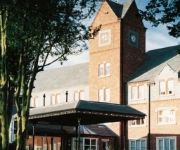
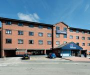
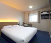
Amado Boutique Hotel
THE PARK ROYAL - QHOTELS
pentahotel Warrington
Daresbury Park
Happy Guests Lodge
VILLAGE WARRINGTON
Holiday Inn WARRINGTON
TRAVELODGE WARRINGTON
ibis budget Warrington Lymm Services
TRAVELODGE WARRINGTON LYMM SERVICES
Videos from this area
These are videos related to the place based on their proximity to this place.
GoKarting TeamSport - Warrington 26/04/2014
Footage from the karts last night. Top laugh! If you ever get chance, do it! Camera: GoPro Hero 3 - Black Edition 1080p - 60fps.
Warrington GoKarting Members 21/12/14
This was my first attempt with a GoPro Hero. The camera angle is a little low.
The old courtyards & passageways of Bridge Street, Warrington
In the mid-19th century the courtyards behind Bridge Street, Warrington, were home to hundreds of Irish immigrants. The yards were a notoriously bad place to live with tiny slum houses, little...
Piloxing Fitness in Warrington
Piloxing is an amazing new fitness craze and it's here at StagePro Studios in Warrington. http://www.stageproacademy.co.uk.
HD River Mersey In Warrington
Quick video shot close to the Warrington Rowing Club on the River Mersey in Warrington. To be honest it took me ages to find some decent water to take the Phantom over as the ground was pretty...
Approved Roofing Warrington
Approved Roofing, roofing specialist serving the whole of the North West from Warrington to Manchester and everywhere in between - visit our website at http://www.approvedroofing.info.
Car Valet Warrington Cheshire 07745 143664
http://www.youtube.com/watch?v=DMuftDqOBfI Car Valet Warrington Cheshire from the North West's leading car valeting company. * Car Valet Warrington * Warrington Car Valeting * Cheshire...
CPM Warrington Movember Reservoir Dogs
As part of the Movember 2013 fundraising efforts, our CPM Warrington Mo-Pack become "The Reservoir Dogs" in this Movember special edition video.
Trains at Warrington Bank Quay
Just a few trains on a very cold and rainy Warrington train station. Every train was delayed, people going to Glasgow Central on the pendolino had to wait 40 minutes for their train. My first...
Warrington Borough Council Culcheth Hall Drive
Warrington Development Management Committee discuss the planning application for land off Culcheth Hall Drive, Culcheth, Cheshire, WA3 4PX Full Planning - Proposed construction of 9 dwellings...
Videos provided by Youtube are under the copyright of their owners.
Attractions and noteworthy things
Distances are based on the centre of the city/town and sightseeing location. This list contains brief abstracts about monuments, holiday activities, national parcs, museums, organisations and more from the area as well as interesting facts about the region itself. Where available, you'll find the corresponding homepage. Otherwise the related wikipedia article.
Wilderspool
This article is about the district, see Wilderspool Stadium for the former stadium of Warrington Wolves. Wilderspool is a district of Warrington, England, located near the town centre. It consists of Wilderspool Causeway and the streets coming off it, the limits being the River Mersey into Stockton Heath (where it turns into London Road), Bridgefoot (near the town centre), and Centre Park.
Network Warrington
Network Warrington is a bus operator running a network of services within the Borough of Warrington, England and into the surrounding area, including Altrincham, Leigh, Earlestown and Northwich. The limited company "Warrington Borough Transport Ltd" (WBT) is wholly owned by Warrington Borough Council and makes Network Warrington one of the few remaining municipal bus companies in the United Kingdom today.
Wilderspool Stadium
Wilderspool Stadium is a rugby league stadium located in Warrington, England. The ground was Warrington RLFC's old ground before moving to the Halliwell Jones Stadium. It holds just over 9,000, after substantial decreases for crowd safety. It was their home for well over 100 years, and the move to new ground was widely considered long overdue; one of the stands was deemed unsafe, there was no disabled access, and seating for just over 500.
Bridgewater High School (Warrington)
Bridgewater High School is a state school located in Appleton, Warrington, Cheshire. The current headmaster is Mr. Tim Long, with Mrs Tracey Hatton and Mr Roger Parker as Deputy Headteachers.
County Borough of Warrington
The County Borough of Warrington was, from 1900 to 1974, a local government district centred on Warrington in the northwest of England. It was alternatively known as Warrington County Borough and the County of Warrington. The district was created in 1900 and was based upon the earlier Municipal Borough of Warrington, which had, in turn, been based on the older ancient borough of Warrington. This had received its charter in 1847.
St Thomas' Church, Stockton Heath
St Thomas' Church, Stockton Heath is in Stockton Heath, to the south of Warrington, Cheshire, England. The church is designated by English Heritage as a Grade II listed building, and is an active Anglican parish church in the diocese of Chester, the archdeaconry of Chester and the deanery of Great Budworth.
Battle of Warrington Bridge (1651)
The Battle of Warrington Bridge was a skirmish fought on 13 August 1651 between the invading Royalist Scottish army of Charles II and Parliamentary forces under the command of Major-General John Lambert. {{#invoke:Footnotes|sfn}}
Latchford railway station
Latchford railway station was a station in Latchford, Cheshire, England. The first station at Latchford was called Latchford and Grappenhall Road and opened in 1853; this was renamed Latchford in June 1854 but it closed in 1893, when a new alignment was opened in connection with the construction of the Manchester Ship Canal, and a new Latchford station was opened nearby. This closed to passengers on 10 September 1962.


