Safety Score: 3,0 of 5.0 based on data from 9 authorites. Meaning we advice caution when travelling to United Kingdom.
Travel warnings are updated daily. Source: Travel Warning United Kingdom. Last Update: 2024-04-25 08:17:04
Delve into Peover Superior
Peover Superior in Cheshire East (England) is located in United Kingdom about 153 mi (or 246 km) north-west of London, the country's capital town.
Current time in Peover Superior is now 07:55 PM (Thursday). The local timezone is named Europe / London with an UTC offset of one hour. We know of 8 airports close to Peover Superior, of which 5 are larger airports. The closest airport in United Kingdom is Manchester Airport in a distance of 8 mi (or 13 km), North-East. Besides the airports, there are other travel options available (check left side).
There are several Unesco world heritage sites nearby. The closest heritage site in United Kingdom is Pontcysyllte Aqueduct and Canal in a distance of 30 mi (or 49 km), South-West. Also, if you like playing golf, there are some options within driving distance. If you need a hotel, we compiled a list of available hotels close to the map centre further down the page.
While being here, you might want to pay a visit to some of the following locations: Mobberley, Mere, Ashley, Siddington and Ringway. To further explore this place, just scroll down and browse the available info.
Local weather forecast
Todays Local Weather Conditions & Forecast: 8°C / 46 °F
| Morning Temperature | 5°C / 40 °F |
| Evening Temperature | 7°C / 45 °F |
| Night Temperature | 4°C / 39 °F |
| Chance of rainfall | 3% |
| Air Humidity | 79% |
| Air Pressure | 1002 hPa |
| Wind Speed | Moderate breeze with 9 km/h (6 mph) from South-East |
| Cloud Conditions | Broken clouds, covering 63% of sky |
| General Conditions | Light rain |
Friday, 26th of April 2024
8°C (46 °F)
4°C (39 °F)
Light rain, gentle breeze, broken clouds.
Saturday, 27th of April 2024
8°C (46 °F)
3°C (38 °F)
Light rain, gentle breeze, overcast clouds.
Sunday, 28th of April 2024
10°C (50 °F)
4°C (39 °F)
Light rain, moderate breeze, overcast clouds.
Hotels and Places to Stay
Moss Wood
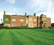
De Vere Cranage Estate PH Hotels
Laburnum Cottage Guest House
The Hinton Guest House
Cottons
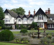
Mere Court Hotel
Bridge Farm Bed & Breakfast
Longview
TRAVELODGE KNUTSFORD TABLEY
ibis budget Knutsford
Videos from this area
These are videos related to the place based on their proximity to this place.
Dun Cow Dining Inn, Knutsford,Cheshire,WA168RH
The Duncow Dining Inn provides a slice of the country with a twist of creativity and flair, you are assured a real warm welcome, with unassuming friendly service. With our stylish homely...
A50 - Holmes Chapel to Knutsford - Front View with Rearview Mirror
The A50 runs from Leicester to Warrington, but originally ran to Hockliffe just north west of Luton. Between Stoke-on-Trent and the M1 near Nottingham, the A50 is a major dual carriageway,...
MERE COURT HOTEL
The Mere Court Hotel was originally built as a wedding present for the Dunkerley family in 1903 and has now been lovingly restored into a fine country house hotel. Standing in 7 acres of gardens...
Business Growth Advice in Cheshire East (FundingStore.com)
http://www.fundingstore.com/pro/business-consulting-john-redfern-business-doctors Running an SME? For expert support and strategic advice Click Here to contact John Redfern from Business Doctors ...
Nationwide Invoice Finance (FundingStore.com)
http://www.fundingstore.com/pro/invoice-finance-liam-baker-bibby-financial-services Bibby Financial Services is the UK's leading independent invoice finance specialist with nearly 30 years...
A535 - Chelford to Holmes Chapel - Rear View
The A535 runs for 6 miles (10km) from the A50 in Holmes Chapel in the South to Chelford on the A537 in the North. Apart from passing through pleasant Cheshire countryside, the A535 passes...
A535 - Holmes Chapel to Chelford - Rear View
The A535 runs for 6 miles (10km) from the A50 in Holmes Chapel in the South to Chelford on the A537 in the North. Apart from passing through pleasant Cheshire countryside, the A535 passes...
60009, Scarborough Flyer 2nd August
Union of South Africa hurries out of the darkness through Goostrey station heading back to Crewe. The strange colour tint is because I was trying the 'Night Vision' setting on the camera,...
A537 - Knutsford to Chelford - Front View
The A537 runs for just over 20 miles (32.5km) mainly through Cheshire, from the A50 in Knutsford in the west, to the A54 near Buxton in the Peak District, via the town of Macclesfield. The...
A537 - Knutsford to Chelford - Rear View
The A537 runs for just over 20 miles (32.5km) mainly through Cheshire, from the A50 in Knutsford in the west, to the A54 near Buxton in the Peak District, via the town of Macclesfield. The...
Videos provided by Youtube are under the copyright of their owners.
Attractions and noteworthy things
Distances are based on the centre of the city/town and sightseeing location. This list contains brief abstracts about monuments, holiday activities, national parcs, museums, organisations and more from the area as well as interesting facts about the region itself. Where available, you'll find the corresponding homepage. Otherwise the related wikipedia article.
St Luke's Church, Goostrey
St Luke's Church, Goostrey is in the village of Goostrey, Cheshire, England. It is designated by English Heritage as a Grade II* listed building. It is an active Anglican parish church in the diocese of Chester, the archdeaconry of Macclesfield and the deanery of Congleton. Its benefice is combined with that of St Peter, Swettenham.
Goostrey Primary School
Goostrey School is a Community Primary school situated in the centre of the village of Goostrey at the heart of rural Cheshire, England. Across from St Luke's Church, Goostrey is Goostrey Primary School which was originally a Church of England School. The earliest reference to a school in the Church records is in 1640 when it was repaired. It was then next to the north wall of the churchyard where the old vicarage now stands, in a house which was also used as the court house for Goostrey Manor.
St Lawrence's Church, Over Peover
St Lawrence's Church, Over Peover is in an isolated position approached by a lane in the civil parish of Peover Superior. The only other buildings nearby are Peover Hall and a farm. It lies some 3 miles south of the town of Knutsford, Cheshire, England). The church is designated by English Heritage as a Grade I listed building. The church is an active Anglican parish church in the diocese of Chester, the archdeaconry of Macclesfield and the deanery of Knutsford.
Peover Superior
Peover Superior is a civil parish in the unitary authority of Cheshire East and the ceremonial county of Cheshire, England. It is described as a Village surrounded by inhabited countryside by the Office of National Statistics Peover Superior is named after The Peover Eye river which forms one of the parish boundaries.
Colshaw Hall
Colshaw Hall is a large house in Peover Superior, Cheshire, England. It has been designated by English Heritage as a Grade II listed building. The house was built in 1903 and designed by the Chester architects Douglas and Minshull. It is constructed in red brick with stone dressings and a slate roof. It has two storeys plus an attic. Its architectural style is Tudor. It was extended and altered by Percy Worthington in 1907.
Radbroke Hall
Radbroke Hall is a former country house in the parish of Peover Superior, Cheshire, England. It was built between 1913 and 1917 for the Manchester businessman Claude Hardy, the architect being Percy Worthington. The house has been designated by English Heritage as a Grade II listed building. As of 2011 the house is in use as offices by Barclays Bank.
Blackden Hall
For the house with a similar name see Blackden Manor Blackden Hall is a country house to the northeast of the village of Goostrey, Cheshire, England. It dates from the later part of the 16th century, and there have been later alterations. It is constructed in timber framing and brick with plastered panels. The house is in two storeys with an attic, and has an L-shaped plan. Its main front has three bays and is gabled. The central bay of the first floor is jettied.
St.Oswald's Church, Padgate
St Oswald's Church is an active Roman Catholic church in the Padgate suburb of Warrington, Cheshire, England. The parish was founded by Benedictine monks from Ampleforth Abbey, it is now served by clergy from the Roman Catholic Archdiocese of Liverpool.


