Safety Score: 3,0 of 5.0 based on data from 9 authorites. Meaning we advice caution when travelling to United Kingdom.
Travel warnings are updated daily. Source: Travel Warning United Kingdom. Last Update: 2024-04-19 08:03:45
Touring Higher Whitley
Higher Whitley in Cheshire (England) with it's 270 residents is a town located in United Kingdom about 162 mi (or 261 km) north-west of London, the country's capital place.
Time in Higher Whitley is now 05:49 PM (Friday). The local timezone is named Europe / London with an UTC offset of one hour. We know of 9 airports nearby Higher Whitley, of which 5 are larger airports. The closest airport in United Kingdom is Liverpool John Lennon Airport in a distance of 11 mi (or 18 km), West. Besides the airports, there are other travel options available (check left side).
There are several Unesco world heritage sites nearby. The closest heritage site in United Kingdom is Pontcysyllte Aqueduct and Canal in a distance of 28 mi (or 45 km), South-West. Also, if you like the game of golf, there are several options within driving distance. Need some hints on where to stay? We compiled a list of available hotels close to the map centre further down the page.
Being here already, you might want to pay a visit to some of the following locations: Stretton, Appleton, Stockton Heath, Daresbury and Hartford. To further explore this place, just scroll down and browse the available info.
Local weather forecast
Todays Local Weather Conditions & Forecast: 12°C / 54 °F
| Morning Temperature | 8°C / 47 °F |
| Evening Temperature | 10°C / 51 °F |
| Night Temperature | 6°C / 42 °F |
| Chance of rainfall | 1% |
| Air Humidity | 67% |
| Air Pressure | 1018 hPa |
| Wind Speed | Moderate breeze with 12 km/h (7 mph) from South-East |
| Cloud Conditions | Scattered clouds, covering 46% of sky |
| General Conditions | Light rain |
Saturday, 20th of April 2024
11°C (53 °F)
6°C (43 °F)
Scattered clouds, gentle breeze.
Sunday, 21st of April 2024
8°C (47 °F)
7°C (45 °F)
Light rain, light breeze, overcast clouds.
Monday, 22nd of April 2024
8°C (46 °F)
8°C (47 °F)
Light rain, calm, overcast clouds.
Hotels and Places to Stay
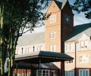
THE PARK ROYAL - QHOTELS
Amado Boutique Hotel
Daresbury Park
Happy Guests Lodge
VILLAGE WARRINGTON
Holiday Inn WARRINGTON
Warrington Centre
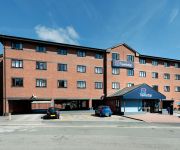
TRAVELODGE WARRINGTON
ibis budget Warrington Lymm Services
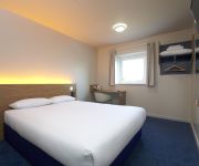
TRAVELODGE WARRINGTON LYMM SERVICES
Videos from this area
These are videos related to the place based on their proximity to this place.
Flamedro99's duel arena video
This is my first duel arena video, this video was initially made to see if i could edit, and i could! So please enjoy =P.
Etienne Chouard - Opinews 29 mai 2012
En savoir plus sur la démocratie directe avec tirage au sort : http://etienne.chouard.free.fr/Europe/index.php.
3 Bed Semi - Orchard Close, Barnton, Northwich - Agents4u Estate Agent
Three Bedroom Semi in Orchard Close, Barnton, Northwich, CW8 4SR. Offered for sale by Agents4u Estate Agent Northwich. Mark Butterworth Agents4u 01606 892333 www.agents4u.co.uk Agents4u ...
The ENGINEARS UK - Take it Easy (Eagles)
The Enginears UK Recorded at Appleton Thorn Village Hall May 2010.
M56 - North Cheshire Motorway - Time Lapse
A time lapse video of the entire length of the M56 motorway running from Manchester in the East, to just beyond Chester in the West, almost to the Welsh border, sped up 4 times - so it allows...
Lymm AC Juniors
For more information about Lymm AC Juniors visit http://lymmanglersclub.com/juniors.htm.
Marbury ward video
Cheshire West and Chester Council Members Cllr Malcolm Byram, Cllr Keith Wilson and Cllr Norman Wright discuss the Marbury Ward.
Green Camouflage Swim Brief
Presenting our green camouflage swim brief. This is a fantastic choice of men's swimwear for men who love the camouflaged look. This green Speedo is for men who want to look macho. Find out...
Videos provided by Youtube are under the copyright of their owners.
Attractions and noteworthy things
Distances are based on the centre of the city/town and sightseeing location. This list contains brief abstracts about monuments, holiday activities, national parcs, museums, organisations and more from the area as well as interesting facts about the region itself. Where available, you'll find the corresponding homepage. Otherwise the related wikipedia article.
M56 motorway
The M56 motorway, also known as the North Cheshire motorway, is in Cheshire and Greater Manchester, England. It runs from junction 4 of the M60 to Dunkirk, Cheshire and is 33.3 miles in length. It is often busy with long-distance commuter traffic towards North Wales. It serves commuters heading to Manchester particularly those from the wider Cheshire area and gives access to Manchester Airport from the national motorway network. The road forms part of the unsigned Euroroute E22.
Whitley, Cheshire
Whitley is a civil parish in the unitary authority of Cheshire West and Chester and the ceremonial county of Cheshire, England. It is surrounded by the parishes of Antrobus, Comberbach, Little Leigh and Dutton. It also borders Daresbury in Halton borough as well as Hatton and Stretton in Warrington borough. The civil parish was created in 1936 based on Whitley Inferior and Whitley Superior, now known as Lower Whitley and Higher Whitley.
Little Leigh
Little Leigh (formerly Leigh-juxta-Bartington) is a civil parish and village within the unitary authority of Cheshire West and Chester and the ceremonial county of Cheshire, England. It is situated on high ground on the north bank of the River Weaver; it is approximately 2 miles north of Weaverham on the A533 road and about three miles north west of Northwich.
St Luke's Church, Lower Whitley
St Luke's Church, Lower Whitley, is in the village of Lower Whitley, in the civil parish of Whitley, Cheshire, England. The church is designated by English Heritage as a Grade II* listed building. It is an active Anglican parish church in the diocese of Chester, the archdeaconry of Chester and the deanery of Great Budworth. Its benefice is combined with those of St Peter, Aston, St Mark, Antrobus, and St Michael and All Angels, Little Leigh.
St Michael and All Angels Church, Little Leigh
St Michael and All Angels Church, Little Leigh, is in the village of Little Leigh, Cheshire, England. The church is designated by English Heritage as a Grade II listed building. It is an active Anglican parish church in the diocese of Chester, the archdeaconry of Chester and the deanery of Great Budworth. Its benefice is united with those of St Peter, Aston, St Mark, Antrobus, and St Luke, Lower Whitley.
St Matthew's Church, Stretton
St Matthew's Church, Stretton is in the village of Stretton, Cheshire, England. The church is designated by English Heritage as a Grade II listed building. It is an active Anglican parish church in the diocese of Chester, the archdeaconry of Chester and the deanery of Great Budworth. Its benefice is combined with that of St Cross, Appleton Thorn.
Cogshall Hall
Cogshall Hall is a country house near the village of Comberbach, Cheshire, England. It was built in about 1830 for Peter Jackson. A kitchen wing was added to the rear during the early 20th century. It is constructed in red-brown brick, and has a slate hipped roof. It is rectangular in plan, and has two storeys. Its architectural style is Georgian. The entrance front has five bays and an Ionic portico. There is a similar, smaller portico on the right side.
Higher Whitley
Higher Whitley is a village in Cheshire, England. Together with Lower Whitley, it is a part of the civil parish of Whitley, situated in the unitary authority of Cheshire West and Chester.


