Safety Score: 3,0 of 5.0 based on data from 9 authorites. Meaning we advice caution when travelling to United Kingdom.
Travel warnings are updated daily. Source: Travel Warning United Kingdom. Last Update: 2024-04-29 08:03:39
Discover Oakwood
The district Oakwood of in England is a district in United Kingdom a little north of London, the country's capital city.
Looking for a place to stay? we compiled a list of available hotels close to the map centre further down the page.
When in this area, you might want to pay a visit to some of the following locations: Enfield Town, Wood Green, Potters Bar, Hendon and Camden Town. To further explore this place, just scroll down and browse the available info.
Local weather forecast
Todays Local Weather Conditions & Forecast: 16°C / 61 °F
| Morning Temperature | 7°C / 45 °F |
| Evening Temperature | 14°C / 56 °F |
| Night Temperature | 10°C / 49 °F |
| Chance of rainfall | 1% |
| Air Humidity | 63% |
| Air Pressure | 1011 hPa |
| Wind Speed | Moderate breeze with 11 km/h (7 mph) from North-West |
| Cloud Conditions | Clear sky, covering 4% of sky |
| General Conditions | Light rain |
Wednesday, 1st of May 2024
16°C (60 °F)
11°C (51 °F)
Light rain, moderate breeze, overcast clouds.
Thursday, 2nd of May 2024
14°C (57 °F)
12°C (54 °F)
Moderate rain, moderate breeze, overcast clouds.
Friday, 3rd of May 2024
8°C (47 °F)
9°C (48 °F)
Light rain, moderate breeze, overcast clouds.
Hotels and Places to Stay
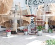
Novotel London Heathrow Airport T1 T2 and T3(Opening Feb 2018)
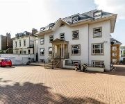
Windsor Holiday Apartments
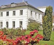
West Lodge Park A Beales Hotel
Royal Chace
Bay Tree House B&B
Lodge Drive Serviced Apartments
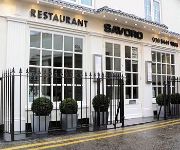
Savoro Restaurant with Rooms
Crompton Court Serviced Apartments
Crompton House Serviced Apartments
Beaconsfield Apartments
Videos from this area
These are videos related to the place based on their proximity to this place.
Jasełka, Enfield, Londyn, UK, Kaplica sióstr nazaretanek by ZOOM TV Daniel Cichy
ZOOM TV Daniel Cichy Professional Photography & Videography Services London www.danielcichy.co.uk photo@danielcichy.co.uk 07895636956.
Enfield Riot
Following Mark Duggan's allegedly unlawful killing in London in August 2011, a riot broke out in Tottenham. Violence, rioting and looting escalated across London and the wider country. Here...
Wedding DJ Gary Scott At The Royal Chace Hotel Enfield London
Wedding DJ @ The Royal Chace Hotel London. Find Out more About Booking A Mobile Disco visit http://www.themobiledisco.com/Royal_Chace_Hotel_Gary_Scott_Mobile_Disco.html Call 01992 ...
Beds Enfield-Call 020 8882 8292 for beds
http://www.vicsmithbeds.co.uk Vic Smith Beds 4-5 Dennis Parade Winchmore Hill Rd Southgate N14 6AA 020 8882 8292 If you are looking for beds in Enfield go to Vic Smith Beds in Southgate,...
Trent Park
In 1973 Trent Park was opened to the public as a country park, which surrounds the university campus and is 320 hectares in area.[4] The country park includes publicly accessible countryside,...
Blood on the Cat's Neck (2002)
Video from the 2002 BAPA (Middlesex University) theatre production of R.W. Fassbinder's 'Blood on the Cat's Neck'. Director: Jorge Balça Video by: Sónia Rodrigues Cast: Lisa Benson - Phoebe...
Oakwood Trains Buses At Night
Oakwood Piccadilly Line station, mostly as seen on a Sunday evening (5pm / 17:00 in December is after nightfall). The platform views include a accessibility lift. Also seen is the inside...
Panasonic GH4 Slow Motion Feature
One of the really nice features on the Panasonic GH4 is the Variable Frame Rate. The GH4 supports frame rates as high as 96fps at full HD resolution, meaning you can achieve a slow motion effect...
BNSF Horsethief Bridge N Scale model railroad
Now moved into new house (across London) and re-roofed the train shed! A quick Iphone video showing scenic progress - still much to do. 4449 running down the gorge as she often does in real...
Swamp Rolling + GoPro Testing
Rolling my Jackson Karma Large @ the Pool, only problem is Ive left my Spray Deck @ Home so im rolling a waterlogged boat. Im also testing out my New GoPro HD Hero 3 Black Edition fitted to...
Videos provided by Youtube are under the copyright of their owners.
Attractions and noteworthy things
Distances are based on the centre of the city/town and sightseeing location. This list contains brief abstracts about monuments, holiday activities, national parcs, museums, organisations and more from the area as well as interesting facts about the region itself. Where available, you'll find the corresponding homepage. Otherwise the related wikipedia article.
Piccadilly line
The Piccadilly line is a line of the London Underground, coloured dark blue on the Tube map. It is the fourth busiest line on the Underground network on the basis of the number of passengers transported per year with 210,000,000. It is mainly a deep-level line, running from the north to the west of London via Zone 1, with a number of surface sections, mostly in its westernmost parts. Of the 53 stations served, 25 are underground.
London Borough of Barnet
The London Borough of Barnet is a London borough in North London, England, forming part of Outer London. It is the second largest London borough by population with 331,500 inhabitants and covers an area of 86.74 square kilometres . It borders Hertfordshire to the north and five other London boroughs: Harrow and Brent to the west, Camden and Haringey to the south-east and Enfield to the east. The borough was formed in 1965 from parts of the counties of Middlesex and Hertfordshire.
Trent Park
Trent Park is an English country house, together with its former extensive grounds, in the north of London, United Kingdom. The original great house and a number of statues and other structures located within the grounds (such as the Orangery) are Grade II listed buildings. The site is designated as Metropolitan Green Belt, lies within a conservation area, and is also included within the Register of Parks and Gardens of Special Historic Interest in England.
Museum of Domestic Design and Architecture
The Museum of Domestic Design and Architecture (MoDA) is a museum in North London, England, housing one of the most comprehensive collections of 19th- and 20th-century decorative arts for the home. The collections include the Silver Studio collection of wallpapers and home textiles and the Crown Wallpaper Archive among others. The museum is part of Middlesex University.
Hornsey College of Art
Hornsey College of Art (aka Hornsey School of Art) is a former college centred on Crouch End in the London Borough of Haringey, England. Founded in 1880, it became Hornsey College of Arts and Crafts in 1955 and later part of Middlesex University.
Grovelands Park
Grovelands Park is a public park in Southgate and Winchmore Hill, London, that originated as a private estate.
Enfield Southgate (UK Parliament constituency)
Enfield, Southgate is a constituency represented in the House of Commons of the UK Parliament since 2005 by David Burrowes, a Conservative.
Oak Hill Theological College
Oak Hill College is a theological college located on Chase Side in Southgate, London, England. It is one of the largest seminaries in the UK.
East Barnet Urban District
East Barnet was a local government district in south Hertfordshire from 1863 to 1965 around the town of East Barnet. The district was created under the Local Government Act 1858 on September 25, 1863, as East Barnet Valley Local Government District. The district was governed by a local board. Apart from the parish of East Barnet, the local board's area included surrounding areas of the parishes of Chipping Barnet in Hertfordshire and Enfield, Monken Hadley and South Mimms in Middlesex.
Trent School Cockfosters
Trent School Cockfosters is a single-form, Church of England primary school serving the Cockfosters, New Barnet and Enfield towns in the northern suburbs of London, England. Although it is a voluntary aided school, it is part of the London Borough of Barnet school system. The school has a Reception class and provides education through to Year 6. The school is known for academic excellence and for its close links with Christ Church Cockfosters.
Syro-Malabar Catholic Church of London
Syro-Malabar Catholic Church of London is a church in Arnos Grove, North London. It is part of the Syro-Malabar Catholic Church, the largest denomination of the Saint Thomas Christians, based mainly in India. It is estimated that there are 55,000 Indian Catholics in the UK. The church in London was first established in 2002 by the initiative of Fr. Biju john Kochuparampil, and was officially recognised by the three Catholic Dioceses in 2005. The new Coordinator of the church is Rev. Dr.
A111 road (England)
The A111 is an A road in London, England. It runs from Palmers Green to Potters Bar.
Salcombe Preparatory School
Salcombe Preparatory School is a co-educational preparatory school for approximately 200 pupils, located in Southgate, London, UK. The school is currently owned and operated by Cognita. Founded in 1918, Salcombe is a co-educational preparatory day school for children aged between 3 and 11. The school is situated on two neighbouring sites in Southgate, North London. Salcombe has a tradition of success in preparing children for selective maintained and independent schools at 11+.
World's End, Enfield
World's End is an area in the London Borough of Enfield, southwest of Enfield Town around Grange Park.
Highlands Hospital
Highlands Hospital was a hospital in Winchmore Hill, in the London Borough of Enfield. The hospital closed in 1993, and the site was developed for residential accommodation, although many of the original buildings remain. The site is designated a conservation area and the former ambulance station is a grade II listed building.
The Abbey Arts Centre
The Abbey Arts Centre is located at 89 Park Road, New Barnet, Hertfordshire EN4 9QX, England. It was originally owned by William Ohly, an art dealer who ran the Berkeley Galleries in Davies Street, London. The Abbey attracted many expatriate Australian artists to its doors during the post war years 1947 - 1951. It became an early base of operations for artists, trying to gain a foothold in London's contemporary art industry.
Southgate Hockey Club
Southgate Hockey Club is a field hockey based at Southgate Hockey Centre in Trent Park, near Oakwood. The men's 1st XI play in the England Hockey League Men's Premier Division for 2012/13. The club has 9 mens sides, 5 ladies sides and a large junior section.
Southgate Hockey Centre
Southgate Hockey Centre is a sports ground in Trent Park in North London, near Oakwood. The Centre is home to Southgate Hockey Club and Trent Park Running Club. It has two artificial grass pitches (one water, one sand), and a grass area (which can fit 3 football pitches). The clubhouse building contains a fitness room and a steam room, as well as changing rooms.
John Walker's Ground
The Walker Ground, Southgate is a cricket ground in Southgate, London. The ground was first used by the Middlesex 1st XI as long ago as 1859, but had to wait until 1991 for its next county match, and until 1998 to become a regular Middlesex venue.
Enfield Old Park
Enfield Old Park was an ancient game reserve located in what is now Enfield, in north London. It is mentioned in the Domesday Book. Today much of the Park is built over as part of the suburb of Grange Park.
St Thomas's Church, Oakwood
St Thomas's Church, Oakwood, London N14, is an Anglican church in the Enfield Deanery of the Diocese of London. It is located in Prince George Avenue in the Oakwood area of the London Borough of Enfield, England.
Oak Hill Wood
Oak Hill Wood is a 10 hectare Local Nature Reserve and a Site of Borough Importance for Nature Conservation Grade I, in East Barnet, London. It is owned by the London Borough of Barnet and managed by the London Wildlife Trust. It is an ancient woodland, dominated by pedunculate oak, hornbeam and ash. A shrub layer includes hawthorns, field maples and wild service trees, and among the ground flora are bluebells and wood anenomes.
Oak Hill Park (Barnet)
Oak Hill Park is in East Barnet in the London Borough of Barnet. It is one of Barnet's premier parks and received a Green Flag Award for 2009-10. It is a large area of parkland with a wide range of facilities, including an outdooor gym, a bowls green, football pitches, a golf course, three tennis courts, a multi-sports court and a play area for toddlers. Oak Hill Woods dates back to at least the eleventh century, when it was owned by the church.
Belmont Open Space, Cockfosters
Belmont Open Space is a one hectare public park and Site of Local Importance for Nature Conservation in Cockfosters in the London Borough of Barnet. It is a small, mainly grass area, behind local residential streets. It has a fair number of wild flowers, such as garlic mustard and cow parsley. Mature trees include oaks and horse chestnuts. The local RSPB has recorded an impressive list of birds, including green, great spotted and lesser spotted woodpeckers, sparrowhawks, and blackcaps.
New Southgate Cemetery
New Southgate Cemetery is a 22 hectare cemetery in New Southgate in the London Borough of Barnet. It was established by the Colney Hatch Company in the 1850s and became the Great Northern London Cemetery, with a railway service running from near Kings Cross station to a dedicated station at the cemetery, similar to the service of the London Necropolis Company to Brookwood Cemetery in Surrey. The railway service to Great Northern London Cemetery soon closed, but the cemetery has remained open.


