Safety Score: 3,0 of 5.0 based on data from 9 authorites. Meaning we advice caution when travelling to United Kingdom.
Travel warnings are updated daily. Source: Travel Warning United Kingdom. Last Update: 2024-04-28 08:22:10
Explore Roddlesworth
Roddlesworth in Lancashire (England) is a city in United Kingdom about 181 mi (or 292 km) north-west of London, the country's capital.
Local time in Roddlesworth is now 02:45 PM (Sunday). The local timezone is named Europe / London with an UTC offset of one hour. We know of 10 airports in the vicinity of Roddlesworth, of which 5 are larger airports. The closest airport in United Kingdom is Blackpool International Airport in a distance of 21 mi (or 34 km), West. Besides the airports, there are other travel options available (check left side).
There are several Unesco world heritage sites nearby. The closest heritage site in United Kingdom is Pontcysyllte Aqueduct and Canal in a distance of 52 mi (or 84 km), South. Also, if you like golfing, there are multiple options in driving distance. If you need a place to sleep, we compiled a list of available hotels close to the map centre further down the page.
Depending on your travel schedule, you might want to pay a visit to some of the following locations: Blackburn, Chorley, Haigh, Bolton and Wigan. To further explore this place, just scroll down and browse the available info.
Local weather forecast
Todays Local Weather Conditions & Forecast: 4°C / 38 °F
| Morning Temperature | 3°C / 37 °F |
| Evening Temperature | 6°C / 43 °F |
| Night Temperature | 3°C / 37 °F |
| Chance of rainfall | 16% |
| Air Humidity | 98% |
| Air Pressure | 1003 hPa |
| Wind Speed | Moderate breeze with 10 km/h (6 mph) from East |
| Cloud Conditions | Overcast clouds, covering 100% of sky |
| General Conditions | Rain and snow |
Monday, 29th of April 2024
11°C (52 °F)
8°C (47 °F)
Light rain, fresh breeze, overcast clouds.
Tuesday, 30th of April 2024
14°C (57 °F)
9°C (49 °F)
Light rain, fresh breeze, overcast clouds.
Wednesday, 1st of May 2024
14°C (58 °F)
10°C (50 °F)
Light rain, gentle breeze, overcast clouds.
Hotels and Places to Stay
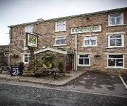
Millstone
Best Western Plus Samlesbury
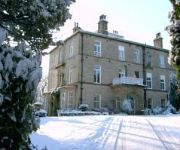
Astley Bank Hotel
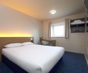
TRAVELODGE BLACKBURN M65
J4) Blackburn South (M65
Blackburn Town Centre
Videos from this area
These are videos related to the place based on their proximity to this place.
St Joseph's Scholars & St Matthew's Pupils, Blackburn (1905)
This film is part of the Mitchell and Kenyon collection - an amazing visual record of everyday life in Britain at the beginning of the twentieth century. To buy the DVD click here - http://www.bf...
Wolves v Blackburn - Doyle's penalty miss and Wards finish from the stands - 13/08/2011 Ewood Park
Doyle's penalty miss and Wards finish from the Wolves away end, the wolves fans sure know how to celebrate a good finish!
Wayne Rooney Pen vs Blackburn 2011 19th Title Winning Goal
Historic Pen against Blackburn. This goal secured Manchester United's 19th Title on the 14/05/2011.
The Beauty of Rivington & Anglezarke
Lancshire's scenic gems, these areas attract thousands of visitors to enjoy the delights of stunning views and amazing wildlife. Everthing from Deer, foxes and squirrels to a huge variety of...
my walk on darwen moors on the 26th September 2014
two days after my birthday (24th) thought id go for a walk on darwen moors and try out my new mono pod and new camera that iv had for a month to try out & get used to . also was sum graffiti...
Mountain biking / sky larks on Darwen Moors 18th March 2015
via YouTube Capture Filmed on iPhone 4s The other day I went for a ride on my Bike to give it a good ride round Darwen moors And to the other side of the moors and down the main rd to vaughns...
Premium Listing: 'Lowood', Hawkshaw Avenue, Darwen
Ainsworth Lord Estates are thrilled to offer for sale ' Lowood ' let me show you around, believe me you will not be disappointed... On arrival at the property, you immediately notice how well...
Snowing in Darwen Thursday morning 26th March 2015
via YouTube Capture filmed on iPad March as known as mad March yet again Darwen n maybe parts of Lancashire wakes up to snow !
Videos provided by Youtube are under the copyright of their owners.
Attractions and noteworthy things
Distances are based on the centre of the city/town and sightseeing location. This list contains brief abstracts about monuments, holiday activities, national parcs, museums, organisations and more from the area as well as interesting facts about the region itself. Where available, you'll find the corresponding homepage. Otherwise the related wikipedia article.
Abbey Village Reservoir
The reservoir north of Abbey Village on the River Roddlesworth - name unknown - is the latest addition to the reservoirs around this small Lancashire village, designed to increase water storage capacity in wet years.
Great Hill
Great Hill is a hill in Lancashire on Anglezarke Moor, between the towns of Chorley and Darwen. It is part of the West Pennine Moors and lies approximately 3 miles north of Winter Hill, which is the highest point in the area at 456 m (1,498 ft). The summit at 381 m (1,252 ft) is only slightly higher than the surrounding moorland, but provides excellent views in all directions particularly to the north and west.
Hollinshead Hall
Hollinshead Hall was a manor house close to the village of Tockholes, Lancashire. It is unclear whether the hall was originally the manor house of Tockholes, or if Hollinshead was indeed a manor in its own right alongside Tockholes and Livesey. The ruins of the hall are situated approximately 2 miles south of the village. The main features of the site consist of the ruins of the late 18th century hall and Gardens, and the associated barn and stables.
Upper Roddlesworth Reservoir
Upper Roddlesworth Reservoir is a reservoir on the River Roddlesworth near Abbey Village in Lancashire. The reservoir is close to Lower Roddlesworth Reservoir and Rake Brook Reservoir and sits within dense woodland.
Lower Roddlesworth Reservoir
Lower Roddlesworth Reservoir is a reservoir on the River Roddlesworth close to Abbey Village in Lancashire. The reservoir is close to Upper Roddlesworth Reservoir and Rake Brook Reservoir, situated within thick forest.
Rake Brook Reservoir
Rake Brook Reservoir is a reservoir fed by two streams, including the eponymous Rake Brook, a tributary of the River Roddlesworth in Lancashire. The reservoir is adjacent to the two Roddlesworth Reservoirs.
Roddlesworth
Roddlesworth is the name of a hamlet in the parish of Withnell in Lancashire, England. It lies on the road connecting Preston with Bolton. The name is first encountered as Rodtholfeswrtha (1160), meaning "the homestead of Hrothwulf".
Withnell railway station
Withnell railway station was a railway station that served Abbey Village and Withnell, in Lancashire, England.


