Safety Score: 3,0 of 5.0 based on data from 9 authorites. Meaning we advice caution when travelling to United Kingdom.
Travel warnings are updated daily. Source: Travel Warning United Kingdom. Last Update: 2024-04-24 08:14:40
Discover Burnley
Burnley in Lancashire (England) with it's 149,422 citizens is a place in United Kingdom about 181 mi (or 292 km) north-west of London, the country's capital city.
Current time in Burnley is now 12:54 AM (Thursday). The local timezone is named Europe / London with an UTC offset of one hour. We know of 10 airports near Burnley, of which 5 are larger airports. The closest airport in United Kingdom is Leeds Bradford Airport in a distance of 24 mi (or 38 km), East. Besides the airports, there are other travel options available (check left side).
There are several Unesco world heritage sites nearby. The closest heritage site in United Kingdom is Liverpool – Maritime Mercantile City in a distance of 57 mi (or 92 km), South-East. Also, if you like playing golf, there are a few options in driving distance. If you need a hotel, we compiled a list of available hotels close to the map centre further down the page.
While being here, you might want to pay a visit to some of the following locations: Rochdale, Bury, Blackburn, Oxenhope and Oldham. To further explore this place, just scroll down and browse the available info.
Local weather forecast
Todays Local Weather Conditions & Forecast: 8°C / 46 °F
| Morning Temperature | 2°C / 36 °F |
| Evening Temperature | 7°C / 44 °F |
| Night Temperature | 2°C / 35 °F |
| Chance of rainfall | 0% |
| Air Humidity | 57% |
| Air Pressure | 1018 hPa |
| Wind Speed | Moderate breeze with 9 km/h (6 mph) from South |
| Cloud Conditions | Broken clouds, covering 58% of sky |
| General Conditions | Broken clouds |
Thursday, 25th of April 2024
8°C (47 °F)
1°C (34 °F)
Light rain, moderate breeze, broken clouds.
Friday, 26th of April 2024
9°C (48 °F)
2°C (36 °F)
Overcast clouds, gentle breeze.
Saturday, 27th of April 2024
8°C (47 °F)
5°C (42 °F)
Light rain, moderate breeze, overcast clouds.
Hotels and Places to Stay
The Barley Mow
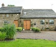
Dam Head Barn
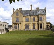
Best Western Oaks Hotel & Leisure Club
JCT.10 Holiday Inn Express BURNLEY M65
The Pendle Inn
Burnley
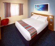
TRAVELODGE BURNLEY
Videos from this area
These are videos related to the place based on their proximity to this place.
Burnley FC vs Wigan AFC - 21.04.14 - Premier League Promotion!!! - Last Few Minutes
Last few minutes of the clarets promotion to the Premier League!
SEO Burnley
http://bigseobuzz.com/google-places SEO Burnley Marketing your business could very well be the most essential thing you can do to keep your doors open. Google Places SEO Burnley Think...
JackjonPT Burnley - 8 Week Metabolic Challenge Fitness Training
Bored of the gym? Check out the team of Personal Trainers at JackjonPT in Burnley delivering our Primal Training series as part of the 8 Week Metabolic Challenge! - Give your body the new...
Bristol City defender Liam Fontaine in sexy pose
Bristol City defender Liam Fontaine is goalkeeping after goalkeeper David James has been injured in the away match against Burnley.
Lee cox from the Hakuda-gym in burnley Golden belt Thai boxing title
lee cox from Hakuda Thai boxing gym in Burnley winning the golden belt title.
BURNLEY BUSES APRIL 2011
a trailer for www.pmpfilms, the world's largest range of transport hobby films, see website for shop, list, links, blog etc.
Burnley FC vs Wigan AFC - 21.04.14 - Premier League Promotion!!! - Post Match Walk of Honour
Post Match celebratory walk of honour as the clarets seal promotion to the premier league at turf moor in 2014.
Paul Howarth on MTB annoys a Burnley Roadie
We were on our way back from an epic Hebden bridge cross country when Paul Howarth over took a Burnley Roadie on his mountain bike without saying "Hi"! "Every time Paul sees someone on a bike.
Videos provided by Youtube are under the copyright of their owners.
Attractions and noteworthy things
Distances are based on the centre of the city/town and sightseeing location. This list contains brief abstracts about monuments, holiday activities, national parcs, museums, organisations and more from the area as well as interesting facts about the region itself. Where available, you'll find the corresponding homepage. Otherwise the related wikipedia article.
Fulledge Recreation Ground
Fulledge Recreational Ground, situated in the East Lancashire town of Burnley in the United Kingdom, is used for events such as festivals, fairs, etc. Fulledge is across the River Calder from Unity College and close to the grounds of Towneley Park. It is surrounded by streets of terraced houses on one side and Towneley Park on the other. Turf Moor, the home of Burnley Football Club, can be seen from the ground. The ground has a children's play area.
Turf Moor
Turf Moor is a football stadium in Burnley, Lancashire. It is the home ground of Burnley Football Club, which has played there since moving from its Calder Vale ground in 1883. The stadium, which is situated on Harry Potts Way, named so after the club's longest serving Manager, has a capacity of 22,546, all seated. It is one of the last remaining stadiums in England to have the players' tunnel and dressing rooms behind one of the goals.
Burnley Central railway station
Burnley Central railway station is a station in the town of Burnley, Lancashire and is on the East Lancashire Line. It is managed by Northern Rail, which also provides its passenger service. Following the singling of the track in 1986, Burnley Central has one platform in use, together with a small booking hall, waiting area and public address facility. There are information boards at the entrance of the station and in the booking hall.
River Brun
The River Brun is a river in eastern Lancashire. Rising at the confluence of Hurstwood Brook (draining Wether Edge, Hameldon and supplying the Hurstwood Reservoir) and Rock Water at Foxstones Bridge near the village of Hurstwood, the river runs northwest towards the town of Burnley. The river passes through the artificial Rowley Lake near Rowley Hall and collects Swinden Water and the River Don, the latter at Netherwood Bridge.
Stoneyholme
Stoneyholme is a district of Burnley, Lancashire, England, situated immediately north of the town centre. It is bounded by the M65 motorway to the west, and by the railway and the Leeds and Liverpool Canal to the east, and consists of predominately pre-1919 terraced housing. Stoneyholme developed between 1860 and 1914 to house Burnley's expanding workforce.
Sir John Thursby Community College
Sir John Thursby Community College is a mixed 11-16 comprehensive school in Burnley, Lancashire, England. It is named for Sir John Hardy Thursby (1826-1901), a local benefactor.
Thomas Whitham Sixth Form
Thomas Whitham Sixth Form is a mixed 16-20 sixth form centre in Burnley, Lancashire.
Burnley bus station
Burnley bus station serves the town of Burnley, Lancashire, England. The bus station was funded by both the Lancashire County Council and Burnley Borough Council. The station was re-built in 2002 at a cost of £3m and consists of 11 stands, a travel centre and electronic passenger boards. It was designed by SBS Architects.
Angels (nightclub)
Angels was a nightclub and music venue in Burnley, England. It became most famous during the early 1990s with the rise of the house music scene, drawing visitors from across the United Kingdom. It occupied part of a Multi-storey car park on Curzon St, currently the site of another car park and Wilkinson store. Carl Cox, Paul Oakenfold, Pete Tong, Sasha, Judge Jules, all regularly DJ'd, and there were also memorable appearances from Boy George and Nigel Benn.
Burnley Grammar School
Burnley Grammar School was latterly, a state-funded selective boys grammar School, situated in Byron Street in Burnley, England. However during its long history, it moved between a number of sites in the town.
St Peter's Church, Burnley
St Peter's Church is an Anglican church in the town of Burnley, Lancashire, England. It is an active parish church in the Diocese of Blackburn and the archdeaconry of Blackburn. The oldest part of the church—the lower tower—dates from the 15th century, and there have been several later additions and restorations. St Peter's has been designated a Grade II* listed building by English Heritage.
St Andrew's Church, Burnley
St Andrew's Church, Burnley, is located in Colne Road, Burnley, Lancashire, England. It is an active Anglican parish church in the deanery of Burnley, the archdeaconry of Blackburn, and the diocese of Blackburn. Its benefice is united with those of St Margaret, Burnley, and St James, Burnley. The church has been designated by English Heritage as a Grade II listed building.


