Safety Score: 3,0 of 5.0 based on data from 9 authorites. Meaning we advice caution when travelling to United Kingdom.
Travel warnings are updated daily. Source: Travel Warning United Kingdom. Last Update: 2024-05-04 08:22:41
Explore Sparkbrook
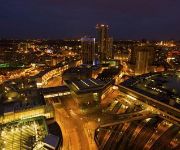
Sparkbrook in Birmingham (England) is located in United Kingdom about 99 mi (or 160 km) north-west of London, the country's capital.
Local time in Sparkbrook is now 02:06 AM (Sunday). The local timezone is named Europe / London with an UTC offset of one hour. We know of 9 airports in the wider vicinity of Sparkbrook, of which 5 are larger airports. The closest airport in United Kingdom is Birmingham International Airport in a distance of 5 mi (or 8 km), East. Besides the airports, there are other travel options available (check left side).
There are several Unesco world heritage sites nearby. The closest heritage site in United Kingdom is Pontcysyllte Aqueduct and Canal in a distance of 56 mi (or 90 km), North-West. Also, if you like golfing, there are multiple options in driving distance. We found 1 points of interest in the vicinity of this place. If you need a place to sleep, we compiled a list of available hotels close to the map centre further down the page.
Depending on your travel schedule, you might want to pay a visit to some of the following locations: Birmingham, Tidbury Green, Dickens Heath, Cheswick Green and Solihull. To further explore this place, just scroll down and browse the available info.
Local weather forecast
Todays Local Weather Conditions & Forecast: 17°C / 62 °F
| Morning Temperature | 9°C / 47 °F |
| Evening Temperature | 12°C / 54 °F |
| Night Temperature | 11°C / 51 °F |
| Chance of rainfall | 0% |
| Air Humidity | 55% |
| Air Pressure | 1007 hPa |
| Wind Speed | Gentle Breeze with 6 km/h (4 mph) from North |
| Cloud Conditions | Scattered clouds, covering 32% of sky |
| General Conditions | Scattered clouds |
Monday, 6th of May 2024
17°C (63 °F)
12°C (53 °F)
Light rain, gentle breeze, overcast clouds.
Tuesday, 7th of May 2024
18°C (64 °F)
10°C (51 °F)
Light rain, gentle breeze, broken clouds.
Wednesday, 8th of May 2024
16°C (60 °F)
9°C (49 °F)
Overcast clouds, light breeze.
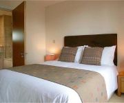
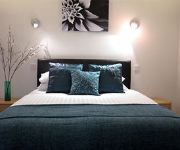
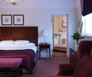
Hotels and Places to Stay
POSTBOX BY BRIDGESTREET
Hotel du Vin & Bistro Birmingham
Aparthotel Adagio Birmingham City Centre
Burne Jones House by CityQuarters
Clayton Hotel Birmingham
pentahotel Birmingham
Macdonald Burlington
Staying Cool at Rotunda Stylish Serviced Apartments
Conference Aston
Royal George Hotel
Videos from this area
These are videos related to the place based on their proximity to this place.
Leeds United Supporters Singing Before The Game: Birmingham City 1-3 Leeds United 26 04 2014
Leeds United supporters on our last away trip of the year for 2014, Going out with pure class #MOT.
Nearly a SMIDSY and a RLJ (BNZ 5860)
Two clips from my journey in a lady starts to pull out on me but spots me just in time. Then a bit later a guy in a Mercedes goes colour blind and blasts through on red. Interestingly he doesn't...
Super Meat Boy Walkthrough Playthrough
Hey Check Out My Video On The Classic Arcade Game Super Meat Boy! Please Leave a Like If You Enjoyed the Video! It really helps me to keep making videos! Got a Question? Or Just Wanna Let...
Muslim Aid Visits Elderly In Tipton - Muslim Aid Warm Heart Campaign
Muslim Aid Birmingham Staffs and Volunteers visited a volunteer lead Friday gathering for the elderly members of the Tipton community as part of our Winter Campaign. Few of the local Councillors;...
Robert Nutt - Be Birmingham Summit and the Big Society
Robert Nutt, from Cerebral Palsy West Midlands, reflects on the Be Birmingham Summit (18 March 2011), at which Lord Nat Wei, Government Adviser for Big Socie...
Dimensions Dru Health Store, Bangor
Dimensions Dru Health Store, in Bangor, is North Wales' most extensive, independent health store. Here you can choose from over 3500 products - Natural foods, organic and local produce, supplemen ...
Oussama Assaidi Incredible Goal vs Birmingham City HD
Oussama Assaidi great goal against Birmingham City in the thrilling 4-4 League Cup encounter!
Videos provided by Youtube are under the copyright of their owners.
Attractions and noteworthy things
Distances are based on the centre of the city/town and sightseeing location. This list contains brief abstracts about monuments, holiday activities, national parcs, museums, organisations and more from the area as well as interesting facts about the region itself. Where available, you'll find the corresponding homepage. Otherwise the related wikipedia article.
Sparkbrook and Small Heath
Sparkbrook and Small Heath is a defunct administrative district, formerly managed by its own district committee, in Birmingham, England. Its boundaries were those of the Birmingham Sparkbrook and Small Heath parliamentary constituency.
Sparkhill
Sparkhill is an inner-city area of Birmingham, England, situated between Springfield, Hall Green and Sparkbrook.
St Agatha's Church, Sparkbrook
The Church of St Agatha is a parish church in the Church of England in Sparkbrook in Birmingham, England.
Ladypool Junior & Infant School
Ladypool Primary School is a Grade II* listed primary school on Stratford Road in Sparkbrook, Birmingham, England. It stands next to St Agatha's Church. It was built as Stratford Road Primary in 1885 by architects Martin & Chamberlain as a Birmingham board school, one of around forty schools built by that firm in an innovative style as a result of the Elementary Education Act 1870.
Balti Triangle
The Balti Triangle is an area of Balti houses clustered along Ladypool Road, Stoney Lane and Stratford Road, to the south of Birmingham city centre. It covers parts of Sparkbrook, Sparkhill and Balsall Heath. This area probably contains Birmingham's highest concentration of balti restaurants, as well as some of the oldest to be found in Britain. Birmingham is popularly believed to be the birthplace of the Balti curry
Nelson Mandela Primary School
Nelson Mandela Primary School is a primary school located in Sparkbrook, Birmingham, England. The primary school opened on the 7th of September 1987, and was visited by Nelson Mandela on the 11th of October 1993. As of December 2008, the has 496 students.
Camp Hill railway station
Camp Hill railway station was a railway station in Camp Hill, Birmingham opened by the Birmingham and Gloucester Railway in 1840 and was its first terminus. Subsequently, the line extended to join the London and Birmingham Railway to the latter's Curzon Street terminus. From 1854, New Street opened but because of the necessity for a reversal many trains from the Midland Railway line from Derby continued to use Camp Hill until New Street was extended in the 1880s.
Ghamkol Shariff Masjid
Central Jamia Mosque Ghamkol Sharif is a major Sunni-run mosque in the Small Heath area of Birmingham, England. Construction work was started on 15 March 1992 in the holy month of Ramadan. Each night throughout construction, a hafiz would recite the Quran on the construction site.
Battle of Camp Hill
The Battle of Camp Hill (or the Battle of Birmingham) took place in and around Camp Hill, during the First English Civil War, on Easter Monday, 3 April 1643, when a company of Parliamentarians from the Lichfield garrison with the support of some of the local townsmen, in all about 300 men, attempted to stop a detachment of Royalists, of about 1,200 cavalry and dragoons and 600 to 700 foot, under the command of Prince Rupert from passing through the unfortified parliamentary town of Birmingham.
Birmingham Independent School of Performing Arts
The Birmingham Independent School of Performing Arts (BISPA)is a private foundation School In Birmingham, England. The School is based at the Old Fire Station in Birmingham which was established in 1912. In 2004 the building was converted into BISPA.
St John's Church, Sparkhill
St John's Church is an Anglican church in Sparkhill Birmingham. St John's is a welcoming multi-ethnic church situated in the heart of Birmingham's Balti Belt, it is one of England's most ethnically and religiously diverse parishes. The main Sunday service is held at 10.30am, the first Sunday of the month being an All Age Service follwed by a shared meal for those who wish to stay. The church is a member of the South Asian Forum of the Evangelical Alliance and the New Wine Network of churches.
Rotton Park
Rotton Park is a former name for an area of Birmingham, England, centred on what is now known as Edgbaston. Sources differ as to the origin of the name. Some claim it is derived from the Rotton family, (Ambrose and Bridget Rotton built a surviving timber-framed house, now known as Stratford House, at Camp Hill, in 1601). Others say it is derived from the Anglo-Saxon 'rot tun', meaning 'cheerful farm'. The first recorded use of the name was in 1275.


