Safety Score: 3,0 of 5.0 based on data from 9 authorites. Meaning we advice caution when travelling to United Kingdom.
Travel warnings are updated daily. Source: Travel Warning United Kingdom. Last Update: 2024-04-25 08:17:04
Delve into Hall Green
Hall Green in Birmingham (England) is a town located in United Kingdom about 97 mi (or 156 km) north-west of London, the country's capital town.
Time in Hall Green is now 04:30 AM (Friday). The local timezone is named Europe / London with an UTC offset of one hour. We know of 9 airports closer to Hall Green, of which 5 are larger airports. The closest airport in United Kingdom is Birmingham International Airport in a distance of 4 mi (or 7 km), North-East. Besides the airports, there are other travel options available (check left side).
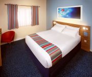
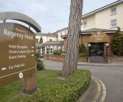
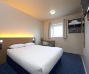
There are several Unesco world heritage sites nearby. The closest heritage site in United Kingdom is Pontcysyllte Aqueduct and Canal in a distance of 58 mi (or 94 km), North-West. Also, if you like the game of golf, there are some options within driving distance. We saw 1 points of interest near this location. In need of a room? We compiled a list of available hotels close to the map centre further down the page.
Since you are here already, you might want to pay a visit to some of the following locations: Dickens Heath, Tidbury Green, Cheswick Green, Solihull and Birmingham. To further explore this place, just scroll down and browse the available info.
Local weather forecast
Todays Local Weather Conditions & Forecast: 10°C / 50 °F
| Morning Temperature | 2°C / 35 °F |
| Evening Temperature | 9°C / 48 °F |
| Night Temperature | 5°C / 40 °F |
| Chance of rainfall | 0% |
| Air Humidity | 48% |
| Air Pressure | 1004 hPa |
| Wind Speed | Gentle Breeze with 7 km/h (4 mph) from South-West |
| Cloud Conditions | Overcast clouds, covering 97% of sky |
| General Conditions | Overcast clouds |
Saturday, 27th of April 2024
4°C (40 °F)
4°C (39 °F)
Moderate rain, gentle breeze, overcast clouds.
Sunday, 28th of April 2024
5°C (42 °F)
6°C (43 °F)
Moderate rain, gentle breeze, overcast clouds.
Monday, 29th of April 2024
13°C (55 °F)
7°C (45 °F)
Light rain, moderate breeze, scattered clouds.
Hotels and Places to Stay
Clayton Hotel Birmingham
Aparthotel Adagio Birmingham City Centre
VILLAGE SOLIHULL
Crowne Plaza Solihull
The St Johns Hotel
TRAVELODGE BIRMINGHAM CENTRAL MOOR STREE
Solihull The Regency Hotel
Ramada Birmingham Solihull
TRAVELODGE BIRMINGHAM CENTRAL BULL RING
The Limes Country Lodge Hotel
Videos from this area
These are videos related to the place based on their proximity to this place.
No Proof - Promotional Video - Red Lion Shirley
No copyright infringement was intended. Selection of songs from No Proof's Red Lion, Shirley Gig on 25th October 2013. Badge - Cream, All Right Now - Free, Bad Love - Eric Clapton, Jumpin'...
Shirley Library
The new Shirley Library and Solihull Connect walk-in centre opened in Parkgate at 9.30am on Monday 19th May 2014. For opening hours and contact details see ...
Black 5 5305 Test Run at Shirley, 20/10/10.
Proir to the railtour on Saturday, 5305 was tested on the mainline with stock on the 20/10/10. Tyseley - Stratford upon Avon and back. It is seen passing Shirley tender first on the outward...
John Wigley - Memories of Margaret Street
This year the University celebrates a very special milestone - 125 years of art at Margaret Street The School of Art building, more widely known as 'Margaret Street', opened in 1885 and...
BSA and RSC Collaboration: Pilot
Birmingham School of Acting is working together with the RSC to support theatre training The world-famous Royal Shakespeare Company (RSC) has initiated a national programme of skills sharing...
Shane Breen and Milord D'Elle British Open 2008 Day 2
Shane Breen and the up and coming Milord D'Elle clear round Day 2 of the British Open, Birmingham.
GBRF 7x09 Class 20's Full Boar past Tyseley 5/5/2014
7x09 tube stock run. Class 20's. Sorry about the video recording freezing. Phone camera was playing up. It didn't spoil the sound fortunately. But a great video overall. Enjoy!
Videos provided by Youtube are under the copyright of their owners.
Attractions and noteworthy things
Distances are based on the centre of the city/town and sightseeing location. This list contains brief abstracts about monuments, holiday activities, national parcs, museums, organisations and more from the area as well as interesting facts about the region itself. Where available, you'll find the corresponding homepage. Otherwise the related wikipedia article.
Sarehole
Sarehole is an area in Hall Green, Birmingham, England (formerly in Worcestershire, but transferred to the city in 1911). Sarehole, a name no longer used in addresses, was a hamlet which gave its name to a farm (now built over) and a mill. It extended from the ford at Green Lane, southwards for about a mile, along the River Cole to the Dingles.
Birmingham Hall Green (UK Parliament constituency)
Birmingham, Hall Green is a constituency of part of the city of Birmingham represented in the House of Commons of the UK Parliament since 2010 by Roger Godsiff of the Labour Party.
John Morris Jones Walkway
John Morris Jones Walkway is a path on the River Cole in Hall Green, Birmingham, England (in an area once called Sarehole). It is part of the Shire Country Park. John Morris Jones was a headmaster of George Dixon Junior School in west Birmingham from 1960 – 1980. He wrote extensively about the local history of the South Birmingham area, particularly Yardley, Hall Green and Sarehole.
Hall Green railway station
Hall Green railway station serves the Hall Green area of Birmingham in the West Midlands of England. The station, and all trains serving it, are operated by London Midland.
Yardley Wood railway station
Yardley Wood railway station serves the Yardley Wood area of Birmingham in the West Midlands of England. The station, and all trains serving it, are operated by London Midland. Despite the station's name, Yardley Wood it is in fact just inside the Hall Green district of Birmingham. The station was known as Yardley Wood Platform until 1924.
Church of the Ascension, Hall Green
The Church of the Ascension (previously known as the Job Marston Chapel and Hall Green Chapel) is a Church of England parish church in the Hall Green area of Birmingham, England.
Hall Green Stadium
Hall Green Stadium is a greyhound racing stadium located in the Birmingham suburb of Acocks Green, just over the border from Hall Green itself. Opened in August 1927 it was the first greyhound track to be built in the city. It hosted speedway races between 1928 and 1938. It is one of six owned and run by the Greyhound Racing Association and one of the 28 licensed stadiums in the UK. The track itself is a 412 metre long oval track with a sand covered surface.
Robin Hood Cemetery
Robin Hood Cemetery and Crematorium is located near Shirley, West Midlands, within the Metropolitan Borough of Solihull, in the West Midlands. The cemetery was opened in 1917 and covers an area of 45 acres and comprises extensive landscaped lawn graves interspersed with ancient woodland. A cemetery chapel was built in 1931, and the crematorium was built in 1958, including for modifications to the chapel to cater for the cremation facilities.


