Safety Score: 3,0 of 5.0 based on data from 9 authorites. Meaning we advice caution when travelling to United Kingdom.
Travel warnings are updated daily. Source: Travel Warning United Kingdom. Last Update: 2024-04-26 08:02:42
Explore Sheldon
Sheldon in Birmingham (England) is a city in United Kingdom about 96 mi (or 155 km) north-west of London, the country's capital.
Local time in Sheldon is now 03:16 PM (Friday). The local timezone is named Europe / London with an UTC offset of one hour. We know of 9 airports in the vicinity of Sheldon, of which 5 are larger airports. The closest airport in United Kingdom is Birmingham International Airport in a distance of 1 mi (or 2 km), East. Besides the airports, there are other travel options available (check left side).
There are several Unesco world heritage sites nearby. The closest heritage site in United Kingdom is Pontcysyllte Aqueduct and Canal in a distance of 59 mi (or 95 km), North-West. Also, if you like golfing, there are multiple options in driving distance. We found 1 points of interest in the vicinity of this place. If you need a place to sleep, we compiled a list of available hotels close to the map centre further down the page.
Depending on your travel schedule, you might want to pay a visit to some of the following locations: Solihull, Bickenhill, Cheswick Green, Hampton in Arden and Dickens Heath. To further explore this place, just scroll down and browse the available info.
Local weather forecast
Todays Local Weather Conditions & Forecast: 9°C / 49 °F
| Morning Temperature | 2°C / 35 °F |
| Evening Temperature | 8°C / 46 °F |
| Night Temperature | 5°C / 41 °F |
| Chance of rainfall | 0% |
| Air Humidity | 56% |
| Air Pressure | 1005 hPa |
| Wind Speed | Gentle Breeze with 7 km/h (4 mph) from South-West |
| Cloud Conditions | Overcast clouds, covering 88% of sky |
| General Conditions | Overcast clouds |
Saturday, 27th of April 2024
6°C (43 °F)
5°C (41 °F)
Moderate rain, moderate breeze, overcast clouds.
Sunday, 28th of April 2024
7°C (45 °F)
5°C (41 °F)
Moderate rain, moderate breeze, overcast clouds.
Monday, 29th of April 2024
13°C (55 °F)
8°C (46 °F)
Light rain, moderate breeze, few clouds.
Hotels and Places to Stay
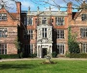
Castle Bromwich Hall
Novotel Birmingham Airport
The St Johns Hotel
Genting Hotel
Crowne Plaza Solihull
BEST WESTERN WESTLEY HOTEL
Ramada Birmingham Solihull
ibis Birmingham Airport - NEC (new ibis rooms)
Arden Hotel & Leisure Club
Holiday Inn Express BIRMINGHAM - SOUTH A45
Videos from this area
These are videos related to the place based on their proximity to this place.
Solihull Moors 1 Worcester City 4 Vanarama Conference North
Solihull Moors 1 Worcester City 4 Saturday 14th March 2015.
Solihull v Gainsborough
Solihull Moors FC - Official v Gainsborough Trinity. Decided to film bits of the last 10 minutes. Solihull 3 - 2 Gainsborough. Solihull were 2-1 down with 4 minutes to go, Pulled it back to...
Solihull Moors v Worcester City
Blue Square North - Solihull Moors 0 Worcester City 1 - Tuesday 2nd October 2012 (dedicated to the person coming out of the loo after the goal)
Team Black Belt Karate School Solihull. Grading Festival 2015
Team Black Belt. Karate classes for children are based in Solihull in the West Midlands. Team Black Belt is a Child Friendly Karate school with Age Specific classes, starting from 5 years...
Land rover Birmingham - Solihull, Polacy w UK
Nocna zmiana w fabryce Land Rover w Birmingham, Solihull.
Team Black Belt Karate School Solihull Stop Drop Roll
Does your child know what to do if their clothes catch alight? A quick easy fun to practice drill.
WMCCL Youth Solihull 21 Oct 2012
West Midlands Cyclo Cross League Youth (U16 & U14) Boys and Girls battle through thick mud in round 5 of the Waldrons Cyclo Cross League. Note: There is no video of the youths crossing the...
100 planes land in Country Park! FREE Air Show! Sheldon Birmingham Airport BHX
Free Air Show every day! Includes full descriptions of many aircraft. Sheldon Country Park is between Birmingham airport Runway 15 and Marston Green train station, close to the NEC and five...
Videos provided by Youtube are under the copyright of their owners.
Attractions and noteworthy things
Distances are based on the centre of the city/town and sightseeing location. This list contains brief abstracts about monuments, holiday activities, national parcs, museums, organisations and more from the area as well as interesting facts about the region itself. Where available, you'll find the corresponding homepage. Otherwise the related wikipedia article.
Kitts Green
Kitts Green is an area of Birmingham, England, approximately 5 miles east of the city centre and on the borders of Stechford, Ward End, Shard End, Lea Village and the Meadway. The original green, which belonged to 'Mr Kitts', is located opposite St Richards Church near Lea Hall railway station. Kitts Green's main local attractions are St. Richards Church, The Glebe Shopping Centre, The Poolway Shopping Centre, Ridpool Primary School, The Pump, and Alcoa.
Lyndon, Solihull
Lyndon is a district within the Metropolitan Borough of Solihull in the English county of the West Midlands. The ancient monument of Hobs Moat is nearby, as is Hatchford Brook. The area is not generally called Lyndon, but amenities such as schools and pubs have Lyndon in their title. Lyndon ward elects its representatives on to Solihull Council three in every four years.
Olton railway station
Olton railway station serves the Olton area of Solihull, in the West Midlands of England. The station is operated by London Midland, and is also served by occasional Chiltern Railways services. Pre-1967 trains between London (Paddington) and Birkenhead (Woodside) on the former GWR main line passed non-stop through Olton station.
Tile Cross
Tile Cross is an area in the east of the city of Birmingham, England. It is a small area with a shopping centre on the borders of Stechford, Marston Green and the Radleys. The name originates from the tile production at the former quarry that existed on what is now parkland between St Peter's C of E Church and Shirestone School.
Elmdon, West Midlands
Elmdon is a village within the Metropolitan Borough of Solihull in the county of West Midlands, England. The name Elmdon means hill of the elms. It is primarily a residential area. It was formerly home to Elmdon Aerodrome, which is now Birmingham Airport. Elmdon Parish Church dates from 1780 and overlooks the Rover Works, home of Land Rover since 1946.
Gilbertstone
Gilbertstone is a residential suburban area straddling the border of Yardley and South Yardley in Birmingham, West Midlands.
St Edburgha's Church, Yardley
St Edburgha's Church (also known as Old Yardley Church) is a parish church in the Yardley area of Birmingham, England. It is a Grade I listed building and a part of the Old Yardley conservation area.
Damson Park
Damson Park is a stadium in Damson Parkway, Solihull, West Midlands, England. It was the traditional home of Solihull Borough F.C. before they merged to become Solihull Moors. They currently share Damson Park with Birmingham and Solihull Bees and also have an agreement that allows Birmingham City Reserves the use of the ground for their reserve games. Capacity is 3,050.


